@cadmunkey said:
How accurate are the levels on Google earth imagery? Is there anywhere that documents this?
not as accurate as a site survey... i think it is based on topo data, which can vary depending on source, date, etc.
@cadmunkey said:
How accurate are the levels on Google earth imagery? Is there anywhere that documents this?
not as accurate as a site survey... i think it is based on topo data, which can vary depending on source, date, etc.
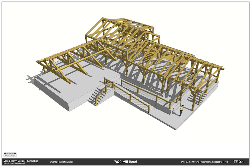
A few quick shots of recent work (design by another firm):
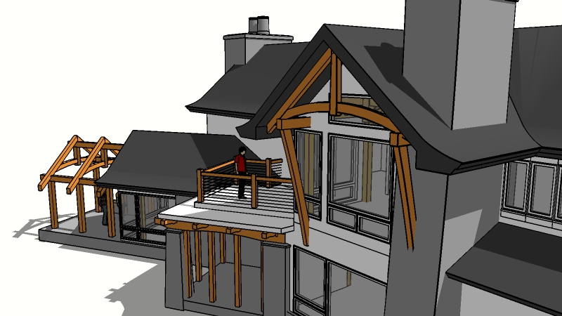
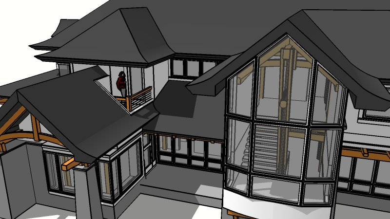
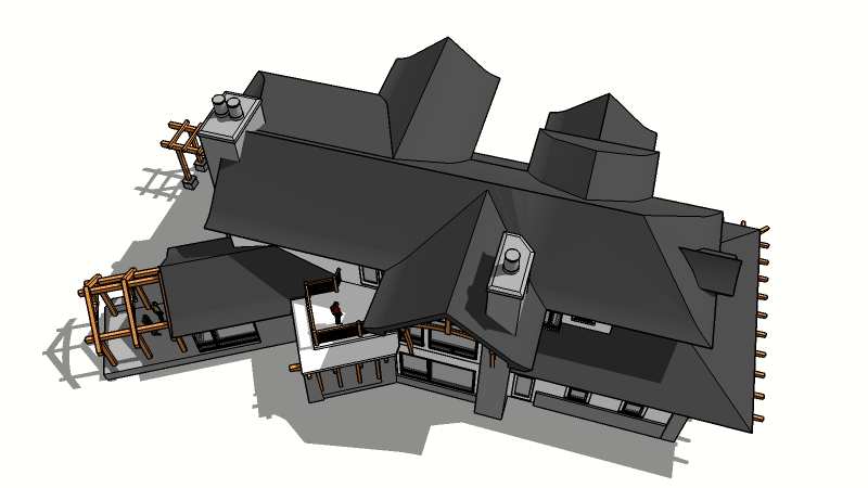
Nice to see other work that keeps it simple.
I posted these over in the LO discussion on construction documents: (size will hurt me here, these were 24x36" PDFs)
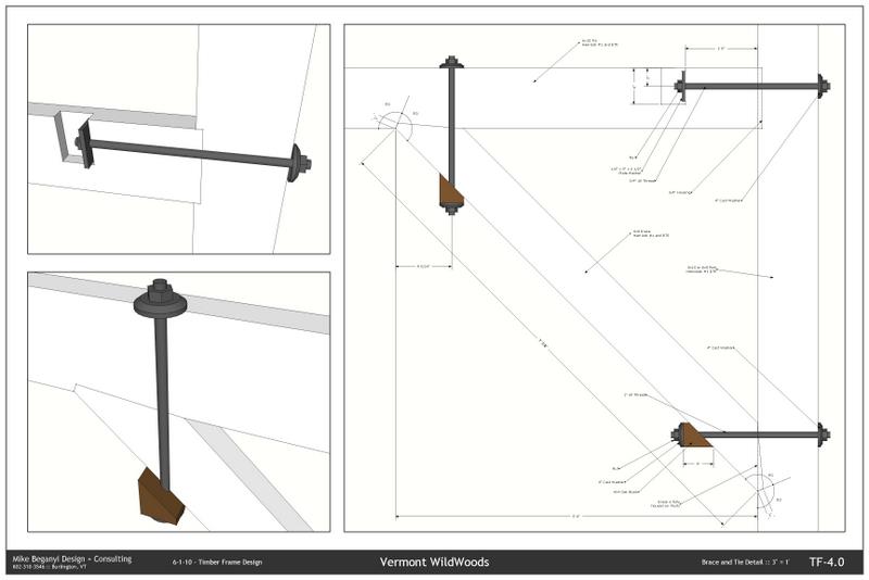
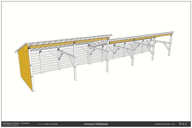
Another project:
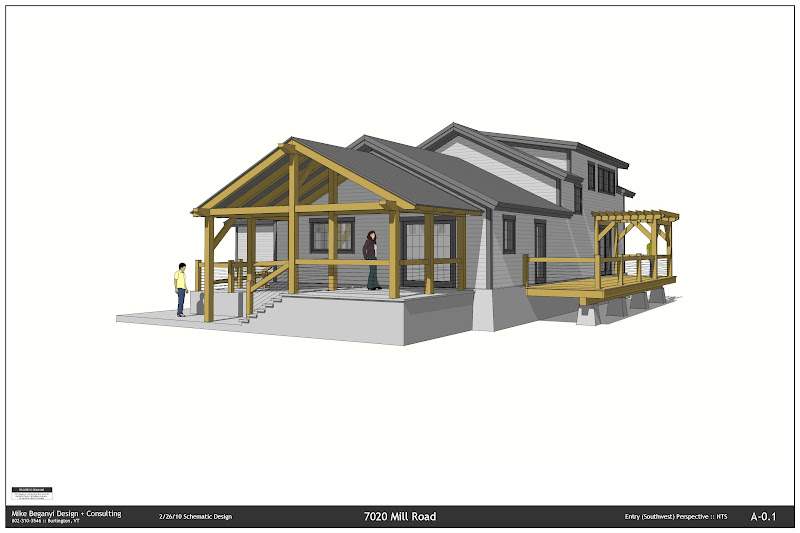
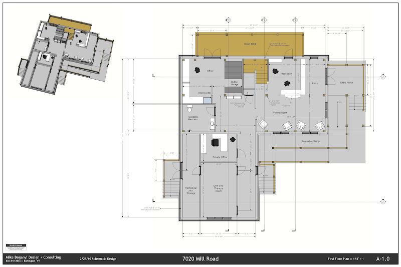
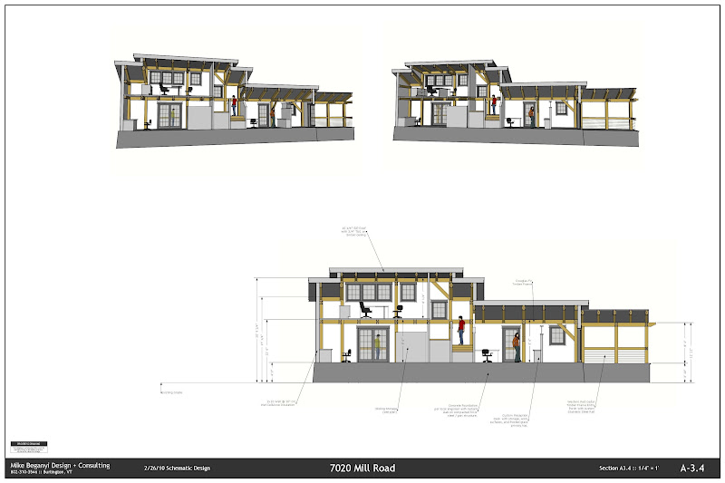
@kilgo said:
The problem with Sketchup is still the same as when it first came out. Modeling accurate terrain and incorporating with the architecture. Let me elaborate...
My last model was fun, until I had to set it into the landscape. The landscape was a severe grade with winding paths, platforms, stairs and driveways. The paths were integrated into the multiple stories of the structure and that meant the terrain had to meet the architecture precisely. At first there was no digital survey model and I could only use Google Earth. Google Earth is rudimentary at best and I only could supply a rough concept, tweaked and pulled for hours.
I searched for a way to use DEM data, but on a MAC it's impossible. Later when I did get the site survey I still had a hard time twisting the surfaces to mate with the model. I spent as long with the landscape getting it to work as I did building the structure that was to set into it.
Yes, I bought the book (You know the one I'm talking about) but it really fell short of what I needed. And I used every conceivable plug in and tool in sketchup.
For now, I'm going to have to refuse settle structures into there site landscapes. Until I can figure this one out.
I'm quite glad GoogleEarth is 'rudimentary' at best. At least there are still places to explore that we haven't mapped to the n'th inch.
A proper site survey, coupled with some simplified geometry, then working back and forth between model and site maybe more useful / streamlined process. The few times I've done this I've kept it very simple. Boots on the ground, a good surveyor, and a good site will go a long way to implementation, even if you've managed perfect drawings.
Folks were doing complicated landform / architecture coordination long before FREE 3d tools arrived.
From SketchUp to SketchUp?
You can do it manually. Open the file you want to import. Select all the Layers (except Layer 0).
Delete.
You will get an option to delete the geometry or move it to the default layer. Choose to move it to the default layer.
Save the drawing.
Open the other drawing, import the file. It should come in as a component.
Place the component on the layer of your choice.
If you want all the entities in the component on this same layer, edit the component, select all the geometry, move to the same layer.
I use this process when working with AutoCAD imports. Bring it into SketchUp, clean it up, strip all the layers, views, excess components, etc. Get it all on Layer 0.
Bring it into my working drawing.
@tig said:
The SectionCutFace isn't always perfect as it has to guess which are solids and which are voids - if your model is 'manifold' then it's fine - but, if you have overlapping volumes it will sometimes get it wrong - in the latest version there should be a choice to not hide edges which is useful to manually edit such errors.
its pretty easy to delete stuff out, for sure, even with the edges hidden.
i've done some recent work on a house with a complex roof - curved eaves and such. section cut face picked up the complex stuff about 50% of the time.
Use the plug in, or create a group from slice, then move it back .1 inch (or similar).
Edit the group by hand to get the colors / lines you want.
I used the group from slice method on these:

I've had mixed results with the plug in... so I mix and match depending on what I need.
do iPads handle PDFs?
you could print to a 3d PDF. been using it with clients. not the same control as with a sketchy presentation, but the plugin i'm using saves out views, etc... you can measure, create section cuts (it doesn't seem to transfer them from sketchup  ) etc.
YOU SHOULD TALK IN ALL CAPS ALL THE TIME!
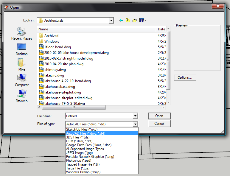
Look for the pull down. If using Pro, you should be able to open DWG.
Draw cylinder. Make it a component.
Draw keys, make them longer than you need. Make component.
Copy these where you need them.
Explode keys.
Edit cylinder component. Select all by triple clicking.
Right click>Intersect with model
Close component.
Triple click your key(s).
Right click>Intersect with model.
Delete the 'extra' bit of the key(s).
Explode your cylinder component.
Delete out the curved rectangle where the key entered the cylinder.
You should now have the remnant of the key inside the cylinder.
Remake into component.
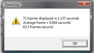
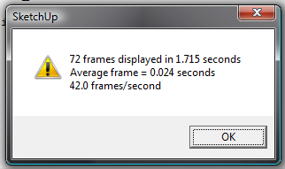
Dell M6400 with NVIDIA Quadro FX2700.
Stats went up after I went into the NVIDIA control panel and changed the 3d settings to 'Let Application Control' or somesuch.


@watkins said:
It was forbidden to dry clothes outside and so she had to hire a dryer.
Vermont passed a 'right to dry' law last year. Our townhouse complex wouldn't allow it either - on the front porch or in the backyard...
But now we have a nice backyard... just need to rig up the line after I finish the sandbox for the little one...
@unknownuser said:
whow bmike... such an amazing and original idea!!
hard to beat the free energy the sun throws down on us every day. 
i always get a chuckle out of these 'eco' and 'green' design contests... always a technological fix, always more to buy, always more required to mine out of the ground, ship around the world, have things built by cheap labor, then shipped thousands of miles to the end consumer only to be plugged in and draw more energy.
thomthom - nice tools!
how have i lived so long without them?
thanks.

I'd be interested in the same... this would be really useful when importing CAD files.
But I'm not sure how it would know which groups were identical - unless it somehow could compare geometry...?
You may need to move the scrapbook images to the top - either on their own layer that sits above the viewport into your model, or by right clicking on the item and using the 'arrange' option.
I think you'd also need to focus in on what the target is - BIM for what? Houses? Hospitals? Airports? Commercial mixed use / retail? They all have their own special languages...
And while I'd agree that many technologies and processes can scale - the language of the residential builder is vastly different from that of the commercial developer / project manager. Essentially one needs to codify a language for the process of communicating what you want built - and its huge in terms of scope when looking at how to create a generic system that could work for multiple projects / types / scales. Add in software guys who most likely have never swung a hammer or climbed scaffold - and you create several translation problems - the first being codifying the language of building so that most folks agree on what the heck you are talking about, the second getting the programmers to understand how this should work in software' the third getting the software to be logical and referential to 'the real world', and fourth - getting the end user (designer, builder, architect, engineer, etc.) to understand how to make the software go - without having to adjust or adapt problems from the real world to fit in the box the software painted you into.
The software cycle is pretty quick - buildings (should) last a long long time. The language of building has been morphed from that of master builders into professional categories and subdivisions and specialties from the architect on down through the mechanical contractors and the day laborer carrying the concrete forms to the hole from the truck.
In the end, its about the building.
Tools continue to change. And with the fast cycle of software - it seems that the tools may always be lacking when trying to virtually control all the aspects of building in a physical world.
And in regards to 'adequacy' - I'd rather be effective than efficient than adequate any day. 
@unknownuser said:
bmike,
I am really liking these drawings. The 3D bolted connection details are great

thanks...!