sketchucation logo sketchucation
    • Login
    1. Home
    2. unearthed
    3. Posts
    🛣️ Road Profile Builder | Generate roads, curbs and pavements easily Download
    U
    Offline
    • Profile
    • Following 0
    • Followers 0
    • Topics 52
    • Posts 264
    • Groups 1

    Posts

    Recent Best Controversial
    • [Tutorial] convert triangular mesh to square mesh

      Hi All

      I've been looking for a quick easy route to converting a From Contours mesh or TIN (Triangular Irregular Network) to a square mesh. This method involves dropping a From Scratch mesh over a From Contours mesh using TIG's drop vertices.rb http://forums.sketchucation.com/viewtopic.php?t=39251 - thanks TIG, it's a great plugin and speeds up my workflow dramatically.

      triangular mesh to square mesh

      And now that i've worked out the process I can go from an eyeball sketch of the ground surface to a simple terrain with a house mass model on the terrain in ½ an hour.

      I've also included the .skp as some may find that more helpful.

      Sometimes I use Terrain Reshaper plugin http://forums.sketchucation.com/viewtopic.php?t=11320 but my little machine sometimes has problems with all the processing.


      Unzips to 1.6Mb

      posted in SketchUp Tutorials sketchup
      U
      unearthed
    • RE: GIMP - Reducing large Geo photographs in size

      I had this problem once and used photoshop's watercolour filter to downgrade some huge tiff files (I don't know GIMP but looks like it's possible there too). My file sizes went from approx. 22Mb to around 2-5Mb.

      I was using mine as a background too, although I only had to print A3 size and the scale was usually around 1:1000 - I don't have the original but in my example you can still see tree crowns down to a metre across (the vector work is archaeological features), and the filter just made them a bit 'muddy' through the averaging process.


      down-graded tiff

      posted in Extensions & Applications Discussions
      U
      unearthed
    • RE: Landscape planting plan - text leader show component count

      Hi clayc, I too used to use VW and thought that symbol/plant counting was one of VW's few useful attributes. See replies to my previous post on the same topic http://forums.sketchucation.com/viewtopic.php?f=15&t=41324. I'll probably adopt bjornkn's solution, although it is still only a partial solution.

      I have another post (as yet unanswered) http://forums.sketchucation.com/viewtopic.php?f=289&t=41473 on the possibility of using Dynamic Components to 'auto-label' plants.

      For me too, the ability to count plants is an absolute need (with any software), as is auto-numbering of components, which I've also not yet solved.

      posted in LayOut Discussions
      U
      unearthed
    • RE: Using laser distance meters in bright sun

      I've been reading this post with interest as I have a Disto and have been looking for a way to add horizontal measurement, but most systems are very buggy and/or very expensive, but some Swiss cavers have added a third-axis upgrade to a Disto A3 http://paperless.bheeb.ch/. Apparently it will work on other lasers, but the Disto has greater accuracy and functionailty (and the Disto A3 has enough room within the case for the upgrade). The device uses the Disto's memory to hold the resulting point cloud prior to Bluetooth transmission to PDA for field-drawing or for building into a drawing later.
      .showing horizontal angle at top of Disto A3 screen

      I'm considering getting someone to build me one of these, as it's essentially a poor-man's electronic theodolite, and would revolutionise field work. I understand they cost around 150 Euros to build (and the site has full specifications and construction info for the electronically-minded)

      Just thought you might be interested in this.

      posted in Hardware
      U
      unearthed
    • Dynamic component 2D tree symbols

      I'm trying (following on from my query http://forums.sketchucation.com/viewtopic.php?f=15&t=41324) to build a series of components to represent trees, and enable their counting using either TIG's Component Report++ or using Space Design.

      What I want is have a 2D component that I can drop into place and add attributes to it (that is I want each component to have unique attributes). I have made components unique using the right-click option.
      shows icons, component options, component  attributes and expanded attributes for tree health
      The minimum info I want to hold on each tree is it's species, height, trunk diameter, provenance (where it comes from) and health.

      But a few problems - I can't find anything about entering List Option and Value area values - for instance I want to have a option to be able to say whether a tree is healthy or dead etc, but what should I be entering?

      Also is there a way to have a different coloured fill depending on a selection? e.g. if a plant is 1 metre tall the component instance changes to a red fill, but with a 2 metre plant it gets agreen fill?

      OR have I got the wrong end of the stick and DCs are not suitable for this kind of thing - ? (it's not sexy, no moving parts (maybe just some changing colours)

      posted in Dynamic Components sketchup
      U
      unearthed
    • RE: Tree surveys and numbering trees

      Thanks TIG, but that method takes removes the information (the tags) from the dxf - I'm hoping that there's a way to import each block's attribute data into a DCs attributes. Seeing as your script parses the incoming data stream to create the 3D text, would it be possible to create a text block for each icon, from each Autocad Block?

      Certainly it does what it says on the tin though, thanks
      and yes, you're right it does run for a while -
      for my data it was best to do it in batches of 100 icons at a time:
      screen cap showing imported tags on top of icons

      bjornkn, this would work well as a complement to Alan's method above, thanks.

      posted in SketchUp Discussions
      U
      unearthed
    • RE: Vehicle Tracking and Swept Paths

      I use a free program called Bricsturn http://www.glamsen.se/BricsTurn.htm which I run alongside Bricsys (an Autocad alt. http://www.bricsys.com fully func. 30day trial). I'm not a programmer but a swept-path program might be quite a chunky plugin - if anyone were to write one.

      It's pretty good and you can add more vehicles: bricsturn ford ranger 
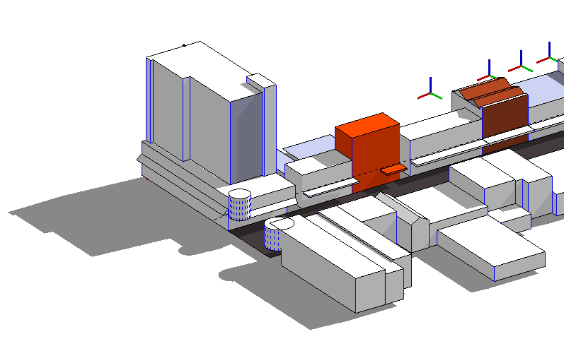
(I put my truck in for instance -altho' you can't new new icons! - nothing fashionable about a luton van).

      Bricsturn may require an MS addon to run http://www.microsoft.com/download/en/confirmation.aspx?id=22276.

      They also produce something more generic called MS Turn, but I couldn't get it to run, but it may run on Acad.

      posted in SketchUp Discussions
      U
      unearthed
    • RE: Tree surveys and numbering trees

      Thanks Alan

      Your last idea is what I might use - very interesting - I could use this with a tablet in the field, - Like you say, tedious setting up, but once you've got the components done it's easy.

      I also need a way of entering tree info into components (species, height, trunk thickness, health etc - as individual fields in the component) - does one use dynamic components for this?

      There are two main routes that I use for getting tree data into CAD

      One - getting a surveyor to record tree position - this results in an Autocad file comprising many blocks (each block representing a tree) and with several attributes attached to each block, e.g. species, x and y position, tree height, tree species, trunk diameter etc (refer to image from autocad (BricsCAD actually))autocad survey file block attribute data The data seems to get lost on its way into Sketchup.

      Two - the other route (normally smaller jobs) involves a basic survey (using gridded paper to speed location by eyeball), again I usually collect species, height, girth and plant health, and then CAD it up later. What I'm working towards is avoiding paper, but without buying a robotic thedolite (just seeking a happy medium).

      posted in SketchUp Discussions
      U
      unearthed
    • RE: Overlays in LO - how to do?

      Yeah, well thanks Dave - while I was doing a rough to show you I (more or less) worked out how to do it. What I wanted to do was overlay as shown
      gg.chk.JPG
      finally got it - only sort of though as my shadows disappeared.

      The trick was the raster/vector tickbox in Tray>Sketchup Model: set
      it to vector for your vector objects to overlay, and it'll drop the default background
      out and you get your overlay. BUT it's all very fiddly and LO is sloooow doing it.

      With the scenes I found the best way was to get the underlay in, scale it etc, then copy it and use Tray>SU model>View>Scenes dropdown to change the copy to the overlay scene.

      Also I found that if Rendered Auto was off then the underlay won't update.

      posted in LayOut Discussions
      U
      unearthed
    • Tree surveys and numbering trees

      Hi, tree surveys are an important part of my work, and in other CADs I've used in the past there's usually been a way of adding a number/label to a tree symbol/block/icon (this is also useful for room, house or any other object numbering).

      I've searched high and low and have found nothing like this for skp. I want to use this in sketchup and then send it out with the scenes to LOtree survey
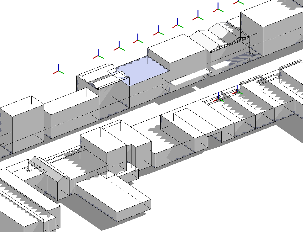
. I include a small part of a typical case - this was only 75 trees but 500 to 1000 or so is not so unusual.

      The ideal would be where one can start labelling and have a dialog to input attributes (species, height, health etc) (being able to add to this later would also be very useful). I'm hoping this is possible, and that i can then link it up with Space Design (here's hoping). Is thee a script that does this?

      posted in SketchUp Discussions sketchup
      U
      unearthed
    • Overlays in LO - how to do?

      I want to do a simple drawing in LO, with buildings and landscape over an aerial (but my aerial is also my terrain - I dont see the point of having an aerial AND a terrain). But to show buildings etc I need edges on, but then my terrain appears overly complex - is there a way to have edges on in one set of objects and off in another set within the same scene?

      I tried overlaying two scenes, one with edges on, the other with edges off, but the upper white area of the image blocked the one underneath -is there a way to do overlays in LO that gets around this?

      posted in LayOut Discussions layout
      U
      unearthed
    • RE: Newbie problem - shadow artifact on objects in model view

      Thanks thomthom - the clipping bug was driving me nuts - I spent ages looking for what it was. And now I've moved back to origin everthing's fine.

      posted in SketchUp Discussions
      U
      unearthed
    • RE: Newbie problem - shadow artifact on objects in model view

      So what happens with large projects where a project (irrespective of megabittage) is very long,or is it better to avoid that sort of thing?

      • maybe when I need that I'll just move on to using Rhino, or go back to my copy of Bricscad (highly functional Autocad-alike costing US500 or so)
      posted in SketchUp Discussions
      U
      unearthed
    • RE: Newbie problem - shadow artifact on objects in model view

      Nvidia eh, I agree I've had a better run with those. Have to see if I can swap.

      Model size, I'm trying to purge often and I find your (thomthom) cleanup³ really useful, it took my model from 2mb to 154k with no problems! Lots of rubbish from booleans etc. And thanks for the modelling tips Thom².

      And yes, the model's about 3km from origin, and the model itself is about 250m across (I hope to get most of the downtown -about four streets like this-at least for the massing model, maybe if/when I detail I'll break it out to parts of streets only)

      posted in SketchUp Discussions
      U
      unearthed
    • RE: Newbie problem - shadow artifact on objects in model view

      No transparent materials were in there, and what's strange is that this morning I put hardware acceleration on again and its fine - see pic (I'm pretty sure my video card - ATI mobility radeon HT 4500 series - is the problem, drivers say up to date.). I'd prefer HW accel on as work is much faster and smoother - thanks for your help. I'm probably working at the limits of my laptop.


      icc.cbd.PNG

      posted in SketchUp Discussions
      U
      unearthed
    • RE: Newbie problem - shadow artifact on objects in model view

      Hi TIG, Dave R - thanks

      Yes, I went into SU's Prefs and sure enough all three boxes were ticked (funny thing tho' seeing as I had no probs before, altho' this is my first model which is sizeable - about 250 metres across, but only 1mb at the moment) , so I just left Fast Feedback on it's all good again. Video driver thinks it's up to date, but I'll follow that up more.

      posted in SketchUp Discussions
      U
      unearthed
    • Newbie problem - shadow artifact on objects in model view

      Hi, I'm building a massing model of my town's main street. When I finished before shutting down it looked fine, with normal shadows. On opening up today I have these strange jagged artifacts (see image). They are only in the model and don't print, but I want to use this to talk clients through options so I how I fix this?

      I built a very quick model in a new file and it did not have this problem.

      Nigel


      jagged artifacts.PNG

      posted in SketchUp Discussions sketchup
      U
      unearthed
    • RE: I cant find a way to import .asc format lidar data

      Hi Chris

      Here's a Sketchup workflow from a very qualified contributor here http://www.chrisfullmer.com/tutorials/sudem/index.html - you might want run a cleaner plugin on it as the resulting TIN can be a bit chunky.

      However if that doesn't float your boat my workflow would include microdem - I've successfully used it in the past with SRTM (lidar) data, you've often got to fiddle with the setttings including the projection.

      Another freeware route is Landserf http://www.landserf.org/ (13Mb java-based) which is deceptively simple but can handle quite big data sets, and can import and exports
      the formats .bil, .flt, .grd, .asc, .dem, .bin, .hgt, .ter... and more. I've used it for mountainous viewshed work here and it handles large datasets fine.

      posted in SketchUp Discussions
      U
      unearthed
    • RE: Wishlist Colour faces by aspect

      Hi Tig

      Thanks for reply. Yes that looks promising, however I'm not remotely a programmer, so do you think someone may consider this an interesting/useful plugin - I'm sure many of the landscape folk would find this useful in a number of ways.

      Also would it be possible for such a plugin to make each face a component and then each face-component could hold attributes (I think this is what you were alluding to in your post on colour by slope in viewtopic.php?f=323&t=20635) such as solar gain incidence, surface erodibility, soil type etc.

      Sorry if this is a bit vague, but people are doing interesting things with SU and I don't know what's possible.

      cheers

      posted in Plugins
      U
      unearthed
    • Wishlist Colour faces by aspect

      Hi

      I've been looking at the plugin colorBySlope by Chris Fulmer and wonder if it's possible to add the ability to color faces by aspect (compass direction of a given face) (discussed in passing by TIG in http://forums.sketchucation.com/viewtopic.php?p=173331#p173331). To simplify things the color map could be constrained to 10 colours; one for each of the main compass points (arbitrary but simpler) North, N East, East, South East etc, plus one for land that was flat or within say 2% of being flat.

      This would then enable surface analysis, such as stormwater flow, plant growth potential on various soil types (the better soil ends up at the bottom of the slope), frost heave potential... Is this possible? Additionally is it possible both in TINs and regular triangular meshes?

      cheers
      Nigel

      posted in Plugins
      U
      unearthed
    • 1 / 1