[Plugin][$] TopoShaper - v2.7a - 01 Apr 24


-
@unknownuser said:
@gundamzd said:
Hi,
Thanks so much for sharing this great plugin. However everytime I click "Calculate Terrain" SketchUp just crashes....and I tried the old sandbox tool it worked OK...can anyone tell me how to resolve this? Thanks so much!
Could you post or PM me the contours model so that I have a look.
Does it happen on all models you test (for instance on the sample models which are attached to the first post of this thread)?Fredo
I reinstalled SketchUp and now it's working...must be some other conflicting plugins. Thanks again!
-
@krisidious said:
@gundamzd said:
Hi,
Thanks so much for sharing this great plugin. However everytime I click "Calculate Terrain" SketchUp just crashes....and I tried the old sandbox tool it worked OK...can anyone tell me how to resolve this? Thanks so much!
do you have any of these conflicting plugins? and have you downloaded the new libfredo library?
@unknownuser said:
IMPORTANT: Requires to download LibFredo6 4.8 or higher if not already installed
CONFLICTING PLUGINS: some plugins conflicts with some of my scripts
Some versions of Podium
SunPosition
Matchbox
You're right it was some other conflicting plugin but solved the problem by re-installing SketchUp. Thanks!
-
No Problem... Enjoy Fredo's awesome plugin.
-
Hey Fredo,
pbacot's post made me thinking: One more nifty feature would be "Automatic Elevation".
Oftentimes one receives topographical data in 2D form (each line represents lets say 1 meter, but the actual model is just a 2D plan).
While your plugin does everything else perfectly, one still has to rely on manual labour (or another plugin) to move the contours up one by one.Therefore this feature request for "Automatic Elevation". It would work as follows:
-
when analyzing the model, TopoShaper checks, if there is a third dimension to the geometry.
-
if all the contours reside on a planar surface, the plugin assumes a default step size (1 meter) and offsets each contour line by that distance in z-direction (or perpendicular to the planar surface of the contours).
-
TopoShaper chooses one boundary-contour as the "bottom" (usually the southern one I would presume) and displays a gizmo, sitting on that contour.
-
you can drag the gizmo to the other side of the terraint to reverse the direction of elevation
-
alternatively you get that little popup-window (that is already being used by the plugin) to choose the direction. The gizmo would then jump to the other side
-
the gizmo shows a vertical scaling-handle (like the green scale knob in the scale tool), which you can use to change the overall height of the terrain
-
alternatively you can type in a numerical height in the menu at the top of the screen
-
this "Elevation Gizmo" is deactivated by default, should the plugin find z-elevation already present in the model. It can be toggled on/off in the top menu though
In my opinion, this addition would perfect the plugin! Don't know, if it is possible. But considering what the plugin already does...

Would love to hear your thoughts on this.
-
-
P-P
Contours, as you know can be convoluted. The tool I use in PowerCADD is more hands-on but goes pretty fast. You set the tool to the height of the contour you want to start with, set the increment and up-down direction. Then as you drag the cursor (in this case needle) it tells you what the contour under the cursor will be, then sets it when you let go. So you can do many contours in a sweep, all with a tag giving their elevation. You let go and they're set. Hovering with the cursor will give the contour's set elevation. And you can change it the same way.
PowerCADD is 2D but it will export such a set of contours in 3d dxf.
P
-
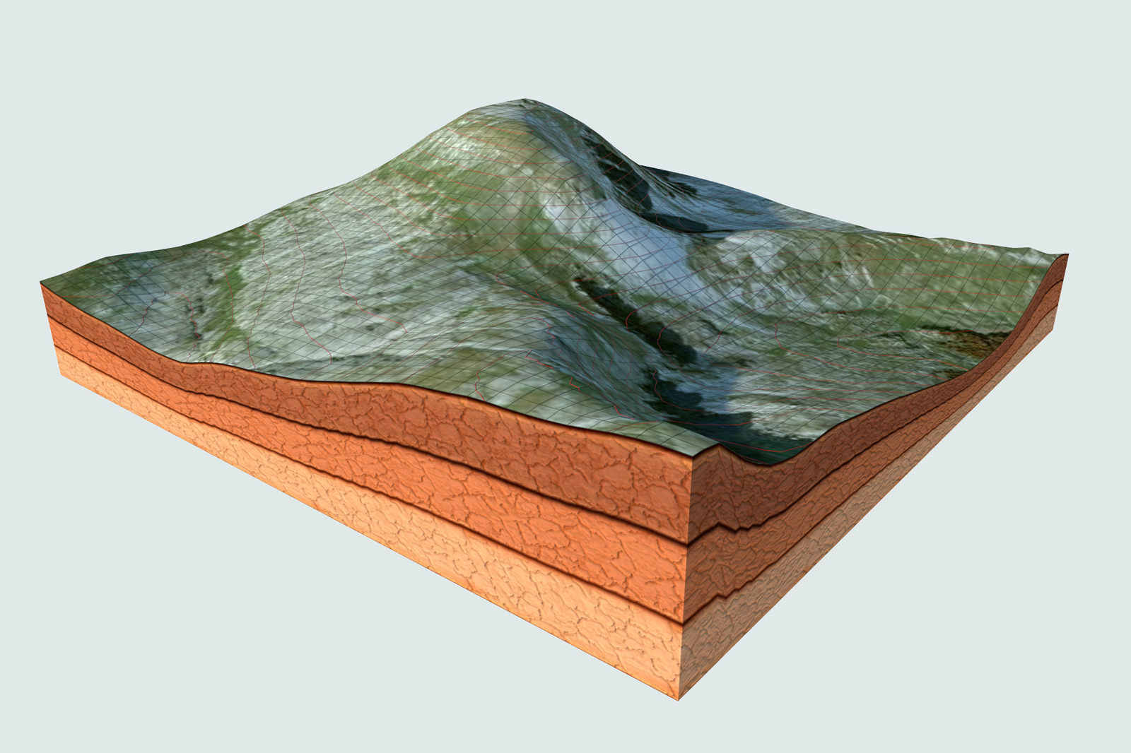
i'm not into this kind of modeling.. anyway i'm interested into trekking and mountan biking so i tried to have fun with this plugin it works hella fine even with massive geometry here is my test with one of my favourite mountains

-
Fredo, you must be very rich giving a plugin like this away for free

Crazy amounts of code.. -
A really big thanks for this one Fredo, as always ! You don't imagine how many hours of my life you give me back with this ! I'll hit the donation button again, and hit it hard ! Now I have to learn this plugin, it seems that there's so many features in it !
Thinking of it, you just made what I was waiting from the SU dev team since I started using sketchup... -
@panixia said:
i'm not into this kind of modeling.. anyway i'm interested into trekking and mountan biking so i tried to have fun with this plugin it works hella fine even with massive geometry here is my test with one of my favourite mountains
That's some nice terrain graphics there. Did you make the earth section texture yourself?
-
i don't deal with contour models, landscape and so on.. just wanted to play with this beauty of plugin.. so grabbed the mountain from google used contour maker by tig to cut the contours, used the cuntours to generate the mesh, did a bit of general cleanup and texturing with a mix of VT + QFT + trupaint, then copied and pasted in place into groups both the contours and the quad grid and converted them with "lines to tubes" plugin for vray to render them.
just to practice.. one never knows.. plus this is funny.edit. i misunderstood the question.. my english is quite bad.. and i'm tired.. yeah i did the texture by myself.. here is the vismat if you like it..
-
Fantastic! thank you Fredo for sharing.
-
no words. one only: amazing!
+thank you -
thanks fredo... your the man
-
Very cool Fredo!. Since I used to grab terrains from within SU that were supposed to be geolocated and truthful...I grabbed one today, used the contour tool, to generate the iso-lines then deleted the terrain I grabbed. Used TopoShaper to redo the terrain. It worked well after a few attempts thank you very much!. All is not perfect however, I tried to project a gradient material to the terrain, and I ended up with a bunch of different colored triangles, not a smooth texture, I will see if I can figure out what I did wrong...
-
Really Thank You!! A real Master!
-
Just seeing this now for the first time. Pure brilliance!
 Another incredible addition!
 -
@Whaat:
see this example: http://sketchucation.com/forums/viewtopic.php?f=81&t=52237 -

Any ideas why I get this when starting SU after installing TopoShaper? -
Have you observed the correct footprint? (See the first post of the thread)
-
@massimo said:
Have you observed the correct footprint? (See the first post of the thread)
Ha! Silly mistake. Thanks!! works fine.


Advertisement