[Plugin][$] TopoShaper - v2.7a - 01 Apr 24
-
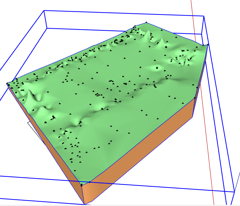
I just try TopoShaper with a point cloud with more than 130.000 points out of a ASCII-File. How I can import it in SU and make any kind of terrain model?
Any ideas and suggestions are most welcome!!

Best Regards Simon
-
@simonhaufe said:
I just try TopoShaper with a point cloud with more than 130.000 points out of a ASCII-File. How I can import it in SU and make any kind of terrain model?
Any ideas and suggestions are most welcome!! Best Regards Simon
I don't think TopoShaper can handle 130,000 points; and I don't think either that Sketchup will not scream with a mesh of 130,000 vertices.
So you'll probably have to find a way, with other tools to simplify the input points or raw mesh, either simplifying, or cutting in pieces if the cloud covers a very large area. I don't know if there are Ruby scripts in Sketchup to do that, but I know there are specialized terrain software that can do it. There are several discussion threads in Sketchucation and Sketchup forums about terrains.Fredo
-
I'm trying to use Toposhaper to create a topo from points. I have points selected and when I run the plugin all I get is a blank error.

-
@rspierenburg said:
I'm trying to use Toposhaper to create a topo from points. I have points selected and when I run the plugin all I get is a blank error.
Hi,
It would be helpful that you attach your model so that I can investigate. Thanks.
Fredo
-
-
You just need to put all contruction points and the contour within a Group, then select the group and run TopoShaper Cloud.
Note that your model seems to have some points which create peaks.
Fredo
-
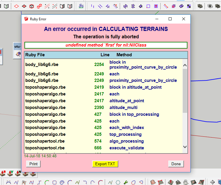
What can be the reason of such error of TopoShaper?
It appears on SketchUp17 and 18, if I try very simple terrain, just of 2 or 3 curves.
-
Put your SKP, that can be helping!

Save as V6 for a more large audience! -
As I said it happens in any file, just if I try to create a terrain from 2 simple curves drawn by "freehand".
This is a full text of the error:
body_lib6g6.rbe
2254
block in proximity_point_curve_by_circle
body_lib6g6.rbe
2249
each
body_lib6g6.rbe
2249
proximity_point_curve_by_circle
toposhaperalgo.rbe
2419
block in altitude_at_point
toposhaperalgo.rbe
2417
each
toposhaperalgo.rbe
2417
altitude_at_point
toposhaperalgo.rbe
2390
altitude_multi
toposhaperalgo.rbe
427
block in top_processing
toposhaperalgo.rbe
425
each
toposhaperalgo.rbe
425
each_with_index
toposhaperalgo.rbe
425
top_processing
toposhapertool.rbe
574
algo_processing
toposhapertool.rbe
666
execute_validate
toposhaperpalette.rbe
130
execute_from_palette
toposhaperpalette.rbe
76
notify_from_palette
toposhaperpalette.rbe
518
call
toposhaperpalette.rbe
518
block (2 levels) in palette_validate
body_lib6palette.rbe
3596
call
body_lib6palette.rbe
3596
execute_button
body_lib6palette.rbe
3401
onLButtonUp
lib6palette.rbe
91
onLButtonUp
toposhapertool.rbe
984
onLButtonUp
-
Could you indicate the text of the error (just just give the files and line numbers), as well as post one of this simple model with free-hand drawn curve.
Many thanks
Fredo
-
Thank you Fredo
amazing plugin -
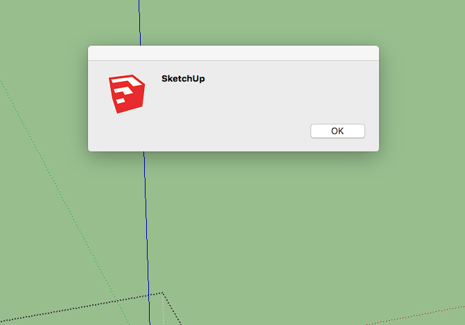
Hi, Can't get this to work on my Mac. Using the supplied 'test' SKP file I either get a full on program bug splat! a non contoured output, just the shape of the face or the attached useless error message:
Any help appreciated
-
Hi, Finally got this working on my mac after I realised that it worked on a group rather than selecting points (contrary to some vids I've watched) However, now I've got it working the results I've got are not using all the cloud points in the group. Therefore the result is very "pointy" Any help appreciated
-
Very difficult to help if you do not post the model
Fredo
-
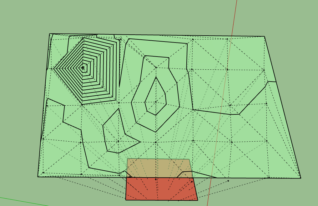
hi fredo btw this plugin is very useful but i have some question . i want to create full area terrain but this is what i got . could you help me what i have to do
ps. thank you
-
hi fredo ,i got some problem . i want to create terrain in full area but this is what i got . how can i do for expand the extent of terrain
thank you
-
@akaraphon said:
hi fredo ,i got some problem . i want to create terrain in full area but this is what i got . how can i do for expand the extent of terrain
If you include a face (or several) in the group where you have the Guide points, TopoShaper will use them for the contour of the terrain.
Anyway, the best is that you post your model so that I can have a look.
Fredo
-
Fredo, first off let me thank you for all of your amazing plugins. I have a request for toposhaper. I don't know anything about coding and/or how difficult this would be. But in surface modeling programs you have the ability to add breaklines which make a more accurate surface. Do you think this can be added?
A Breakline is a line used to connect data representing a distinct surface feature, like a ridge line, edge of pavement, toe of a slope, centreline of a road, or flowline of a ditch or stream. When a breakline is defined, the surface triangulation must first follow the breakline, by placing triangle edges coincident with the breakline segments. This ensures the feature in the model is accurately depicted. Then, the rest of the interpolation is performed based on proximity. Breaklines are typically critical to creating an accurate surface model. It is the interpolation of the data, not just the data itself that determines the shape of the model.
-
That's great Fredo, look forward to it.
-
@alpro said:
Fredo, first off let me thank you for all of your amazing plugins. I have a request for toposhaper. I don't know anything about coding and/or how difficult this would be. But in surface modeling programs you have the ability to add breaklines which make a more accurate surface. Do you think this can be added?
It is complex (it involves constrained Delaunay triangulation), but I finally built an algorithm (I use it already in FredoCorner). I will integrate it in TopoShaper when I can, along with a GUI refresh. This would look like a "from Contour", where you can also influence the terrain with additional guide points.
Fredo


Advertisement