[Plugin][$] TopoShaper - v2.7b - 30 Jan 26


-
Hi my friends,
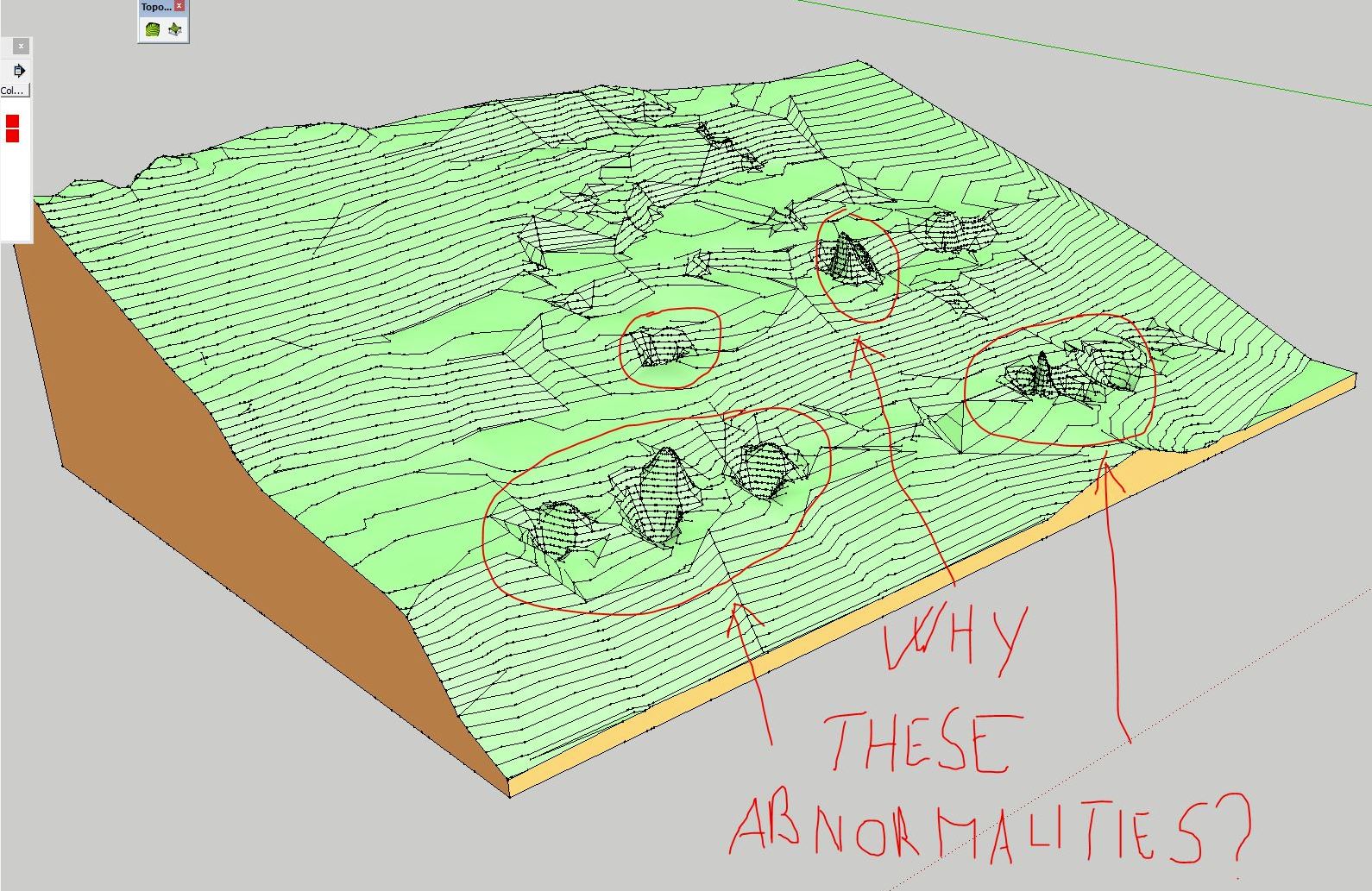
i have a little problem.. i tried to model a cloud point to get a soil.. everything ok, except some peek and deep that the plugin generate, and i don't know to get rid.
You see in the attached screen, and in the skp file with point.
Hope in your help! Thanks man!!
PE_9064 - MODELLAZIONE TERRENO_light.skp
-
no one could help me?
-
What would you expect from such a point?
If you only have some of these, you can move the vertices afterwards manually.
Or you can use a plugin to smooth the surface after the creation.
-
If you only have a limited number of these points above the terrain causing the spikes then delete these points before running Toposhaper.
-
Why not use Triangulate Points first by TIG ?
-
After playing with TopoShaper I ended up with several (three) terrains overlapped. Why this happened? It seems I am missing something in functionality of this plugin, so instead of refining the just created terrain, I end up with new modified copies of the terrain.
-
@kenny said:
If you only have a limited number of these points above the terrain causing the spikes then delete these points before running Toposhaper.
I have some deeps and some peeks. I don't know why this happened.
I know that i can move up and down these points to get a level.. but i would like to understand how to evitate those problem.Why suggest to use triangulate point instead of toposhaper? toposhaper is much better than triangulate point for this, or not?
Thanks mate!
-
It was just a suggestion for have a preview of the terrain and maybe see if there are not aeras where some confusion between near vertices are possible!

And give to Toposhaper faces and not only vertices!
-
@pilou said:
Why not use Triangulate Points first by TIG ?
Pilou,
The first iteration of TopoShaper is precisely the Delaunay Triangulation (same results normally as with the Falé /TIG plugin).
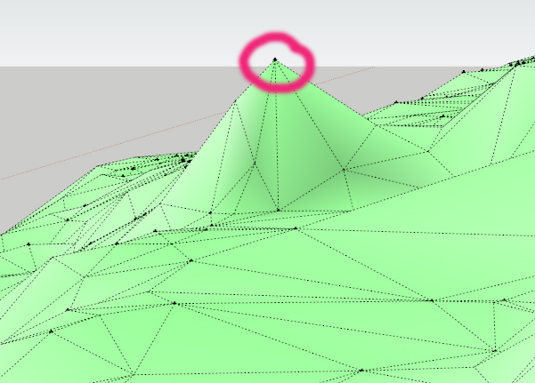
@orei: the spikes are due to singular points with very different altitudes compared with immediate neighbours. TopoShaper CloudPoints generates a surface passing through the points.
My suggestion would be that:
- you generate the group of isocontours from the triangular mesh (an option in TopoShaper Cloud)
- then from the isocontours group, you generate a quad mesh terrain, using the other tool of TopoShaper.
This will smooth the spikes
Fredo
-

-
@fredo6 said:
@orei: the spikes are due to singular points with very different altitudes compared with immediate neighbours. TopoShaper CloudPoints generates a surface passing through the points.
My suggestion would be that:
- you generate the group of isocontours from the triangular mesh (an option in TopoShaper Cloud)
- then from the isocontours group, you generate a quad mesh terrain, using the other tool of TopoShaper.
This will smooth the spikes
Sorry Fredo, tried to do what you suggest, but nothing change. I generate the group with triangular mesh (how always i did) and peek and deep are present. After that, used the quad mesh terrain, but peek and deep still present.
Could you, please, verify those things with my skp file previously attached to last post?
Thanks mate. You are the best!!!
-
Orei,
Your cloud points data includes these sharp peaks and deeps. Because TopoShaper Cloud ensures that the terrain surface goes through ALL the points, these peaks will be reflected in the terrain.
If they do not correspond to the reality, then simply discard the points or change their altitude.
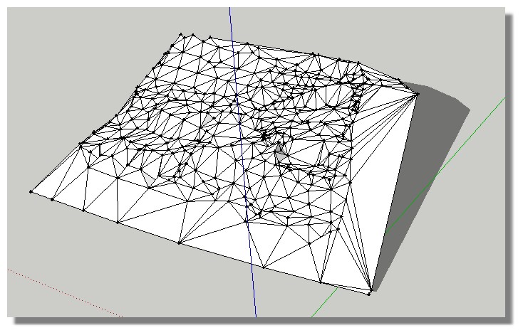
Attached is the file with your original points in both Triangular and Quad Mesh mode.
Fredo
-
@orei said:
@fredo6 said:
@orei: the spikes are due to singular points with very different altitudes compared with immediate neighbours. TopoShaper CloudPoints generates a surface passing through the points.
My suggestion would be that:
- you generate the group of isocontours from the triangular mesh (an option in TopoShaper Cloud)
- then from the isocontours group, you generate a quad mesh terrain, using the other tool of TopoShaper.
This will smooth the spikes
Sorry Fredo, tried to do what you suggest, but nothing change. I generate the group with triangular mesh (how always i did) and peek and deep are present. After that, used the quad mesh terrain, but peek and deep still present.
Could you, please, verify those things with my skp file previously attached to last post?
Thanks mate. You are the best!!!
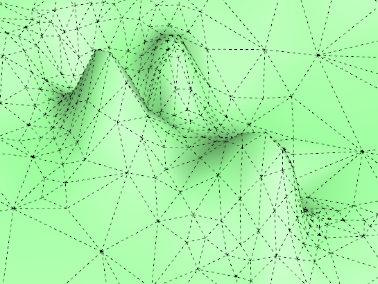
I find that if you to as Fredo suggests: generate terrain from the isocontours, you get a much more regular terrain and you can smooth the few remaining anomalies more easily. If you have bad points in the cloud, there is nothing the plugin can do to change that, but the above procedures helps to "average" them out some.
-
good...cool...cool good ....hehehehe
-
One suggestion.. Can you make option maybe in the next reliese.. "Stick with orriginal contours" for triangulated mesh.. So the plugin would not make triangles between not adjacent contour lines (for example one point of triangle on hight=2m another h=3m and third h=5m). Could be done by inforcing engine to require for points two the same hights and fird different.. simple check.. I'm crab with programming but could be nice add on.. I usually have to stick with orriginal contours...
-
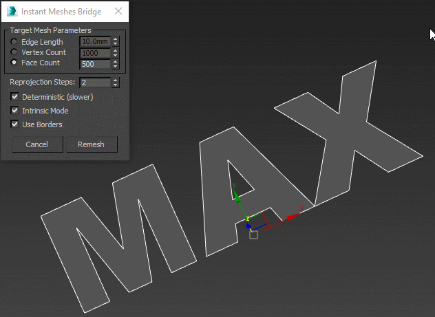
http://www.scriptspot.com/3ds-max/scripts/instant-meshes-bridge
Fredo, could Toposhaper follow the contours as shown on attached gif?
And, generally speaking, is doable to make a bridge to this external free retopologizer?
(https://github.com/wjakob/instant-meshes)
Or make something similar but independent ? -
Well. I know how to constrain the triangulation to the contours. Simply, that's not a trivial development and it requires some time. But it should come.
Fredo
-
Getting some Ruby errors with latest version,
Date: 28-Aug-16 15:37:45
An error occurred in CALCULATING TERRAINS
The operation is fully abortedundefined method `x' for nil:NilClass
mesh.rb: 134 -- ==
TopoShaperAlgo.rb: 1996 -- block (2 levels) in hull_exclude_nodes_outside
TopoShaperAlgo.rb: 1996 -- each
TopoShaperAlgo.rb: 1996 -- block in hull_exclude_nodes_outside
TopoShaperAlgo.rb: 1979 -- each
TopoShaperAlgo.rb: 1979 -- hull_exclude_nodes_outside
TopoShaperAlgo.rb: 1089 -- grid_mark_contours
TopoShaperAlgo.rb: 535 -- top_analysis_contour
TopoShaperAlgo.rb: 418 -- top_processing
TopoShaperTool.rb: 574 -- algo_processing
TopoShaperTool.rb: 666 -- execute_validate
TopoShaperPalette.rb: 130 -- execute_from_palette
TopoShaperPalette.rb: 76 -- notify_from_palette
TopoShaperPalette.rb: 518 -- call
TopoShaperPalette.rb: 518 -- block (2 levels) in palette_validate
body_Lib6Palette.rb: 3058 -- call
body_Lib6Palette.rb: 3058 -- execute_button
body_Lib6Palette.rb: 2865 -- onLButtonUp
Lib6Palette.rb: 93 -- onLButtonUp
TopoShaperTool.rb: 984 -- onLButtonUpThoughts? If it is helpful i have attached the file i am having trouble with.
-
OK upon further inspection the errors above were causd by a conflict between toposhaper and the flux.io plugin for sketchup. Hope this is helpful for someone.
-
After created a terrain, is there a way to show the "grid" on it? I see only the surface but would be nice to see the points of the grid for editing.
Hello! It looks like you're interested in this conversation, but you don't have an account yet.
Getting fed up of having to scroll through the same posts each visit? When you register for an account, you'll always come back to exactly where you were before, and choose to be notified of new replies (either via email, or push notification). You'll also be able to save bookmarks and upvote posts to show your appreciation to other community members.
With your input, this post could be even better 💗
Register Login


Advertisement