For vector PDF's, I've found Inkscape does a creditable job. It imports Ok and I can then clean up the vectors before export as a DXF or OBJ (for Blender).
Oops, your profile's looking a bit empty! To help us tailor your experience, please fill in key details like your SketchUp version, skill level, operating system, and more. Update and save your info on your profile page today!
FredoBend | Powerful new bending tool for SketchUp Download
M
Offline
Posts
-
RE: PDF Import
-
RE: Recurrrence: First Geolocation works - Add imagery fails
It's the old Style Menu issue (revisited after upgrade). Easily, if not obviously, fixed and for the record;
Window -> Styles -> Edit [tab]-> Match Photo sliders (may need to scroll down) -> Foreground Photo (tick box on).
For some reason, I'm not wired to see Geolocations terrain display issues as Style problems! -
RE: Recurrrence: First Geolocation works - Add imagery fails
Thanks for your response.
I use Geolocation regularly; it's an integral part of my workflow. This is a very recent development, (last week or so). It may be location specific.I have found a workaround in this case, which is to reduce the zoom (zoom out) a step or two.
EDIT - the odd intersection is not something I did - the blank plane seems to be at a small angle, or an artifact, as it changes with rotation - disappearing or getting worse.
-
Recurrrence: First Geolocation works - Add imagery fails
This problem first occurred about a year ago, IIRC. The first geolocation image and terrain imports fine, but the subsequent "Add imagery" fails to bring in the image.
I'll post to Trimble, as well. -
RE: Boulder newspaper spills the beans about Trimble future
HHGTTG fan here. Also passed the infection along to family members, offspring, and casual acquaintances.
The books are great, but the original radio broadcasts are even better. Most are available on CD, so probably as MP3 as well -
RE: A new home for SketchUp
Also just caught this. I'm pretty happy with SU8 as it is - ably augmented by various rubies (kudos all).
So long as the Add Location function (a Google dependency) isn't crippled, I'm cool.
More integration with survey/ GPS data might be nice, though.So wait and see.
I've been Blendering for a while. It's a steep learning curve, a very different user interface, and would need a number of tools developed for it. That said, the new Bmesh is pretty cool. -
RE: Sketchy +WINE--A question about feasibility
There was a thread on this some time back ... for SU 7.1 and WINE (XP).
It covers a number of issues including some graphics related matters.
If you haven't already had an opportunity to view it, here is the link.
http://forums.sketchucation.com/viewtopic.php?f=180&t=9687 -
RE: Uses for SketchUp
Safety barriers on golf courses, driving ranges and sports fields.
For golf facilities, I provide optimised barrier location and sizing reports using a golf ball flight trajectory model.
Sketchup is a major part of the work flow - geo-location gives me some terrain and relative siting data, import allows me to integrate survey or plan data (ususlly in dwg/dxf format), various plugins allow me to transfer data to the trajectory model, and I export various vews as visualisation aids. Also, I do some overlays using Photomatch for presentations. -
Update of Mitsuba renderer
http://www.mitsuba-renderer.org/download.html
Specific improvements for fabrics, and significant other "engine" improvements.
-
LuxRender 0.8 stable release
This is a new stable release, announced in the forum link below.
SU2Lux works fine, and LuxRender allows networked rendering.
This version has some GPU rendering enabled, but it's a new feature and still improving.
http://www.luxrender.net/forum/viewtopic.php?f=12&t=6315There's also a competition announcement on the home page.
-
RE: Show Me Your SketchUp
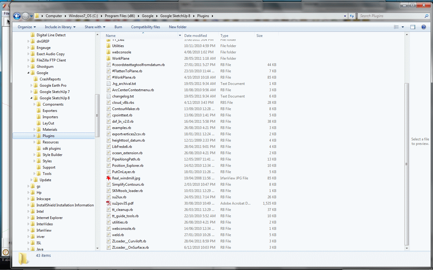
I'm not an intensive user - a lot of terrain work, and measuring. Some point cloud and DXF/DWG import export for survey details, and some rendering. I use specifiic plugins (Put on Layer, Pipe along path, co-ords tag, points cloud) extensively.<p>
Screen shot and Plugins folder below.
-
RE: Free rendering software(s) for Sketchup
two more
LuxRender http://www.luxrender.net/
There is an Su2Lux plugin, and some users in these forums.Mitsuba http://www.mitsuba-renderer.org/
uses DAE Collada format, but very much beta, and no recent updates.All have relatively steep learning curves, though.
-
RE: 2D to 3D modeling - antenna pattern
It's difficult to provide a single solution without knowing what the format of the data is. Here's some suggestions.
-
if you have XYZ data (or polar co-ordinate data that can be converted) then Didier Bur's excellent pointscloud ruby script (Didier's site is http://rhin.crai.archi.fr/RubyLibraryDepot/) will import spreadsheet data and provide some level of triangulation/skinning. I use it mostly for terrain/ DEM data for which it works well.
-
If you have the contour data for the illustrated diagrams in digital form, then TIG's suggestions are the way to go. You may need to tweak the interpolations.
-
If all you have is the graphs, you could import these as images, trace each and then scale as required and follow TiG's suggestion. Another program that is good at accurately digitising images of graphs is Engauge (http://digitizer.sourceforge.net/). The interface is not slick, but its very capable.
Hope that helps.
If not, SU may not be the right tool - you may want to look at dedicated data visualisation programs. I haven't used these much, but GGOBI (http://www.ggobi.org/) integrates with the R data/statistical environment (http://cran.r-project.org/), or OpenDX seems well regarded (http://www.opendx.org/). I know nothing about Axiis (http://www.axiis.org/) but it might be another option. -
-
RE: Trace pdf site plan
I have found that importing PDF into Inkscape (open source) is sometimes helpful, especially if the pdf has been created from CAD program. It can then be saved as a DXF file for import to SU (or as a native svg if you want to make changes in a vector drawing program).
Also, some of the programs based around Ghostscript can do a similar conversion, but I've had less success with these.
-
RE: Applying aerial to topo
There're a couple of useful videos that demonstrate painting onto a topo at "Go 2 School".
For the eyedropper ...
http://www.go-2-school.com/media/view/37
and for a tiling technique
http://www.go-2-school.com/media/view/1
The videos are specifically for projecting colour images onto GE terrain in SU6 & 7, but the methods work for what you want to do. -
RE: Placing wire, pipe, connduit and other linear items
I use the pipe along path ruby - which is simple enough, so long as you set the path.
So ... if you have some pathfinder, it might be part of the solution?
Reporting can then be based on the path.Profile builder is rather more sophisticated.
-
RE: Add more imagery geo location in sketchup problem
Seems to be working again - without needing updating, so a server side issue?
Excellent!