[Plugin][$] TopoShaper - v2.7a - 01 Apr 24


-
ah ...by the way
You are great Fredo ...admiration!
-
I keep getting an error while using the extension with Sketchup 2021. Ill post the text below:
Date: 03-Mar-21 10:06:57
An error occurred in CLEANSING
The operation is fully abortedcannot hide layer that is a part of the active path
body_lib6tool.rbe: 2538 -- visible=
body_lib6tool.rbe: 2538 -- block in switch_to_temp_layer
body_lib6tool.rbe: 2537 -- each
body_lib6tool.rbe: 2537 -- switch_to_temp_layer
toposhapertool.rbe: 1391 -- change_view
toposhapertool.rbe: 1358 -- set_preview_working
toposhapertool.rbe: 544 -- cleansing_processing
toposhapertool.rbe: 523 -- after_selection
toposhapertool.rbe: 493 -- notify_edge_picked
body_lib6edgepicker.rbe: 539 -- call
body_lib6edgepicker.rbe: 539 -- notify_action
body_lib6edgepicker.rbe: 595 -- terminate_current_selection
toposhapertool.rbe: 658 -- execute_validate
toposhapertool.rbe: 387 -- handle_initial_selection
toposhapertool.rbe: 319 -- activate
toposhapertool.rbe: 133 -- select_tool
toposhapertool.rbe: 133 -- action__mapping
lib6plugin.rbe: 129 -- call
lib6plugin.rbe: 129 -- launch_action
lib6plugin.rbe: 227 -- launch_action
bootstrap_toposhaper.rbe: 83 -- launch_action
bootstrap_toposhaper.rbe: 136 -- block in startup
lib6plugin.rbe: 1347 -- command_invoke
lib6plugin.rbe: 1328 -- block (2 levels) in build_config_commands
lib6traductor.rbe: 1377 -- block in add_commandShould I just reinstall Sketchup 2020? I can't live without this extension!
-
@sgb1456 said:
Should I just reinstall Sketchup 2020? I can't live without this extension!
You do NOT need to reinstall Sketchup. Maybe relaunch it and try again.
Otherwise, if you could post or PM me the model, this would help.
Fredo
-
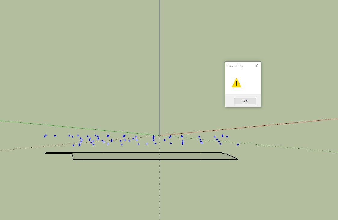
Hi Fredo,
Brilliant plugin.
What am I doing wrong here? When I select cloud I get a yellow triangle warning as if the guide points have not been selected? It worked earlier without any problems?Thanks in advance.
-
Maybe you could upload the .skp file so we can see what you're working with?
-
@grey24601 said:
What am I doing wrong here? When I select cloud I get a yellow triangle warning as if the guide points have not been selected? It worked earlier without any problems?
You need to enclose the guide points in a group and then select this group before launching TopoShaper cloud.
-
NEW RELEASE: TopoShaper v2.6a - 24 Apr 21
Requirement: LibFredo6 11.6a
TopoShaper 2.6a is a technical release for performance of contextual selection menu.
Home Page of TopoShaper for information and Download.
-
Hi,
I have SU2017 and fredo lib 6 and some fredo tools. I need Topo shaper. I have downloaded extension file (TopoShaper_v2.6a - the one for the SU2017 and later versions)I have installed it from extension manager. It said menus will appear after I restart SU. But nothing happened. I have restarted whole computer several times, checked if it was installed actually. I see Toposhaper in extension manager list. I have checked AppData Roaming Plugin folder. Toposhaper is there as well. But no menu is showing up. It is as if it was never downloaded. I have tried the old version for the ones before SU2017. Surprisingly toposhaper menus have showed up. But one of two icons do not work. I could not use it. Now I am going for a trial SU2020 to make it work. But I need to solve the issue for SU2017 as its my paid licensed software. Anyone any ideas?
-
@fredo6 said:
@teknoel said:
Hi this is still a very valuable plugin and one of the most powerful ways of transforming CAD typographical information into 3d. It would be even more powerful if we could get it to output meshes that were compliant with the new Quad workflow that subdivision surfaces utilizes. I imagine you're familiar with the requirements. would it be a big job to update?
Are you referring to the properties of the diagonal of quads?
Hi Fredo
Sorry I never saw your reply. Every time I have to generate topology I think about a quad workflow so I rechecked this post. your exactly right about the diagonal of the quads. If they are soft, smooth and cast no shadows then the quadface plugin will recognize them for accurate subdivision. One could ideally generate a pretty large format grid from toposhaper and then subdivide with subdivision surface for extra detail and editability. you could also export to blender for texturing really easily. -
I have also been receiving the error that sgb1456 outlined (a few minor differences in the numbers are highlighted in red). I am able to get the plugin to work successfully on very simple setups, but not anything more complex. I uninstalled and re-installed all the Fredo plugins I use, but still get the error. I can PM the file if that would help. Thank you for all your wonderful plugins!
Date: 30-Jun-21 11:10:48
An error occurred in CLEANSING
The operation is fully abortedcannot hide layer that is a part of the active path
body_lib6tool.rbe: 2538 -- visible=
body_lib6tool.rbe: 2538 -- block in switch_to_temp_layer
body_lib6tool.rbe: 2537 -- each
body_lib6tool.rbe: 2537 -- switch_to_temp_layer
toposhapertool.rbe: 1391 -- change_view
toposhapertool.rbe: 1358 -- set_preview_working
toposhapertool.rbe: 544 -- cleansing_processing
toposhapertool.rbe: 523 -- after_selection
toposhapertool.rbe: 493 -- notify_edge_picked
body_lib6edgepicker.rbe: 539 -- call
body_lib6edgepicker.rbe: 539 -- notify_action
body_lib6edgepicker.rbe: 595 -- terminate_current_selection
toposhapertool.rbe: 658 -- execute_validate
toposhapertool.rbe: 387 -- handle_initial_selection
toposhapertool.rbe: 319 -- activate
toposhapertool.rbe: 133 -- select_tool
toposhapertool.rbe: 133 -- action__mapping
lib6plugin.rbe: 129 -- call
lib6plugin.rbe: 129 -- launch_action
lib6plugin.rbe: 227 -- launch_action
bootstrap_toposhaper.rbe: 83 -- launch_action
bootstrap_toposhaper.rbe: 149 -- block in startup
lib6plugin.rbe: 1360 -- command_invoke
lib6plugin.rbe: 1341 -- block (2 levels) in build_config_commands
lib6traductor.rbe: 1377 -- block in add_command -
I was able to copy my linework into a new sketchup file and get it to work - not sure what the issue was before - I have been getting similar cleansing errors for some time, but never created a log, so not sure how similar they are...
-
@jschwaiger said:
I have also been receiving the error...
What version of SketchUp are you using? Please complete your profile.
-
Sketchup Pro 2021 on Windows 10.
@dave r said:
@jschwaiger said:
I have also been receiving the error...
What version of SketchUp are you using? Please complete your profile.
-
Hey guys,
Is there a way to make changes to the terrain after it as been generated?
Like making an undergound level.
Also, is there a way to make a step and not join two lines with a slope? -
Hello,
TopoShaper just started giving me problems. I've used for years without any hickups..no idea why I'm getting errors now.When I select contours and run TopoShaper, I get 'cannot hide layer that is a part of the active path' Error.
This is happening on both office and home pc. Sketchup Pro 21.1.299, Windows 10 pro. error log attached, one from office, one from home office. If anyone has any ideas or has time to check this out, I'd sure appreciate it. Thanks!
Ruby Error - CLEANSING - 09-Sep-21 17_50_56.txt
-
Update:
I got it to work. exploded, copied to new drawing, etc. All good now.
-
TopoSahper has to play with layer visibility to have the 2D/3D view. So, if you are not at the top level of the model, there may be problems.
-
I just installed Libfredo6, restarted sketchup, and then installed the toposhaper plugin, then rebooted again and the plugin is nowhere to be found. In the window menu if the LibFredo6 options menu appears. I have SK2019
-
TopoShaper appears in a Fredo... submenu under Tools.
There is also a Toolbar option... -
Installed Toposhaper (sketchup pro 2021) and when I start out with "cleansing contours it goes to a yellow square with the contours to the side and no toolbar to select the parameters from. seem to be able to work through it by right clicking and selecting "create preview". Ultimately what I'm hoping to do is to adjust the level of smoothing so that I get things like the sidewalks showing up in the examples below. Attaching below terrain done with native sandbox tools, and then done with toposhaper. hoping I can get something between the two in terms of terrain detail and most importantly eliminating the jagged geometry created with sandbox.


Advertisement