Terrain from contours - improve on native 'from contours'?
-
Fredo, I wish I had something more helpful to say than 'looks great', but that maybe is a good thing. Perhaps the other fellows will stop back by, they seem to have much more experience than I have. As far as interest in and good use for such a plugin, I would say most definitely.
@unknownuser said:
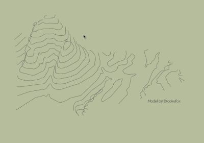
Are the topmost contours supposed to be rounded in their inside or just left as a plateau?
To me they are no different from any of the others. Your results to me look fantastic.
You mention the rectilinear closure of the contours, which was done manually by me to make level faces and which I gather is actually unnecessary and even counter-productive.
-
11 + 7 seconds for the slow and fancy one.
Too simple... Complexify, make inscrutable options so the ignorant can pester you for answers. You know I'll be back.
-
@unknownuser said:
@brookefox and EarthMover,
Thanks for the feedback. I'll see if I can release something beta in the coming days.
Fredo
Hey Fredo,
Any chance on seeing this beta plugin in the future? Could really use it on a few projects I'm working on. If not, no worries, I know you are busy.
Thanks.
-
@brookefox said:
@unknownuser said:
Are the topmost contours supposed to be rounded in their inside or just left as a plateau?
To me they are no different from any of the others. Your results to me look fantastic.
That's a valid question. I suppose the plugin has to assume and make some sort of rounding-off based on the lower contours. It's easier for the user to flatten after if needed. Alternately user can add a small contour or point to indicate the peak.
This looks great, I was just wanting something like this yesterday. I try other skinning plugins on contours but they don't do so well and for all the trouble I end up back with Sandbox. Wonderful coding!
-
@pbacot said:
This looks great, I was just wanting something like this yesterday. I try other skinning plugins on contours but they don't do so well and for all the trouble I end up back with Sandbox. Wonderful coding!
Could you post or PM me your model.
The main reason why I don't release it quicker is because I have not worked too much on the validation of input contours and handling of corrections.
And of course, I have not really tested on real-life models (actually only the one posted by brookefox).Fredo
-
I'd be glad to PM it to you! Will do today. Thanks, Peter
-
By the way, I observe that the native 'From Contours' plugin does a rather good job on your example of terrain.
Because TopoShaper uses a more accurate algorithm (to cope with cases of more abrupt changes of relief and also saddles), the analysis of the contours is more tricky and I'll need some time to write a decent code to handle it.
Fredo
PS: and again, I'm pretty sure Trimble will adress the generation of terrain from contour in a next release of Sketchup
-
Yes sir,
That existing terrain is not too problematic for Sandbox, but I assume a more regular clean mesh, as I think you are after, would serve better for subsequent "regrading". Thank you.
It seems the skinning plugins don't work where ridges twist about as in this case, and SB seems to work that out OK.
Peter
-
Fredo,
I'll Join Earthmover and others to say that what you tried to do with this plugin attempt is my biggest dream in SU !! As a landscape architect, you can't imagine how much time I spent to clean the terrain mesh because of SU native triangulation prevent using the mesh for may things...so...I'll be very gratefull if you can give us even an alpha version of it !!

-
For ideas on terrain mesh results:
http://www.formz.com/products/bonzai3d/bonzai3dFeatures.php?init=27 -
@pbacot said:
For ideas on terrain mesh results:
http://www.formz.com/products/bonzai3d/bonzai3dFeatures.php?init=27Thanks. That's more or less what was my intention.
This is why I need to write some extension in C to have enough speed for the preview mode.
But I am a little bit reluctant to engage in this because I am pretty sure that Trimble will provide a bridge to a Terrain from Contour program in a next release of Sketchup (I guess this is what field engineers need)
I need to think about if I can make a simple beta release quickly. The version I have currently works on close contours only.
Fredo
-
would LOVE this tool. Very needed. amazing as usual Fredo.
-
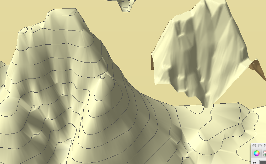
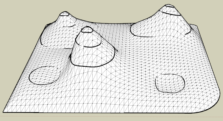
With Vali Architects new Instant Terrain plugin.
Contours at height. Sandbox "from contours". VA InstantTerrain.
This doesn't really address the OP issue, but it's a way to apply a regular mesh to the terrain. And simplify--if you use a larger spacing.
I know, the contours have parts missing--just the most convenient example to grab at the moment.
Some berms added with Artisan
-
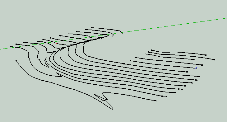
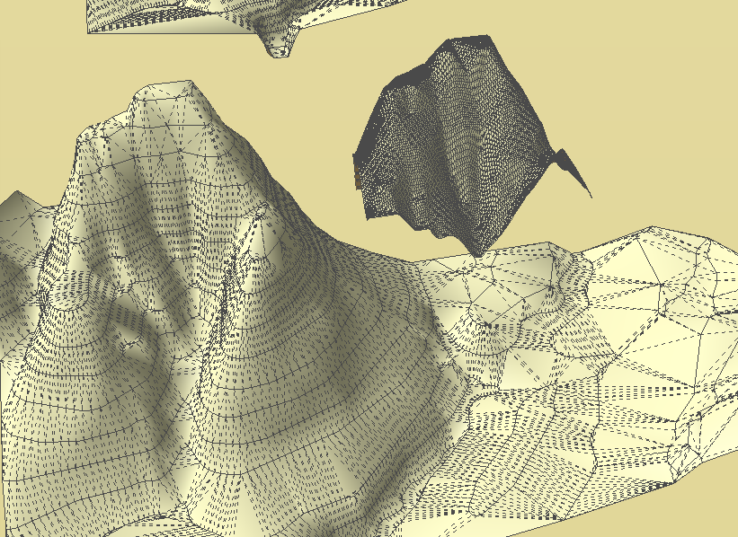
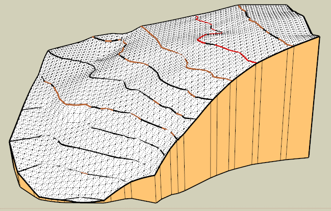
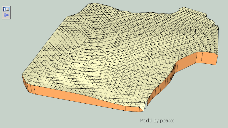
Using Brookefox model, two things:
- The contours do not have enough points for Sandbox. I added 2-3 times as many vertices per curve in some of the countour model.
- A picture of the Sandbox result and some of the model run through Instant Terrain at fine setting. [EDIT: I ran Instant Terrain for whole model at 75' spacing--last image.]
-
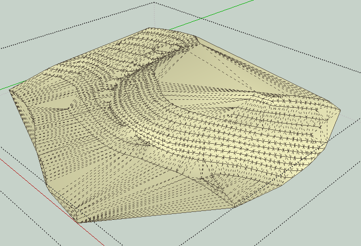
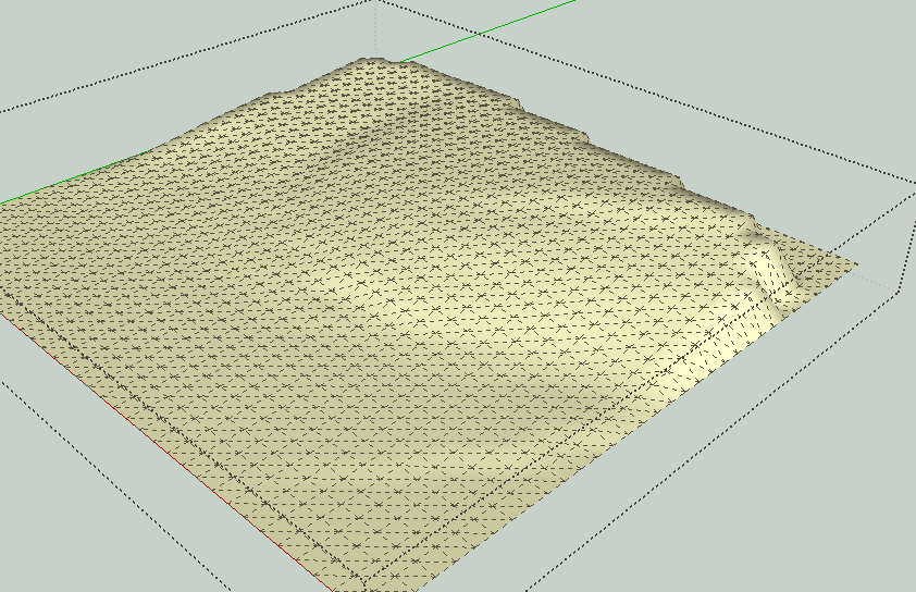
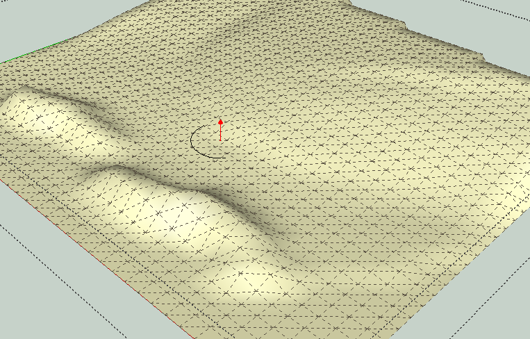
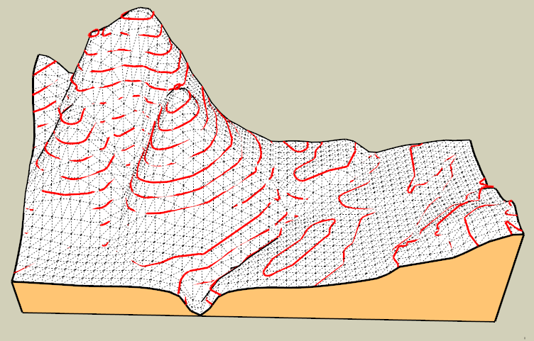
I resumed some work on Toposhaper, in particular around the identification of contour zone and interpolation.
Here is the current state on Brookefox' model, with various resolutions on a quadrangular mesh
Toposhaper - Test 24 Dec 12.zip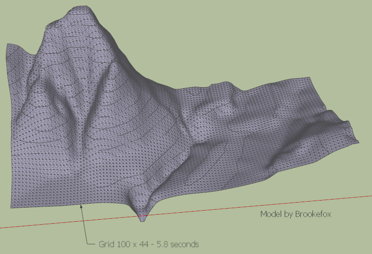
It still takes many seconds
One issue I came across is about zones bordered by a single contour, either loop contour, or open to the outside. In the current version, I try to figure out a kind a simulated relief based on the surrounding elevations.
Fredo
-
This looks fantastic! I would think it should take more than a few seconds. Did you modify the Brookefox contours beforehand?
Happy Holidays, Fredo! Thanks for sharing your gift. Peter
-
Peter,
I took the contours as they are shown on the video, which I think is the original model from Brookefox.
If you have some contours model, please send them to me so that I can test the script in various situations.
Fredo
PS: The main issue I see in the utilisation of Toposhaper is that it generates a lot of faces. The good thing with quandrangular meshes is that they can be easily textured, since based on quads. I may have however to find a way to densify and undensify the mesh in function of the resolution really required by the relief.
-
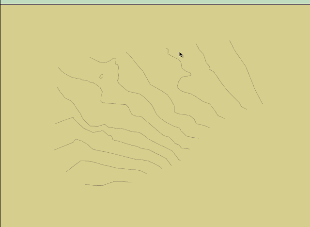
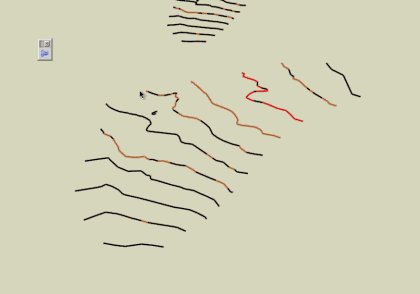
Here's a house site set of contours anyone can experiment with
On another layer there is TIN provided by the civil, if useful for comparison
I welded the contours with Curvizard. I hope that's helpful.
Peter
-
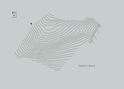
Here is another contour set, also from pbacot:
Fredo
and the previous ones with the current state of the script
-
@pbacot said:
Here's a house site set of contours anyone can experiment with
On another layer there is TIN provided by the civil, if useful for comparison
I welded the contours with Curvizard. I hope that's helpful.
Peter
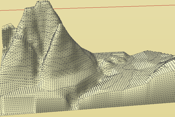
Peter,
Thanks very much for this model, which is very helpful for me to progress on the script.
Toposhaper samples the contours on a grid, and therefore it is not necessary to have extra-smoothed contours. On the contrary, when there is less segments in contours, the calculation is much faster.
In the attached SKP file, you'll have the resulting terrains
- for your original model, with high-definition contours
- for the same model after simplification of contours by Curvizard simplify (17 degerees).
You can see that the generated terrains are almost identical. The simplified model takes 3 seconds (see video) whereas the original one takes over 30 seconds.
TopoShaper pbacot model - 01 Jan 13.skp
Fredo
PS: There is still some work on the algorithms, for calculation of concave hull and extrapolating on the borders, and also some work to package a decent GUI.
Hello! It looks like you're interested in this conversation, but you don't have an account yet.
Getting fed up of having to scroll through the same posts each visit? When you register for an account, you'll always come back to exactly where you were before, and choose to be notified of new replies (either via email, or push notification). You'll also be able to save bookmarks and upvote posts to show your appreciation to other community members.
With your input, this post could be even better 💗
Register Login


Advertisement