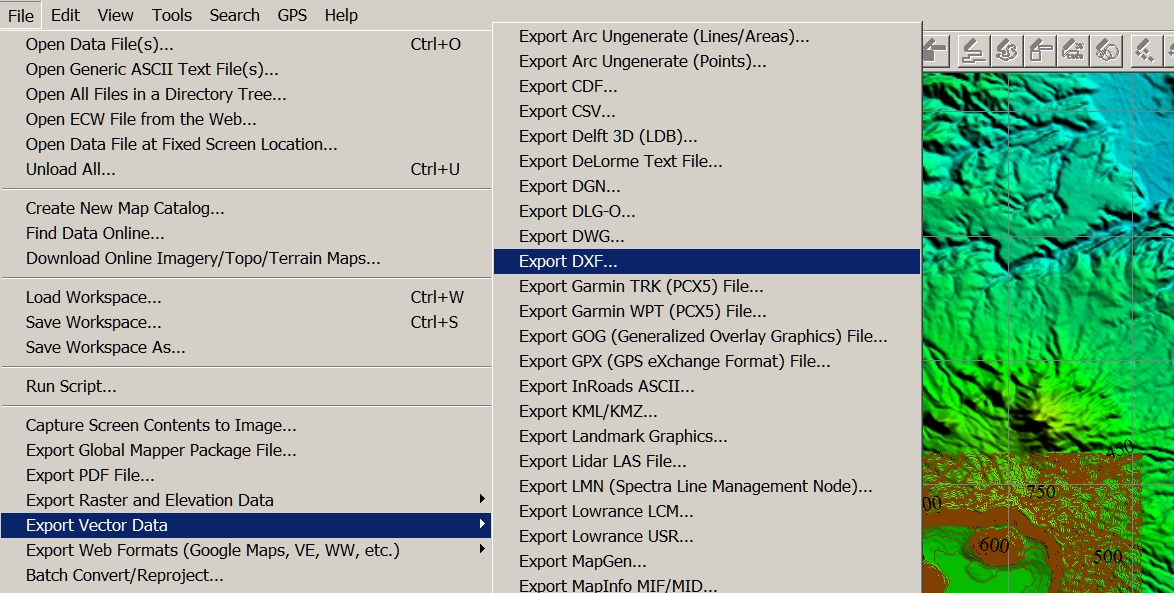
Large Terrain Mesh
-
@dbwv69 said:
@bjornkn said:
Then you would have to open your wallet first, as Polygon Cruncher costs some money, as do DE and Vue

OTOH, my first run ended up very badly in the Cruncher because there was all these non-merged points in the mesh. Try to merge points with DE before you polyreduce it?I was not aware that the mesh had "non-merged points". They had to have been caused by Global Mapper because that is the program I used to create the file. How do I detect and merge them with Deep Exploration?
Join Equal Points IIRC -
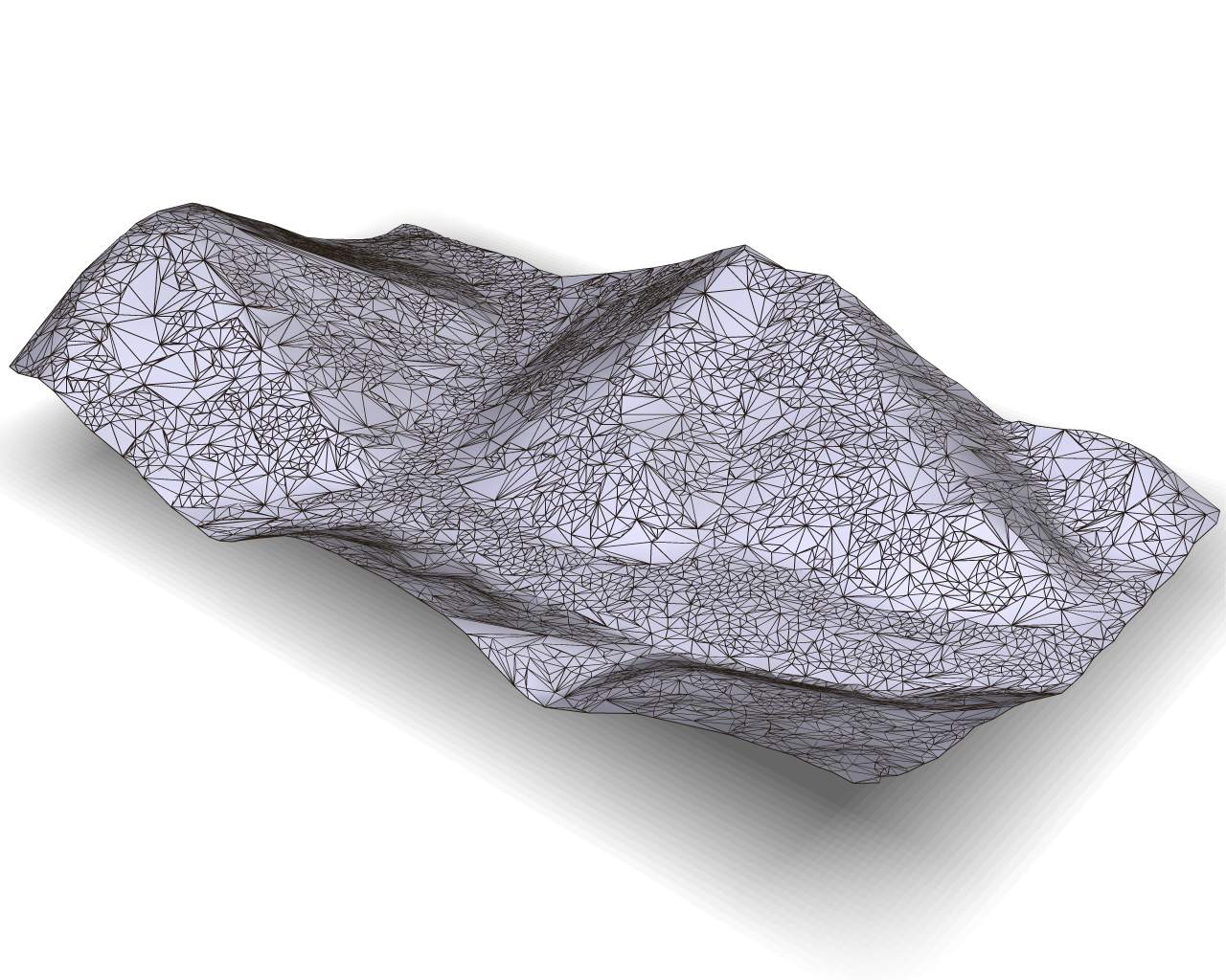
This is the best I have been able to get after joining points and applying a 90% reduction using Deep Exploration. All detail is lost and the surface is a mess. Something is clearly wrong somewhere. The default setting produced something that looked even worse.
Does someone want to tell me EXACTLY how it's done?
-
@solo said:
You may want to check the dem file, it's kinda wierd, hard to explain, lacks all detail.
Open ok in Global Mapper, cannot export though just the viewer
-
@bjornkn said:
@dbwv69 said:
I'm willing to try anything that will help me to achieve my goal. Remember, I'm not a Sketchup expert, or an expert with 3D software in general, far from it in fact. By and large, I am learning as I go and will undoubtedly make a lot of mistakes along the way.
Honestly, and I am showing my ignorance here, but I am not completely sure what the guide point method entails. If you would care to enlighten me, I'd be happy to give it a try.
Try anything? Except open your wallet ie
It's written on that image with 3 brown meshes posted a while ago.
Here is another "tutorial".[attachment=0:20u6n4iw]<!-- ia0 -->GPgrids.jpg<!-- ia0 -->[/attachment:20u6n4iw]As I stated earlier, opening my wallet isn't a matter of choice at this time. Unfortunately, I have to make due with what I have or can get for free.
So guide points are just another word for tracing, or at least that's what I've called it in the past.
-
@solo said:
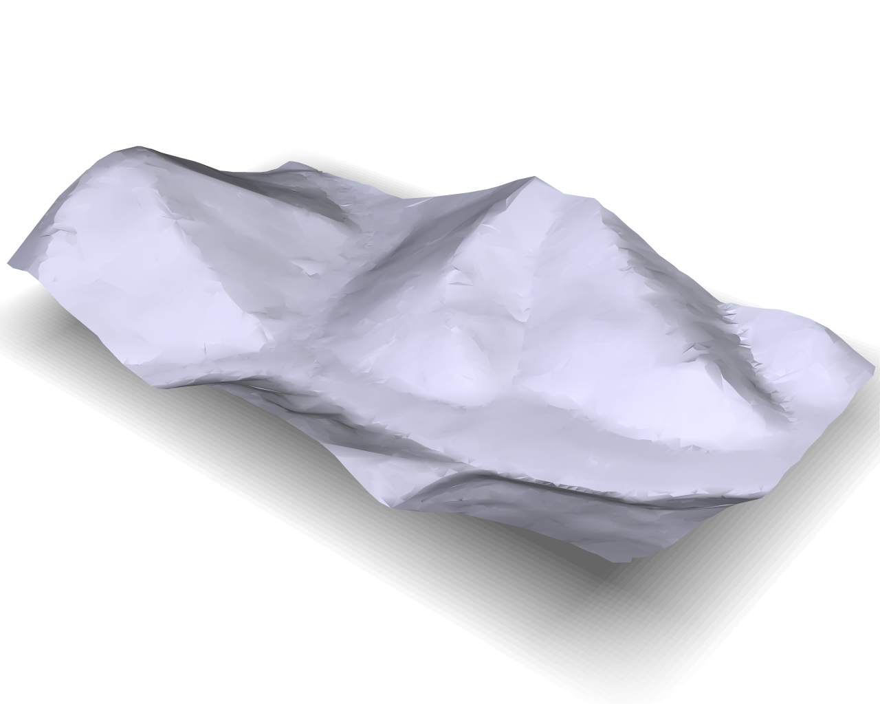
This is what your mesh looks like.
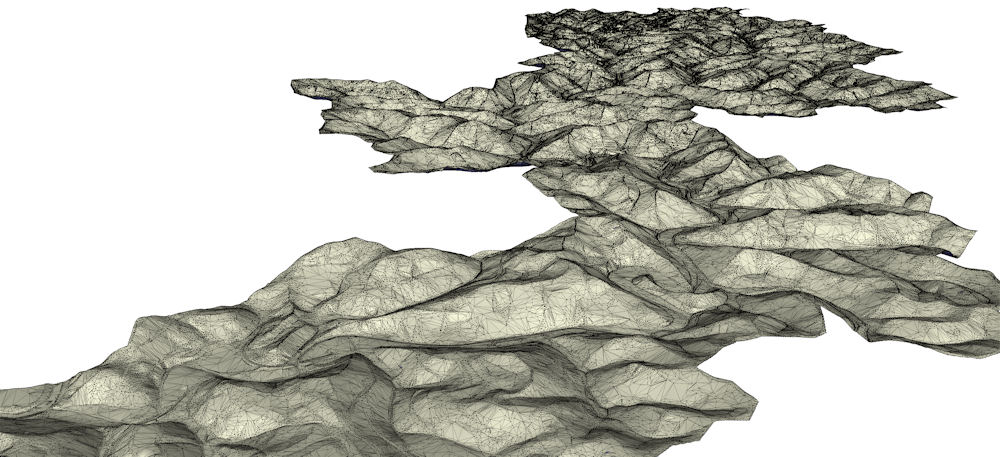
It's too big to crunch right now as it requires more than 12Gb of ram, which is all I have on this machine, if there was a way to trim the sides or even split in two parts, I'd be able to do this easier.
It's a beast of a mesh to be sure. That's why I was testing the sample prior to carefully retracing individual sections in Global Mapper prior to export. I haven't created the individual sections yet because I was focused on achieving a solution to the reduction problem first.
-
@bjornkn said:
The amount of detail is entirely up to you, with full control, and would not take forever. Took about 10-15 min to place ~1400 guide points on the rightmost terrain.
I think you get a bit blinded by the massive amount of data in the mesh, and think that it must be precisely like that in real life. But in reality it shows a smoothed version (3x3m) of the terrain that looks like it's covered in fine sand or snow when you get close - no crisp details. It's like a heavily blurred photo. A real terrain doesn't look like that at all in the details.Most of my problem is directly related to smoothing. In most attempts I have made, the terrain came out very soft, with most of the edge details lost or obscured. What I am hoping to achieve is a crisp division between all of the major features like ridge lines, stream beds, etc... The example Solo posted shows the exact image I have had in my mind while trying to achieve my ultimate goal of simplification without losing the important details.
I'll admit that it is easy to get blinded by the sheer amount of data involved but at the same time I have always been aware that I don't need to show every detail. In essence, I want to preserve the overall shapes while maintaining a sharp division at boundary lines.
@unknownuser said:
Do you have a photo of the area? Ground level? The shapes indicates that there must be lots of boulders, rocks, gravel everywhere?
Where is it?The shapes are actually a bit misleading. While there are some rocky outcrops, most of the area, with the exception of the valleys, is forrested terrain. As irony would have it, Lidar data tends to pick up a lot of ground clutter which only contributes to my problem.
@unknownuser said:
BTW, Solo wrote that he used Deep Exploration, which costs $400-$700 per year
Nice program though. I have an older version of the CAD/expensive version, bought when it was much cheaper and with no annual fees. No skp, Collada, FBX though.Yes, from what he wrote, I too assumed that he used Deep Exploration. As it turns out, I also have an older copy but had completely forgotten about it. If I can learn the method Solo used, my problem may be solved, especially if I can achieve results like the ones he posted.
-
I sent you a PM with settings, I have also managed to reduce the full scene from 650MB to 65MB keeping the detail similar to the sample above.
-
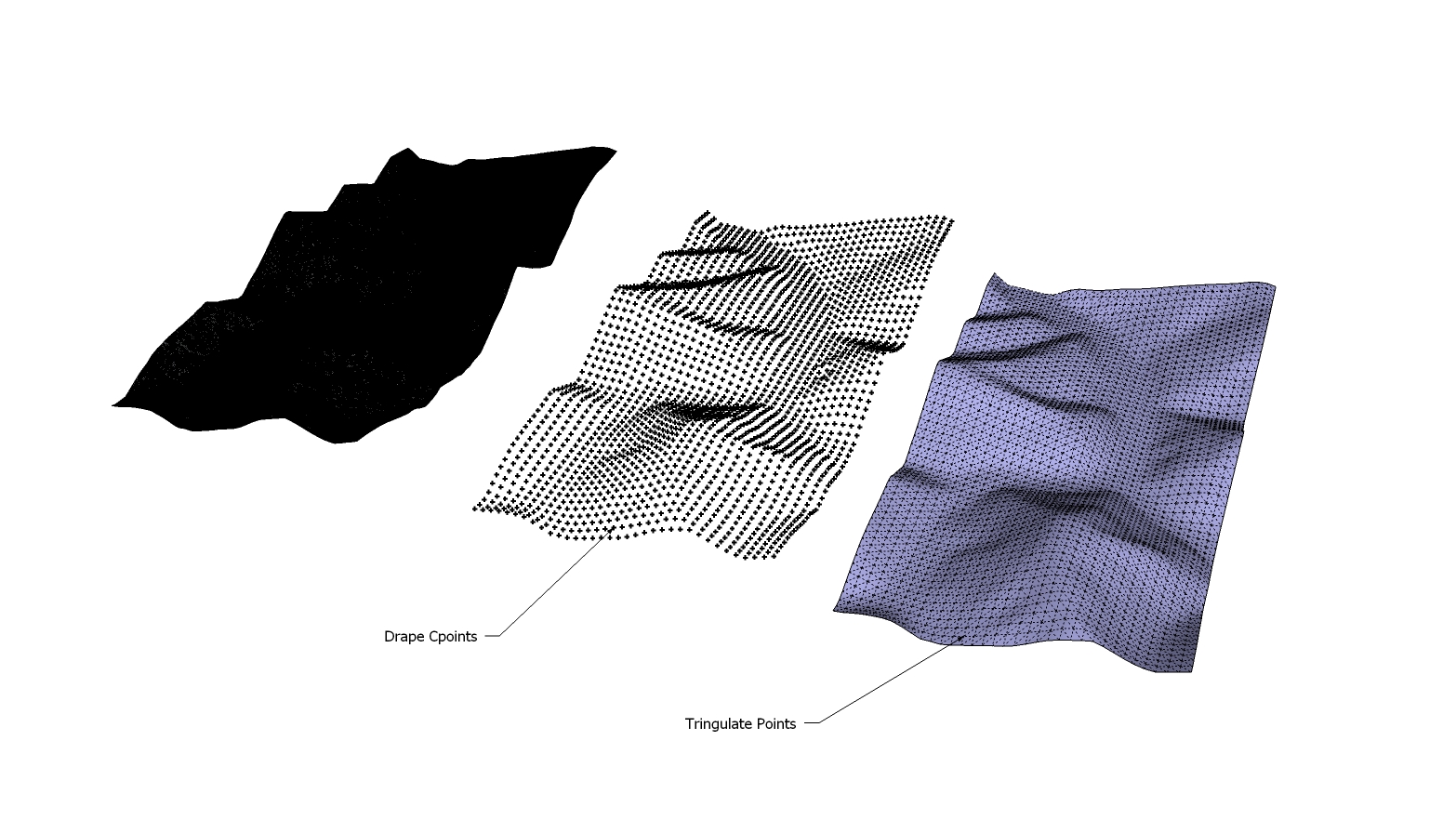
Your best FREE solution is to use TIG's drape Cpoints and Triangulate points scripts. This will allow you set the mesh density based on the quadrant spacing of the Cpoints initially. Doing the original terrain sample at 20' spacing took about two minutes of processing time and reduced the face count to under 4500. The downside is that you get an evenly distributed reduction, thus no interpolation of the reduction within higher detail areas, but it's quick and free. Conversely I like to port my messy/complex terrains into 3ds Max and use a plugin called Wrapit to quadrify the mesh. It seems to do a better job at preserving detail areas, but cost money.
-
@solo said:
I sent you a PM with settings, I have also managed to reduce the full scene from 650MB to 65MB keeping the detail similar to the sample above.
How on earth did you manage to get that beast of a mesh reduced?
I got it, thanks. It's odd but the settings I was using were very much like yours, but with very different results. Obviously something is different but I wonder what it could be?
-
Here is the model if you need it:
-
@earthmover said:
Your best FREE solution is to use TIG's drape Cpoints and Triangulate points scripts. This will allow you set the mesh density based on the quadrant spacing of the Cpoints initially. Doing the original terrain sample at 20' spacing took about two minutes of processing time and reduced the face count to under 4500. The downside is that you get an evenly distributed reduction, thus no interpolation of the reduction within higher detail areas, but it's quick and free. Conversely I like to port my messy/complex terrains into 3ds Max and use a plugin called Wrapit to quadrify the mesh. It seems to do a better job at preserving detail areas, but cost money.
I tried something similar only I was using Global Mapper to vary the point density which was then imported into Sketchup and triangulated there. The only drawback in my case was that triangulation took a bit of time to complete.
That plugin for 3DS sounds great but unfortunately, it's definitely out of my reach at the moment.
-
@solo said:
Here is the model if you need it:
You are good, there's no doubt about that. It's exactly what I have been trying to achieve and is even light enough that I can open it on my laptop without having to fire up the server. How did you manage to do it? As I recall, you mentioned memory requirements/limitations.
-
I used an old faithful.... Truespace, made the first save to .cob and then DE for the rest.
-
@solo said:
I used an old faithful.... Truespace, made the first save to .cob and then DE for the rest.
I had never heard of Truespace until now but after looking at their website I am definitely intrigued. And the best part is that according to their website Truespace is free.
Someday if you have the time, I'd definitely like to pick your brain and hopefully learn how to replicate your results myself.
-
I'm surprised that trueSpace was the solution. I was using (and beta testing) trueSpace for 10 years (93-03) before I switched to SU and LW, and I really liked the program. But I can't see how it helped handling the giant dxf mesh?
Could you really load that giant dxf into tS and save as a .cob?
I still have tS 6.6 installed BTW.BTW, those DE problems may come from different versions? There were many problems with some of the DE versions.
My DE is v 3.5, and it handles/reduces the sample mesh OK, but makes the borders very ugly (very few vertices around the edges). -
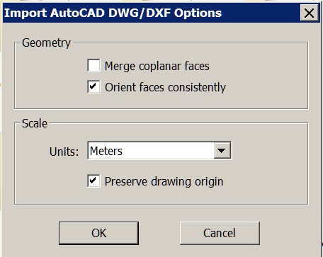
Try 'NOT preserving the origin' of the imported data - it's probably zillions of meters away from [0,0,0]...
Then when it's loaded zoom extents ? -
Dear specialists,
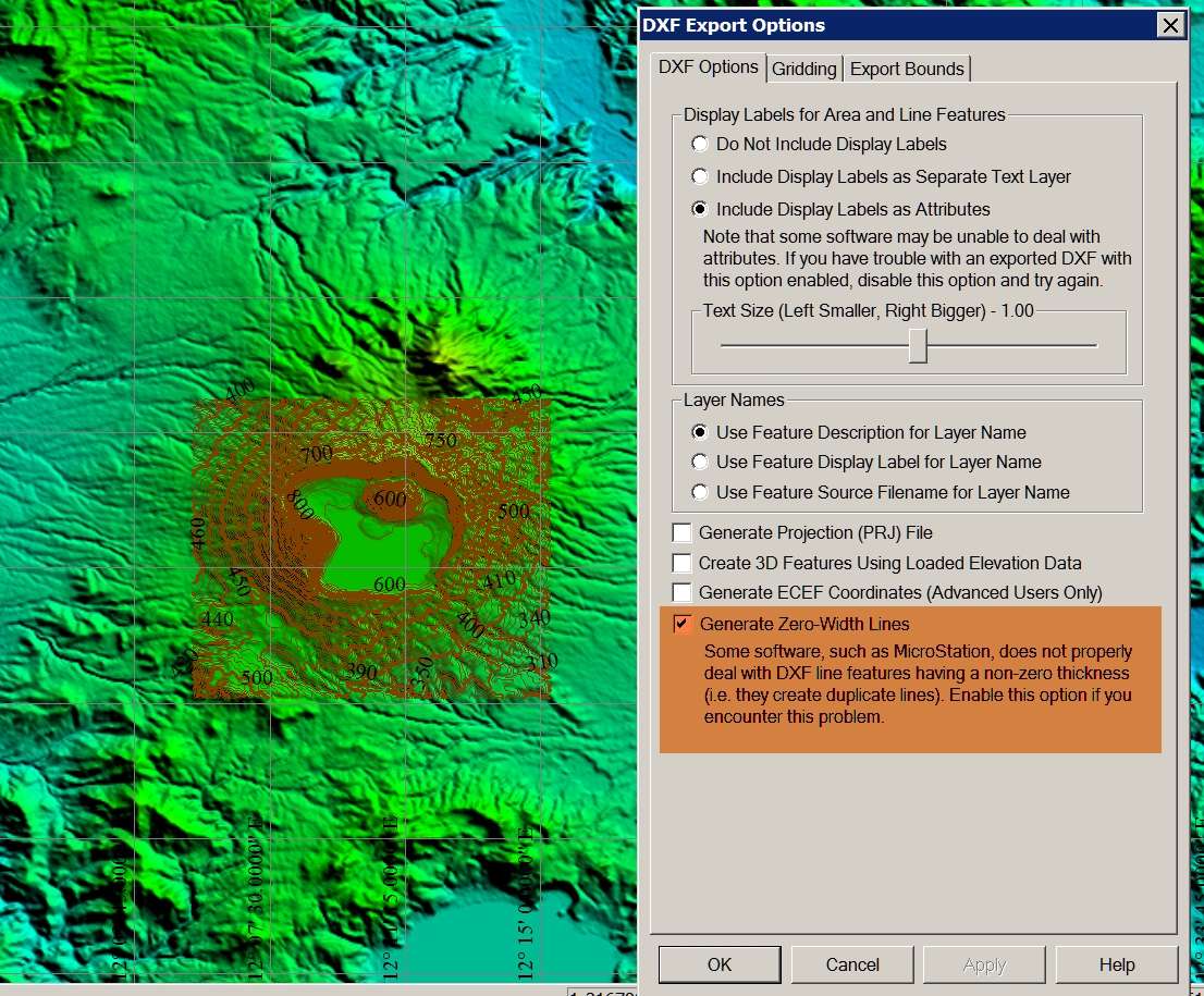
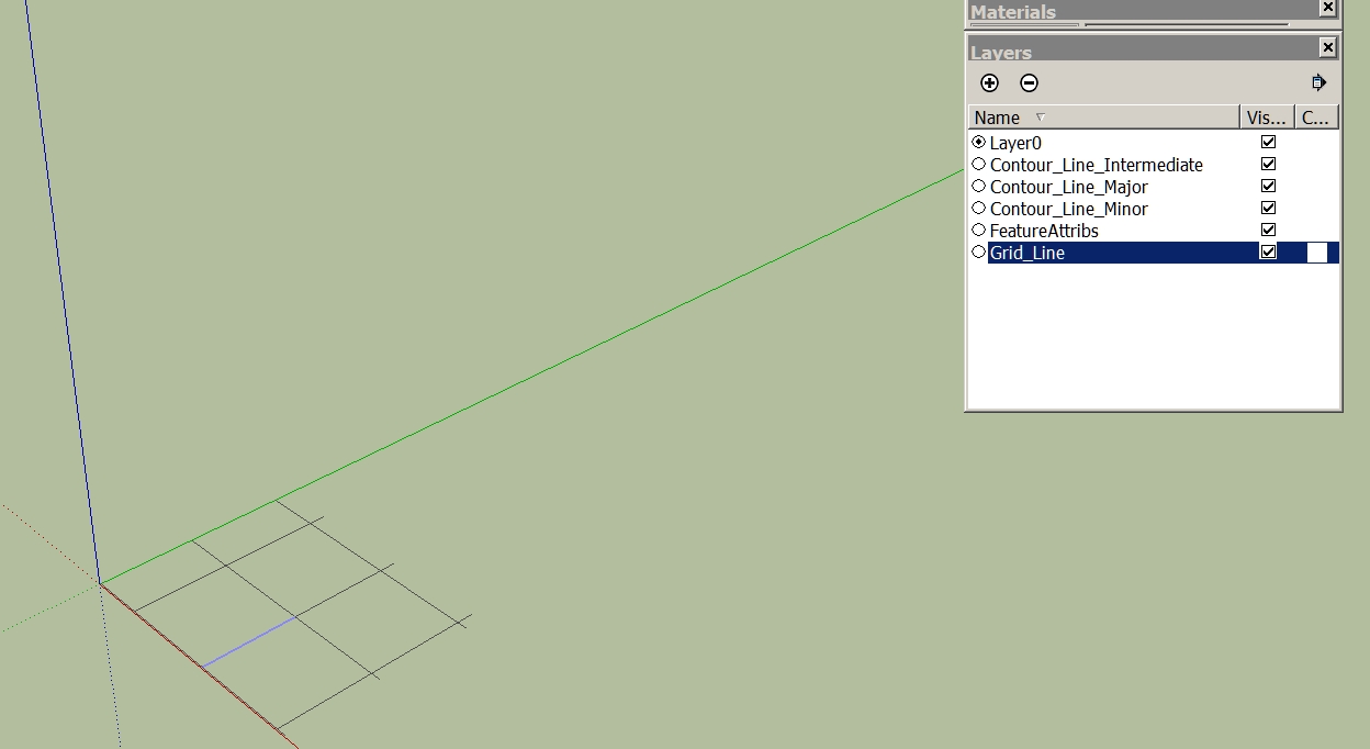
I have a question again. I have created in Global Mapper contour lines. Then I export the vector data as a DXF. When I import it into SketchUp, the layer are displayed, but the model is not visible. What am I doing wrong? I thank you in advance for your help.
Charly
-
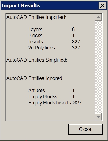
Hi TIG,
then I see a very small piece. Only when I scale it I see it is only a grid. Now what I've discovered! The problem I had once before. I can not remember the solution.
Charly
-
Could it be a scaling issue? Is the import scale and the original scale the same? If it is very tiny, it would explain the missing faces.
-
Hi Gaieus,
If I knew that! I only know that I yesterday tried it with the contour lines (same Options in Global Mapper) of the Vesuv and it worked.
Charly
Hello! It looks like you're interested in this conversation, but you don't have an account yet.
Getting fed up of having to scroll through the same posts each visit? When you register for an account, you'll always come back to exactly where you were before, and choose to be notified of new replies (either via email, or push notification). You'll also be able to save bookmarks and upvote posts to show your appreciation to other community members.
With your input, this post could be even better 💗
Register Login


Advertisement