• Login
sketchucation logo sketchucation
  • Login
🤑 SketchPlus 1.3 | 44 Tools for $15 until June 20th Buy Now

Large Terrain Mesh

Scheduled Pinned Locked Moved SketchUp Discussions
sketchup
105 Posts 11 Posters 13.1k Views 11 Watching
Loading More Posts
  • Oldest to Newest
  • Newest to Oldest
  • Most Votes
Reply
  • Reply as topic
Log in to reply
This topic has been deleted. Only users with topic management privileges can see it.
  • S Offline
    solo
    last edited by 14 May 2011, 02:18

    I used an old faithful.... Truespace, made the first save to .cob and then DE for the rest.

    http://www.solos-art.com

    If you see a toilet in your dreams do not use it.

    1 Reply Last reply Reply Quote 0
    • D Offline
      dbwv69
      last edited by 14 May 2011, 03:39

      @solo said:

      I used an old faithful.... Truespace, made the first save to .cob and then DE for the rest.

      I had never heard of Truespace until now but after looking at their website I am definitely intrigued. And the best part is that according to their website Truespace is free.

      Someday if you have the time, I'd definitely like to pick your brain and hopefully learn how to replicate your results myself.

      1 Reply Last reply Reply Quote 0
      • B Offline
        bjornkn
        last edited by 14 May 2011, 07:47

        I'm surprised that trueSpace was the solution. I was using (and beta testing) trueSpace for 10 years (93-03) before I switched to SU and LW, and I really liked the program. But I can't see how it helped handling the giant dxf mesh?
        Could you really load that giant dxf into tS and save as a .cob?
        I still have tS 6.6 installed BTW.

        BTW, those DE problems may come from different versions? There were many problems with some of the DE versions.
        My DE is v 3.5, and it handles/reduces the sample mesh OK, but makes the borders very ugly (very few vertices around the edges).

        1 Reply Last reply Reply Quote 0
        • T Offline
          TIG Moderator
          last edited by 16 May 2011, 12:11

          Try 'NOT preserving the origin' of the imported data - it's probably zillions of meters away from [0,0,0]...
          Then when it's loaded zoom extents ?

          TIG

          1 Reply Last reply Reply Quote 0
          • C Offline
            charly2008
            last edited by 16 May 2011, 12:24

            Dear specialists,

            I have a question again. I have created in Global Mapper contour lines. Then I export the vector data as a DXF. When I import it into SketchUp, the layer are displayed, but the model is not visible. What am I doing wrong? I thank you in advance for your help.

            Charly


            11.jpg


            2.jpg


            12.jpg


            4.jpg


            1.jpg

            He who makes no mistakes, makes nothing

            1 Reply Last reply Reply Quote 0
            • C Offline
              charly2008
              last edited by 16 May 2011, 12:37

              Hi TIG,

              then I see a very small piece. Only when I scale it I see it is only a grid. Now what I've discovered! The problem I had once before. I can not remember the solution.

              Charly


              5.jpg


              6.jpg


              6.jpg

              He who makes no mistakes, makes nothing

              1 Reply Last reply Reply Quote 0
              • G Offline
                Gaieus
                last edited by 16 May 2011, 12:59

                Could it be a scaling issue? Is the import scale and the original scale the same? If it is very tiny, it would explain the missing faces.

                Gai...

                1 Reply Last reply Reply Quote 0
                • C Offline
                  charly2008
                  last edited by 16 May 2011, 13:28

                  Hi Gaieus,

                  If I knew that! I only know that I yesterday tried it with the contour lines (same Options in Global Mapper) of the Vesuv and it worked.

                  Charly

                  He who makes no mistakes, makes nothing

                  1 Reply Last reply Reply Quote 0
                  • C Offline
                    charly2008
                    last edited by 16 May 2011, 13:49

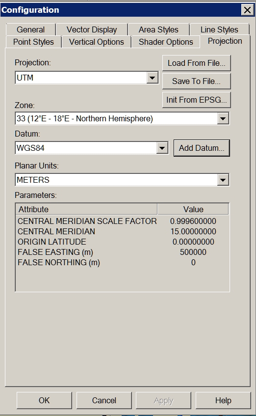
                    Problem solved! I forgot to change the projection to UTM Datum WGS84.

                    Charly


                    1.jpg


                    2.jpg


                    3.jpg

                    He who makes no mistakes, makes nothing

                    1 Reply Last reply Reply Quote 0
                    • G Offline
                      Gaieus
                      last edited by 16 May 2011, 13:55

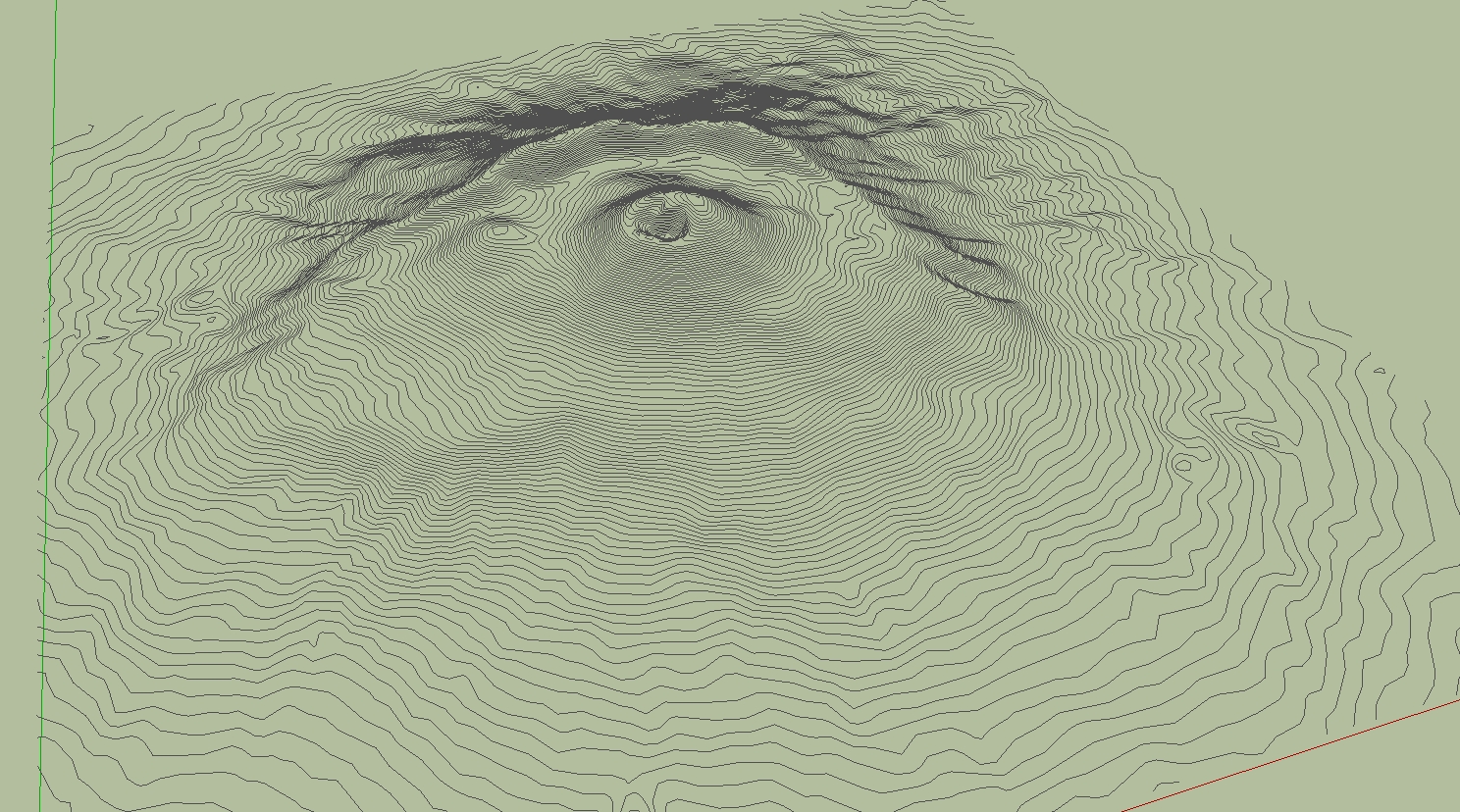
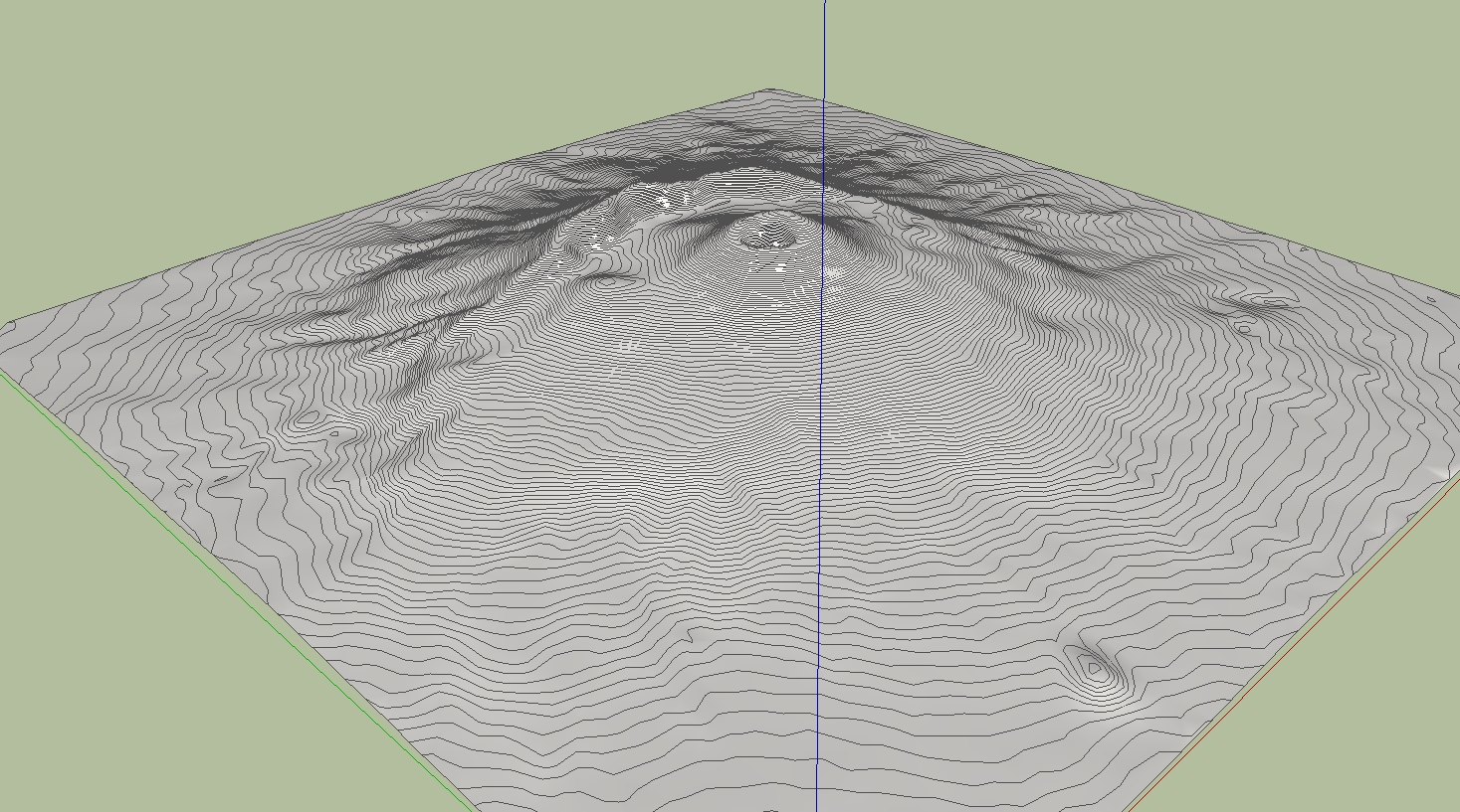
                      Cool. And now let's see some nice eruption!
                      😄

                      Gai...

                      1 Reply Last reply Reply Quote 0
                      • D Offline
                        dbwv69
                        last edited by 16 May 2011, 17:25

                        Through some experimentation and the help of someone who has a newer version of DE, I was able to determine that the problem I was having is related to the way the DE reduces files of different types.

                        Solo was importing the DXF file into Sketchup and saving it as Sketchup version 6 prior to reducing the mesh in DE. I was unable to import the DXF file into Sketchup due to it's size so I was opening the DXF file directly with DE.

                        After sending a sample DXF file to a friend with a newer version of DE and hearing that he was seeing the same problem, I began to suspect that it must have something to do with the file type so I tried converting the DXF file to another type, OBJ I think, then opened that with DE and reduced the terrain mesh. After doing this, I was finally able to obtain acceptable results at 90% reduction.

                        1 Reply Last reply Reply Quote 0
                        • C Offline
                          charly2008
                          last edited by 18 May 2011, 13:56

                          Hi,

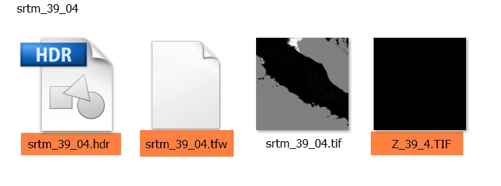
                          I have a additional question to the downloaded SRTM. For what purpose is served by the tagged files. Thanks in advance.

                          Charly


                          2011-05-16_201330.jpg

                          He who makes no mistakes, makes nothing

                          1 Reply Last reply Reply Quote 0
                          • N Offline
                            noklu
                            last edited by 19 May 2011, 00:21

                            I have used Global Mapper quite a bit to generate contours for import to SU. The largest I have done was about 2000 acres. You may want to play with the contour interval to speed up SU. I generated a terrain model with 2' contours on 2000 ac. SU ran all night. When It was complete, I had to zoom WAY back (really far). Good Luck, sounds like a cool project.

                            1 Reply Last reply Reply Quote 0
                            • 1
                            • 2
                            • 3
                            • 4
                            • 5
                            • 6
                            • 6 / 6
                            6 / 6
                            • First post
                              102/105
                              Last post
                            Buy SketchPlus
                            Buy SUbD
                            Buy WrapR
                            Buy eBook
                            Buy Modelur
                            Buy Vertex Tools
                            Buy SketchCuisine
                            Buy FormFonts

                            Advertisement