Milking it..... I know...  but we have been published on ArchDaily
http://www.archdaily.com/171797/28-church-street-s-porobic-associates/
Posts
-
RE: 28 Church Street, Wellingborough
-
RE: How to use this type of data
@chris fullmer said:
EDIT:
ok, I imported the example dxf and see the point cloud. Very interesting. What are you expecting differently than you achieved previously? The triangulated TIN looks pretty good to me.
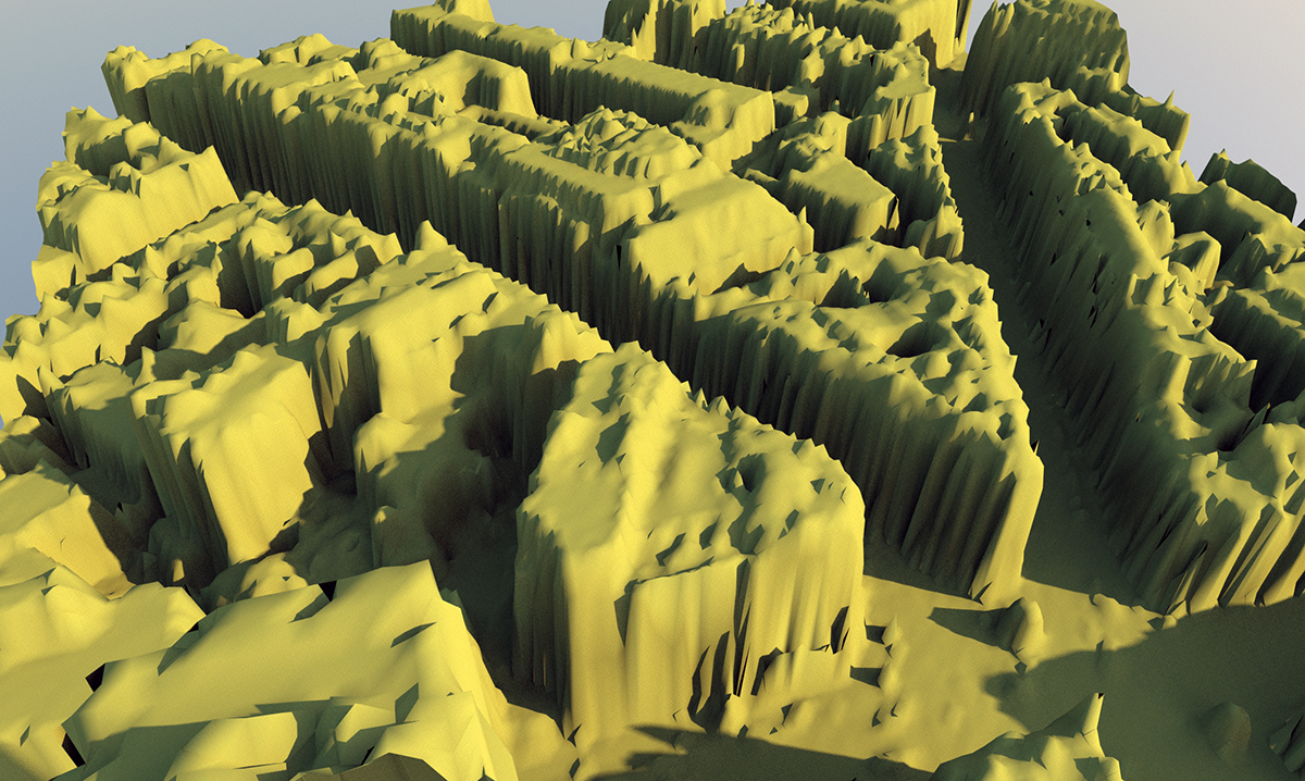
Well the TIN is unusable as the buildings (in my case) look like melting cakes.
-
RE: How to use this type of data
@tig said:
Any text format file [even DXF] can be parsed and the points extracted in order.
If we know that that say every three of them make a triangular facet we can use that to add geometry.
It'd be a pain in the proverbial to parse a DXF file [it can be done! e.g. I extract 'text' in my dxf-text-importer tool] but other types like OBJ, CSV etc can be readily parsed and used... [DAE doesn't seem to support raw 'points', just facets]

OK so no joy there as well.

-
RE: How to use this type of data
@roger said:
Sepo, I have not used it yet but I have installed the tgi3d plugin. I suspect it would handle the stereo pairs quite nicely. This is exactly what their PhotoScan product is supposed to do. Basically you take two or more photos of a surface or surfaces from widely separated areas. Then you mark corresponding points in the photo sets and the software uses these control points to reverse engineer the 3D shape of the surface.
I have also figured out a LIDAR like system of establishing surface control points on small stationary object that does not have strong features to compare photographically. I will post my experiments as time allows. Will be heading to Thailand for a month so it might be a while before I can test the system.
That would be quite interesting. Have you actually tried PhotoScan with tgi3d? I was wondering which other software people would use to create models from 2 photos shot with time delay.
-
RE: How to use this type of data
@chris fullmer said:
What does it export? If it will take any other sort of standard file type - csv, obj, anything?, maybe we can write an exporter for it.
Chris
This is website I wanted to get Lidar data from .... http://www.stanfords.co.uk/Business-Mapping/BM/Products/LiDAR_BM-LIDAR.htm -
RE: How to use this type of data
I supose I could export .dxf to collada and try it that way....
-
RE: How to use this type of data
Thanks Notareal but as far as I know Meshlab does not import .dxf/dwg.
-
RE: How to use this type of data
Hmmm... It does not appear to be available. I was wondering if maybe this is all driven for Autodesk Map
-
RE: How to use this type of data
I see....I need to check if there are any other file types available.
-
RE: How to use this type of data
I managed to do it but using SU8 on the Mac side. SU7 has no such problem on Vista. Kind of interesting.
It took nearly 3 hours and SU did not go non-responsive in both instances. Coffee was good and cake very moist.
The mesh turn out in not very usable state as buildings look like they are melting....maybe good for some Sci-Fi environment.....this Lidar data is kind of disappointing.
The file had 40406 points ... It created 80000 triangles. -
RE: How to use this type of data
Is there other method of triangulating which would be better for buildings.... as I am after buildings really?
-
RE: How to use this type of data
Well... I installed your plugin and it starts triangulating but after small amount of time SU goes into non responsive mode. I do not know if there is issue of number of points that SU can handle. I tried it on couple of different comps on SU 8. (64 bit Windows 7 ; dual 6 core, 32 Gb Ram , Nvidia Quadro 4000 GPU)
-
RE: How to use this type of data
Yes the file imports in SU as bunch of cpoints....I will try your triangulate plugin. Thanks again.
-
RE: How to use this type of data
Tig
Which scripts would be for triangulating mesh from the points. I have just discovered that LiDAR data can come as points (.dxf).
-
RE: Teenage Wildlife
looks good Adam... You are getting very good at rendering ....so no more excuses of being technologist.

-
RE: Thea Render - Interactive Rendering
Excellent update...Well done Thea team.

-
RE: Vodin
Haha... You have decided to model all Voysey's houses. Mind you it could be quite good material for some sort of digital book on Voysey. I was wondering are you actually modelling interiors as well. I know it could be hard to aquire true info but maybe worth exploring in your case.
I like the quality of your models. All bits including flashing are corret and read true. The only crit for render I have is a bit of slate repetion on the roof and maybe more clouds in the sky as render shows pretty overcast day. But this is really nitpicking as render and especially model as well are great.
