Terrain from contours - improve on native 'from contours'?
-
-
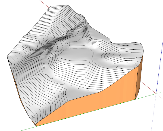
I've gone ahead and started using one of the tests you made of my contour set, Fredo. I don't have a lot to do as yet but it was really clean leveling some areas and "filling" others with Artisan. Maybe we can illustrate the cut and fill on the project with before and AFTER terrains. Thanks!
-
@earthmover said:
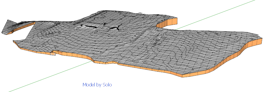
Here's another set of contour lines from my current project. All welded up.
Adam,
Here is what I obtain on the original file. I think however that the contour should be simplified a little bit because there are a lot of edges and it slows down the calculation.
Fredo
-
A quick play with the contours. Simplified the curves using Thom's Edge Tools. Then did a From Contours terrain. Then a Drape Cpoints / Triangulate method to retopo. Then opened the high res contour lines in 3ds Max and used the free Populate Terrain plugin to generate a similar terrain. Then brought it back into sketchup and compared the two.
-
Terragen2 download

http://planetside.co.uk/index.php?option=com_content&view=article&id=30&Itemid=170
Someone here was looking for this and here tiz
dtr
-
By the way, did anyone try SimuTerra? (see this post)
Fredo
-
Does anyone know if Erez is still maintaining his Simuterra program? We haven't seen him around in ages!
-
Nice clean results.
I have a set of contours that I'd like to compare if you have the time, I used sandbox and got a mess, wondering if this will give a better result. Here is the skp, however I'm wondering if the dwg would not be better.
-
@solo said:
Nice clean results.
I have a set of contours that I'd like to compare if you have the time, I used sandbox and got a mess, wondering if this will give a better result. Here is the skp, however I'm wondering if the dwg would not be better.
Here is the result on your model without any change, with the current version of TopoShaper. Grid definition is 60 x 27. I did some tests with a higher definition but cannot post it back because the size of the skp file is bigger than 4 Mb.
Note that your contours add up to more than 44,000 edges, with a quite complex concave hull. So it takes a minute to calculate it and there are still some problems on the borders.
Fredo
-
That's very clean, wow, this is awesome.
-
Adam,
Very cool working out the c-points method. I didn't realize those capabilities existed.
Fredo,
Thanks for interface video. Looking great! What you do to program this is so far beyond my ken....
Peter
-
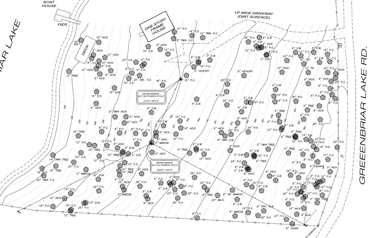
@krisidious said:
here's a topo I just got from a survey company... if you need tests.
I imported the dwg file and found that most contours were interrupted in their middle. This is a problem for TopoShaper currently, at it allows topological communication between contours.
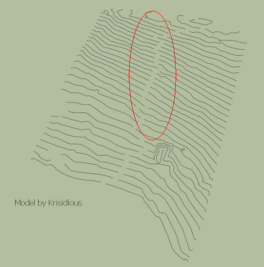
I just closed the missing links, and here is the result
Krisidious Hanna Topo.skp
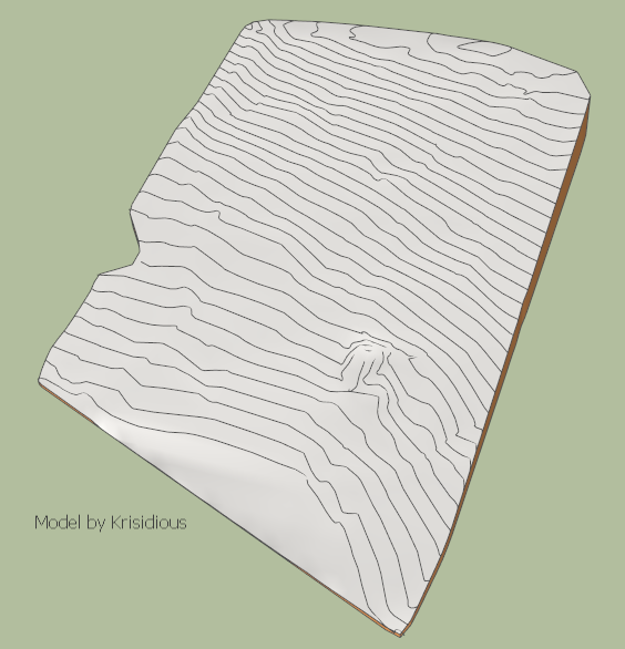
Thanks again for this testing model
Fredo
-
Yes, Fredo... No problem. That's where the road runs in the property. I just thought you'd like to get samples directly from surveyors. no touch ups. Looks great. can't wait to buy/download this plugin.
Edit... actually that is not the road. it's where the grade heights are typed in as text.
-
Any news?
Sorry about bumping this topic but I'm anxiously awaiting this plugin, hopefully it will be in the store soon.
I have a tricky project, I got contours from Civil 3D in fbx format but even though it's not a very large or complicated mesh needed it seems that there are too many edges (think the segments are too much for su) I open it but it crashes sandbox after 7 minutes of thinking.
-
I am progressing. Actually, I had to build a cleanser module because all the contours I have seen so far have many glitches that prevent correct generation of terrain.
For your terrain, just send me the contours and I will see if TopoShaper can handle it.
Fredo
-
Hi Fredo, Any news about this plugin ?
I found something the other day that do more or less the same thing but from objects or an existing terrain, did you already see or try it ?
Regards.
-
I guess you missed this Panga

-
Yep, Fredo finished it and it is wondrous.
But Chucks instant Terrain is also a great tool. It works differently.
-
Damn...I was too busy those days...really missed it ! Thanks

Hello! It looks like you're interested in this conversation, but you don't have an account yet.
Getting fed up of having to scroll through the same posts each visit? When you register for an account, you'll always come back to exactly where you were before, and choose to be notified of new replies (either via email, or push notification). You'll also be able to save bookmarks and upvote posts to show your appreciation to other community members.
With your input, this post could be even better 💗
Register Login


Advertisement