The problem with Sketchup...still
-
Have you considered using SimuTerra along with SketchUp?
http://www.compuneering.com/simuterra.phpIt is inexpensive and will save you hours of time as well as accomplish what you cannot accomplish in SketchUp alone.
SimuTerra is listed on the SketchUp site as a SketchUp partner and back in V5 there was even a Plug-In version.
Erez Anzel still supports SimuTerra though he is working on other things these days. I know many users who swear by this product.
Take a look, try the trial download (MAC version is available) and see if it won't help you.
-
Has anyone tried using topo maps and raising the terrain from those in sketchUp then running the subsmooth plugin on the result? I have not but I am tempted to try it as an exercise.
Or, how about Fredo's newly released "loft by spline." Just set up each contour as a separate spline.
-
If you have survey of the job"loft by spline." will save those painful hours.
-

About two hours using subsmooth and a topo map. Wasn't sure what I was doing, but thought I would give it a test and then I got carried away.
-
I've found this to be a bit of an eye-opener for helpful methods, especially for setting easily drawn vertical and horizontal controls to act as contours from which to quickly generate terrain.
http://www.youtube.com/watch?v=NHCEXlEZlo4&feature=player_embedded#!
Though it looks like you've gotten good responses, adding the something about terrain modeling to the thread title might bring more.
-
To generate terrains, I use the following workflow.
Trace over the topo map in a vector software (Illustrator for me). Use a control point edit function to downsize the number of vertices to a reasonable number. Export out as a DXF.
Import the DXF into Sketchup and move each topo loop to its correct height. Draw over one of the lines of each loop to close the face and ensure a connected loop. Delete each face. Group the whole thing, make a copy and save as a backup.
With the original, explode the group, select all, and run the sandbox tool to generate mesh from contours.
Import a satellite image, or one image cut into 2048x2048 pieces and project it onto the mesh and that should do it.
Cheers, Chuck
-
Actually a topo map would be a fine starting point. Just draw regularly spaced parallel line over the topo. Make tickmarks where each of your lines crosses a contour and note the distance between tick marks. Then draw a vertical from each tickmark to the height of the contour being crossed. Connect the tops of these lines and you will have a spline. Once your have a full set of splines for your terrain, run the result through Fredo's "Loft by Spline."
-
Not accurate, or elegant, but just in time for a quick presentation. How about Chris's simple loft tool. Import the topo as line segments at the correct height. Select with his tool, and loft (example with 4 topographic lines split into 2 segments each pair). Too simple?
-
I think you should look at the loft tool they suggested above Honolulu. Mine was the first, but it is VERY weak compared to Fredo's. His does anything mine does, but does it faster, more accurately, and is much more robust. Its really a better solution now.
Chris
-
How accurate are the levels on Google earth imagery? Is there anywhere that documents this?
-
@cadmunkey said:
How accurate are the levels on Google earth imagery? Is there anywhere that documents this?
not as accurate as a site survey... i think it is based on topo data, which can vary depending on source, date, etc.
-
You are touching an open nerve, for me. I do not have time now, but later I'll try to post a case study of mine!
-
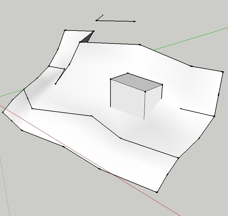
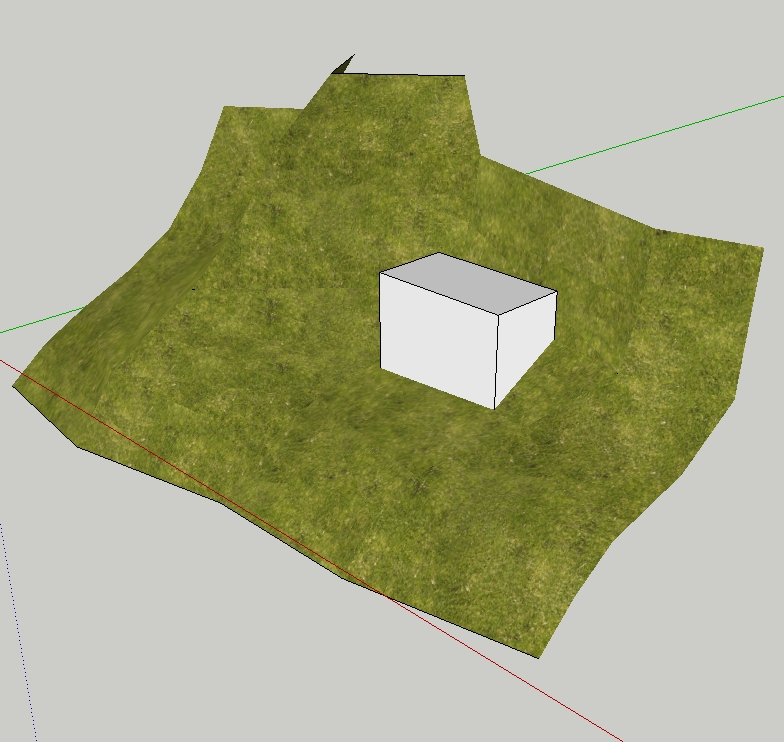
Heres some images from the project.


Hello! It looks like you're interested in this conversation, but you don't have an account yet.
Getting fed up of having to scroll through the same posts each visit? When you register for an account, you'll always come back to exactly where you were before, and choose to be notified of new replies (either via email, or push notification). You'll also be able to save bookmarks and upvote posts to show your appreciation to other community members.
With your input, this post could be even better 💗
Register Login


Advertisement