Fields of green - help with large landscapes
-
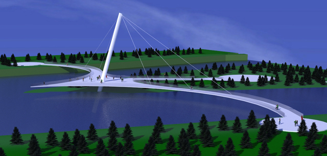
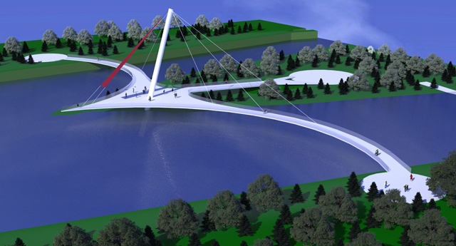
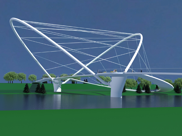
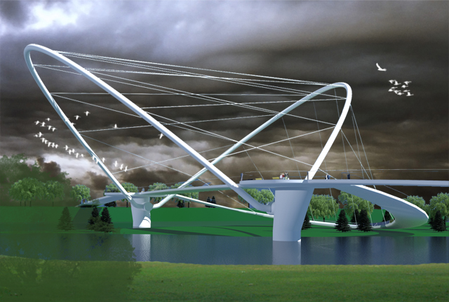
I started using sketchup and kerkythea in September for developing bridge concepts. I spend most of my time developing the bridge idea and a little time on the background. (Bridge concepts are typically white so that discussions about specific materials can be discussed later)
Can I get some input on how to develop good looking background landscapes quickly? I realize I could use the sandbox to make rolling landscapes and add millions of tree but I think that would take forever. I tried adding landscaping with photoshop but then I have to add it every time I rotate the view. (plus I am learning ps as well)
Also I draw the bridges to scale so they can be a couple hundred meters long and my landscapes are large, so adding textures sometimes looks odd.
My question is, how do you make quick landscaping around a bridge look good? Thanks for the help!
s
-
Hi !
Well I'm new to modelling and rendering but I found Kerkythea's instancing brush is amazing tool for what you're trying to achieve.
There's a couple of great grass patches (including Majid's grass pack you can find here :http://www.kerkythea.net/phpBB2/viewtopic.php?t=4960&sid=218bdacb2c1bc20047da887e866a0cea), flowers and trees you can download from KT's repository http://www.kerkythea.net/joomla/index.php?option=com_remository&Itemid=42&func=select&id=17.Also there's this great tutorial on the instancing brush here http://www.kerkythea.net/joomla/index.php?option=com_remository&Itemid=42&func=fileinfo&id=68.
Oh, of course there's also the sandbox tools !
I'm all new to that but I ended up pretty satisfied with my first exterior rendering using these tools.
Hope this helps ! -
All suggestions above are good! I also say you should use a spherical background (you can't see the sky under terrain). about the grass, as your views are not so close (and the fields are very wide) I advise against using 3d grass models, a good mix of textures and procedurals is enough.

Cheers -
I've heard someone created an amazing KT grass material that doesn't visibly tile. Has anyone found it?
And yeah, SketchUp's sandbox tools are good for creating hills all around your project. This will help better integrate your model with a spherical background, especially in aerial views.
-
Slap in in Vue and it will be awesome.
-
Thanks! I have used the instancing brush in KT and it works great. Except...you have to make millions of trees and so far I have not found a grass material that covers everything. (and looks good)
I would love to try Vue but I believe it is a bit pricey...I would be willing to try and buy Vue but which version is a good intro?
thanks
-
I'd say Vue 8 infinite, as it has all the bells and whistles, and you cannot upgrade from complete to infinite.
Try the PLE version first.(free) -
@ecuadorian said:
I've heard someone created an amazing KT grass material that doesn't visibly tile. Has anyone found it?
I'm not sure to want reveal this trick...

I usually use this method, don't remember where i read it (maybe KT or Indigo forum).
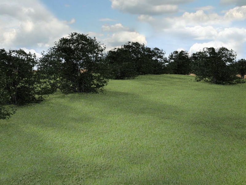
After doing the grass surface I copy it some centimeters upon the original and give it another material. the lower one has a grass texture plus windy procedural, the upper one has a grass texture in the diffuse channel, the same texture and windy procedural in the clip mapping channel. It's not good for closest views, but for a big space helps to avoid 'tiling' effect without adding poligons.
here's a quick example...
-
Thanks tridem, love the grass!
-
Here's the link to the clip mapping grass tutorial !
http://www.kerkythea.net/joomla/index.php?option=com_remository&Itemid=42&func=startdown&id=10Never tried this trick but Tridem's very clear demo really makes me wanna grow some grass...

-
@leminilab said:
Here's the link to the clip mapping grass tutorial !
http://www.kerkythea.net/joomla/index.php?option=com_remository&Itemid=42&func=startdown&id=10yeah, just what i was talking about! I've also read about a technique (might be by Fletch) using a layered material with two different textures weighted with a procedural, but I never tried this

however this is indeed matter for the KT forum... -
read Google SketchUp for Site Design: A Guide to Modeling Site Plans, Terrain and Architecture, by daniel tal. it is a must for anyone who wants to produce terrains and landscapes seriously.
-
Thanks Edson, I will check that book out! I appreciate the help.
s
-
I saw this tutorial and wondered if it would work?
http://www.blender3darchitect.com/2009/10/modeling-terrains-with-displacement-maps-in-sketchup-and-blender-3d/So, maybe a ruby that does the following. (I think the ruby called "subdivide and smooth" may do this but I don't want to spend $22 to find out...)
- draw your area (landscape field)
- ruby step one - random subdivide of the field plane
- ruby step two - random Z height changes of the field
- ruby step three - smooth the field (bumps and gullies)
- use color by Z (chris fullmer plugin) to give the field different surface colors
- use a png of the field to create a displacement map?
- add texture to field
- combine displacement map and texture in rendering software
Is this doable or just plain dumb?
thanks!
-
tallguy, can you share yor model? I would like to see what can be achieved with Terragen2 and Geocontrol.
-
oooh, Terragen has been on my software list for years now, but what's geocontrol?
-
-
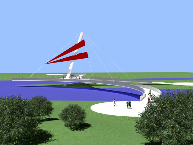
Pete I am at work right now but I have attached a basic bridge design. (Don't laugh at the modeling, I'm new)I can attach better ones when I get home.
So, the bridge concept is quickly developed and then I used KT to add some trees and grass.
thanks!
Stuart
-
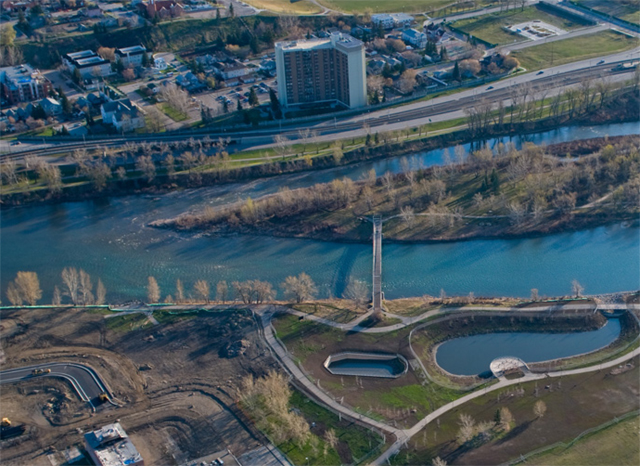
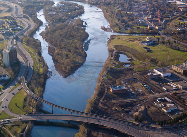
The terrain in the bridge post above is an actual place in Calgary, Canada over the bow river. The island (st patrick) is 3-4 meters lower than the two banks. Calgary had a bridge design competition and I developed some concepts.
here is the site.
s
-
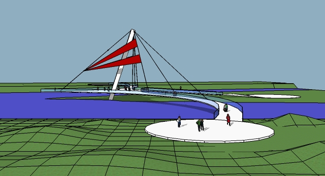
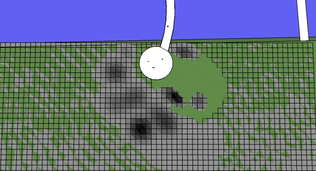
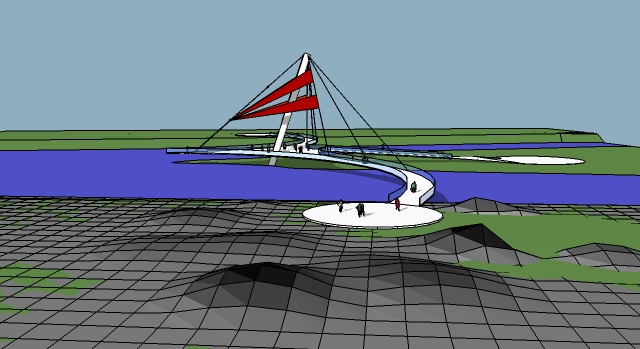
I used the sandbox tools to make some quick terrain but the bumps are not showing well in KT. (I know use a bump map)
So I tired the "color by Z" plugin and I thought I could make a bump map of the terrain to use in KT. The color by Z gives a color to all the different faces based on height and these faces show up in KT as different colors (obviously) si I could work with each face individually. I'm not sure where I am going with this....but all I wanted was some quick landscape around the bridge.
Does this make sense?
Advertisement


