sketchucation logo sketchucation
    • Login
    1. Home
    2. charly2008
    3. Posts
    Oops, your profile's looking a bit empty! To help us tailor your experience, please fill in key details like your SketchUp version, skill level, operating system, and more. Update and save your info on your profile page today!
    ⚠️ Important | Libfredo 15.8b introduces important bugfixes for Fredo's Extensions Update
    Offline
    • Profile
    • Following 0
    • Followers 0
    • Topics 132
    • Posts 1,241
    • Groups 1

    Posts

    Recent Best Controversial
    • RE: Windy Mountain Roads

      Hello scf Members,

      it seems to me that many Sketchup users would like to create realistic looking roads on a curved Terrain in Sketchup. This is also one of my interests. I started a discussion about here: http://www.sketchucation.com/forums/scf/viewtopic.php?f=15&t=19276

      I tried to construct a road with the "FollowMe and keep" plugin. First i draped a single line on the terrain and than i extruded a face along this line with the above mentioned plugin. The road is horizontal in its cross section. But the whole process is not yet satisfactory.

      Karlheinz


      Riedberg14.skp


      Alpen15.skp

      posted in SketchUp Discussions
      charly2008C
      charly2008
    • RE: Strange Effect with "Follow me" Need Help

      The Idea to find a solution for the construction of roads on an terrain within Sketchup does not let me off. I saw in the Forum some nice terrains created by Vue or any other 3D software.

      But i did not yet see any with inserted models and the accompanying Streets or Roads on a sloped and curved terrain in Sketchup excepted in other 3D software (see example pictures below). Also most of architectural works in Sketchup are done on flat 2D grounds. Ore am i wrong.

      When i found this "Anadelta Tessera" program, the idea came to me to generate a points cloud file from a Sketchup terrain for studying the road construction in that program. Because till now i couldn't find a Points Cloud ASCII sample file for download. It is perhaps a creazy idea. I hope I do not bore you with my ideas.

      May be the only possible solution is this Program:http://www.compuneering.com/simuterra.php

      Karlheinz


      roads1.jpg


      roads2.jpg


      roads3.jpg

      posted in SketchUp Discussions
      charly2008C
      charly2008
    • RE: Strange Effect with "Follow me" Need Help

      Hi Gaius,

      i did three trials with FollowMe and keep. I draped single lines on the terrain .One trial with a more flat terrain and the other one with higher hills.In principal it works. But it does'nt look like a real road not yet. At some positions it should be edited so that the road is cutting into the Terrain. At other Positions the road should be without the unrealistic up and downs. In the third trial i created the single line with "Draw line on Surface". But all is not yet satisfactory.

      In the net i found many software for civil engineering but these programs are highly specialized and based on Autocad and they work with measured height points from the real world. An interesting program for road construction: (http://www.anadelta.com/en/index.php?selection=description).

      Karlheinz


      Riedberg14.skp


      Alpen15.skp


      Alpen16.skp

      posted in SketchUp Discussions
      charly2008C
      charly2008
    • RE: Strange Effect with "Follow me" Need Help

      Hi Gaius,

      i downloaded this Demo Version. The program imports terrain from DXF and the corresponding ASCII files. But the problem is the creation of height data i think. Do you think it is possible to create the hight data in Sketchup to an ASCII file?

      Karlheinz


      Terrain DXF from Sketchup

      posted in SketchUp Discussions
      charly2008C
      charly2008
    • RE: Strange Effect with "Follow me" Need Help

      Interesting ideas. I will try these tips. Perhaps it will be sucessfull. I will report about the trials.

      Have a good night. Now i have to look a little bit on TV there is a Sherlock Holmes movie.

      Karlheinz

      posted in SketchUp Discussions
      charly2008C
      charly2008
    • RE: Strange Effect with "Follow me" Need Help

      Hi Gaius,

      The very best gratitude. FollowMe and keep works fine. At present i try to find a method to make a more realistic road on a curved terrain. FMK could be the tool for it.

      Karlheinz


      Riedberg15.skp

      posted in SketchUp Discussions
      charly2008C
      charly2008
    • RE: Strange Effect with "Follow me" Need Help

      Hi Gaius,

      thanks for your fast reply. You are right. Is there any other technik to do this in a better way? Do you have an idea.

      KH

      posted in SketchUp Discussions
      charly2008C
      charly2008
    • Strange Effect with "Follow me" Need Help

      Hello SCF Members,

      i tried to extend a rectangle face along a curved line by the "follow me tool". The face was orientated 90 degree at the beginning of the line. At the end of the line the face was twisted to 72,6 degree.

      I'm not shure if this is a mistake made by me or a bug of the follow me tool. Please have a look in the SKP file attached.

      Greetings

      Karlheinz


      Riedberg14.skp

      posted in SketchUp Discussions sketchup
      charly2008C
      charly2008
    • RE: Some Sketchup models

      Hi Gaius,

      @unknownuser said:

      I see you have a Roman fort, too. I have a friend who's modelled one with awesome details (all interiors, vaulting, even furniture, shields, arms everything).

      This Roman fort is an reconstructed existing one close to Frankfurt I'm shure as an archelogist you have heard the name "Saalburg"

      Is there a possibility to see this Model from your friend? This is also my dream to make such a detailed Model


      Saalburg Kastell


      170347a.jpg

      posted in Gallery
      charly2008C
      charly2008
    • RE: Digital terrain model from Google Earth

      Hi Gaius,

      thanks for your technical explanation. Unfortunately, I am not an expert in the area of GIS. Most of the knowledge about GIS I have acquired on the Internet. Somtimes i use Global Mapper. I tried to use ArcGis but it seemed to me as a non-specialist to difficult.

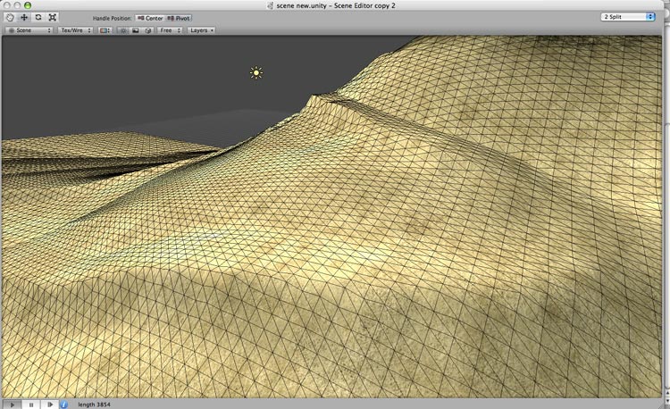
      often I have downloaded SRMT terrains from CGIAR-CSI GeoPortal but the resolution especially for German regions is very low. The Problem is that SRMTs and other map materials with higher resolution one can get only from the german land survey offices against much money, so i saw an alternative only in the GE-Terrains. But The GE Terrains are sufficient for my purposes.

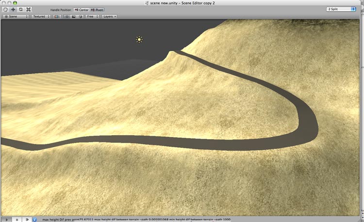
      A new question now for me is, how to get a realistic street on the terrain. I have already investigated in the forum and Internet. This Question seems to be interesting for many user but till now nobody has found a solution. I will continue to work on.

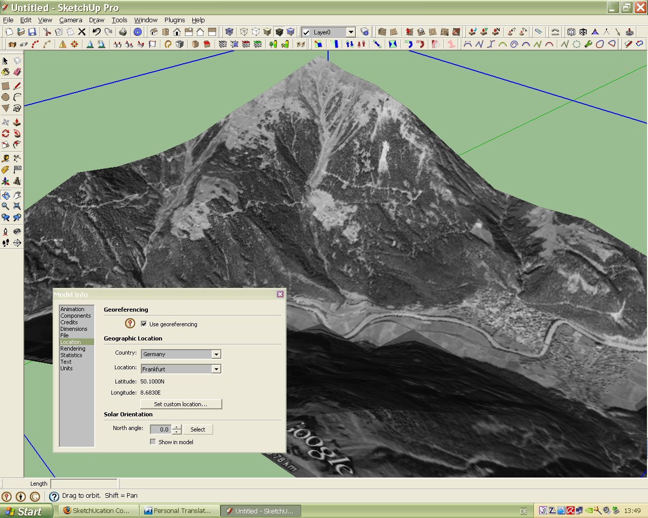
      But your note (you can check this under > Window > Model info > Location). I tried this immediately by importing several terrains but in the model info there is only the location which was predefined by me. Have I made any mistake? See picture below.

      Greetings
      Karlheinz


      Alps.jpg

      posted in SketchUp Discussions
      charly2008C
      charly2008
    • RE: Customizable Toolbar

      Hi Gaius,

      thank you for your explanation. I thought one could organize the plugins with that.

      Karlheinz

      posted in SketchUp Discussions
      charly2008C
      charly2008
    • Customizable Toolbar

      Hello SCF Members,

      i read a topic (http://www.sketchucation.com/forums/scf/viewtopic.php?f=15&t=15309)about this Customizable Toolbar.
      Is there anybody who is using this toolbar? Is this tool useable and recommendable. Does anybody have an experience with this toolbar?

      Karlheinz

      posted in SketchUp Discussions sketchup
      charly2008C
      charly2008
    • RE: Digital terrain model from Google Earth

      Hi thomthom,

      i have a question about terrain views imported from GE. Are the geographical data (coordinates, heights) imported also with the imported view? I'm not shure on which base sketchup calculates the heights of the imported Terrain when "Toggle Terrain" is on.

      The disadvantage of the method with the contour lines is that all geographical data are lost.

      Do you have an idea.

      Karlheinz


      Four tiles merged together


      Triangulated Terrain

      posted in SketchUp Discussions
      charly2008C
      charly2008
    • RE: Some Sketchup models

      Some weeks ago i found a ruby which is very helpfull to create ornaments. The link i shown here:

      301 Moved Permanently

      favicon

      (www.sketchucation.com)

      Below a first attempt

      Karlheinz


      Schmiedetor.jpg

      posted in Gallery
      charly2008C
      charly2008
    • RE: Some Sketchup models

      Hello Gaius,

      this model is really fantastic, particularly the surroundings are looking realistic. How did you create these surroundings. With the rendering techniques I am not so much experienced yet.

      I have many models not yet finished too. Sometimes i loose the motivation . Then i have to motivate myself newly again and again . But the Models i saw in this Forum will give me new energy to continue.

      The Problem at the reconstruction is to find Data which helps you to calculate or estimate tha size of the objects.

      Below again some stuff made with Sketchup.

      Karlheinz


      Historical Tower


      Roman Fort (not yet finished)


      Schwert6.jpg


      Schwert1.jpg


      marble relief


      Schwerter.skp

      posted in Gallery
      charly2008C
      charly2008
    • RE: Some Sketchup models

      Hello Pilou,

      it is a very simple technic but it takes some time . I imported a drawing of the cross an made contours from all elements to get faces. After finishing all faces i used only the push pull tools. I hope this will be helpfull for you.

      Karlheinz

      posted in Gallery
      charly2008C
      charly2008
    • RE: Some Sketchup models

      Hallo Gaius,

      i read your occupation. I'm also activ with our city archeologists here in Frankfurt as a honorary helper.
      within the last 12 months we had to work on a whole quantity of Franconian and bronze temporal graves but the reconstruction is a much harder business.

      Karlheinz

      posted in Gallery
      charly2008C
      charly2008
    • RE: Making a ground with diffrent levels ( for beginners )

      Hello,

      may be this link could be interesting for you : http://www.alejandrobarzi.com/root/br/Home

      there you will find a tutorial which shows how to create contour lines from an GE-Image.

      Greetings from Frankfurt / Germany

      Karlheinz

      posted in SketchUp Tutorials
      charly2008C
      charly2008
    • Digital terrain model from Google Earth

      Hello to all Members,
      I’m a new member in this community and I’m surprised about this many talented people here.

      May i introduce myself. I’m a retired “stoneaged” mechanical engineer. My special interest is in the reconstruction of historical buildings and all other things which can be constructed with Sketchup.
      I came in contact with Sketchup about two years ago. I was immediately enthusiastic with this software. Most of the Sketchup techniques i have learned by online video tutorials.

      Some of my models you can see here:
      http://www.sketchucation.com/forums/scf/viewtopic.php?f=81&t=18835

      Sorry if my English is not so perfect.

      Greetings from Frankfurt/Germany

      Karlheinz

      Digital terrain model from Google Earth
      may be there are users which would like to present models on a terrain that corresponds to the real area. Unfortunately, DEMs are to get in Germany only for a lot of money. I have found an interesting Tutorial at the internet. This tutorial shows a technic how to create height contour lines from the pictures in Google earth. These produced contour lines can be used for modeling a terrain into Sketchup. May be it is interesting for some of you.

      The link: http://www.alejandrobarzi.com/root/br/Home


      Height contours in GE


      Vectorized Image


      terraced land in Sketchup


      Finalized Terrain

      posted in SketchUp Discussions sketchup
      charly2008C
      charly2008
    • RE: Some Sketchup models

      Hello,

      thankyou for your friendly comments. Sorry for my late answer but i was very busy.

      Greetings from Frankfurt
      Karlheinz

      posted in Gallery
      charly2008C
      charly2008
    • 1
    • 2
    • 59
    • 60
    • 61
    • 62
    • 63
    • 61 / 63