sketchucation logo sketchucation
    • Login
    1. Home
    2. charly2008
    3. Posts
    Oops, your profile's looking a bit empty! To help us tailor your experience, please fill in key details like your SketchUp version, skill level, operating system, and more. Update and save your info on your profile page today!
    ⚠️ Important | Libfredo 15.8b introduces important bugfixes for Fredo's Extensions Update
    Offline
    • Profile
    • Following 0
    • Followers 0
    • Topics 132
    • Posts 1,241
    • Groups 1

    Posts

    Recent Best Controversial
    • Problem with Kerkythea exporter

      Hi to All,

      since yesterday the Kerkythea exporter doesn't work anymore. This happened after installation of some Ruby scripts. I changed also the path for saving the xml. But the problem still exists. Below the Ruby message i get on export. Maybe somebody can analyze this message.

      Thanks in advance

      Karlheinz


      Ruby Error.jpg

      posted in Developers' Forum
      charly2008C
      charly2008
    • RE: Terrain data conversion to a xyz-file

      Hi Pichuneke,

      thanks for your efforts but i couldn't install the program. Do you have some screen shots from works you have done with this program? to give me an impression.

      Karlheinz

      posted in SketchUp Discussions
      charly2008C
      charly2008
    • RE: Terrain data conversion to a xyz-file

      Hi TIG,

      in such a terrain it is nearly impossible to get a good result with that method. I will try it again with the steps i described in the quick road tutorial. It is much more work but the result looks better.

      Karlheinz


      GEO128.jpg


      Road.jpg

      posted in SketchUp Discussions
      charly2008C
      charly2008
    • RE: Terrain data conversion to a xyz-file

      Thank you Pichuneke,

      the program looks interesting. I tried to install it but anything was wrong. Unfortunately i don't speak spanish so i couldn't read the messages given at the installation.

      Karlheinz

      posted in SketchUp Discussions
      charly2008C
      charly2008
    • RE: Terrain data conversion to a xyz-file

      The idea was to export the terrain into this Diolkos road design software for designing the road contour and afterwards bringing the terrain back into sketchup for further modelling. This software seemed to be simple to work with but it isn't. May be i will find a simple 3d Software where i can do that works.

      Karlheinz

      posted in SketchUp Discussions
      charly2008C
      charly2008
    • RE: Iron Bend Drawing

      thank you Gaieus.

      i have the latest update.

      Karlheinz

      posted in Developers' Forum
      charly2008C
      charly2008
    • RE: Terrain data conversion to a xyz-file

      Hi TIG,

      in Sketchup i'm working with meters. The triangulation program works also in meters. I tried your advices but without success. It seems that this program needs a reference point to calculate the height. When i inserted a point in the 3D space in sketchup then a average height of 3012 m is shown but the triangulation is messed up. If you need more information please ask.

      Karlheinz


      GEO128.jpg


      GEO1281.jpg

      posted in SketchUp Discussions
      charly2008C
      charly2008
    • RE: Terrain data conversion to a xyz-file

      The import of the created dxf worked. Contour lines were created. But the statistic say there are a average of heights (m): 0,00. I exported a xyz file and there are it seems also z-values. ❓ I'm a little bit confused now.

      Karlheinz


      Bild1.jpg


      Bild2.jpg

      posted in SketchUp Discussions
      charly2008C
      charly2008
    • RE: Terrain data conversion to a xyz-file

      Hi TIG,

      thank you very much. Your AddVertex works fine. Now i will try to get the dxf into this Rod design software mentioned above.

      Karlheinz

      posted in SketchUp Discussions
      charly2008C
      charly2008
    • RE: A good method for making a blade of a sword

      Here is the file for version 6.

      Karlheinz


      Schwerter.skp

      posted in Newbie Forum
      charly2008C
      charly2008
    • RE: Iron Bend Drawing

      Here some models may be interesting for historic architecture, created by help of Drawmetal tool.


      Archi Element.jpg


      Archi Element1.jpg


      Archi Element2.jpg

      posted in Developers' Forum
      charly2008C
      charly2008
    • RE: A good method for making a blade of a sword

      Hi Matsuo,

      please have a look at the attached skp-file.

      Karlheinz


      K640_Sword1.JPG


      Schwert3.skp

      posted in Newbie Forum
      charly2008C
      charly2008
    • RE: Terrain data conversion to a xyz-file

      for that it would be necessary to have a 3D CAD Software i suppose, but the problem is that i don't have a 3D CAD software.

      Karlheinz

      posted in SketchUp Discussions
      charly2008C
      charly2008
    • RE: Terrain data conversion to a xyz-file

      Hi Gaieus,

      I tried to open a from Sketchup exported DXF with this program but i got the message "no points insertion found". I think in the exported dxf there are missing data which the program needs to interpret it as height points. Sorry about my english

      KARLHEINZ

      posted in SketchUp Discussions
      charly2008C
      charly2008
    • Terrain data conversion to a xyz-file

      Hello SCF-Members,

      I found a software, Diolkos-Road design. This software is able to read terrain data as xyz-files or dxf. There is also a trial version. In the Kerkythea xml file which was exported from Sketchup i saw there are the terrain data as a list of xyz points existent. A number of CAD programs work with .XYZ files which are comma delimited text files containing just xyz coordinates of points in space.

      Does anybody have an idea how to convert this data to a dxf or xyz-file which can be read by CAD. So may be it would be possible to modify a terrain or road with this software.

      I did a test, i copied the xml data to a text file and renamed it to a xyz file before i inserted commata as spacings.

      Then i tried to open it with the Diolkos Software. The Read point process asks for three xyz-positions. I'm not shure what has to be inserted. When i apply the predifined values it reports "Erase 575 double points" and nothing happens.

      Karlheinz

      software link: http://www.diolkos3d.com/diolkos_in_brief_en.htm


      xyz data.jpg


      xyz data1.jpg


      xyz data2.jpg


      xyz data3.jpg

      posted in SketchUp Discussions sketchup
      charly2008C
      charly2008
    • RE: Rendering with Graphics Processor

      Hi,

      may be Nvidia Gelato could be a solution.

      "Gelato is a software program that leverages the NVIDIA GPU as a floating point math processor. This allows Gelato to render images faster than comparable renderers, but without the quality limitations traditionally associated with real-time graphics processing on the GPU."

      There is a free and a commercial version.

      Karlheinz

      Page Not Found | NVIDIA

      Page Not Found

      favicon

      (www.nvidia.com)

      posted in Extensions & Applications Discussions
      charly2008C
      charly2008
    • RE: Modelling in a terrain

      Hi Gaieus,

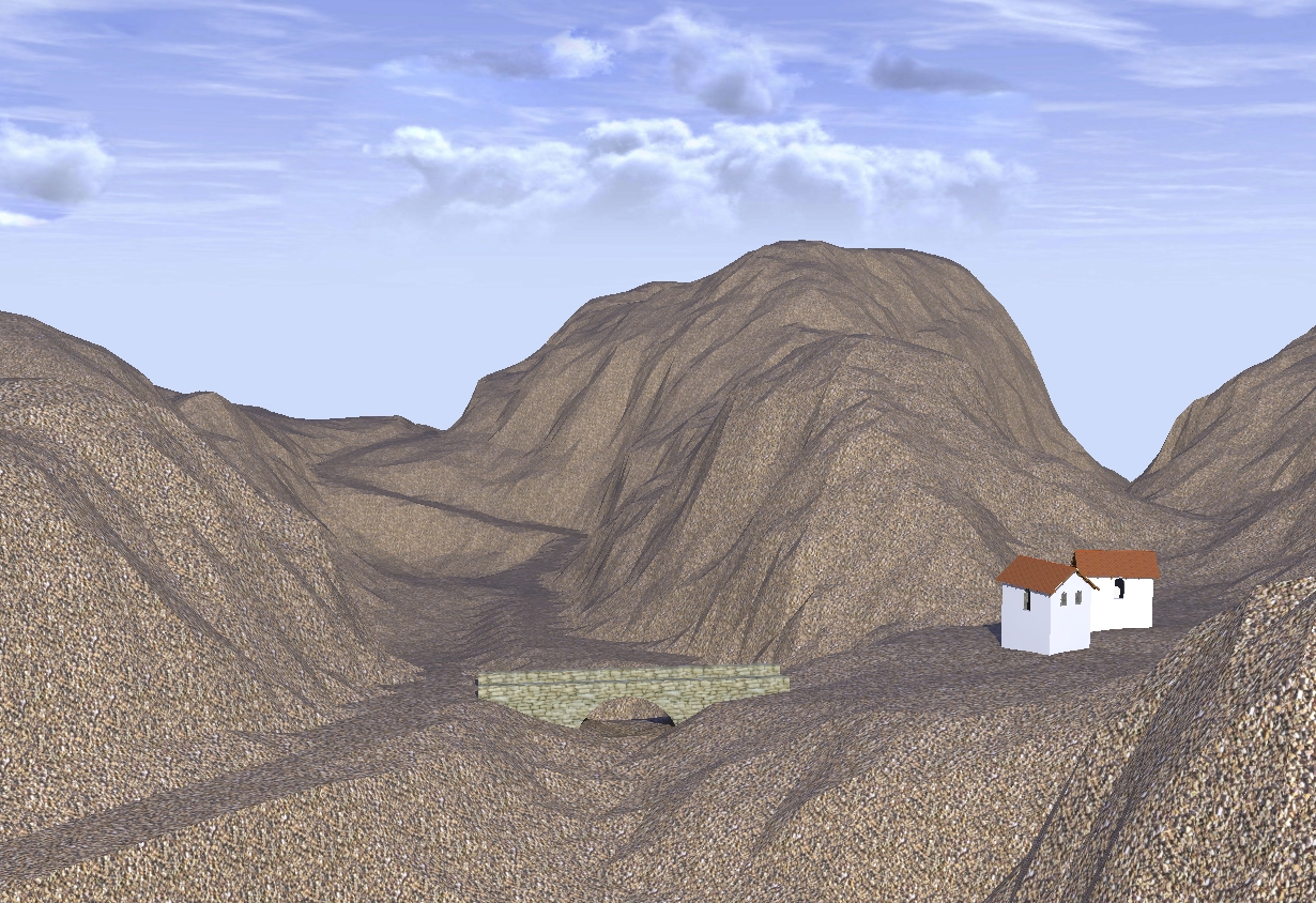
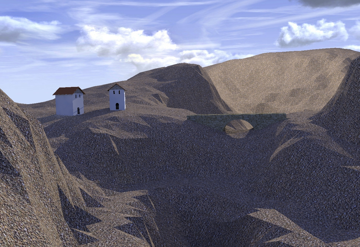
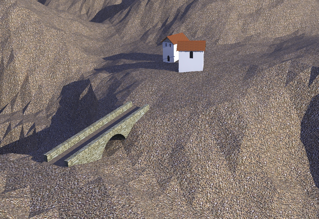
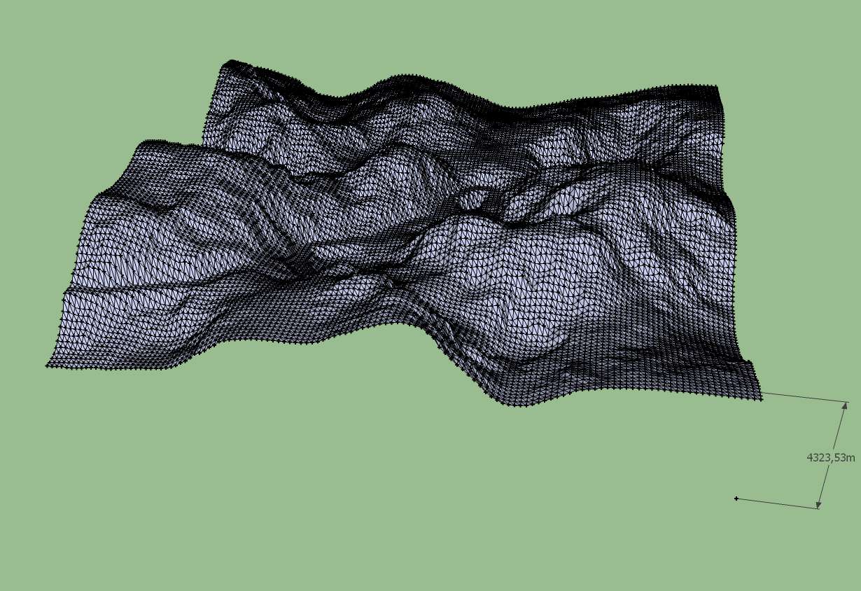
      no i didn't smooth the terrain because you know how much time consuming this is within Sketchup. I tried it with subdivide and smooth but this seemed to me a never ending process. This terrain was produced by Geocontrol2 and you can see the road only as a shadow.

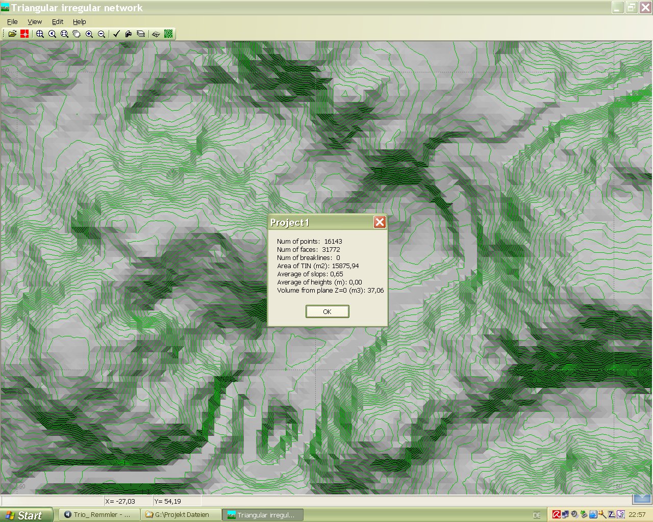
      At present i try to find a workflow from Geocontrol to Sketchup and then to render which is not so much time consuming. Geocontrol is simple to work with it is fast and powerfull for the terrain generation.

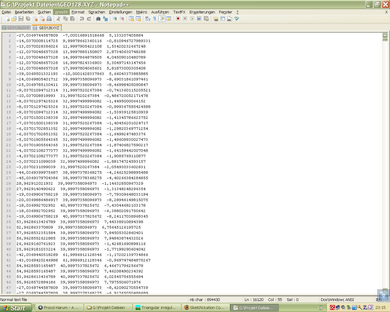
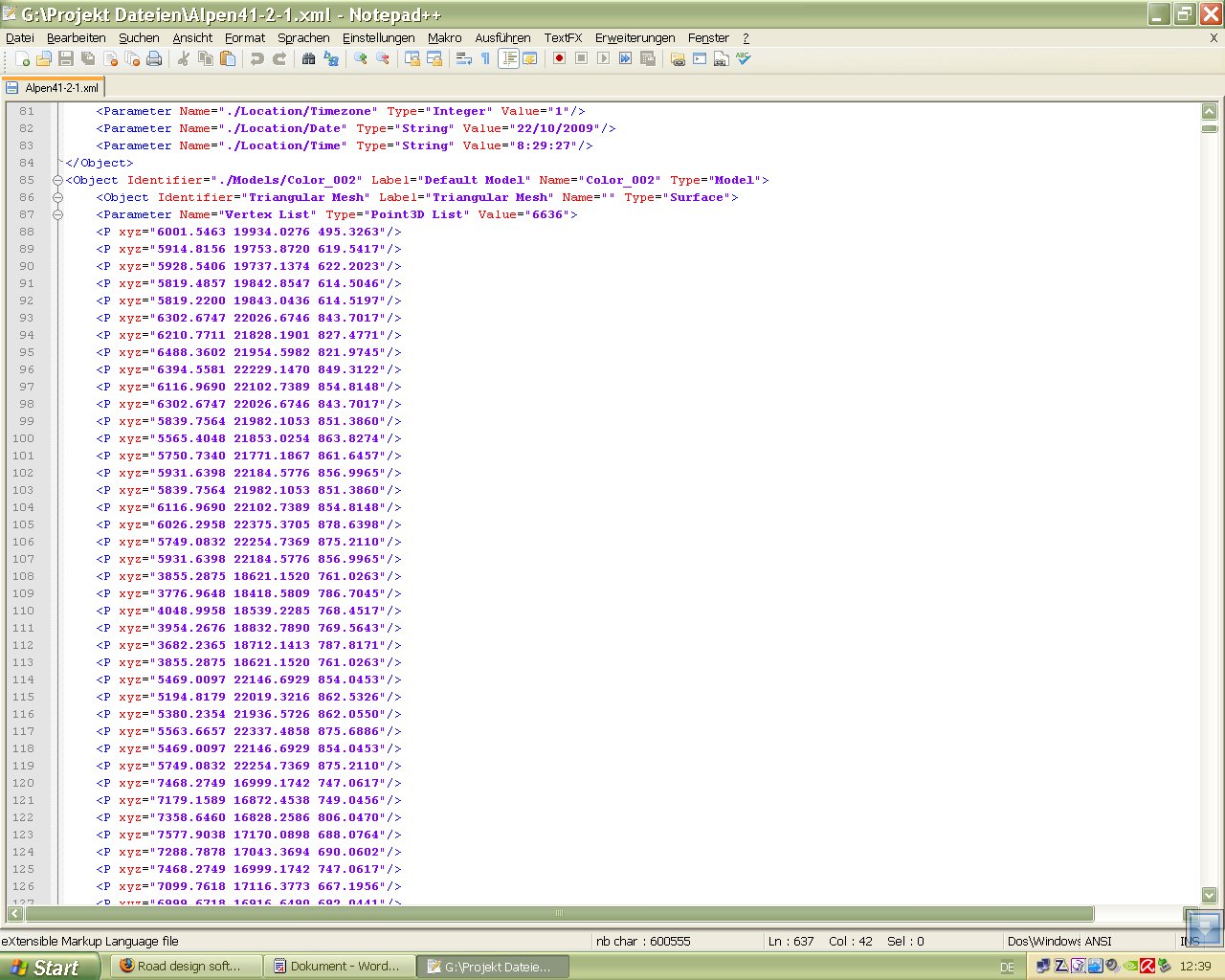
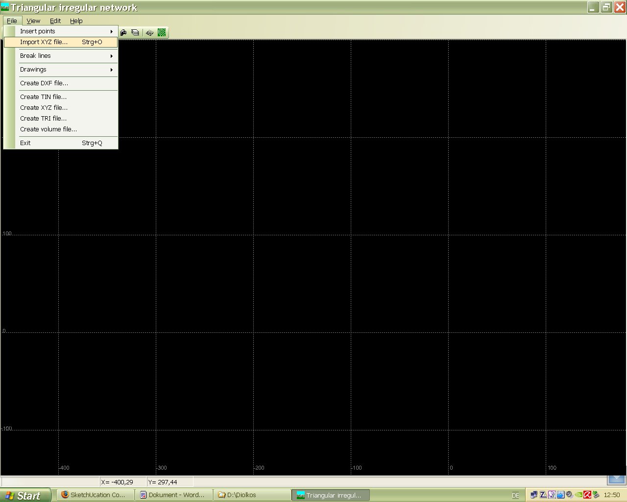
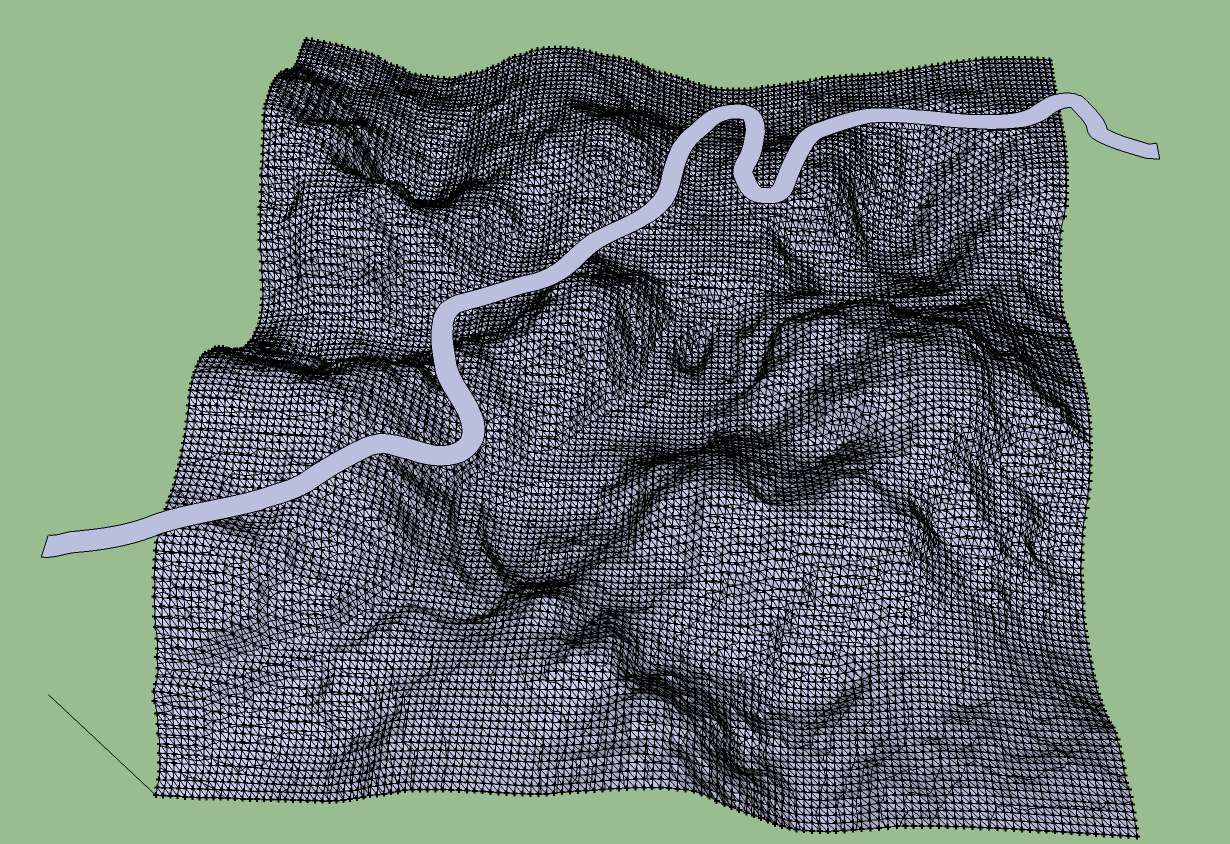
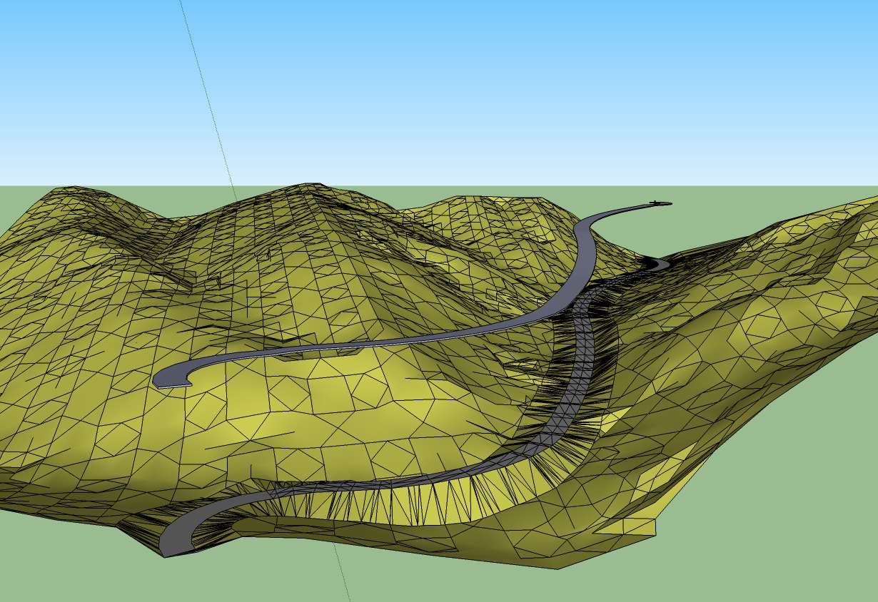
      The terrain is simple to export as a tringulated mesh. The road itself can be exported only as a .BMP image. At the export of the terrain you have to find a optimum size where it is acceptable to deal with in Sketchup. A size between 128 and 256 is usefull. For the export format i choosed a Wave object (.obj) file. That file i exchanged to a 3ds file.

      If you have imported the 3ds file into Sketchup it is possible at a acceptable speed to place components on the terrain.

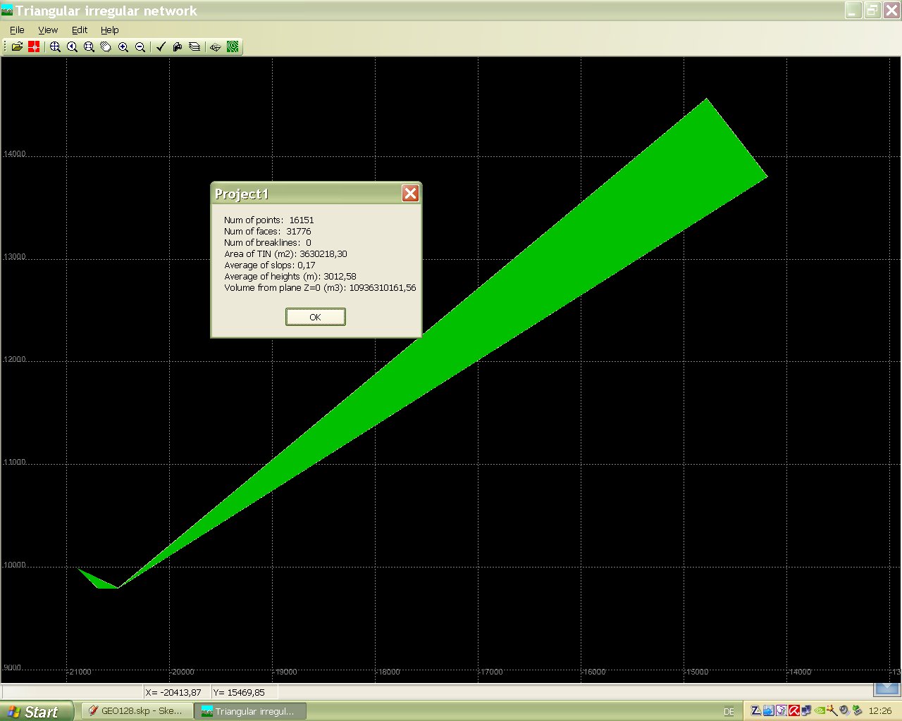
      I have access to Cinema 4d and 3ds max and Vue 7 xStream. in 3ds max there is a function for smoothing a mesh. It works very fast but the exported 3ds file produced a bugsplat in Sketchup. May be there are some wrong adjustments. Till now i'm not so much experienced with both programs.

      The rendering was done by Kerkythea. Later i found in Kerkythea there is also a smooth function which i have to try.

      The texture is a simple texture image from Sketchup.

      More and more questions open up for me .

      How to create a texture or material which is seeming natural rock and placing plants on the terrain

      How to create a sharp contoured road and how to texture it in the triangulated mesh

      Karlheinz

      posted in SketchUp Discussions
      charly2008C
      charly2008
    • Modelling in a terrain

      first Steps of modelling in a low poly terrain and a quick render.


      Simple Rendering.jpg


      Simple Rendering1.jpg


      Simple Rendering2.jpg

      posted in SketchUp Discussions sketchup
      charly2008C
      charly2008
    • RE: Question to all Ruby programmers

      Hi Chris, Hi Thomas,

      in my brain it seemed clear to me. But to express it in english is a little bit difficult. Please be a little forbearingly with me.

      I try to explain the theoratical workflow:

      1. Manually creation of a road line above the terrain on a flat plane.

      2. Calculation of height points along this line on the terrain (Ruby?).

      3. Projecting the calculated points (may be as a line) on a perpendiculare face (unfolded height profile of the terrain) (Ruby?).

      4. Manually creation of the road height profile depending on the height profile of the terrain on this face or on new one (3.).

      5. Calculation of the new road height points and creation of a line.(Ruby?)

      6. Creation of the 3d road height line like it is done with shape bender (ruby).

      The steps above are In principle the more automated steps of that what i did manually in the Quick Road tutorial as there are:

      1. Manually creation of a road line above the terrain on a flat plane.

      2. Taking a copy of this line and placed it below the terrain.

      3. Creating of the terrain height profile using "Loft",

      4. Intersecting the face with the terrain to get the height profile.

      5. Manually take out a copy of the face.

      6. Manually creation a perpendiculare face with help by "Unfold".

      7. Manually creation of the road height profile by drawing a line on the same face.

      8. Manually removing all Terrain height profile lines from this face.

      9. Projecting road height profile line to a 3D Profile by "shape bender"

      Karlheinz

      posted in Developers' Forum
      charly2008C
      charly2008
    • RE: Quick tutorial for road design on a terrain

      Hi csaba,

      i agree with you, but i'm a Lazy dog.

      Karlheinz

      posted in SketchUp Tutorials
      charly2008C
      charly2008
    • 1 / 1