[Plugin][$] TopoShaper - v2.7b - 30 Jan 26


-
I'm a Chinese.The Chinese version by GUANJIN is too bad.You know,he is famous for translating by Google translation which called machine translation in China.Just for perfunctoriness and money.He owns a forum which the plugins translated in Chinese by him are sold.Your plugins are so good,so that,We must put quality before quantity.We would rather go without than have something shoddy.I beg that you should find out the truth.I swear that all I said is true.THANK YOU.
PS:His forum:www.sketchupvr.com -
Topissime!


-
Thank you Fredo! Your have your own SU inside SU. All great plugins.
-
Awesome!! Really awesome. Thank you.
Daniel -
Another stunning plugin! Thanks, Fredo.
-
 as ever...
 -
Plugin of the year for me.
 Been checking in consistently to see if it was released and then today just happened upon it in the Plugin Store from within Sketchup. (Thanks Rich!!!)
Thanks for putting the time and effort into this Fredo. Can't be happier and will definitely donate for this one! You are the man!!
-
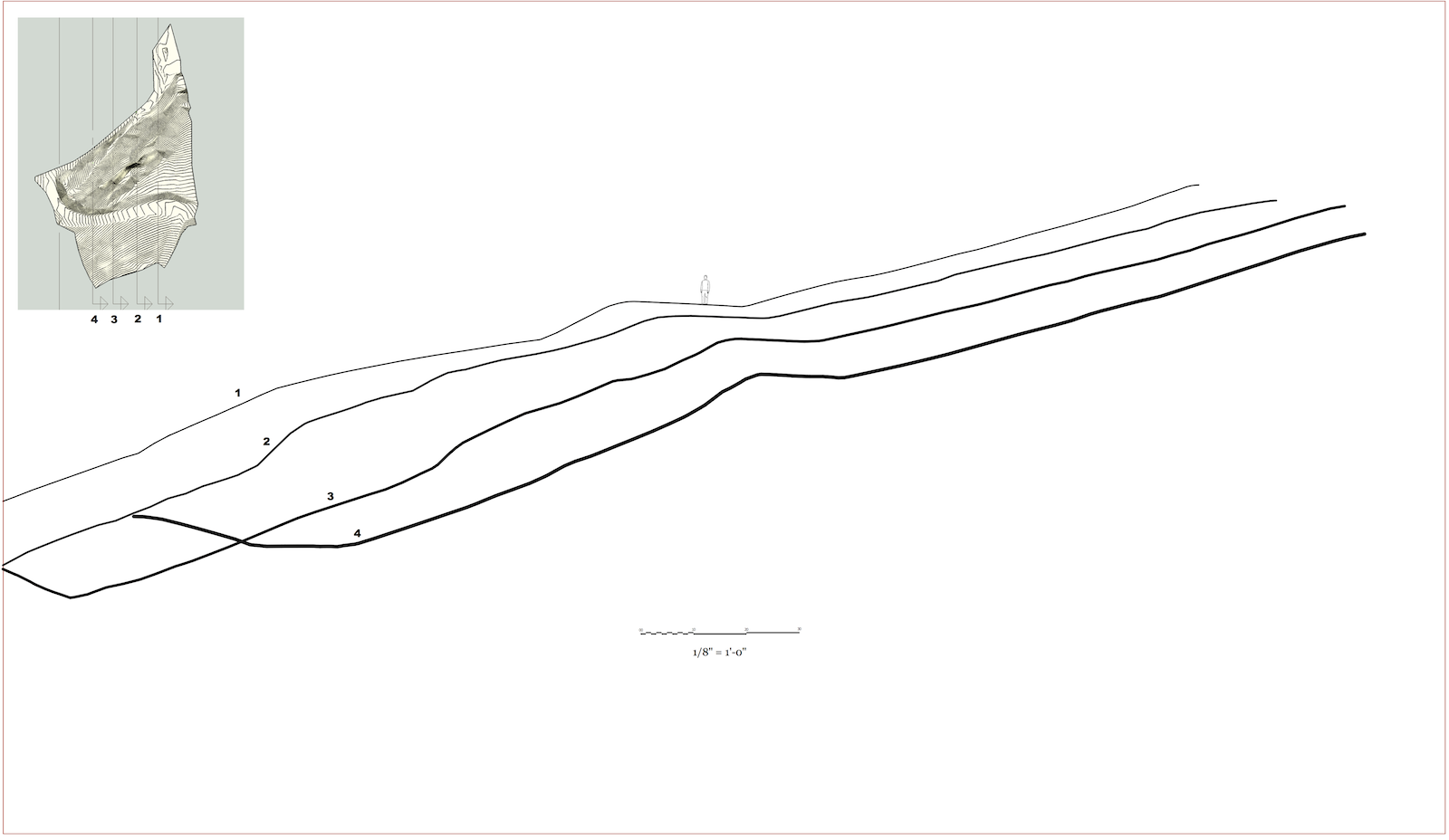
Well I had no problem whatsoever with my first trial. This image doesn't do full justice to the model and what I hope to do with it, but I needed these sections first and it was a pretty quick and painless with SU and LO to make this sheet (Low res here for SCF). And Toposhaper... I just clicked and boom it was done-- I raised the grid resolution up a ways (perhaps ridiculously high) and no problem. Made some "groups from sections" and made overlapping scenes in LO. All from a 2d plan (I had a tool in PowerCADD to give the contours elevation).
Thanks Fredo!
A good occasion to donate on.
-
Well done, Fredo. You are the master!!!
ching ching!
-
Wow, absolutely, amazingly, WOW!! What an amazing job Fredo, thank you x1000!!
-
this is fantastic! thank you one more time!!
a question about your tool interface: is there a way to avoid the text in tool panel being same color of the sketchup line style? i realized this looking at your screenshot.. if i turn on a style with black lines, i can see the text, but i'm used to work with a dark style + white edges and this make the text over yellow or other very light-coloured buttons almost unreadable.. is there a way to set this or some workaround to this? thank you! -
@panixia said:
this is fantastic! thank you one more time!!
a question about your tool interface: is there a way to avoid the text in tool panel being same color of the sketchup line style? i realized this looking at your screenshot.. if i turn on a style with black lines, i can see the text, but i'm used to work with a dark style + white edges and this make the text over yellow or other very light-coloured buttons almost unreadable.. is there a way to set this or some workaround to this? thank you!Unfortunately, I have no control on the text color with the current Ruby API. I think that the text color is inherited from the line color.
I will see if I can make a palette style.Fredo
-
@unknownuser said:
I will see if I can make a palette style.
thank you a lot!
 maybe if you already got control over the label's color it could also be easier to change them with some colors which can work good with both light or dark line style, pheraps using colors wich ar not much light or much dark..
 -
When working on architectural models, generating good topo for a hillside plot can be an absolute pain.
I just tried this on a project that previously took me the best part of a day to deal with the landscaping. A few clicks with this plugin and job done - simply amazing
-
Absolutely astounding work as always sir. A donation will be on it's way soon

-
This is AWESOME. I've been fighting with trying to smooth out some not-so-detailed contours from a USGS map for a while, this ruby did it in a snap with perfect detail. Thank you!
-
HUGE time saver!!
Normally i'd have to make construction point grids and then triangulate the points. This is so much more streamlined.
-
Hi,
Thanks so much for sharing this great plugin. However everytime I click "Calculate Terrain" SketchUp just crashes....and I tried the old sandbox tool it worked OK...can anyone tell me how to resolve this? Thanks so much!
-
@gundamzd said:
Hi,
Thanks so much for sharing this great plugin. However everytime I click "Calculate Terrain" SketchUp just crashes....and I tried the old sandbox tool it worked OK...can anyone tell me how to resolve this? Thanks so much!
do you have any of these conflicting plugins? and have you downloaded the new libfredo library?
@unknownuser said:
IMPORTANT: Requires to download LibFredo6 4.8 or higher if not already installed
CONFLICTING PLUGINS: some plugins conflicts with some of my scripts
Some versions of Podium SunPosition Matchbox -
@gundamzd said:
Hi,
Thanks so much for sharing this great plugin. However everytime I click "Calculate Terrain" SketchUp just crashes....and I tried the old sandbox tool it worked OK...can anyone tell me how to resolve this? Thanks so much!
Could you post or PM me the contours model so that I have a look.
Does it happen on all models you test (for instance on the sample models which are attached to the first post of this thread)?Fredo


Advertisement