Large Terrain Mesh
-
I used an old faithful.... Truespace, made the first save to .cob and then DE for the rest.
-
@solo said:
I used an old faithful.... Truespace, made the first save to .cob and then DE for the rest.
I had never heard of Truespace until now but after looking at their website I am definitely intrigued. And the best part is that according to their website Truespace is free.
Someday if you have the time, I'd definitely like to pick your brain and hopefully learn how to replicate your results myself.
-
I'm surprised that trueSpace was the solution. I was using (and beta testing) trueSpace for 10 years (93-03) before I switched to SU and LW, and I really liked the program. But I can't see how it helped handling the giant dxf mesh?
Could you really load that giant dxf into tS and save as a .cob?
I still have tS 6.6 installed BTW.BTW, those DE problems may come from different versions? There were many problems with some of the DE versions.
My DE is v 3.5, and it handles/reduces the sample mesh OK, but makes the borders very ugly (very few vertices around the edges). -
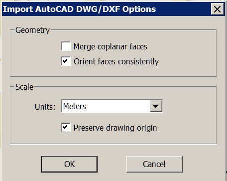
Try 'NOT preserving the origin' of the imported data - it's probably zillions of meters away from [0,0,0]...
Then when it's loaded zoom extents ? -
Dear specialists,
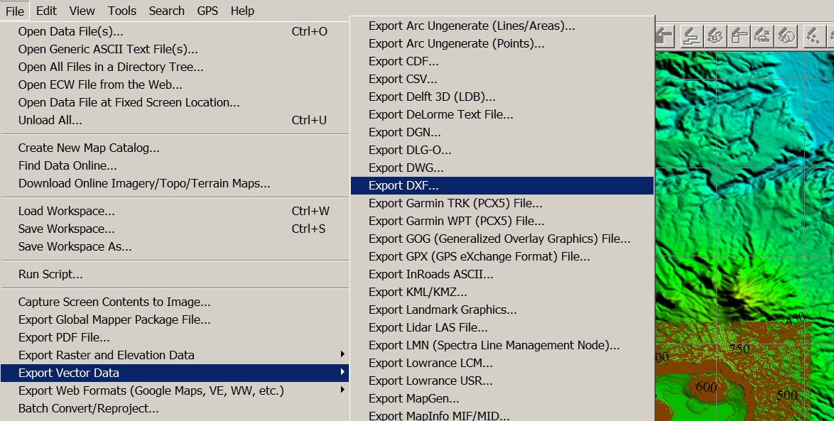
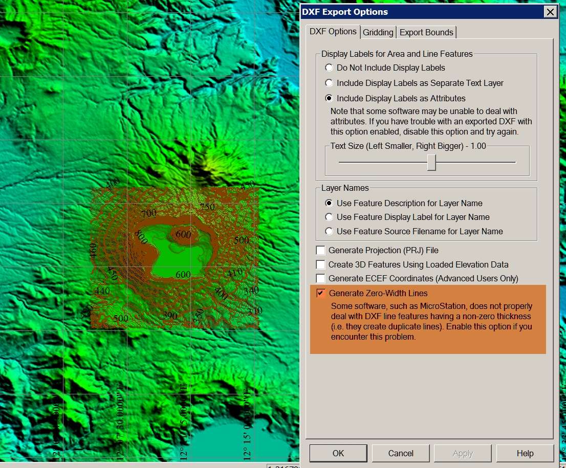
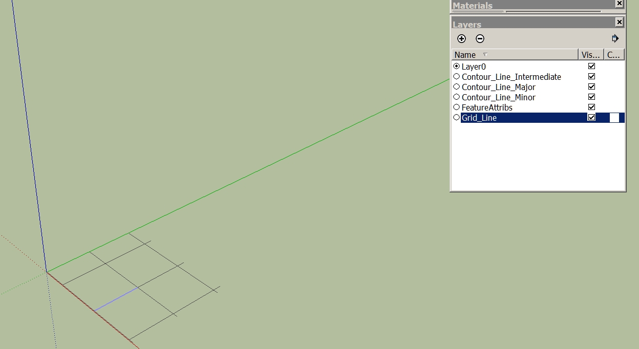
I have a question again. I have created in Global Mapper contour lines. Then I export the vector data as a DXF. When I import it into SketchUp, the layer are displayed, but the model is not visible. What am I doing wrong? I thank you in advance for your help.
Charly
-
Hi TIG,
then I see a very small piece. Only when I scale it I see it is only a grid. Now what I've discovered! The problem I had once before. I can not remember the solution.
Charly
-
Could it be a scaling issue? Is the import scale and the original scale the same? If it is very tiny, it would explain the missing faces.
-
Hi Gaieus,
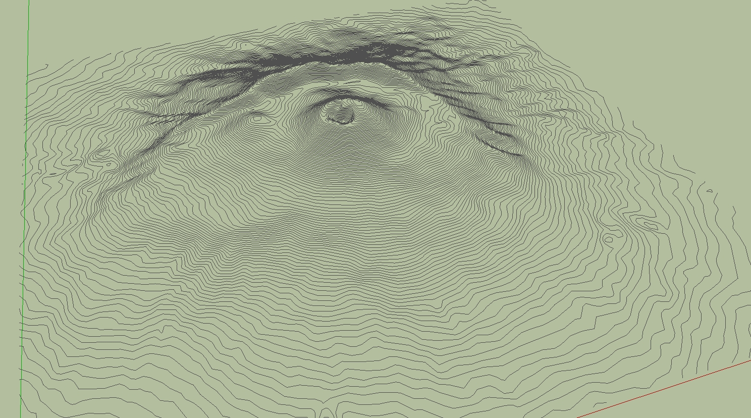
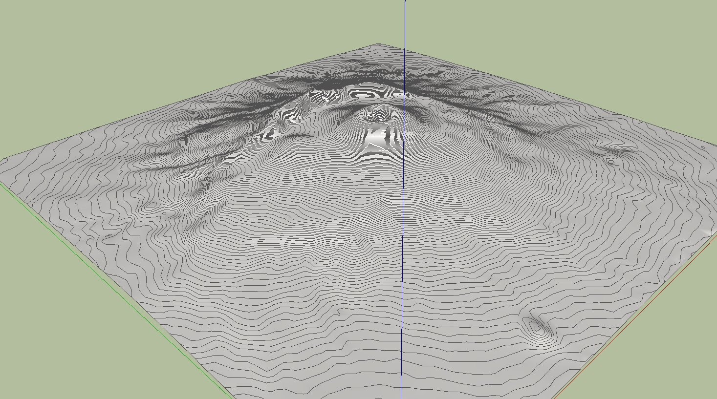
If I knew that! I only know that I yesterday tried it with the contour lines (same Options in Global Mapper) of the Vesuv and it worked.
Charly
-
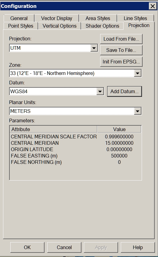
Problem solved! I forgot to change the projection to UTM Datum WGS84.
Charly
-
Cool. And now let's see some nice eruption!

-
Through some experimentation and the help of someone who has a newer version of DE, I was able to determine that the problem I was having is related to the way the DE reduces files of different types.
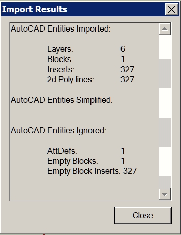
Solo was importing the DXF file into Sketchup and saving it as Sketchup version 6 prior to reducing the mesh in DE. I was unable to import the DXF file into Sketchup due to it's size so I was opening the DXF file directly with DE.
After sending a sample DXF file to a friend with a newer version of DE and hearing that he was seeing the same problem, I began to suspect that it must have something to do with the file type so I tried converting the DXF file to another type, OBJ I think, then opened that with DE and reduced the terrain mesh. After doing this, I was finally able to obtain acceptable results at 90% reduction.
-
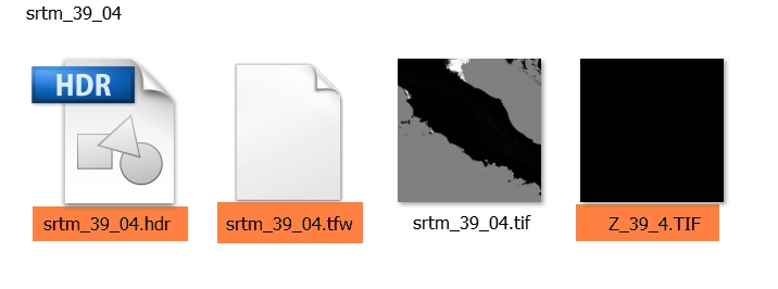
Hi,
I have a additional question to the downloaded SRTM. For what purpose is served by the tagged files. Thanks in advance.
Charly
-
I have used Global Mapper quite a bit to generate contours for import to SU. The largest I have done was about 2000 acres. You may want to play with the contour interval to speed up SU. I generated a terrain model with 2' contours on 2000 ac. SU ran all night. When It was complete, I had to zoom WAY back (really far). Good Luck, sounds like a cool project.
Hello! It looks like you're interested in this conversation, but you don't have an account yet.
Getting fed up of having to scroll through the same posts each visit? When you register for an account, you'll always come back to exactly where you were before, and choose to be notified of new replies (either via email, or push notification). You'll also be able to save bookmarks and upvote posts to show your appreciation to other community members.
With your input, this post could be even better 💗
Register Login


Advertisement