3D road from outlines and height points at centerline?
-
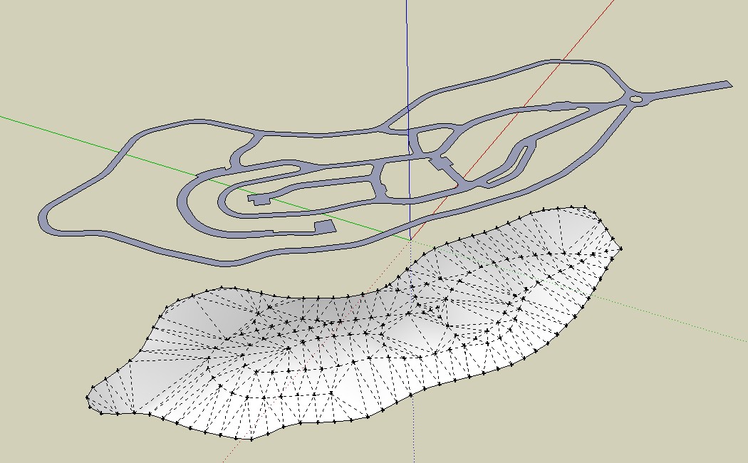
I have outlines of a road and height points of the center of the road. (height points taken from a dwg but do not represent the exact center of the path, but an approximation)
What methods would you guys recommend for building a 3D road out of the information at hand?
I've tried triangulating the points and draping the road over them, but that isn't satisfactory. the road becomes too angled at some parts. I'd like a method for getting the road to be "horizontal" as much as possible.
Attached are an illustration image and the sketchup model.

-
Vali architects plug

-
Vali Architects have a nice set of plugins, but from what I can see, they can't quite solve my issue...
-
Hi,
Such problems interest me much. I've converted the c-points in a triangulated surface. Then I tried to stamp to transfer the contour of the road. No result.
Charly
-
You are trying to drape onto a drapee shape that's smaller that the draper...
Also [more importantly] the draper needs grouping...
I quickly made the drapee larger, then grouped the draper,,, and it 'draped' OK...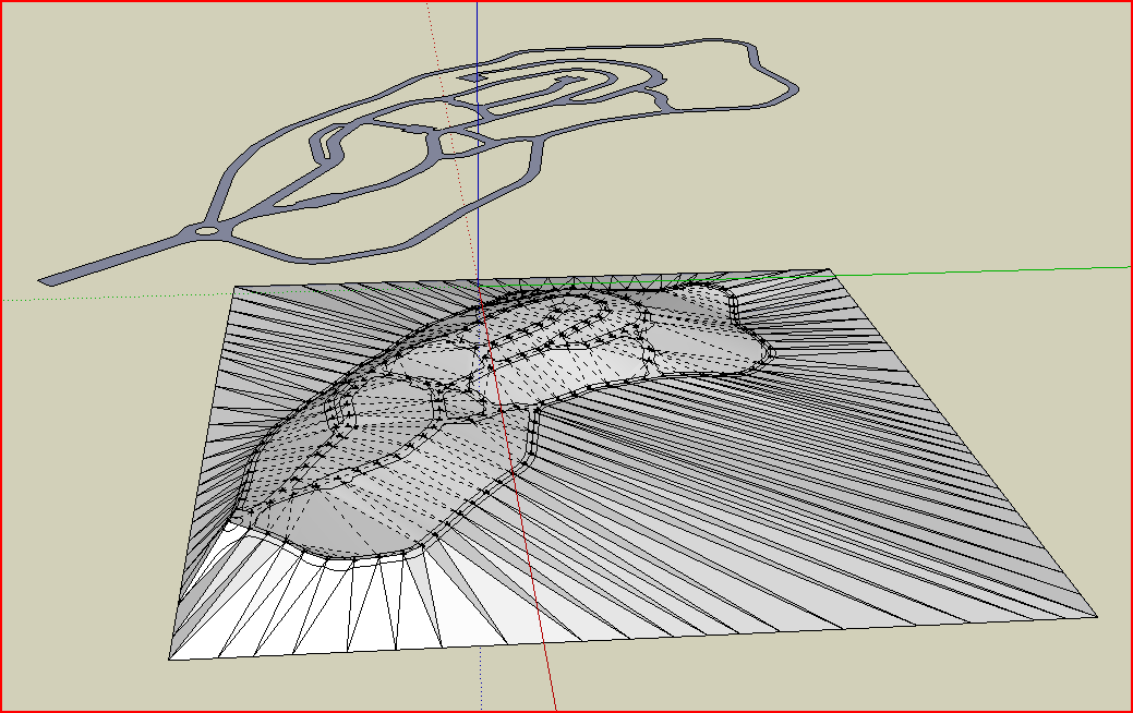 road outline to height points1 [draped].skp
 -
I have actually already tried the triangulation method, like I wrote above. I also added surfaces to the sides so the stamping would work just like good o'l Tig did.
The problem with this method is that the roads don't come out flat, but rather in an angle which just happens to be determined by the triangulated faces that are around it. So it's good for a far away model, but I need something closer to reality, so I can zoom in on some parts later.I have tried something else which comes close to what I want, using "profile builder" with a rectangular profile. The problem is that "profile builder" can't handle forking geometry too well. So it only builds sgemented profiles. maybe something like tube along path would get what I want...
I'll attach an image tomorrow when I'm back at work. good night guys and gals, and thanks!
-
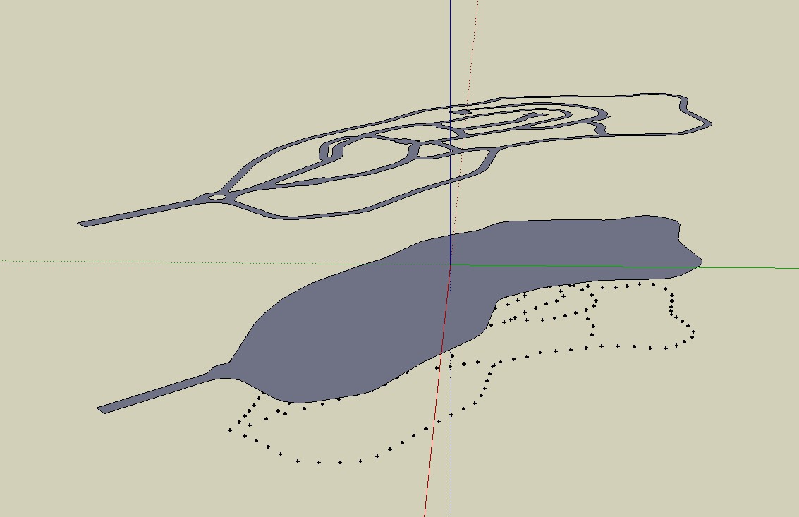
If you want the roads 'flat' use stamp [here 20m embanks]... then drape on what is stamped.
If you want to leave existing surface sticking through then stamp/drape the outlines of the roads split into separated into separate groups...![road outline to height points1 [stamped].PNG](/uploads/imported_attachments/xIoU_roadoutlinetoheightpoints1stamped.PNG) road outline to height points1 [stamped].skp
road outline to height points1 [stamped].skp -
Below are images describing the kind of road geometry I am looking for, with what I call a "horizontal road" which is in the correct heights as in the guide points.
Running "profile builder" with a 20x4m profile on the center line only works on single lines that don't fork. if they fork, it only gives the option for fragmented elements.
Maybe there is a plugin out there the will do what I am looking for?


 after the stamping I can keep the road and remove all the rest...")


-
Halroach
Have not found a plugin for your problem. This is a different conceptal work flow http://sketchup.google.com/3dwarehouse/details?mid=738b817225ba7158427d16763a0ff49 . Your plan model is made up of two main loop roads and then some branches. Each main and the loops were made into components, assigned layers to allow individual work and then the follow me and keep plugin used to create the basic roads. I don't have SU8 so did not know your scale and used 75ft. w. The roads were make using the elevation line as a ref, its segmentation is not very good. Left the hard part for you , getting the bump outs, the radii and doing the intersections. You can get the ref points for these by projection up from the plan to the road elevation.
Lot of work not sure I would recommend this approach
-
Halroach, Having spent 30 years in the survey and mapping business, I think I have a reasonable understanding of your problem. The centerline grade points provided the minimum of information but if you assume that the grade is constant between points and the road in 'flat' then each segment can be used to define a plane. The following link, http://sketchup.google.com/3dwarehouse/details?mid=52b5a9dc661d47291f3d773b4af1f0c9
is to a model I have uploaded. This model was accomplished by first converting the individual segments into curves using 'weld.rb', then the curves were smoothed using my own plugin to apply a cubic spline interpolation. Finally, using another plugin of mine, I lifted the 2d plan data to grade by first finding the two closest points horizontally to the road edge end point. Using those two points, I defined a plane and intersected a veritcal line with that plane to get the grade position. -
@sdmitch said:
the curves were smoothed using my own plugin to apply a cubic spline interpolation. Finally, using another plugin of mine, I lifted the 2d plan data to grade by first finding the two closest points horizontally to the road edge end point. Using those two points, I defined a plane and intersected a veritcal line with that plane to get the grade position.
Sam, are those plugins available to try or are they yours privately? -
There some changes I still want to make on both of the plugins, so for now they will remain private.
Hello! It looks like you're interested in this conversation, but you don't have an account yet.
Getting fed up of having to scroll through the same posts each visit? When you register for an account, you'll always come back to exactly where you were before, and choose to be notified of new replies (either via email, or push notification). You'll also be able to save bookmarks and upvote posts to show your appreciation to other community members.
With your input, this post could be even better 💗
Register Login


Advertisement