Medeek Project
-
First look at the icons for the Medeek Project extension:


This plugin is the administrative plugin that will bring a number of tasks together in the mdkBIM suite.
Planned modules and tools:
- Medeek Project: Project Info, Design Criteria, Levels
- Medeek Documents: Scenes, DXF, PDF (removed from Wall plugin)
- Medeek Estimator (removed from Wall plugin)
-
This plugin will be essentially the command and control center for the mdkBIM suite. The other plugins are there to create and edit the geometry, specializing in their specific niches while this plugin will contain the tools that works across all three plugins, bringing everything together.
There is so much work to be done to make all of this a reality. I don't even take weekends or vacations off anymore. My last coding break was in September, during the SketchUp Basecamp. I won't take a break from the code until I have completed what I set out to accomplish or I fall out of my chair trying.
-
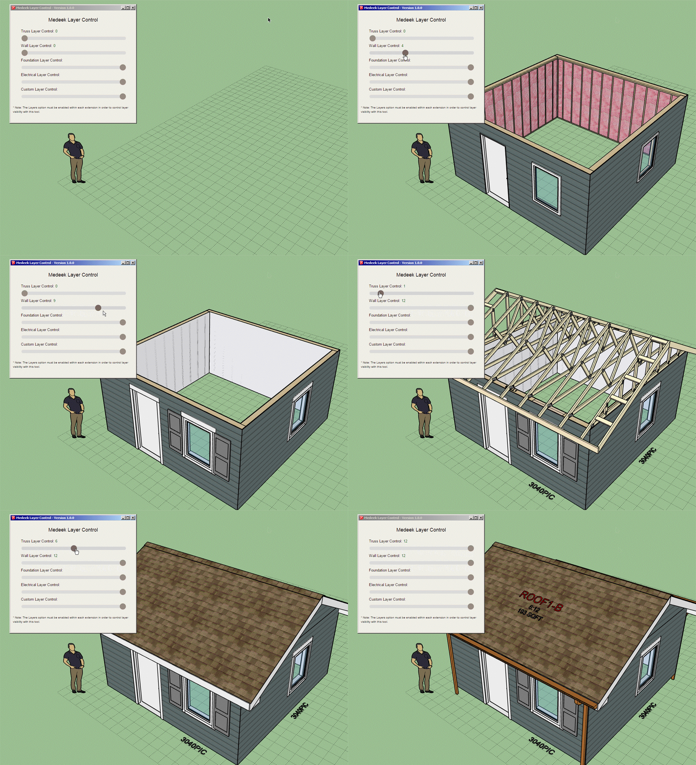
First look at the Layer Control tool and its HTML menu:

Fairly simple really. Just a bunch of sliders that allow one to incrementally change the visibility of the layers of the plugins.
I now need to add in a visibility option/integer for each layer in each plugin which can be adjusted within the global settings of each plugin.
-
adding templates for various project types would be excellent as well!
-

-
Another look, this time with walls and a truss roof:

-
it would be cool if the slider settings could be preserved on an SU scene. thus creating a sequence using scenes (and maybe you are doing this to create the animation)
i typically create construction guides which show each step of the process. each scene is then added into my master layout project with whatever size viewport is best for the detail, and this results in one or two pages in the output documentation for 10-16 scenes.
-
I will give that some more thought.
-
I've officially released the plugin now. However I do consider it still in BETA since I have not yet added the Project Info tool:
I think it would be very useful if one could input the project address and then have it not only pinpoint the lat and long but also give the elevation and the site criteria at that location (ie. Seismic, Snow Loads, and Wind Speeds.)
Granted this would probably only work fully for locations in the United States and possibly Canada but I think it would be a useful feature.
Version 1.0.0 - 01.11.2023
- Created the Medeek Project Plugin, utilizing SketchUp's Ruby API.
Medeek Design Inc. - Medeek Project Plugin Changelog
Medeek Design Inc. - Medeek Project Plugin Changelog
(design.medeek.com)
Also note that if you purchase the mdkBIM bundle today it will include a license/serial for the following plugins:
Wall, Truss, Foundation, Floor and Project
Since the Floor plugin is not yet complete you will not be able to download and install this unreleased plugin but all of the others are available.
Also note that the price of the mdkBIM bundle has not increased.
-
I think I will use the Global Settings as my HTML template for the Project Info tool. I've already established the look and feel with the global settings so why not stick with what is tried and true.
I can then have multiple pages, the first few that come to mind are:
1.) Location: Name, Address, Lat. and Long. and Elevation
2.) Seismic
3.) Wind
4.) Snow
5.) EOR: Engineer of Record - This information will be used to populate the title block for the PDF reports created by the site criteria from above.
Thoughts?
P.S.
Right now I am putting my focus back onto the Floor plugin but I would like to at least push out Item #1 above so that the tool has something more than an icon in the main toolbar that does nothing. -
Version 1.0.1 - 01.14.2023
- Added the Grid Tool to the main toolbar.
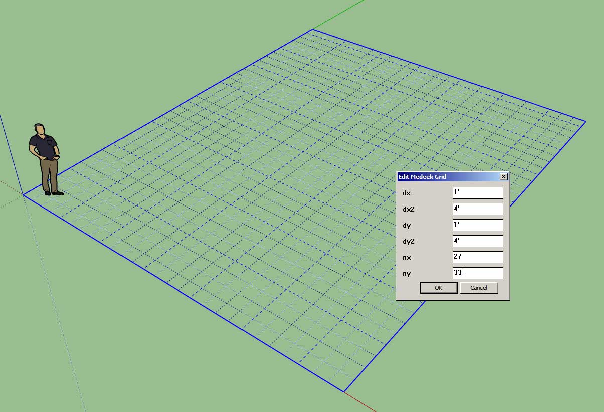
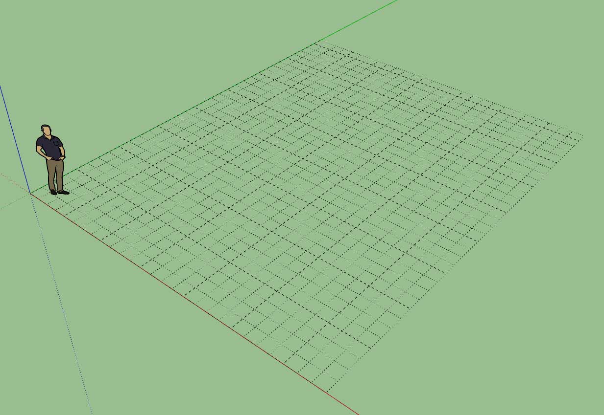
- Enabled a parametric grid tool with major and minor grid lines.


I'm a huge fan of the free Grid Tool provided by SketchUp in the Extension Warehouse. However my only one complaint is that with a grid like this it is hard to visually tell how many units over you are when trying to measure out a house or any other structure. After giving it some thought, I concluded that major grid lines would go a long way in alleviating this one deficiency.
I also thought it would be nice to include a grid tool in the plugin since it would eliminate the user from having to go out and install yet another plugin (ie. the SU Grid Tool) from the warehouse.
I've created an updated version of this classic plugin by adding in major grid lines (that default to 4 feet and minor grid lines that default to 1 foot). Currently these settings are hard coded into the tool however one can easily edit a grid once created and modify both minor and major grid line parameters in both the x and y directions. I will eventually add a global settings tab for this tool so one can set the global defaults.
-
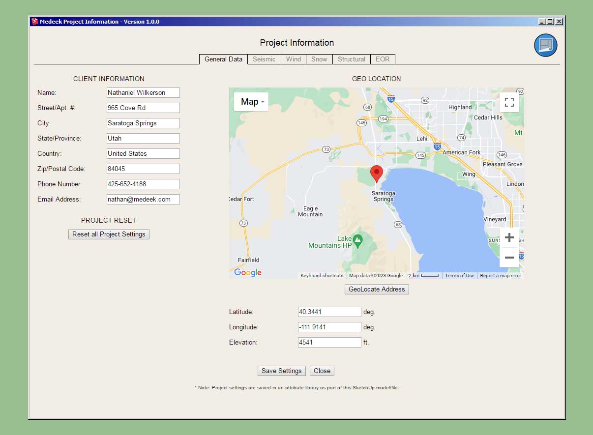
First look at the project info tool:

I still have some major changes for the General tab. First and foremost I want to try in incorporate an interactive Google Maps window with a button to auto-geo locate based on the address that is input by the user. Then also have the ability to zoom the map as necessary and refine the geo-location on the map. Using the Google maps API I should be able to get the lat, long and elevation (which will be important for the determination of other site criteria).
I've already done a good bit of programming using the Google API's on my website (running on my server) but this is something a bit new so I'm still uncertain if it will work within SketchUp. This should prove to be interesting.
-
Version 1.0.2 - 01.16.2023
- Added the General Data tab to the Project Information tool.
- Enabled a dynamic map (with geolocation) within the General Data tab of the Project Information tool.

This new feature is quite experimental so I am hoping for some feedback on it.
-
Version 1.0.2b - 01.16.2023
- Fixed a bug with the Grid Tool and the Project Info Tool.
!ATTENTION!
This is a critical bug fix for the Grid Tool and the Project Info tool. Please download and replace the previous version of the plugin. -
Version 1.0.2c - 01.17.2023
- Fixed a namespace bug with the Grid Tool.
-
Version 1.0.2d - 01.19.2023
- Optimized the Google Map API portion of the Project Info tool.
- Choice of map type made persistent across different sessions.
Tutorial 1: Introduction (20.01 min.)
-
First look at the EOR tab:

-
First look at the AOR tab:

-
First look at the Title Block tool in action:


Note that these title blocks are being drawn in SketchUp not Layout so they may only have limited utility but I think they still may be useful for those wanting to quickly throw together something for presentation purpose.
The Customer, Architect/Designer and Engineers data is pulled as the default but all of this information can be customized completely.
I call this title block a "no frills" title block, just a functional element that is simply meant to convey the most basic information.
-
Version 1.0.3 - 01.26.2023
- Added the EOR tab to the Project Information tool.
- Added the AOR tab to the Project Information tool.
- Added the Title Block Tool to the main toolbar.
- Added a parametric Title Block tool.
Let me know what you all think of this feature. Again I don't believe this should replace a proper Title Block in Layout but it will offer a quick and dirty solution in SketchUp for those who don't need or want to go into Layout.
I should probably also put out a short tutorial video on this feature and now it integrates with the Project Information data.
Advertisement


