Yes, thanks, I saw that. As I said above. I will have to re-download it and make sure I get the 2022 Pro this time.
Posts
-
RE: [Plugin] FredoTools::ColorByAltitude - v1.2a - 10 Jul 21
-
RE: [Plugin][$] TopoShaper - v2.7b - 30 Jan 26
Merci, Fredo.
 Well, TopoShaper is amazing! Yes, my file has lots of edges but your Extension can handle it in the groups I have created. So that is not a problem.
I am looking for other ways to open the dmg file (I don't have autocad) and try to reduce the edges. I even installed GRASS GIS in my Mac and it reduces the edges by 63% but it is not keeping the 3D. I am trying to find ways to fix that.
I really want to understand more how your extension works
 It would help me immensely, if you could answer my questions, please:
-
How does the Maximum Edge Angle for Follow Mode work?
-
Because I am sectioning the whole terrain in chunks, should I Stop Prolongation at Edge Crossings? Or should I keep the Prolongation?
-
If left untouched will TopoShaper keep the altitude for each point that was in the original DWG?
-
Is there a way to edit out the extrapolation that takes place between a single contour and the hull border?
-
Will a Grid of 200 X give me a MORE precise Terrain than a grid with 100 X ?
6.Is there a way to pan and or orbit the view? Every time I try to use the Orbit or Pan tools I am taken OUT of TopoShaper
I hope you don't mind my questions. I love your extension, and I would like to use it properly

Have an excellent weekend!
Helena
-
-
RE: [Plugin] FredoTools::ColorByAltitude - v1.2a - 10 Jul 21
Thanks! I thought I had downloaded the Pro! I am on the trial and going to buy the Pro. Maybe while in the Trial it downloads the Make? Anyhow, thanks. I will purchase the version Pro next week.

-
RE: [Plugin] FredoTools::ColorByAltitude - v1.2a - 10 Jul 21
Hi Fredo,
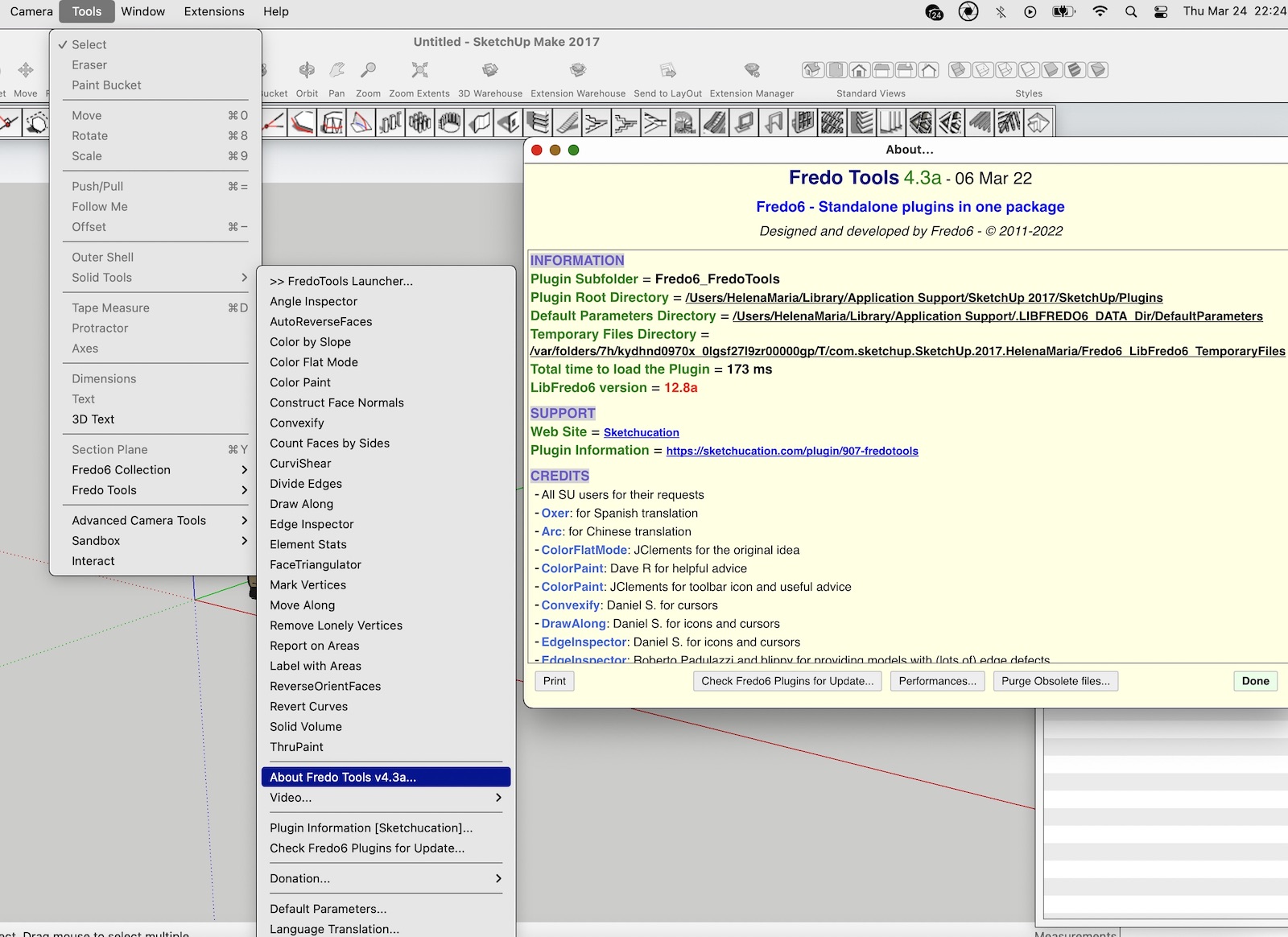
I went to Tools> FredoTools> About FredoTools 4.3 and it opens a window that says: "Fredo Tools 4.3a - 06 Mar 22"
See attached screenshot please.

Thanks!

-
RE: [Plugin] FredoTools::ColorByAltitude - v1.2a - 10 Jul 21
Hi Fredo!

Of course, here is the Screenshot.
Merci beaucoup!
Helena

-
RE: [Plugin][$] TopoShaper - v2.7b - 30 Jan 26
Bon Jour Fredo and TopoShaper users

I am new. I only downloaded TopoShaper yesterday. I found it while looking for solutions for a DMG file with LiDAR contour lines for our 20 acre land. The DMG once opened in SketchUp shows almost 2 million edges


At first when I tried working with it on Sketchup, either exploding it, or once in Edit Component trying to use the SketchUp From Contours tool. Sketchup crashed. I learned that if I isolated/selected small areas of a maximum 10,000 edges then I could work with the Sketchup tools, but that would take me too long.
So, looking for solutions, I found this great tool! That said, I have a couple of questions, I hope you can help me with.

First, TopoShaper seems to have successfully exploded the DMG. It took a long time but it didn't crash!
QUESTIONS:
Since what I need is a terrain as precise as possible (hence the LiDAR) , I want to preserve all the detail provided by the contours. Do you have any suggestions for the settings I should use to get these results?
In the SELECTION Stage:
Using Iso-Contours, I tried to "select", all the Contour lines in my Original but that crashed the program. So I am generating the terrain in "sections/groups" that I created from my original, far larger than what I could do with the native sketchup tools.- How does the Maximum Edge Angle for Follow Mode work?
- because I am sectioning the whole terrain in chunks, should I Stop Prolongation at Edge Crossings? Or should I keep the Prolongation?
[pre:2p2bp0ts][/pre:2p2bp0ts]At present,
In the CLEANSING stage:- I am not excluding contours
- I am accepting all simplification of the contours. The PDF says that TopoShaper uses an 8 degree angle automatically. Is this the same angle referred to in the SELECTION Stage - Maximum Edge Angle for Follow Mode in degree?
- I am not accepting the junctions, (My file does not have labels, so the few proposed junctions are on the perimeter of each section I am converting.
- I am not using Edit Altitude. If left untouched will TopoShaper keep the altitude for each point that was in the original DWG?
For the CALCULATING OF CONTOURS stage:
- Is there a way to edit out the extrapolation that takes place between a single contour and the hull border? Since I am doing this in sections, this creates flat surfaces in between SOME sections, not always. (I always choose the hilltop option FYI)
- I am using a grid of 100 for the X value and let TopoShaper calculate the Y. Will this give me enough "precision" or should I increase the value to 200?
In the GENERATION screen, There is a section for Altitude Labels. I have tried, the ALL option, and also the Filtering, but they never show. What should I do?
Once TopoShaper is active, **is there a way to pan and or orbit the view?**Every time I try, I am taken out of TopoShaper, so I cannot see, if the result is what I want before I generate it.
I know these are a lot of questions. Apologies. But I really need to understand how to use this great tool to produce the results I need.
Thanks for your time, energy and ingenious mind!

Helena
-
RE: [Plugin] FredoTools::ColorByAltitude - v1.2a - 10 Jul 21
Bon Jour Fredo!

I found today your extensions. Thank you so much for creating all these wonderful tools!
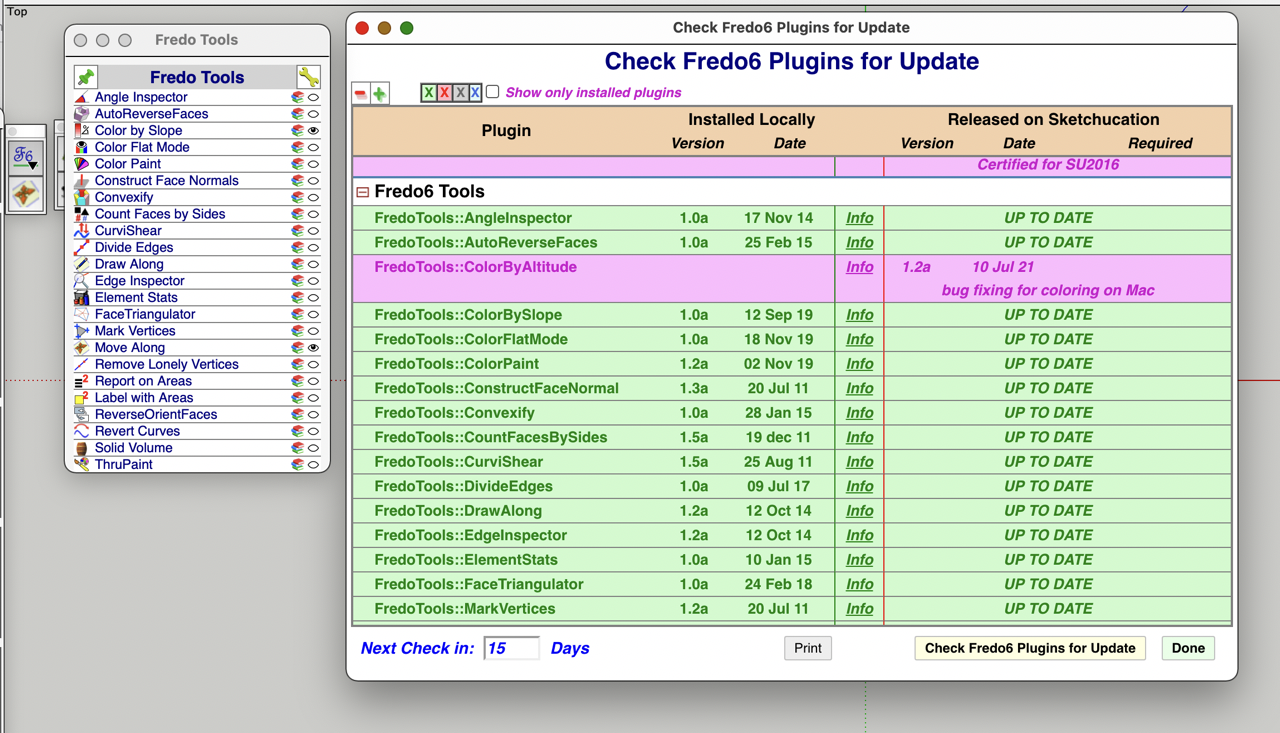
I use a Macbook Pro 2021 M1 not intel and installed today: LibFredo6 12.8a, TopoShaper 2.6a and FredoTools 4.3a
Sadly ColorByAltitude is NOT showing in my toolbar and it shows in in pink in the "Check Fredo6 Plugins for Update".
This is the reason I downloaded the FredoTools
 I need to color by altitude a 20 acre land.
Please help!
Thanks for all you do! (I will post a message under TopoShaper for I have a couple of questions I hope you can help me with too)
Have a happy one!
Helena