Am I looking for this? 
I'm so confused

...


Am I looking for this?
I'm so confused
...
@chris fullmer said:
Google Earth terrains are brough in and lcoked to show that it is important that you do not modify them.
One way to push that part down 3m, would be to lift your entire building 3 feet, and then add a slope around the outside that goes down to nicely meet with the existing G.E. terrain. Even put on the G.E. image so it looks like it fits in nicely with the terrain. That might help,
Chris
Good Idea! But I'm no sure how to do that  I'm trying right now...
@unknownuser said:
Unfortunately you'll have to make your model fit to GE terrain rather than editting the terrain. Google want models which do not float so extending your model footprint downwards is the best option. Also from your pictures it's clear your model is extensively detailed. Not a bad thing but as it's for GE the optimization needed you may have to make changes.
!!! N O T A C H A N C E !!!
So why I can modify the terrain when there will be no effect in GE ........ WHY??? Now I have to draw the terrain do crazy stuff and ...... DAMN! 
I'm creating this project for a whole month... why...? To press Shift Delete ???  Stupid shit. Why not, just push the ground down and thats it.............. It's freaking me out!
I'm getting nervous! I was so excited 'cause this is my firs model and it's pretty good.
Something smells bad, toooooooo bad
Here is the problem. I want this place of the terrain to push down 3 meters 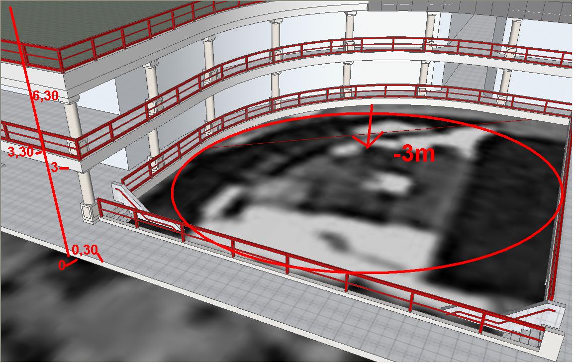 so when i upload to "Google earth" to look like this
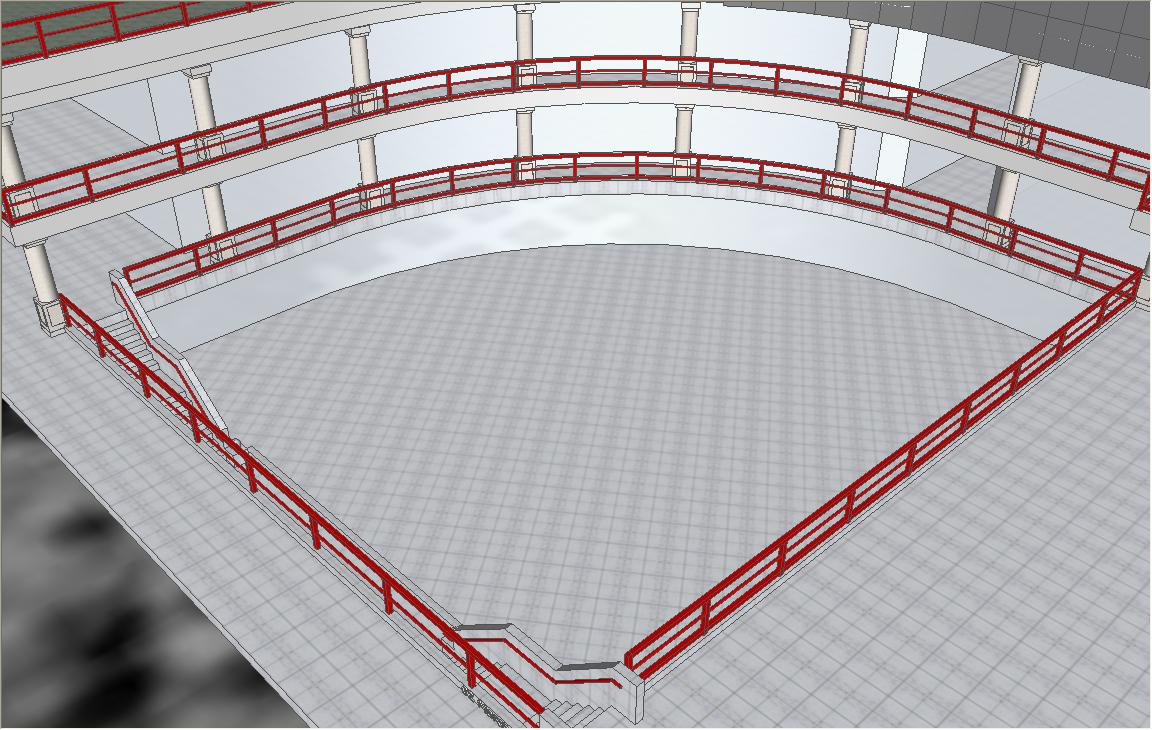
Is this possible 
Please answer! 
I have two layers "Google Earth Snapshot" and "Google Earth Terrain", now, I want to use "Google Earth Snapshot" because it's flat, so when I'm going to upload it witch one of this two layers will be used by "Google Earth" "Google Earth Snapshot" or "Google Earth Terrain". And I was wondering if I can delete "Google Earth Terrain" layer and it's contens so I'll be 100% sure that "Google Earth Snapshot" will be used. I've been creating this thing for a whole month and I'm serious so I don't want to mess up my model
Onse again: Witch one of this two layers will be used I want the first one "Google Earth Snapshot" this one is flat right?
Pleace answer me, only if you are 100% sure
@xrok1 said:
right click on your group and choose explode.
 Just... that... That's it!?!?! I did it !!! Thanks man!
  Thaaanks! You hear that
It's simple but when you don't know where it is...
Well done 
Hi everyone!
I did stupid mistake now i want to fix it. 
I grouped part of my model and then I've added in to a layer that OK, but then I changed my mind and from the same group I've create another layer, now...  first layer I can show/hide by checking/unchecking in the layer window, the second layer i can't show/hide until i check the first layer that's because this two layers are in the same group so.... i want to ungroup this part (or whateve it is) and create separate group for this two layers. I.... found something about this problem here
  http://sketchup.google.com/support/bin/answer.py?hl=en&answer=95642 but I can't see that "Ungroup" menu item???
So.... can someone help me pleeease
erm... Sorry for my English. (If there is some grammar mistakes )
@numbthumb said:
( dobro dosao )
Thanks numbthumb! ( FALAAAAAAA numbthumb! Ha ha ha ha nashi sme? Jas sum od Makedonija )

