Thanks Gaieus, I made myself a member of the group. 
Oops, your profile's looking a bit empty! To help us tailor your experience, please fill in key details like your SketchUp version, skill level, operating system, and more. Update and save your info on your profile page today!
Check out Febhouse | New extensions for Shadow Analysis in SketchUp Download
N
Offline
Latest posts made by nantax
-
RE: How do I manually model solids from Domebook 2?
-
RE: How do I manually model solids from Domebook 2?
I think I got it. I just made a circle that is centered and parallel to the side of the pentagon inside the group and where they meet, its the snap point for rotating the faces outside the central pentagon.
-
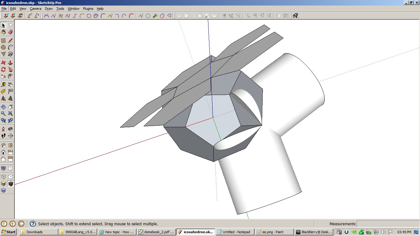
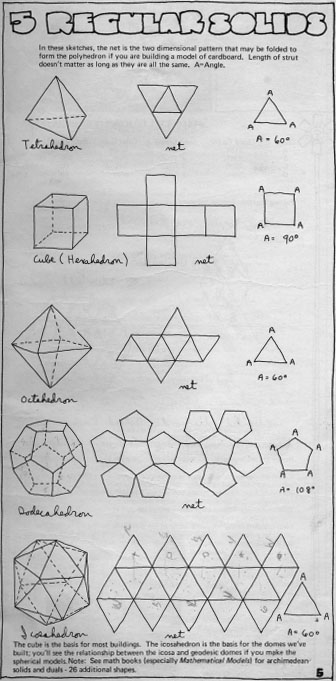
How do I manually model solids from Domebook 2?
I am tasked to do an igloo type structure and ended up downloading all of TaffGoch's models from the 3dwarehouse including the Domebook 2 pdf. I am following the book, but I am now stumped in page 5, where there are 5 solids and I don't know how to model them manually, like laying the shapes flat then folding them into place.
Can somebody teach me how to rotate the shapes into place so that the vertex will line up properly?
-
RE: Need a way to create contours from gps data
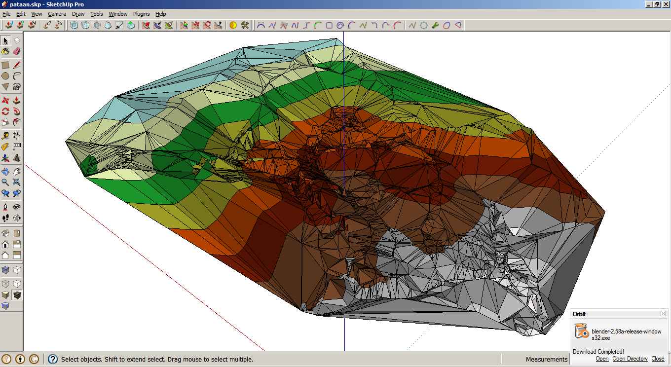
Call it dumb luck, but I came across this post:
http://groups.google.com/group/Sketchup-Pro/browse_thread/thread/ca7d0ba921af4611Then I tried opening ArcScene, selected the tin surface, then added the face elevation with graduated color ramp from the symbology properties, and exported it in 3d vrml (.wrl). I then imported it in Blender 3d and exported it as collada (.dae). I don't know much about Blender 3d and I can't figure out how to display the imported data but just the same, I when I imported it to SketchUp, the surface was there together with the colors.

Not as clean as the surveyor's version, but it is almost there.
-
RE: Need a way to create contours from gps data
Tig, you are simply amazing!
Ruby scripting is way beyond me right now, but I really appreciate the effort you have exerted on this project. There is a big gap from the gathering data from the GPS unit to importing it to SketchUp but you showed us a way. I will try to redo it and learn as much as possible from it.
I also appreciate your mentioning of the workflow on how you approached it.
Thank you very much!
-
RE: Need a way to create contours from gps data
Thanks Tig, I already downloaded lots of your plugins and I am excited with the actual laying out of roads and putting the proposed huts/cottages than the actual generation of the surface in which I have no idea on how to proceed...
Basically I think that i have to extract the data from the kml for the lot boundary, then I have to extract and plot out the gps points + elevation as point cloud and then map out the surface. I will try to do them next week since it is already late here and I am suffering from GIS burnout. It is tough to do something when you have zero knowledge about it.

Thank you all for the reply.
-
RE: Need a way to create contours from gps data

This is going to be developed into a resort in the future. No actual schedule for it, more like being cooked in the backburner in low fire.
-
RE: Need a way to create contours from gps data
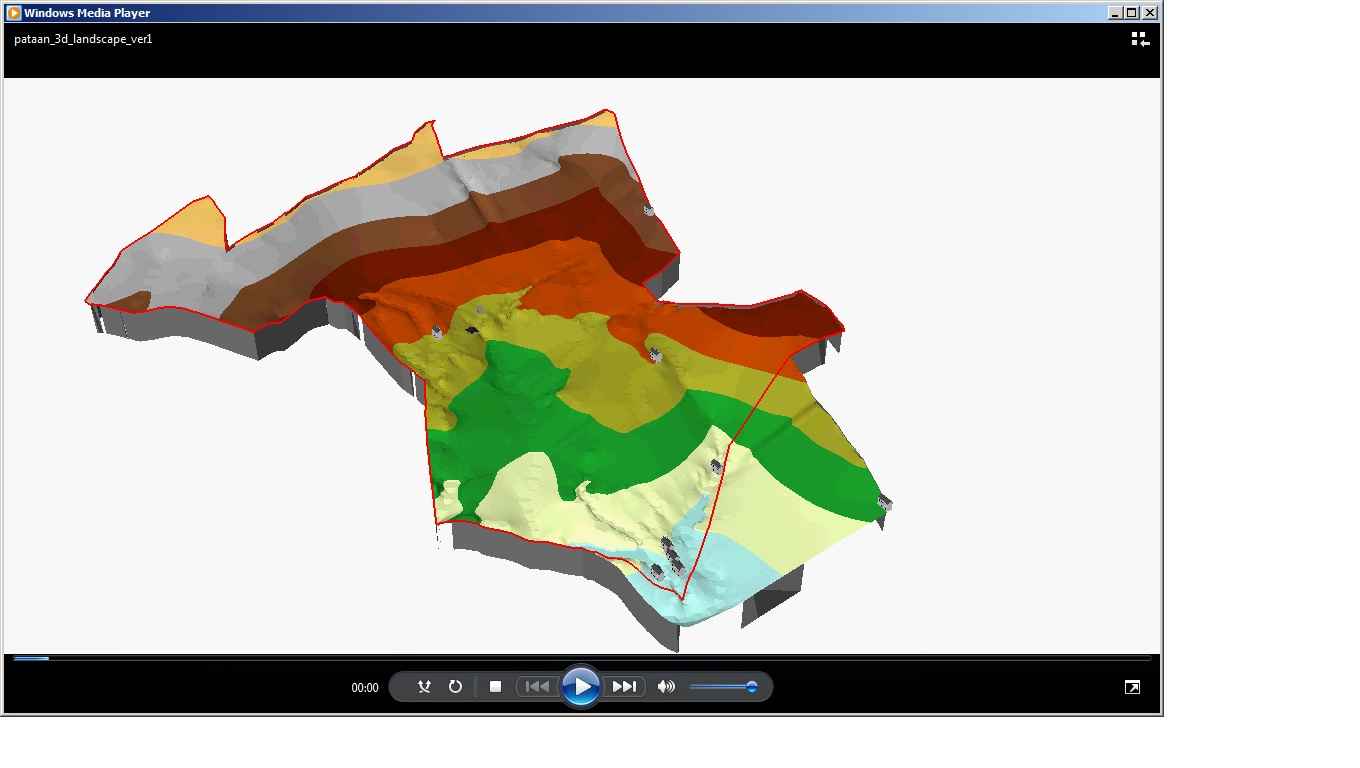
This is a screen shot of the avi movie that they have included in the cd:
-
RE: Need a way to create contours from gps data
Thank you for the tip Gaieus & bjornkn.
I have no part with the agreement of the owner and the surveyor. I was plugged in the middle of the survey schedule to "watch and learn". And they are expecting a bit much from half a day of watching the guy walk around the parcel of land with his gps device.

Anyway I spent the day tinkering with ArcGIS 9 and was able to create a surface that is quite far from the surface that they have included in the cd. I will just poke around with this and hopefully if I can't get anywhere, they will send me to the firm for training.

I tried the kml plugin but it just outputs nothing to import. I might be doing something wrong and maybe it is because of this line: "SketchUp's current capabilities of KMZ do not go beyond Collada models", and I have no idea what that means either.
-
RE: Need a way to create contours from gps data
It seems that the board will only allow one attachment. I'm zipping the other files from the first post.