Some times when I modify some lines then it will appear like that(see the picture in attachment). Is there any convenient way to let the line extend to connect with the other one? Thanks!
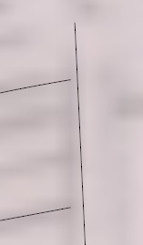
Some times when I modify some lines then it will appear like that(see the picture in attachment). Is there any convenient way to let the line extend to connect with the other one? Thanks!
I have found a plugin"simplify contour" which could solve this problem. But one tricky thing about this plugin is that you should import free floating contours, which means the contours has no connection and no plane. Otherwise when you work this plugin, it will remove some of your contours.
Still learning.........
HI,
I drew contour in CAD with pline. Then I imported it into sketchup in order to produce a terrain model with sandbox tool. But I found the contour is a series of sections of line and I could not elevate the contour to specific height.
Anyone knows how to solve the problem?
Thank you~
Hi,
Why sometimes we need to import the image from google earth into sketchup? Is that used for its terrain? But I suppose if we want to draw a terrain analysis image, it seems the most convenient way is to draw the contour from a CAD file and produce a terrain in sketchup.
So what the purpose to get image from google earch into sketchup?
Thank you~