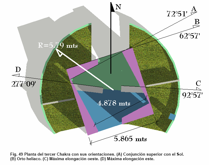
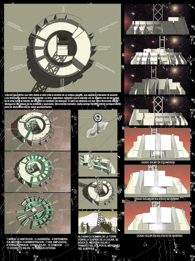
Hi Chris and thank you for your reply and letting me know that it can be done. I’m sorry if in my first mail was not clear enough. You are very right on thinking how to match the data to be used with the model. Thinking on the answer, I concluded that using the Azimuth-Altitude coordinate system is better than the one I mentioned in my first mail because now there are things that are common to both SU space and star data, which can be the start of the Plug-in:
A NORTH: The Azimuth-Altitude coordinate system used to locate a star needs a geographical north (http://en.wikipedia.org/wiki/File:Azimuth_(PSF_2.svg) related to the point of observation, and the SketchUp space has this north that can be indicated in the Location section of the Model Info window. As you can see in the image of the wiki link, the Azimuth is an angular measure and starts at the north and rotates towards east. So at the north the Azimuth is 0° and at the east is 90°.
A HORIZONTAL PLANE: To have the Altitude part of a star coordinate (which is another angular measure and is also known as elevation above the horizon or elevation angle), a horizontal plane is needed, which is the one that it is located in the 0,0,0 of the X,Y,Z space coordinate system of SketchUp.
A GEOGRAPHIC LOCATION: A geographic location is needed to calculate the Azimuth and Altitude of a star to be observed in that particular location, and the SketchUp space has a geographic location that can be indicated in the Location section of the Model Info window.
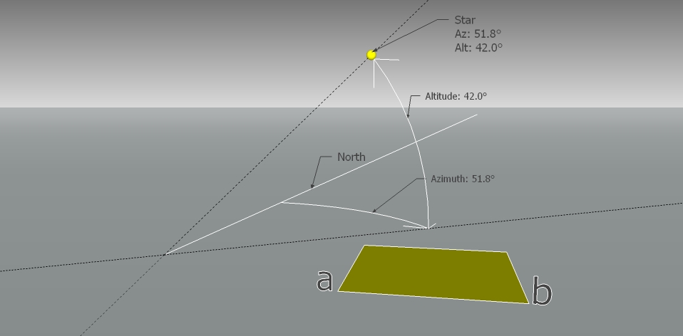
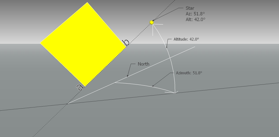
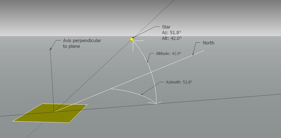
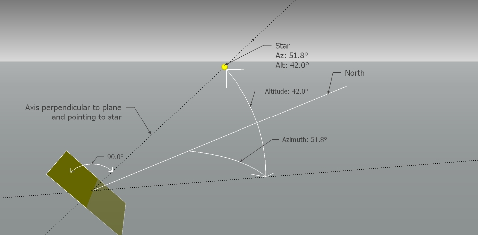
With this things in common, I will try to be clearer with what I wish to have as a Plug-in with the following example, using the type of coordinates mentioned above. Let’s say I want the edge “a-b” of a plane to point to a star with an Azimuth and Altitude coordinates of 51.8° and 42.0° respectively (Fig. 1). The final result is showed in Fig. 2. Besides an edge, a plane (fig. 3) can also face a star (fig. 4). In this last case, if the star where to be the sun, it would be something like the “Always Face Camera” command but instead of looking at the camera, it would face the sun. SketchUp internally calculates the coordinates of the sun according to a geographic location, so I think is a matter of simple programming to make a plane to face it.
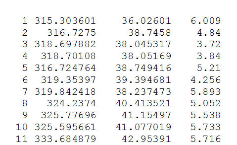
About what you ask about generation of the coordinates, there is a lot of free and open source software that calculate them, and it would be great if the results of the calculations that these programs can be showed inside of sketchup. Unfortunately, I’m not a programmer and don’t know if this can be done, but I can give you a list of the software that is freely available. For ease of use, it is preferred this way that to run them separately and input the coordinates by hand to a possible SU plug-in. Normally, this programs outputs in tabulated form the name and coordinates of the stars, so it would be great if this table can be looked inside of sketchup, click a particular star of the table, assign it's coordinates to an edge or plane, and see how they automatically align or face the star. Let me know if this explanation is of any help. Regards.
@chris fullmer said:
Yes, it can definnitely be done. It just might be a lot of work. And I'm still trying to comprehend what you need exactly. I think you had mentioned earlier that you wanted to rotate buildings to point at a certain celestial body. That's fine, if the angles can be determined from your data (which I know it can). So what star do things align to? Is it possible to generate the coordinates automatically or read them from somewhere? Or does it have to be entered by hand?
I think what my brain is unseure of is how does the data you have match up with the model? if you have a series of coordinates, how would you tell the model what pieces align to what coordinates? Any thoughts on how that would be achieved?
Chris
Sketchup Model
 , but glad to help if possible.


