@mike amos said:
Extremely nice illustrations, earned your money and then some.
Thanks. Early on I think I made wages at best... 
@mike amos said:
Extremely nice illustrations, earned your money and then some.
Thanks. Early on I think I made wages at best... 
@sketch007 said:
I watched you Timber Framing at basecamp video. You used two plugins that look really helpful. The color coded one and the "white out." Are these not available to the public? They were only given out to people attending base camp? Are they available for purchase anywhere?
m@
Thanks.
TIG wrote WhiteOut for me.
SDMitch wrote the Color by Face plugin.
Both are members here - I'm sure they would share if asked!
You can change the line thickness that LO uses to render the window, and you may see exults change if you render in vector or raster. This also can be affected by the style Edge settings in SU.
When I first started doing shop drawings in LO I did a few sheets of typical joinery and changed rendering type, line weights, etc. and built a template with what I liked.
Have you tried starting a new file and dropping in the correctly sized components from a collection or copy / paste?
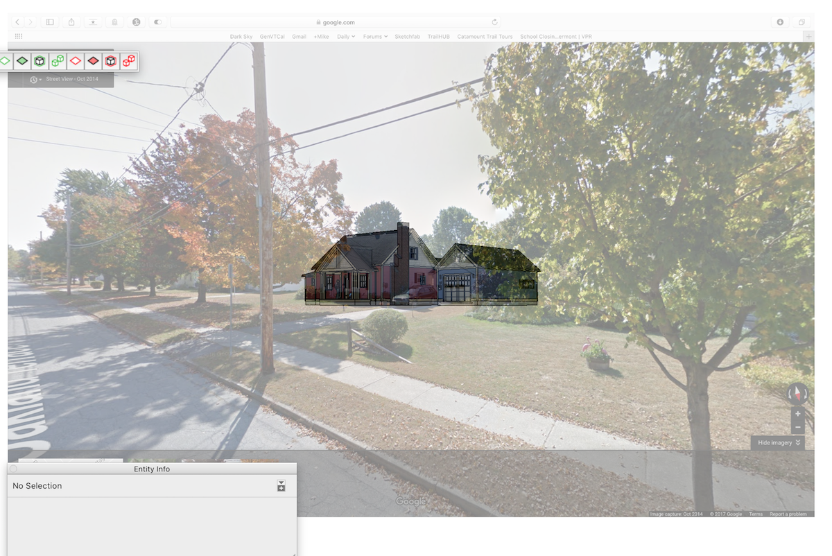
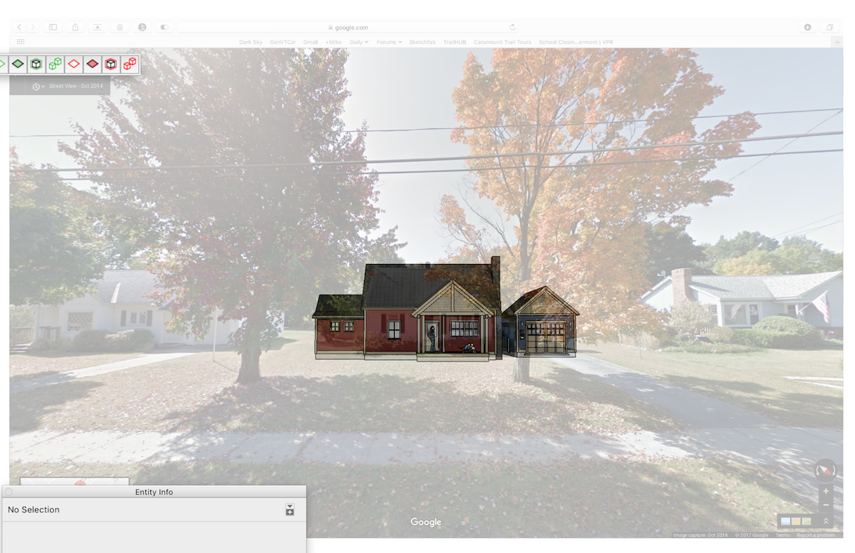
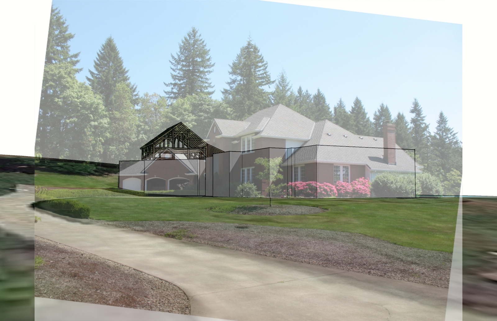
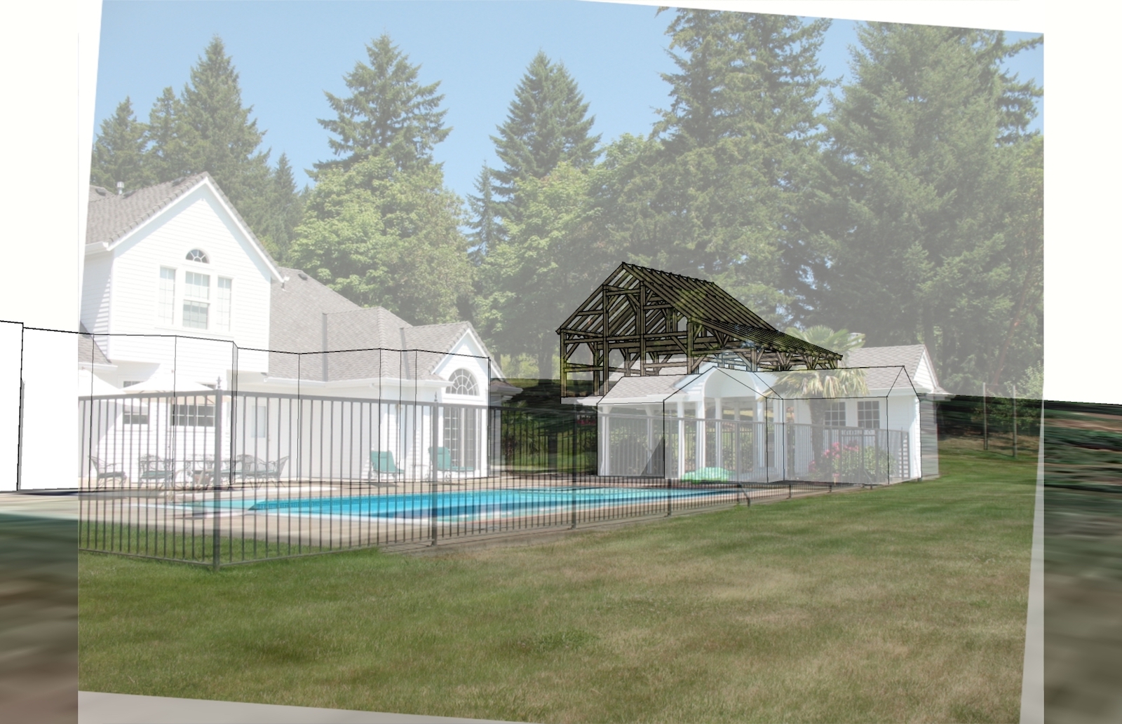
Consider bringing the image in as a watermark / style... here are 2 samples, both with terrain / land images turned on. 1 is using Streetview that I screen captured, the other a photo from someone who stood on the site. After placing the image as a watermark, use the camera tools to adjust the model to match - orbit, zoom, adjust field of view, etc.
Streetview + terrain / image:
 \
\
Combining site photos with terrain and terrain image:
@dave r said:
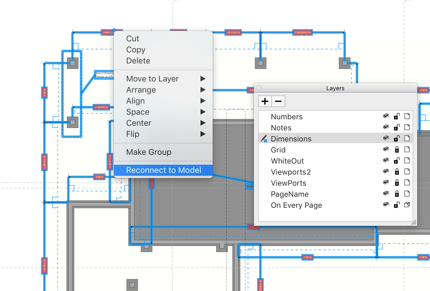
You can select all the dimensions and right click on one to reconnect them en masse if you want.
Better still, for larger projects and a smooth workflow - have a 'Dimensions' Layer, Right click on the layer name, select everything in that layer,
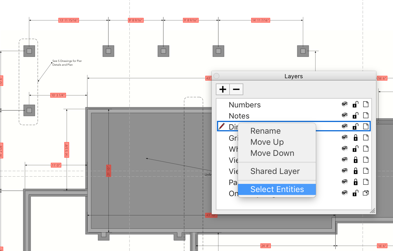
then right click on one of the dimensions...
@utiler said:
Hi fellas, are any of you experiencing this with LO2017?
I noticed it first when updating from 2016 to the latest version when opening an old file. clicking on the dimension text doesn't show text as having a fill or profile at all....
Right click on them to reconnect them to model.
In 2017 dimensions and leaders can be 'connected to model'
They turn red if you open a drawing from an older version, or if the model (component, group, etc.) changes.
@pbacot said:
What's really good for quick studies is the geo located aerial imagery. That way one can quickly locate new work relative to existing features, good enough for initial planning and presentation. The actual "terrain" model (that I've seen) is only so useful at the site scale. Topo maps might be better, lacking a survey.
Agreed that the usefulness of the imported 3d data isn't always as useful, but its usually close enough for early stage work, until a survey is done or can be found / imported / created.