High quality satellite images needed
-
Hey guys
I am desperate for very high resolution/quality satellite maps, I use Placemaker and I also use Nearmap but the resolution is not that great, I have tried using AI to upscale but that too does not really solve my issues.
Is there another solution?
I have considered flying out to the location and doing 4k drone images but that cost is just beyond the project as there are 9 different locations over 3 states
-
Does the local GIS service offer hi res aerial imagery? Our county's GIS has offers fairly hi res images on their website. I expect it's possible to purchase even higher res images from them.
-
I am not versed with this type of solution, is there a tutorial on this? I have once (a long time ago) tried very high-resolution images but struggled to map them to the then Google imagery and terrain I geolocated
-
Check and see if you can hire some in the area to get what you need.
Wedding photographers have drone services as side hustles this side of the pond.
Failing that there's https://earthexplorer.usgs.gov/ for height map data and satellite images
-
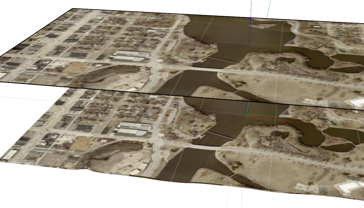
I expect there are tutorials out there although I don't know of any specific ones to point you to. I guess I would start with importing the aerial image as an image and adjust its size. Then create a texture and apply it to the terrain. I'll try to make an example for you.
-
I zoomed in as best I can
-
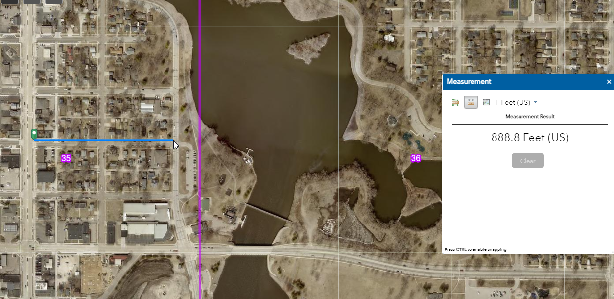
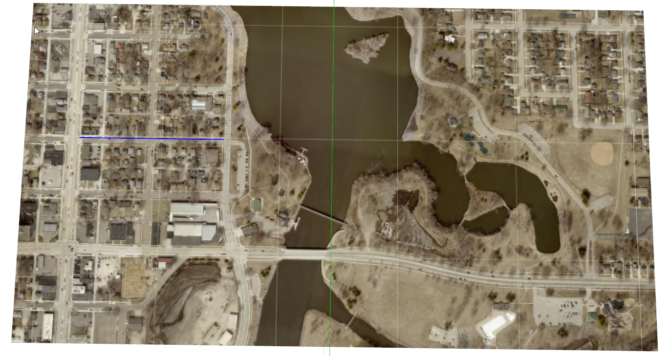
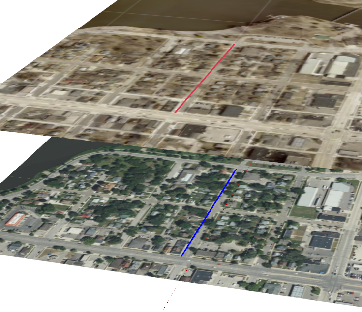
Hopefully this will make sense. For this example I'm just using a screenshot grabbed from the county's GIS site. As it turns out, the imagery from Add Location is higher res than the screenshot. On the other hand, the imagery from the website is only a few months old.
-
Do you have a link to the GIS site you got the image from?
-
Here you go. Unless your site is in the county I live in, though, it won't do you a lot of good.
You should be able to find the GIS site for the county where the site is with a simple Google search.
-
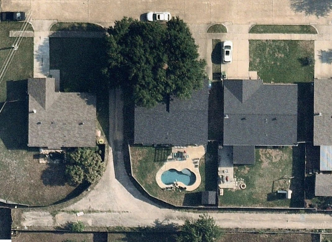
Example from the GIS site for a county closer to home.
-
Thanks, Dave
That looks promising, I'll try to look up the counties I need, hopefully I can then figure out the mapping, if only one could get images with terrain
-
Getting it all in one go would be nice but I expect difficult to find. The county might have topo data in .dxf or .dwg form that you could import into SketchUp. The county that supplied the imagery for that last image I posted has topo lines in one foot intervals. I'd expect you could get the CAD file for them and use that in SketchUp.
-
Dave
I am an absolute plonker, to the life if me I cannot figure this out, I cannot get a satellite view like yours above
Can you please show me how?
Here is one of the locations (there are 3 in total in the same county)
I just need to understand one to be able to carry onAttached is a kmz
Thanks in advance (only if you have the time)
[attachment=0:rpjcdryq]<!-- ia0 -->Sunset Parkway & Novato Boulevard, Novato, CA.kmz<!-- ia0 -->[/attachment:rpjcdryq]
-
Go to this website and navigate to the area where the site is.
https://www.marinmap.org/Html5Viewer/Index.html?viewer=smmdataviewerOn the upper left of the map click on the I Want To button. Then at the bottom of the left hand panel choose Layers. Turn off the layers for stuff you don't need and turn on the Aerial Photography layer. It should look something like this.
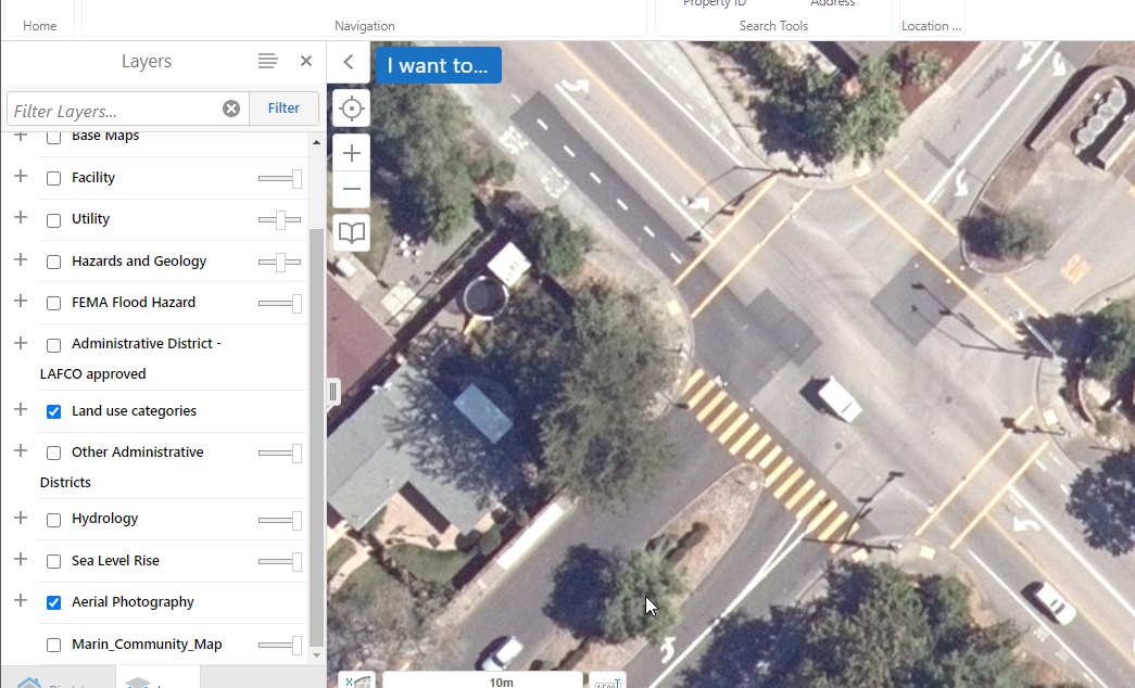
I expect the Marin County GIS office would gladly sell you higher res imagery if you want.
-
Thank you
I may need to get hold of them for higher resolutions as this is about the same as Nearmap (at least now I do not have to keep paying Nearmap for something I can get free)
-
You're welcome.
What version of SketchUp are you using? I looked at that same intersection with the Add Location feature in SketchUp 2023 and it was very similar to the image suplied by Marin County on their site.
-
2018

-
Ah.... So no imagery with Add Location?
If you're contacting Marin County for imagery you might ask about contour in some CAD format you can import.
Advertisement


