sketchucation logo sketchucation
    • Login
    Oops, your profile's looking a bit empty! To help us tailor your experience, please fill in key details like your SketchUp version, skill level, operating system, and more. Update and save your info on your profile page today!
    🫛 Lightbeans Update | Metallic and Roughness auto-applied in SketchUp 2025+ Download

    Large terrain photo help

    Scheduled Pinned Locked Moved SketchUp Discussions
    sketchup
    25 Posts 9 Posters 2.3k Views 9 Watching
    Loading More Posts
    • Oldest to Newest
    • Newest to Oldest
    • Most Votes
    Reply
    • Reply as topic
    Log in to reply
    This topic has been deleted. Only users with topic management privileges can see it.
    • soloS Offline
      solo
      last edited by

      You are right, I edited my post

      http://www.solos-art.com

      If you see a toilet in your dreams do not use it.

      1 Reply Last reply Reply Quote 0
      • soloS Offline
        solo
        last edited by

        Every image gets a watermak so the whole terrain gets coved in Google watermarks.

        http://www.solos-art.com

        If you see a toilet in your dreams do not use it.

        1 Reply Last reply Reply Quote 0
        • pilouP Offline
          pilou
          last edited by

          Some advices by DareDevil 😄 in French but...
          http://sketchucation.com/forums/viewtopic.php?f=51&t=41070&p=363944

          Frenchy Pilou
          Is beautiful that please without concept!
          My Little site :)

          1 Reply Last reply Reply Quote 0
          • AureusA Offline
            Aureus
            last edited by

            @solo said:

            Every image gets a watermak so the whole terrain gets coved in Google watermarks.

            Not only that but you also end up with a silly outline. If you need to crop it so that you get a normal rectangular outline you can try with exploding images and drawing a rectangle over their flat surfaces. Then you have to delete unwanted area. Or if you deal with 3-d images you need to employ intersecting method with an adequate cube.

            I'm afraid watermarks are unavoidable in any case. That's Google Earth's policy: on every image you download you get some stuff so that everybody knows it's from Google Earth.

            Obviously, this can be edited in some editing software outside Sketchup.

            1 Reply Last reply Reply Quote 0
            • daleD Offline
              dale
              last edited by

              There is some other satellite imagery out there, and depending on where you are sometimes it's better than Google Earth. Maybe give Flash Earth a try. http://www.flashearth.com/ I don't remember them watermarking either.

              Just monkeying around....like Monsanto

              1 Reply Last reply Reply Quote 0
              • Chris FullmerC Offline
                Chris Fullmer
                last edited by

                There are plenty of sites that offer non-watermarked imagery and topo. You just have to learn how to navigate their websites and specify what area you need - not always very easy to do! Its not terribly expensive, but you might need someone with GIS experience to help you put it into a 3d model?

                Lately you've been tan, suspicious for the winter.
                All my Plugins I've written

                1 Reply Last reply Reply Quote 0
                • mitcorbM Offline
                  mitcorb
                  last edited by

                  I input the location you gave into GE. It was interesting to note that a street address label appears a couple of hundred feet west of the apparent location, right at the edge of a grove. Did you see that, or do I need to adjust something? Also, the resolution of that area seems less than you may desire.
                  What about USGS data?

                  I take the slow, deliberate approach in my aimless wandering.

                  1 Reply Last reply Reply Quote 0
                  • soloS Offline
                    solo
                    last edited by

                    I have the terrain, I got the USGA info and used civil3D to generate the terrain as needed but do not have a good aerial photo to overlay, however I found Bing maps a better quality and will stitch a map from them....tsk,tsk Google! Bing has better maps.

                    http://www.solos-art.com

                    If you see a toilet in your dreams do not use it.

                    1 Reply Last reply Reply Quote 0
                    • mitcorbM Offline
                      mitcorb
                      last edited by

                      Yeah, but you can't measure anything- even for approximations- or I haven't found a way.

                      I take the slow, deliberate approach in my aimless wandering.

                      1 Reply Last reply Reply Quote 0
                      • wind-borneW Offline
                        wind-borne
                        last edited by

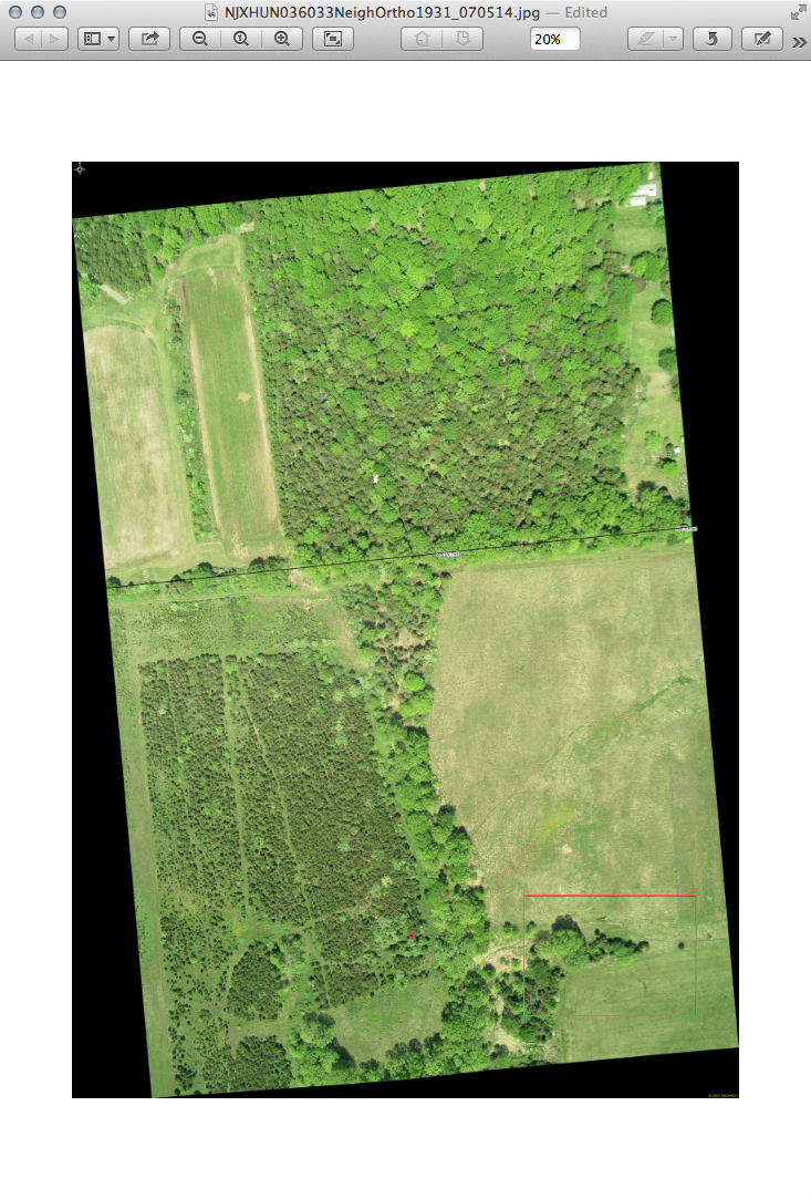
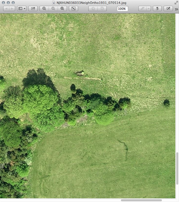
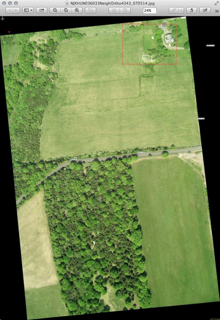
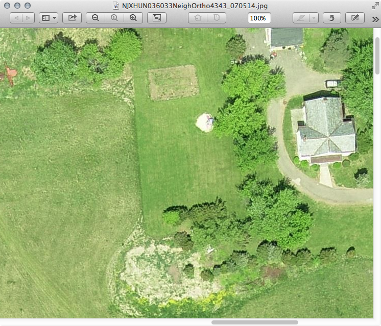
                        If you want to stitch together some ~4000x3000 images from 2007 pm me with email address and area you want and I'll send via a Transfer Big Files link.

                        jpeg's about 3-4 MB
                        png's about 15-20 MB
                        tiff's wanna be about 38MB but my connection times out before finishing

                        A couple reduced images
                        Those property lines are deletable and a dimensioned line can be added to images to resize in SU if needed.


                        Screen Shot 2013-03-08 at 4.13.27 PM.png


                        Screen Shot 2013-03-08 at 4.11.31 PM.png


                        Screen Shot 2013-03-08 at 4.22.32 PM.png


                        Screen Shot 2013-03-08 at 3.32.20 PM.png

                        "To read between the lines was easier than to follow the text."OSX 10.11.6

                        %(#BF80BF)[SU 8 pro

                        1 Reply Last reply Reply Quote 0
                        • GaieusG Offline
                          Gaieus
                          last edited by

                          @solo said:

                          ...tsk,tsk Google! Bing has better maps.

                          Not everywhere. In my place, Bing map really sucks while Google is bearably average.

                          Edit: it does not even suck that much. They must have updated it. 😄

                          Gai...

                          1 Reply Last reply Reply Quote 0
                          • 1
                          • 2
                          • 2 / 2
                          • First post
                            Last post
                          Buy SketchPlus
                          Buy SUbD
                          Buy WrapR
                          Buy eBook
                          Buy Modelur
                          Buy Vertex Tools
                          Buy SketchCuisine
                          Buy FormFonts

                          Advertisement