sketchucation logo sketchucation
    • Login
    ℹ️ Licensed Extensions | FredoBatch, ElevationProfile, FredoSketch, LayOps, MatSim and Pic2Shape will require license from Sept 1st More Info

    Google Earth into Sketchup?

    Scheduled Pinned Locked Moved Corner Bar
    23 Posts 9 Posters 1.2k Views 9 Watching
    Loading More Posts
    • Oldest to Newest
    • Newest to Oldest
    • Most Votes
    Reply
    • Reply as topic
    Log in to reply
    This topic has been deleted. Only users with topic management privileges can see it.
    • charly2008C Offline
      charly2008
      last edited by

      Hi,

      Please, can you help me with this problem i asked in the post below.

      http://forums.sketchucation.com/viewtopic.php?f=15&t=31427&p=276692#p276692

      Charly

      He who makes no mistakes, makes nothing

      1 Reply Last reply Reply Quote 0
      • olisheaO Offline
        olishea
        last edited by

        can i just ask why you still want to import into sketchup 7? you get a colour texture in sketchup 8....


        Picture 29.png

        oli

        1 Reply Last reply Reply Quote 0
        • Rich O BrienR Offline
          Rich O Brien Moderator
          last edited by

          You asking charly or the world?

          Download the free D'oh Book for SketchUp 📖

          1 Reply Last reply Reply Quote 0
          • soloS Offline
            solo
            last edited by

            Too bad that the image resolution is still pretty weak in version 8, I believe that bing 3d maps may be better. 😲

            http://www.solos-art.com

            If you see a toilet in your dreams do not use it.

            1 Reply Last reply Reply Quote 0
            • charly2008C Offline
              charly2008
              last edited by

              Hi Olishea,

              I have also ver.8 but mainly I still work with 7.1. And I can not stop if something is not working properly.

              Charly

              He who makes no mistakes, makes nothing

              1 Reply Last reply Reply Quote 0
              • D Offline
                d12dozr
                last edited by

                @solo said:

                Too bad that the image resolution is still pretty weak in version 8, I believe that bing 3d maps may be better. 😲

                Pete, is there a way to get Bing data into Sketchup?

                3D Printing with SketchUp Book
                http://goo.gl/f7ooYh

                1 Reply Last reply Reply Quote 0
                • olisheaO Offline
                  olishea
                  last edited by

                  same here charly, i'm still with 7.1 for most work. 😄

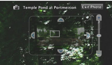
                  is there a way of saving the spherical image from google street views? i can see the preview in google earth (see screengrab) but i cant save the whole image.....any suggestions? (besides stitching)


                  Picture 32.png

                  oli

                  1 Reply Last reply Reply Quote 0
                  • GaieusG Offline
                    Gaieus
                    last edited by

                    @solo said:

                    Too bad that the image resolution is still pretty weak in version 8, I believe that bing 3d maps may be better. 😲

                    Some places, yes. My city's just a barely coloured blob in Bing. The new SU 8 import brings in the best available resolution both for the imagery and the terrain (when zoomed in properly).

                    Gai...

                    1 Reply Last reply Reply Quote 0
                    • charly2008C Offline
                      charly2008
                      last edited by

                      Csaba,

                      I agree with you. Also the terrain overlap in SKP 8 has been clearly improved. Yesterday I bought a 24 "widescreen monitor and I'm thrilled that I can now import huge pieces. It is a pity that the selection window, only in height but not can change in width.

                      Charly


                      Unbenannt.JPG


                      Unbenannt1.JPG

                      He who makes no mistakes, makes nothing

                      1 Reply Last reply Reply Quote 0
                      • GaieusG Offline
                        Gaieus
                        last edited by

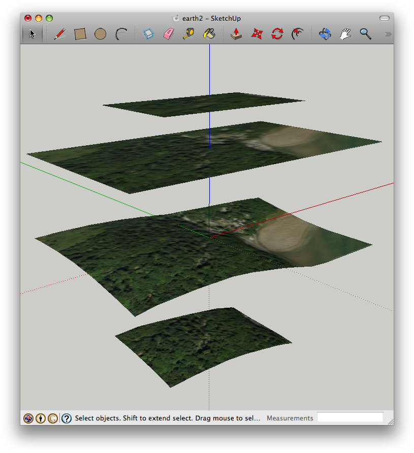
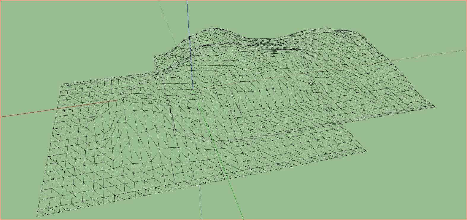
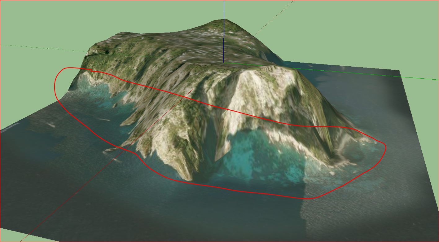
                        I would still like a safe and precise way to merge those terrains (hopefully not completely manually).

                        Gai...

                        1 Reply Last reply Reply Quote 0
                        • charly2008C Offline
                          charly2008
                          last edited by

                          I would like also. The other would be a better projection of the image. But I do not know if such a thing were possible. That would probably require a more accurate DTM.


                          Unbenannt.JPG

                          He who makes no mistakes, makes nothing

                          1 Reply Last reply Reply Quote 0
                          • GaieusG Offline
                            Gaieus
                            last edited by

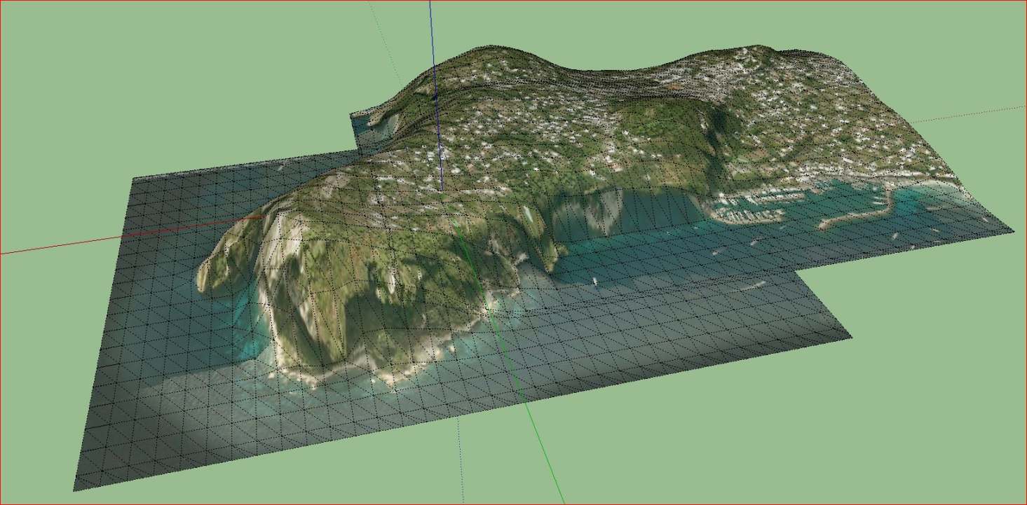
                            Hehe. That's a neat, slanting shoreline!

                            Gai...

                            1 Reply Last reply Reply Quote 0
                            • R Offline
                              Ross Macintosh
                              last edited by

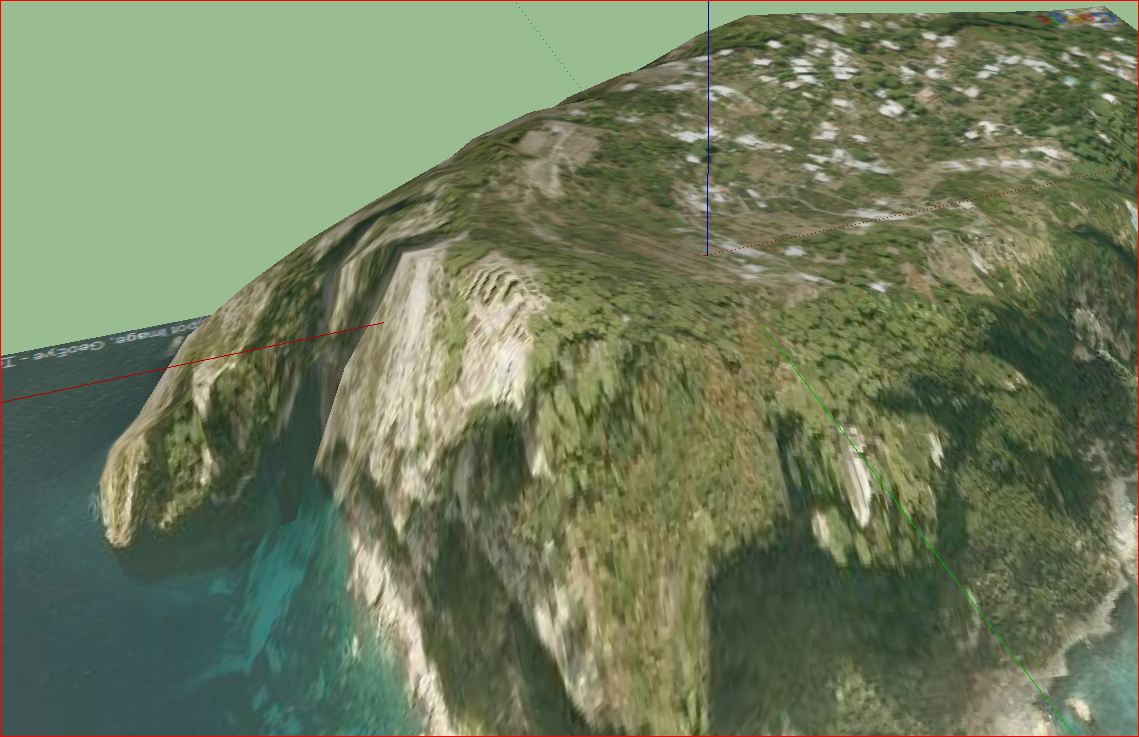
                              Charly, at the recent 3dBaseCamp, it was noted by the SketchUp developers that the resolution of the terrain will (if the data is available in Google's database) be imported at a higher resolution if your grab area is smaller. For instance, if you have a smaller building site on the island then grab it as well but making the grab only as big as you need. It can allow you to get higher resolution where you need it most by combining it with the big grabs.

                              They also noted that the terrain in SUv8 can actually be higher resolution than it appears in Google Earth. SketchUp now has access to the same source database that is used by Google Earth. The difference is Google Earth down-samples if the database file has excessive resolution whereas SketchUp can bring it in full resolution if the grab area is relatively small. Apparently there are some limited areas of the world in the database that have resolution the equivalent of 6" contour intervals!

                              Regards, Ross

                              1 Reply Last reply Reply Quote 0
                              • charly2008C Offline
                                charly2008
                                last edited by

                                Hi Ross,

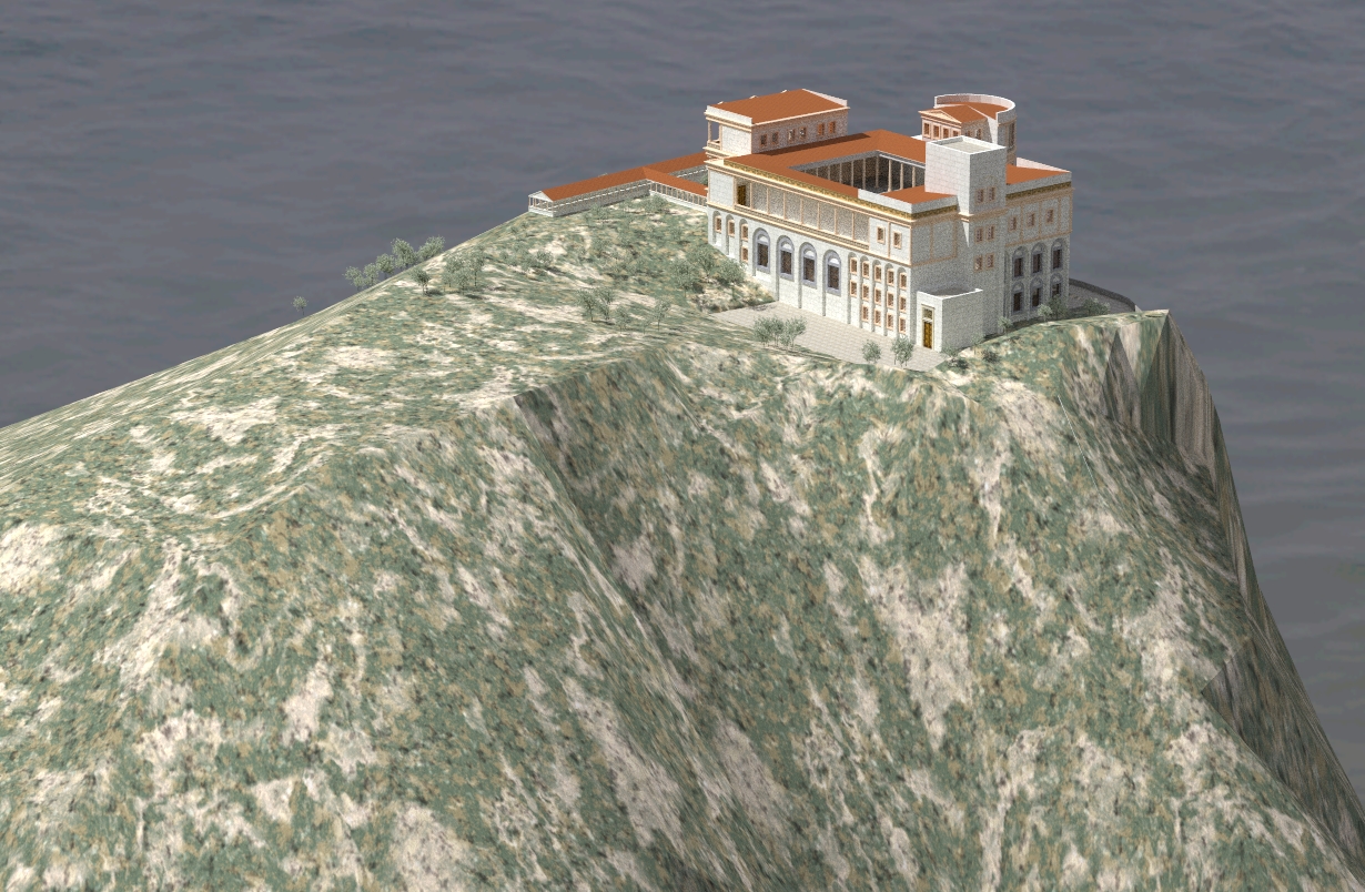
                                Thanks for the note. What I meant is that for example the floor plan of the Roman Villa Jovis and the water lines are not placed correctly.


                                Unbenannt.JPG


                                jovis3.jpg

                                He who makes no mistakes, makes nothing

                                1 Reply Last reply Reply Quote 0
                                • 1
                                • 2
                                • 1 / 2
                                • First post
                                  Last post
                                Buy SketchPlus
                                Buy SUbD
                                Buy WrapR
                                Buy eBook
                                Buy Modelur
                                Buy Vertex Tools
                                Buy SketchCuisine
                                Buy FormFonts

                                Advertisement