Finding usable DEMS in this day and age
-
I know this has been discussed before, I have been using Cadmapper to get my DEMS, it works OK but getting exactly what you want is difficult, without a satellite view to go by.
I just spent the past hour or so trying to find what I want on the USGS site nothing that will work with SU2017 make.
Ideas for other sources? -
What is it you actually need and in what area? How will the data get used?
-
https://cs.heightmap.skydark.pl/
I've used this in the past because you can download RAW file that's 32bit. Even the default PNG can give good results depending on how distant you are....
[mod=:29zjzejc]Fixed my awful spelling
 [/mod:29zjzejc]
 -
@dave r said:
What is it you actually need and in what area? How will the data get used?
Out place in the Nebraska panhandle, I am doing some virtual scenes of what I want to do.
-
@rich o brien said:
https://cs.heightmap.skydark.pl/
I've used this n the past because you can download RAW file that a 32bit. Even to default PNG can give good results depending on how distant you are....
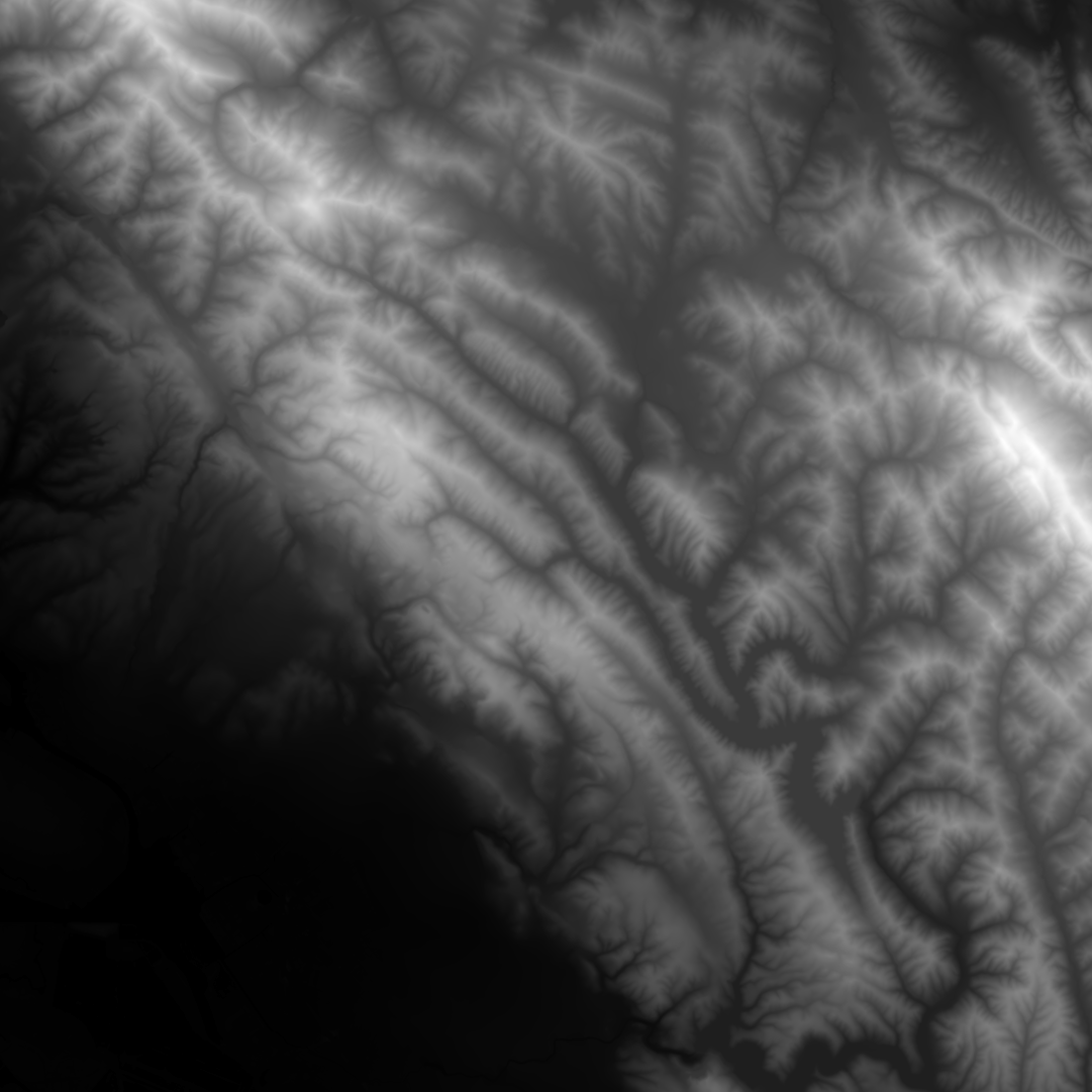
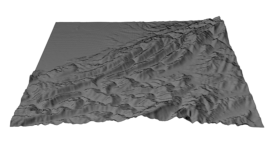
[attachment=1:2ja2j9wz]<!-- ia1 -->heightmap.png<!-- ia1 -->[/attachment:2ja2j9wz]
[attachment=0:2ja2j9wz]<!-- ia0 -->terrain.png<!-- ia0 -->[/attachment:2ja2j9wz]
I downloaded a png, there must be more to this?
-
The PNG has black to white values. Pure black is no height and pure white is highest point.
Displace a subdivided mesh using this PNG as the driver for the height. Your subdivided mesh should match the pixel density to the PNG to get accurate results.
Hello! It looks like you're interested in this conversation, but you don't have an account yet.
Getting fed up of having to scroll through the same posts each visit? When you register for an account, you'll always come back to exactly where you were before, and choose to be notified of new replies (either via email, or push notification). You'll also be able to save bookmarks and upvote posts to show your appreciation to other community members.
With your input, this post could be even better 💗
Register Login


Advertisement