[Plugin][$] TopoShaper - v2.7b - 30 Jan 26
-
Fredo, thank you so much for addressing my issue. That is truly some amazing support. Please include your preferred link and I will gladly donate for your efforts!
-
@slagothoric said:
...Please include your preferred link and I will gladly donate for your efforts!
Many authors provide a 'Donate' link-button [yellow] on their PluginStore entries listings... -
where ccan i download it?#
-
@edarchm2 said:
where ccan i download it?#
You can download the RBZ at https://sketchucation.com/pluginstore?pln=TopoShaper
Note that you need to install also the companion library LibFredo6.
Otherwise, the best is to install the Sketchucation ExtensionStore plugin and then auto-install TopoShaper and any of the 800 plugins in the store in one click.
Fredo
-
Hi Fredo,
*) How do I solve 'needle eye' obstacle (see attached)? Plugin get stuck at this stage forever.
*) Second very primitive mesh crashes on generating. Could you take a look at this example?
P.S. I always had scruples to ask, What is purpose of this 2nd 'zoomed' mesh in beige square?Thanks
-
@rv1974 said:
Hi Fredo,
*) How do I solve 'needle eye' obstacle (see attached)? Plugin get stuck at this stage forever.
*) Second very primitive mesh crashes on generating. Could you take a look at this example?
P.S. I always had scruples to ask, What is purpose of this 2nd 'zoomed' mesh in beige square?Thanks
Your models seems 'unprepared' for TopoShaper. I don't see contour lines, but instead lot of edges with intersections and different altitudes.
The blocking on Needle Eye is actually just a Ruby error due to the convoluted configuration of contours, but even if I fixed it, I don't see how you can generate a terrain from your input data.
Fredo
-
RTFM helped as usual, many thanks
-
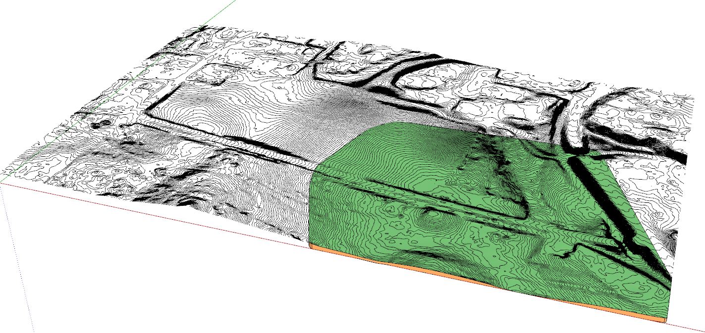
I was wondering if there is a limit to how detailed a ISO lines terrain can be to work with Toposhaper?
As you can see in the attached image only a part of the terrain is created. If I try with a less dense contour file of the same area it works but I need the detail as high as possible.
-
@pixero said:
I was wondering if there is a limit to how detailed a ISO lines terrain can be to work with Toposhaper?
As you can see in the attached image only a part of the terrain is created. If I try with a less dense contour file of the same area it works but I need the detail as high as possible.[attachment=0:2s5end60]<!-- ia0 -->screenshot.jpg<!-- ia0 -->[/attachment:2s5end60]
The typical usage of TopoShaper is to smooth out the terrain, using isocontours as guides for altitude. The precision of the contours is not necessary (i.e. does not need closely spaced contours, nor many points in the contour curves), and anyway in relation with the resolution of the mesh.
All this being said, I am impressed by the large model you have.
Fredo
-
Bonjour Fredo,
Après installation de la dernière version de Toposhaper (2.3b) et de LibFredo6 v8.1h, Toposhaper ne s'execute pas à l'ouverture de Sketchup, renvoyant un message d'erreur qui est le suivant : "you must install LibFredo6 to run Toposhaper
Open the download page of LibFredo6 at https....".Après vérification dans l'extension manager, LibFredo est pourtant bien installé. Une idée sur l'origine du bug ?
-
@clement duvoux said:
Bonjour Fredo,
Après installation de la dernière version de Toposhaper (2.3b) et de LibFredo6 v8.1h, Toposhaper ne s'execute pas à l'ouverture de Sketchup, renvoyant un message d'erreur qui est le suivant : "you must install LibFredo6 to run Toposhaper
Open the download page of LibFredo6 at https....".Après vérification dans l'extension manager, LibFredo est pourtant bien installé. Une idée sur l'origine du bug ?
Il faut verifier que LibFredo6 est bien chargé. Est ce qu'il y a un menu Window > LibFredo6 Settings.... ?
Fredo
-
@pixero said:
I was wondering if there is a limit to how detailed a ISO lines terrain can be to work with Toposhaper?
As you can see in the attached image only a part of the terrain is created. If I try with a less dense contour file of the same area it works but I need the detail as high as possible.[attachment=0:1bzib748]<!-- ia0 -->screenshot.jpg<!-- ia0 -->[/attachment:1bzib748]
Maybe you can make just smaller portions and join them in the end?
Gio
-
Hello,
Great plugin, however I am having an issue, after generating the terrain from guide points, using the toolbar, and clicking off elsewhere, the toolbar disappears and I can't seem to get it back to modify the terrain. How can I get the toolbar back after it has disappeared?
David. -
@dlannetts said:
Hello,
Great plugin, however I am having an issue, after generating the terrain from guide points, using the toolbar, and clicking off elsewhere, the toolbar disappears and I can't seem to get it back to modify the terrain. How can I get the toolbar back after it has disappeared?
David.Can you open the Ruby console, as there may be an error.
Did the terrain generate correctly by the way?
Fredo
-
I just try TopoShaper with a point cloud with more than 130.000 points out of a ASCII-File. How I can import it in SU and make any kind of terrain model?
Any ideas and suggestions are most welcome!!

Best Regards Simon
-
@simonhaufe said:
I just try TopoShaper with a point cloud with more than 130.000 points out of a ASCII-File. How I can import it in SU and make any kind of terrain model?
Any ideas and suggestions are most welcome!!

Best Regards Simon
I don't think TopoShaper can handle 130,000 points; and I don't think either that Sketchup will not scream with a mesh of 130,000 vertices.
So you'll probably have to find a way, with other tools to simplify the input points or raw mesh, either simplifying, or cutting in pieces if the cloud covers a very large area. I don't know if there are Ruby scripts in Sketchup to do that, but I know there are specialized terrain software that can do it. There are several discussion threads in Sketchucation and Sketchup forums about terrains.Fredo
-
I'm trying to use Toposhaper to create a topo from points. I have points selected and when I run the plugin all I get is a blank error.
-
@rspierenburg said:
I'm trying to use Toposhaper to create a topo from points. I have points selected and when I run the plugin all I get is a blank error.
Hi,
It would be helpful that you attach your model so that I can investigate. Thanks.
Fredo
-
-
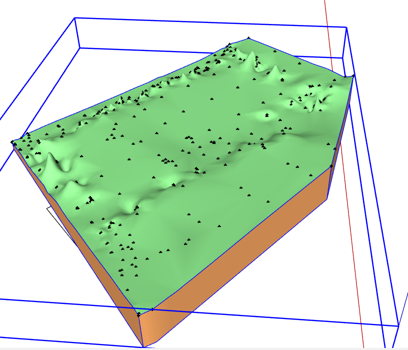
You just need to put all contruction points and the contour within a Group, then select the group and run TopoShaper Cloud.

Note that your model seems to have some points which create peaks.
Fredo
Advertisement


