Implications of end of google earth
-
@valerostudio said:
Is anyone still fuming over this? I am trying to get site information for a model and SketchUp was always the go to. Now I don't know what the heck to do. These topo models that import from DG are useless. The grid is WAY to spread out. In some cases 100-200' grid. That's ridiculous.
Yes.
I went the revit route, mentioned previously here and in other threads. It worked but it was very frustrating. It bloated my model and I had to sit through dozens of spinning wheels. For example, here is an area of a site I modeled that had just enough slope that I didn't have time to clean it up:
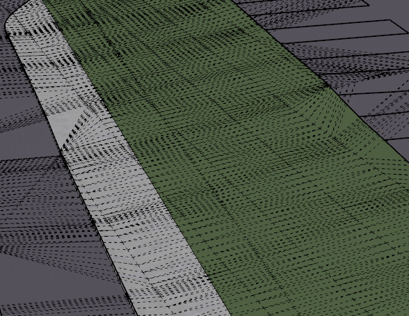
The old way would have been a piece of cake with hundreds of entities. This one, x 4 acres, was a real strain on my computer.
-
Yep - me too!
I have been working on a large project for a few months, came back to working on a few site mock ups and noticed the diminished quality of the "add more imagery" when trying to set up my 9 square grid of the city block I was working on.
Ended up grabbing Google Earth Pro and saving the highest resolution and then attempted to scale it to match the blurry DG image.
For some reason I couldn't draw directly on the top of the GEP image, I had to draw from the bottom - very odd.
But I really noticed there was something amis when I started extruding buildings and wanted to "Add Photo Texture..." that was where I was informed of the 5 year contract with Google that had expired and after I made do with just faceless blocks I came here to see what the F was up!I am looking for a viable alternative for both features I have lost and will be following this and any other thread that pop up on the subject.
-
I sent an email direct to Trimble which was forwarded to Bryce. It's just crap and to even suggest that this is an ok replacement is a slap in the face of all SketchUp users. They should have honestly cut a deal with Google and told us that we would have to pay a fee for the service.
-
From what I've read on the SketchUp forum, Google isn't making the data available at any price.
-
@juju said:
From what I've read on the SketchUp forum, Google isn't making the data available at any price.
That's true. And Google's terms of usage prevent the data from being used as it has been in SketchUp since they started the Location thing. Unfortunately many users are just ignoring those facts.
-
So Google owns and controls all high resolution aerial and topo data on Earth?
-
Who said or even implied anything close to that? They own their data and they aren't allowing it to be used the way it was in SketchUp.
Again, Trimble didn't just decide to change suppliers. Google quit supplying.
-
@valerostudio said:
So Google owns and controls all high resolution aerial and topo data on Earth?
and Mars
-
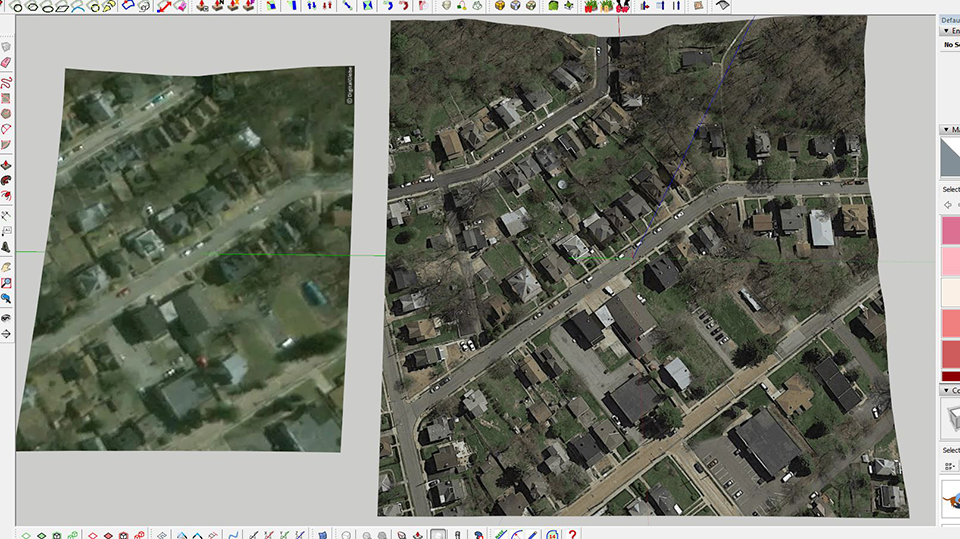
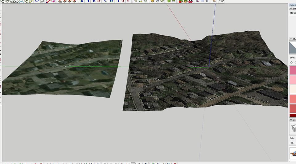
I have been one of the complaining pissed off users. I've demoed several of the Autocad and Revit add-ons but the workflow just didn't suit me and why should I pay almost $300 for something I used to be able to do. But it gave me some insight into how they work and apparently the Google Earth api isn't as restrictive as Google Maps because this is what these add-ons are using (or they're just breaking the terms?). Anyway Dave R in another post asked what the alternative is? Well that's not my job but the folks at Trimble who have been taking my money for the last 5 years and had plenty of time to come up with a better alternative. Trimble should be ashamed to offer this crap as a "pro" feature. With that being said, here is my alternative, the whole process takes me about a 1/2 hr. And sometimes I have to do some cleanup, in the video I removed about 20 points from the surface to get rid of the "bumps" in the road and any super sharp elevation changes. I've used this process on several sites now and am pretty satisfied, I get a surface identical to Google Earth with high res terrain and imagery. And as a bonus I get a terrain skirt for section cuts. I've also had a very quick communication with Daniel Tal to see if this process or something similar can be integrated with and automated by Placemaker.
-
@alpro said:
I've also had a very quick communication with Daniel Tal to see if this process or something similar can be integrated with and automated by Placemaker.
I may be wrong, but I think WHAAT (Dale Martens) does all the coding / development.
-
Thanks for sharing, Alpro! Much appreciated. I'll try it for my non-USA locations and report back.
-
Good job Trimble, leave it to the plugin authors.
-
I know this is a bit of an old post, but we at Twilight Render wanted to let you know that after a lot of hard work we are bringing satellite and terrain back to SketchUp Make through Twilight Render Pro and the Terrain Tools AddOn package. We've posted more about it here https://sketchucation.com/forums/viewtopic.php?f=80%26amp;t=68220 or you can visit our website announcement here: https://www.twilightrender.com/phpBB3/viewtopic.php?f=10%26amp;t=5861
We hope this provides a useful workflow for all SketchUp users who have been missing their terrain since May!
Hello! It looks like you're interested in this conversation, but you don't have an account yet.
Getting fed up of having to scroll through the same posts each visit? When you register for an account, you'll always come back to exactly where you were before, and choose to be notified of new replies (either via email, or push notification). You'll also be able to save bookmarks and upvote posts to show your appreciation to other community members.
With your input, this post could be even better 💗
Register Login


Advertisement