Importing/creating streetmap data into Sketchup
-
Do you know if there is any simple way or extension to import streetmap data into Sketchup?
I would like to create a wireframe (centerline of each road) out of this map. Before tracing all the roads I wanted to check if there are any tools/extension/workflows to make it easier than just tracing all the roads with pen tool?
My target is to 3D print the road network and I have been using/testing SVG import but when doing this I am not able to control the width of the road that needs to be exact width to have a nice and clean 3D print.
-
Try Qgis: https://qgis.org/
It has an extensive plugin ecosystem for map creation and 3D exporting
-
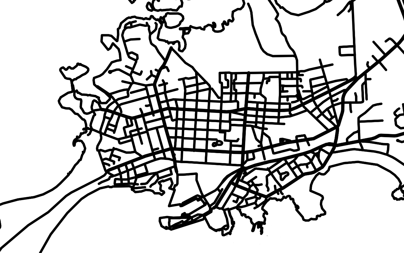
I am getting back to this topic. Qgis seemed to be quite some work to lear so I have been trying to use Inkscape for the purpose. My workflow has been:
- Create an road/street/coastline/water network image with external mapping solution
- Import the image to Inkscape for tracing the lines (center lines)
- Export the traced map in dxf format and import this to Sketchup as dxf
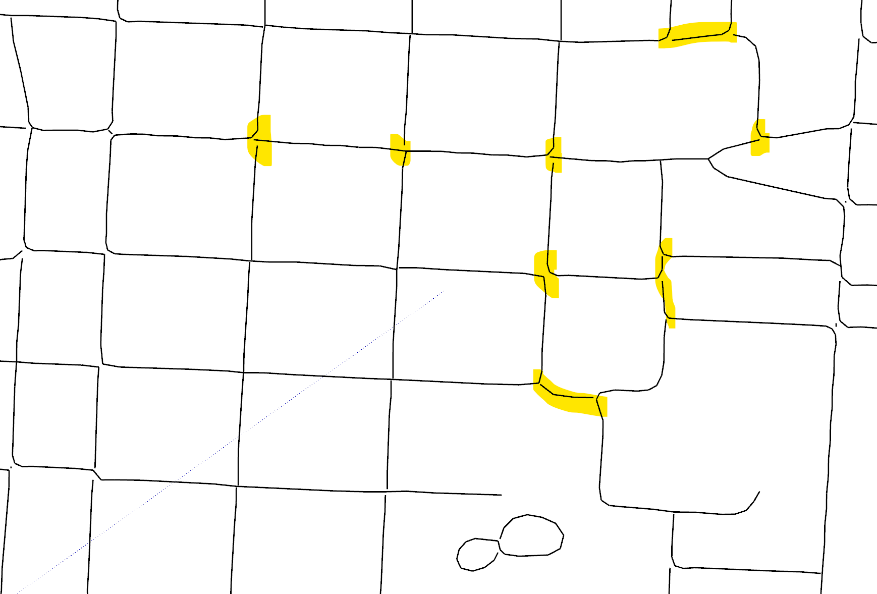
Has anybody else been using similar workflow (Inkscape + dxf export/import)? Do you have the same prblem with lines not connected or have you been able to solve this in Inscape or Sketchup, see below images?
DXF import to Sketchup:
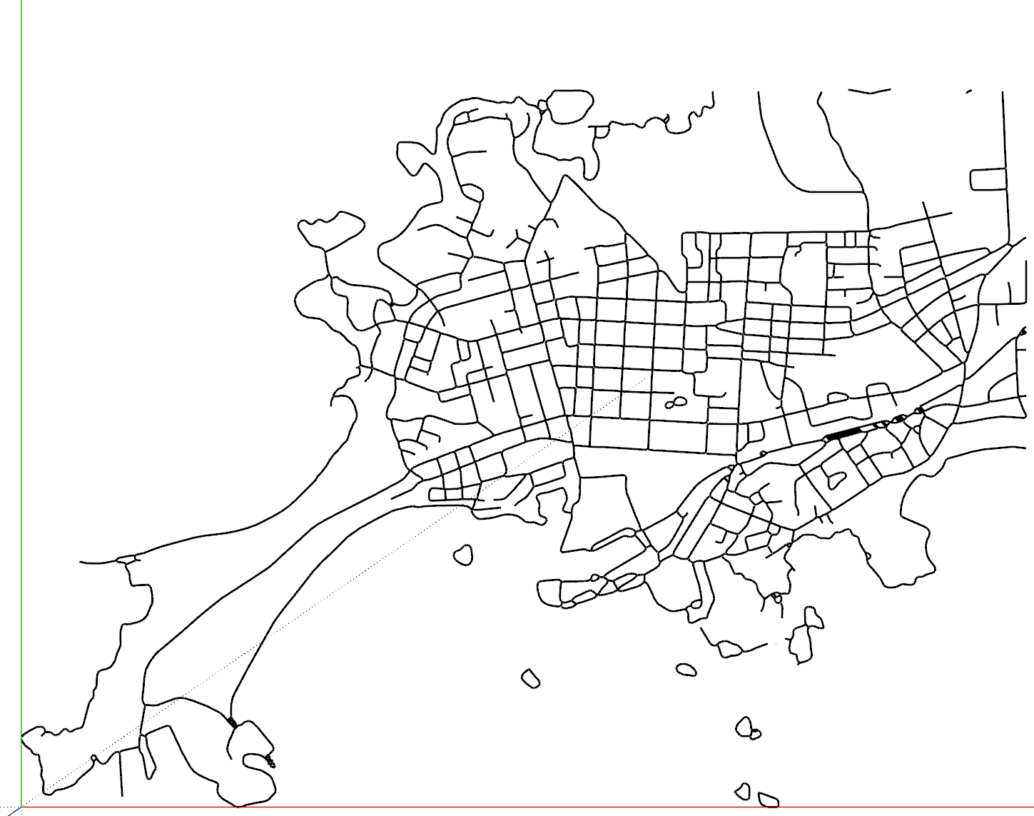
Problem with lines not connected:
-
Try this: https://map2model.com/
You can control all manor of things
-
@Rich-O-Brien Thanks for the suggestion.
I noticed this tool few weeks ago and this would be perfect for "tracing roads" because you can define the road width separately. Unfortunately I have not found a way to include coast line in this tool and the water/sea areas are not properly defined. Hopefully this tool will be even further developed.
Hello! It looks like you're interested in this conversation, but you don't have an account yet.
Getting fed up of having to scroll through the same posts each visit? When you register for an account, you'll always come back to exactly where you were before, and choose to be notified of new replies (either via email, or push notification). You'll also be able to save bookmarks and upvote posts to show your appreciation to other community members.
With your input, this post could be even better 💗
Register Login


Advertisement