Modeling big city for animation.
-
Hi guys,
I need to make an animation and some still images off a rather big piece of a city.
My plan was to draw this in sketch up and put textures on it, then import it in twinmotion ore lumion and put on the right textures, decoration and so on make the animation and still images... finish job.But what is the best way to start on such job?
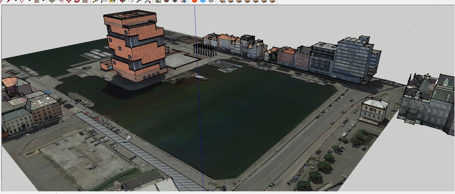
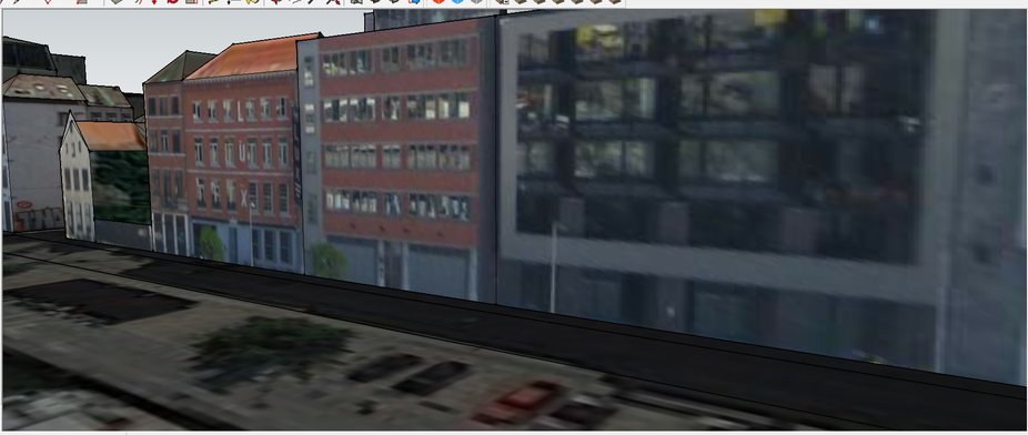
I'm now so far as you can see on the pictures( not far at all
 ), but i have some doubts about the buildings along the side these are now just pulled up from google earth, and photo textured.The thing is when i make an animation, the quality of the photo textured buildings is not like what i want.
I think i have two options make the buildings white , ore draw them better from the photo textured and put better textures on them. Am i right here? Ore are there better options? This is a great tutorial by the way
(https://www.youtube.com/watch?v=nVhM3IYMF8o)Do you guys have some tips/tutorials/programs about modeling such big site's,
for example the roads and stuff like that?Thanks in advance,
Sam


-
Guys
 ?
?
Nobody whit some hints ore tips.Thanks in advance,
Sam
-
It is a pretty huge question your asking. Be patient, Someone will chime in.
It is a little like saying...I would like to live in a house, how do I build one?
-
My $0.002 is planning.
You can spend hours building a city scene and the animation only really has 30% showing close up. First figure out the camera positions and animation path then model best detail closest to camera and lower level of detail further from camera, will save you a ton of time.
-
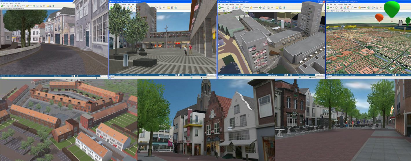
From 2004 to 2006 my job was just what you are asking for: making 3d city models.
Our workflow back then was (in 3dsMax):
-
start with some sort of planning / script so you know what needs to be in 3d, what can be a billboard/panel and what can be skipped. Edit: there's a big difference in a walkthrough model and a birdseye view model.
-
get the contours of the houses (2d dxf city data) -> maybe OpenStreetmap?
-
take photographs yourself of all the buildings you need to model
-
roughly model the shape of a building by doing:
4a. model a shape using the 2d city data (contours, streets etc). The 2d city data helps here because now you have the contour and exact width of the individual buildings
4b. Add a texture to the facade. Scale(z) the facade with the texture so its proportions are just like in the photographs
4c. add all the 3d details that define the building (overhangs, chimneys etc)
4d. use some sort of hierarchy in the model Name your models and textures so you can easily find something.
4e. edit the textures in Gimp/Photoshop to remove perspective in the windows, people, bicycles etc.
Back then we used a constant TexturePerMeter for the textures so all the textures had the same sharpness / blur. Because of the limitations of hardware we used 32 pixels per meter. With the modern graphic cards you can go much higher
-
for the curbs and roads we used a lofting technique with tileable textures
-
you really need trees, streetlights, streesigns, cars, decals etc etc to make it come alive
This is a very very very brief explanation. Feel free to ask more specific questions.
Edit: if you brief allows you to keep all the buildings white instead of textured, you will save a TON of work.
Edit: added a picture of some of our projects in 2004-2006
edit: think about a consistent level of detail.Max

-
Advertisement


