Modeling fairly flat terrain
-
Is there any hope of making something visually noticeable about this terrain or is it just too flat to look like anything much? (I will add also relatively minor water features and trees but the are likewise not very significant at this scale and another problem.)
Which plugins or settings would you recommend I try? Sandbox results in not much and is included (I know about the recurring error at the top left corner). I know I can exaggerate the relief but want it to be accurate. I've included the model in case anyone wants to show results.
Contours are at 5' intervals and have been simplified. Contoured planes are face-able by re-drawing a bounding straightedge. Please advise me of any mods you'd like me to make.
Image shows model construction - just flat planes.
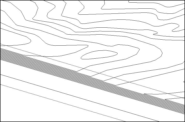
terrain to post.skpBlood from a stone? Turnip?
Blood from a stoned turnip? -
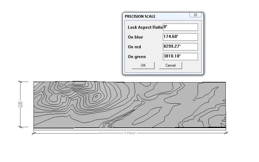
mashtab 4
by SahiScaling tool for the selected objects, along XYZ axes.
How to install: Just drop it in Plugins folder.
UI Location: Toolbarz axis x 10
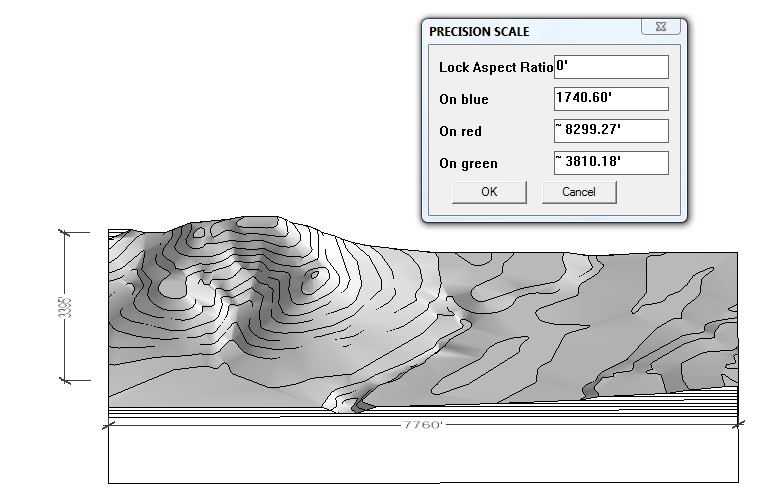
info hight factor of 10 |....|....|....|....|
174 feet is the elevation of Kanas very flat
How high was the plane that took the contour line
let say 300 feet thus factor 10 of sitewitgh=1.5 mile
deep 3/4 mile
height of hills 174 feet or 1740 feet. I guess You know best since you on the ground.
You house will be very small to the given terrain. so cut up and divide by 10 the terrain grade may then look like 17 feetWhat I would do is to use mashtab 4 to resize just simple models to this terrain.
-
I know I can scale along Z with native scale and hoped to save you the trouble:
@unknownuser said:I know I can exaggerate the relief but want it to be accurate.
I appreciate your input. Thank you.
For anyone interested in mashtab: http://forums.sketchucation.com/viewtopic.php?f=323&t=11677&start=0&hilit=mashtab
-
Brooke,
Maybe try Chris Fullmer's Plug-in color by Z to help enhance the contour visibility.
http://www.smustard.com/script/ColorByZBest,
Charlie
-
Nice idea, and thanks very much for the example. I'll try it.
Thanks, Charlie.
Hello! It looks like you're interested in this conversation, but you don't have an account yet.
Getting fed up of having to scroll through the same posts each visit? When you register for an account, you'll always come back to exactly where you were before, and choose to be notified of new replies (either via email, or push notification). You'll also be able to save bookmarks and upvote posts to show your appreciation to other community members.
With your input, this post could be even better 💗
Register Login


Advertisement