(New York) Real Photographs VS. Google Earth models
-
Hi guys,
Haven't used Google Earth in a couple of weeks...
When I went in to take a closer look at New York, I noticed almost all buildings are now modelled in 3D!I've used some of my New York photographs and tried to find the exact same location in Google Earth.
Please take a look at the enclosed GIF file.

I think Google Earth did a great job!

Regards,
Ward -
Indeed it is impressive! And you did a good job matching your photos. I've watched the sequence over & over -- always something different to see. When you were in NY you must have taken one of the helicopter rides - it looks like you had a great tour.
Regards, Ross
-
Wow, it takes hours until all the Buildings appear

-
@ Ross M.
Yeah, most images are from a heli tour.
I'm impressed Google has modeled Manhattan! -
Great Shots of New York
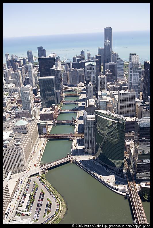
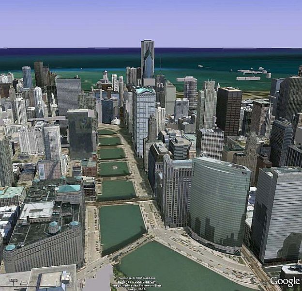
However it looks like Chicago is not too far behind. Attached is an aerial shot of Chicago in article by Philip Greenspun on photo.net(http://photo.net/learn/aerial/primer)Cheers
alpmeadow
-
Nice one Alpmeadow!
Chicago looks realistic, I'll have to take a look in GE.
Hello! It looks like you're interested in this conversation, but you don't have an account yet.
Getting fed up of having to scroll through the same posts each visit? When you register for an account, you'll always come back to exactly where you were before, and choose to be notified of new replies (either via email, or push notification). You'll also be able to save bookmarks and upvote posts to show your appreciation to other community members.
With your input, this post could be even better 💗
Register Login


Advertisement