[Plugin] ElevationProfile - v1.4a - 17 Dec 25
-
The information on ElevationProfile is maintained on the Plugin Home Page of ElevationProfile. This is also where you can download the RBZ file.

- LibFredo6: v15.6a or above
- Sketchup version: SU2017 and above
- Platform: Windows and Mac OSX
- Usage: Licensed under Sketchucation SCFLicense as of 01 Sep 25
- Free Trial period (full features): 30 days from activation
- Perpetual license (3 seats): $15
If you land on this page and are unfamiliar with how to install Sketchup Extensions such as LibFredo6 or how to register on Sketchucation], please watch this video or refer to the Plugin page of LibFredo6.

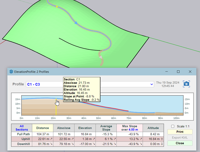
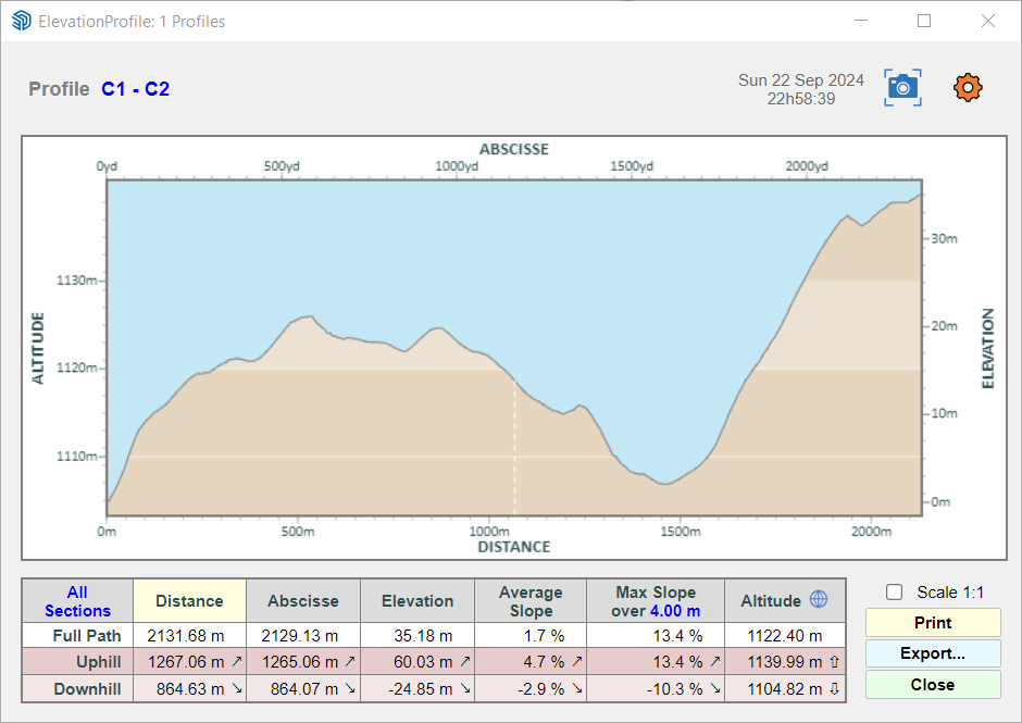
ElevationProfile visualizes and performs a vertical analysis of profiles made of curves, in particular for elevation and slope (gradient).
Profiles can be imported in KML format and, if geolocated, can be tracked with geo-coordinates.


NO documentation for the time being. The usage is straightforward and is shown in the video.
- Select curves forming one or several paths
- Click on the check mark button
- The Analysis Panel is displayed.

-
@fredo6 Looks good! Thanks
-
@fredo6 - Wow! Thanks for sharing.
Just one addition I can see - can the slope format be toggled or added to show a 1:X format rounded to whole numbers (e.g. 1:12, 1:20...)? -
NEW RELEASE: ElevationProfile v1.1b - 20 Sep 24
Requirements:
- LibFredo6 14.6a
ElevationProfile v1.1b is a release including:
- Assign name to curves (via contextual menu)
- Reverse curve via contextual menu (you could anyway click on the arrow to toggle the orientation)
- Bug fixing for some georeferenced models
Home Page of ElevationProfile for information and Download.
-
NEW RELEASE: ElevationProfile v1.1c - 22 Sep 24
Requirements:
- LibFredo6 14.6a
ElevationProfile v1.1c is a release including:
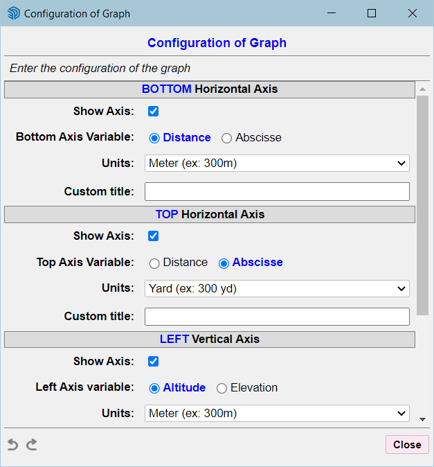
- Full axis configuration (via dedicated dialog)
- small adjustments
- Bug fixing
You can configure each of the 4 axes for:
- show / hide axes (top, bottom, left, right)
- choice of units per axis
- custom title for each axis
- type for axis (horzontal: distance / abcisse, vertical: altitude / elevation.


Home Page of ElevationProfile for information and Download.
-
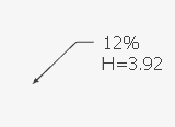
@fredo6 A humble real-life request: Is it possible to add an special Text* tool that, when glued to a face\edge\line in model, would interactively show the slope (in %) and elevation (respecting the project's 0.00 set by user) ?
*- with a leader or some point\cross sign

-
@rv1974
Are you talking about a tool that would hover a curve and display this information? This can be done, but has nothing to do with ElevationProfile specifically. It may already exist.Or do you request that ElevationProfile creates persistent Sketchup Text labels with the information?
-
@fredo6 persistent and real time of course - it'd allow geo editing with "finger on the pulse"
-
NEW RELEASE: ElevationProfile v1.1e - 02 Oct 24
Requirements:
- LibFredo6 14.6a
ElevationProfile v1.1e is a release including:
- **Export CSV
- **Other evolutions and bug fixing
Home Page of ElevationProfile for information and Download.
-
NEW RELEASE: ElevationProfile v1.1f - 01 Dec 24
Requirements:
- LibFredo6 14.8a
ElevationProfile v1.1f is a release including:
- Bug fixing of a problem when importing some KML files
Home Page of ElevationProfile for information and Download.
-
NEW RELEASE: ElevationProfile v1.2a - 11 Feb 25
Requirements:
- LibFredo6 14.8a
ElevationProfile v1.2a is a release including:
- Bug fixing of a problem whenexporting to CSV
Home Page of ElevationProfile for information and Download.
-
NEW RELEASE: ElevationProfile v1.2b - 11 Feb 25
Requirements:
- LibFredo6 14.8a
ElevationProfile v1.2b is a release including:
- Bug fixing of another problem when exporting to CSV
Home Page of ElevationProfile for information and Download.
-
NEW RELEASE: ElevationProfile v1.3a - 01 Jun 25
Requirements:
- LibFredo6 14.8a
ElevationProfile v1.3a is a release including:
- Extension of validity
Home Page of ElevationProfile for information and Download.
-
NEW RELEASE: ElevationProfile v1.4a - 17 Dec 25
Requirements:
- LibFredo6 15.6a
ElevationProfile v1.4a is a release including:
- Extension of validity
Home Page of ElevationProfile for information and Download.
Advertisement


