sketchucation logo sketchucation
    • Login
    ℹ️ Licensed Extensions | FredoBatch, ElevationProfile, FredoSketch, LayOps, MatSim and Pic2Shape will require license from Sept 1st More Info

    Import Terrain

    Scheduled Pinned Locked Moved SketchUp Discussions
    10 Posts 4 Posters 0 Views 4 Watching
    Loading More Posts
    • Oldest to Newest
    • Newest to Oldest
    • Most Votes
    Reply
    • Reply as topic
    Log in to reply
    This topic has been deleted. Only users with topic management privileges can see it.
    • Joe WoodJ Offline
      Joe Wood
      last edited by

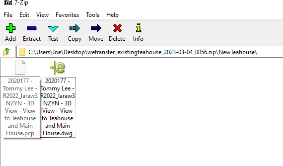
      OK folks I've never done this. I have .pcp and .dawg files. Do I import both into a SUp blank file?

      any pointers for doing the import?


      1 TLee.png

      Joe Wood
      woodsshop.com/

      1 Reply Last reply Reply Quote 0
      • Joe WoodJ Offline
        Joe Wood
        last edited by

        OK I figured it out.

        Joe Wood
        woodsshop.com/

        1 Reply Last reply Reply Quote 0
        • ntxdaveN Offline
          ntxdave
          last edited by

          @joe wood said:

          OK I figured it out.

          And the answer was? 😮

          1 Reply Last reply Reply Quote 0
          • Joe WoodJ Offline
            Joe Wood
            last edited by

            To import just the dwg.

            Joe Wood
            woodsshop.com/

            1 Reply Last reply Reply Quote 0
            • ntxdaveN Offline
              ntxdave
              last edited by

              👍

              1 Reply Last reply Reply Quote 0
              • HornOxxH Offline
                HornOxx
                last edited by

                hi - if I understand it correctly you have a 7z file. This could also be a zip file. Your opened 7z window only shows you the content of this zipped file. What you have to do now is to unzip this 7z file so that you get access to these still zipped files.
                The easiest way is to select the desired zipped files and drag them out of the 7z window to a desired location on your hard drive. These files are then unziped and ready for use as normal files.

                Best & hope this helps?


                unzip 7z.gif

                never trust a skinny cook

                1 Reply Last reply Reply Quote 0
                • HornOxxH Offline
                  HornOxx
                  last edited by

                  @hornoxx said:

                  hi - if I understand it correctly you have a 7z file...

                  😄 I was probably a little too slow, but I'm glad you managed it

                  never trust a skinny cook

                  1 Reply Last reply Reply Quote 0
                  • Joe WoodJ Offline
                    Joe Wood
                    last edited by

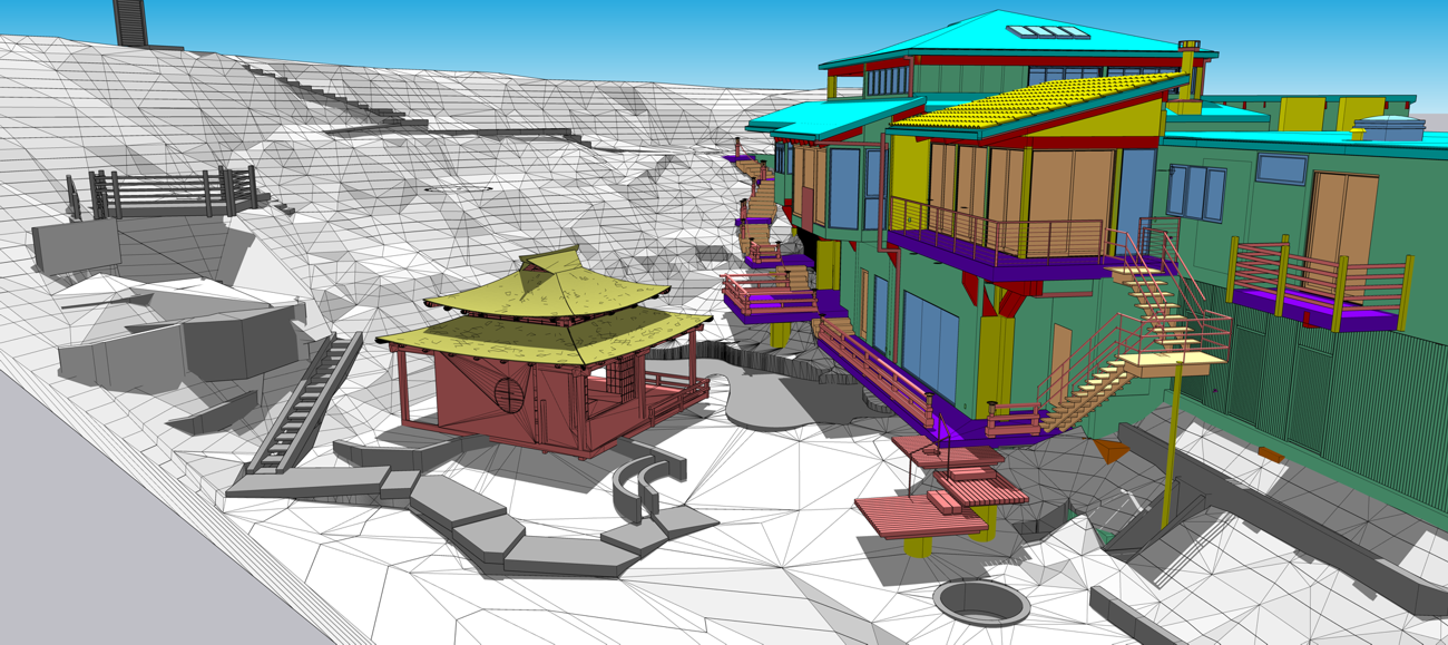
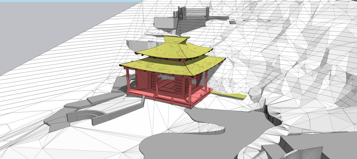
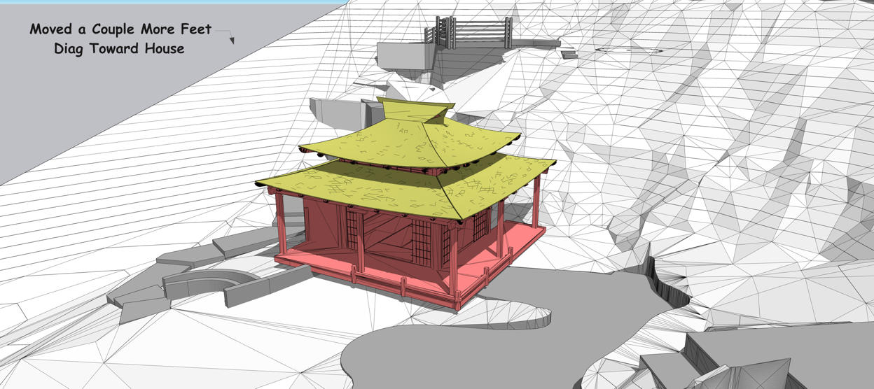
                    Wow Folks I've never worked with a 3d terrain like this before! How accurate is it!? Is this like a lidar scan you can import as a 3d? How would I get terrain models like this myself, minus all the structures! What a great tool, esp for a terrain like this one!

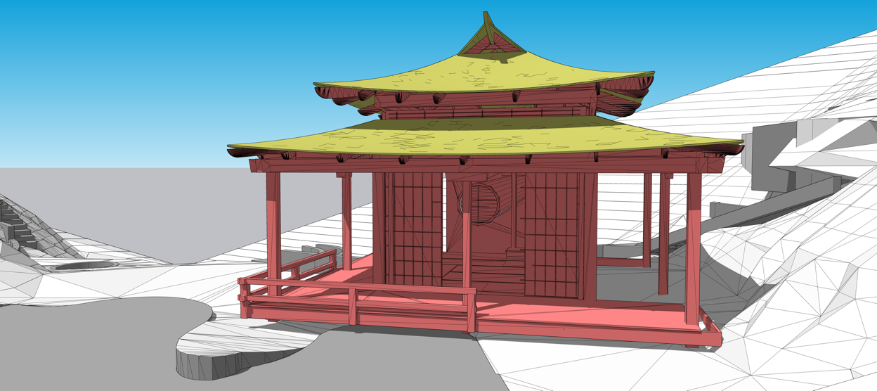
                    You see the issue, a beautiful teahouse, that I’m already fabbing the parts for, the original design layout didn’t fit the site plan and everyone was freaking out, zoom meeting tomorrow! Project on hold! Now we can get back to work making sawdust tomorrow fingers crossed!

                    You see how accurately I can place the model, and all the imported teahouse model dims are correct.

                    What a great new tool!


                    1 Tea House.png


                    5a THouse.png


                    5c THouse.png


                    5d THouse.png

                    Joe Wood
                    woodsshop.com/

                    1 Reply Last reply Reply Quote 0
                    • Joe WoodJ Offline
                      Joe Wood
                      last edited by

                      Darn, I asked him how he created that terrain, hoping it'd be something like LIDAR, but no!

                      We had a surveyor take measurements of the site for us at the beginning of the project, and then I had to manually build the site off of their survey points. Expensive and laborious, but worth it for a project of this size!

                      so how else could I get terrain models??

                      Joe Wood
                      woodsshop.com/

                      1 Reply Last reply Reply Quote 0
                      • Dave RD Offline
                        Dave R
                        last edited by

                        The county's GIS department might have LIDAR or other terrain data. It depends on how much resolution you need, though. It also depends on how fresh the data needs to be. It's possible to get data points from an on-the-ground survey and import that insto SketchUP as a point cloud. Then use the Sandbox Tools or TopShaper to generate the terrain geometry.

                        Etaoin Shrdlu

                        %

                        (THERE'S NO PLACE LIKE)

                        G28 X0.0 Y0.0 Z0.0

                        M30

                        %

                        1 Reply Last reply Reply Quote 0
                        • 1 / 1
                        • First post
                          Last post
                        Buy SketchPlus
                        Buy SUbD
                        Buy WrapR
                        Buy eBook
                        Buy Modelur
                        Buy Vertex Tools
                        Buy SketchCuisine
                        Buy FormFonts

                        Advertisement