sketchucation logo sketchucation
    • Login
    βŒ› Sale Ending | 30% Off Profile Builder 4 ends 30th September

    Knock out Aerial Drone and super tough SU Challenge

    Scheduled Pinned Locked Moved SketchUp Discussions
    sketchup
    31 Posts 12 Posters 43.3k Views 12 Watching
    Loading More Posts
    • Oldest to Newest
    • Newest to Oldest
    • Most Votes
    Reply
    • Reply as topic
    Log in to reply
    This topic has been deleted. Only users with topic management privileges can see it.
    • Rich O BrienR Offline
      Rich O Brien Moderator
      last edited by

      @dennis_n said:

      It worked!!!

      Hooray! πŸ‘

      Download the free D'oh Book for SketchUp πŸ“–

      1 Reply Last reply Reply Quote 0
      • olisheaO Offline
        olishea
        last edited by

        There is also a workflow for the less expensive Parrot Bebop:

        Nowhere near as advanced as the DJI Inspire 1 but similar results and more than 5 times cheaper. I am not even trying to compare them as the DJI is a different league, but if you want "cheap" 3D terrain mapping then the Bebop is pretty awesome.

        http://blog.parrot.com/2015/01/06/mapping-the-statue-of-liberty-with-bebop-drone-pix4dmapper-pro/

        They also used drones to 3D map the Matterhorn in Switzerland:

        oli

        1 Reply Last reply Reply Quote 0
        • pbacotP Offline
          pbacot
          last edited by

          This is incredible. Years ago I was following the blog of a kite photographer who worked with a research team at University of California to map one tower and it seemed so cool, and also so far away from being something that others would be able to do.

          MacOSX MojaveSketchUp Pro v19 Twilight v2 Thea v3 PowerCADD

          1 Reply Last reply Reply Quote 0
          • A Offline
            alpro
            last edited by

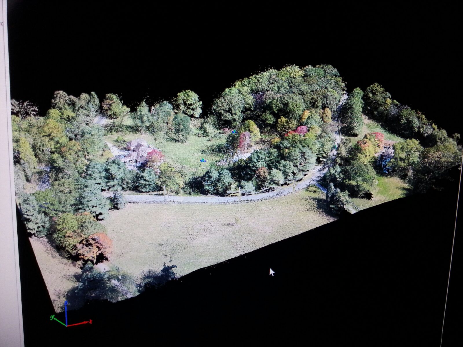
            This is great, didn't think anyone else has been doing this. I've been flying the DJI Phantom 2 Vision + along with Pix4Dmapper for about 10 months. I have access to Trimble GPS and robotic total station so my models are georeferenced but I've been able to do some comparisons also and it's surprising how accurate this workflow is. I have point clouds created this way with Pix4Dmapper that are within a couple tenths horizontally and vertically of survey grade and can cover a much larger area in about a quarter of the time (including processing time in Pix4Dmapper) than an actual field survey . Below a screen shot from Pix4Dmapper of a recent flight.

            Ps
            By georeferenced I mean to State Plane grid as it's already georeferenced from the photo gps tags

            Mike


            Screenshot (1).jpeg

            1 Reply Last reply Reply Quote 0
            • D Offline
              Dennis_n
              last edited by

              Roland - Here is the resulting SKP Model. Let say if the work flow is polished up from the time you step out of the office to take pictures (minus travel time) to the moment you get model like that is 2 -3 hours safe.

              Dennis

              1 Reply Last reply Reply Quote 0
              • BoxB Offline
                Box
                last edited by

                I really must stop reading this thread before my bank account takes a hit.

                1 Reply Last reply Reply Quote 0
                • R Offline
                  roland joseph
                  last edited by

                  @unknownuser said:

                  Forgive me but...workflow for what?....and can you show us the result?

                  I must just be dumb cause I still have no clue what the workflow is for.

                  I see the cool image but it's resolve is very poor.

                  "workflow"? sure you didn't just mean "playflow"

                  1 Reply Last reply Reply Quote 0
                  • D Offline
                    Dennis_n
                    last edited by

                    Roland, I don't have the model with me now, but it is pretty similar to what Rich posted.
                    Can you be more specific about what you are looking for? Witch piece of the puzzle are you missing?

                    1 Reply Last reply Reply Quote 0
                    • A Offline
                      alpro
                      last edited by

                      I think what roland joseph is referring to is that your model is not very defined, I know for a fact that you can get much better results with this workflow, unfortunately I can not post any of my models but here is a link to a video by the Pix4Dmapper team.
                      Pix4D - Mapping Christ the Redeemer: http://youtu.be/-ucLIckILT4
                      And here is the 3D model
                      https://skfb.ly/CRws

                      Mike

                      1 Reply Last reply Reply Quote 0
                      • R Offline
                        roland joseph
                        last edited by

                        Thanks Denis and alpro...I get it now....cheers!

                        1 Reply Last reply Reply Quote 0
                        • D Offline
                          Dennis_n
                          last edited by

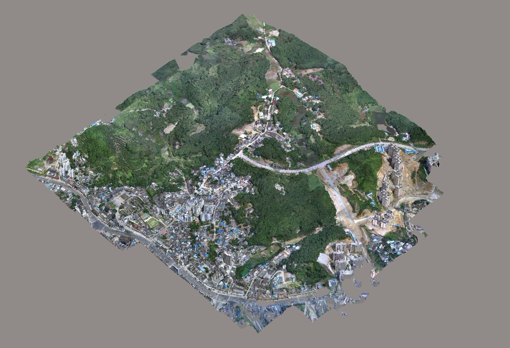
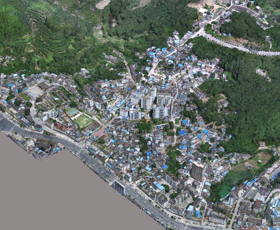
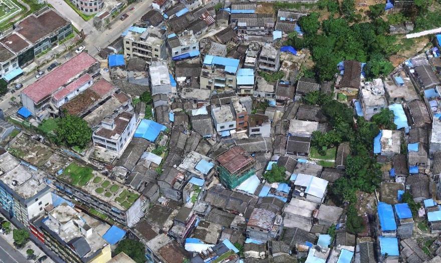
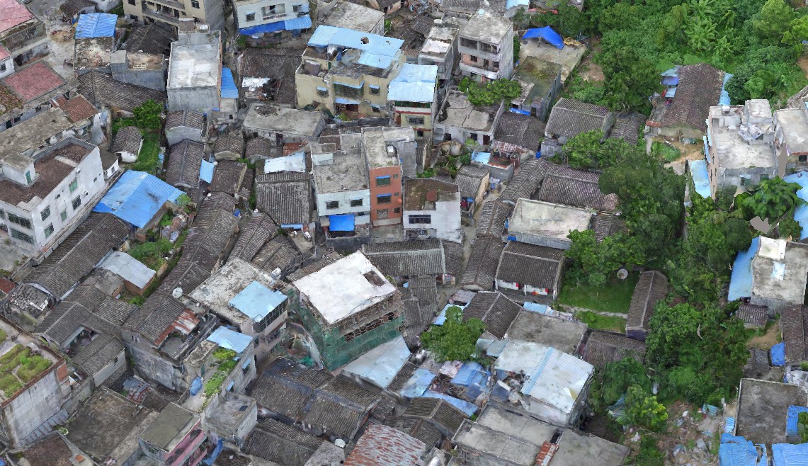
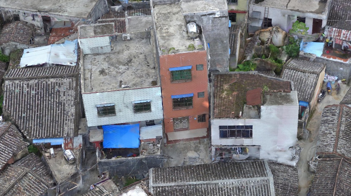
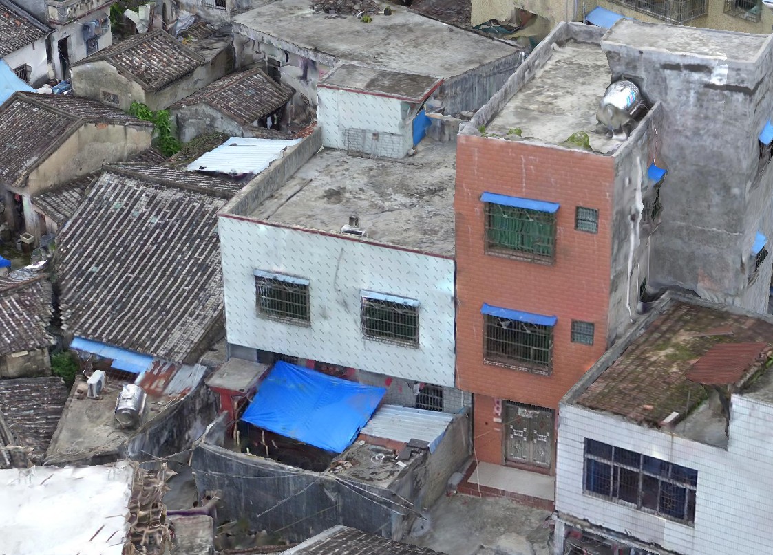
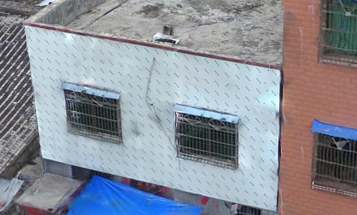
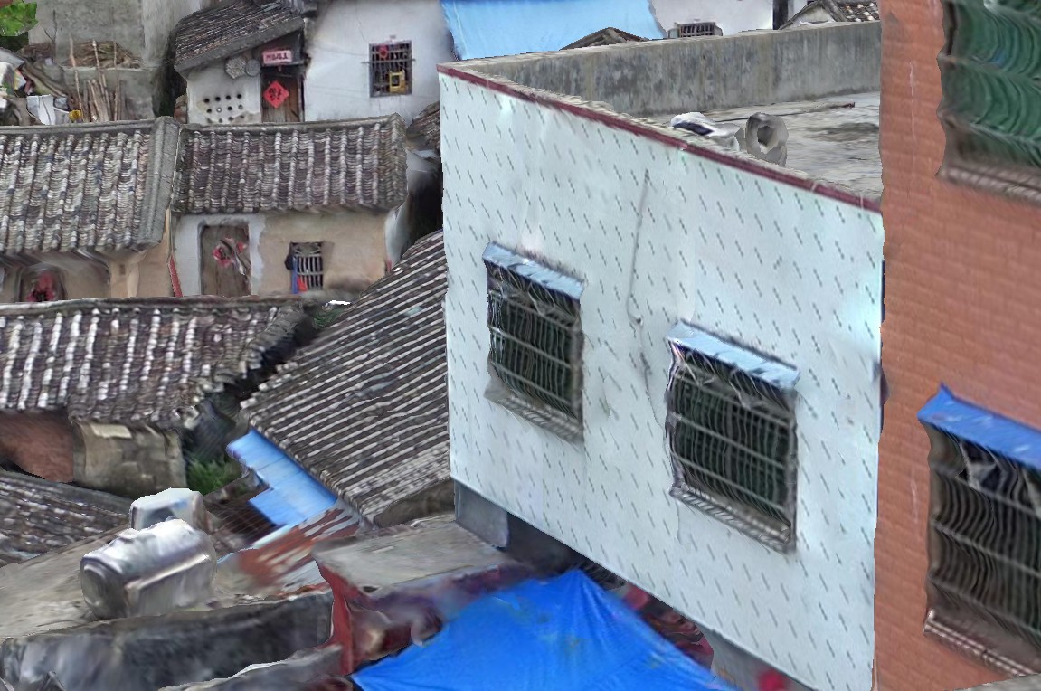
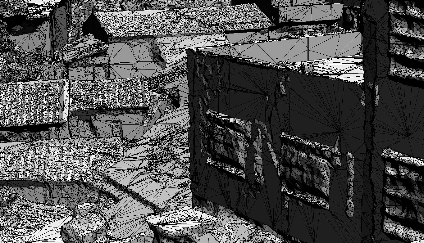
                          1.5 years later. Look what I am doing with photogrammetry now.

                          The 1st picture is almost a square mile. then zooming to a random detail.

                          It is all light and moving fast. no overloading PC anymore! the future is here!

                          Just to get a kick -scroll these pictures up and down a few times.


                          1.jpg


                          2.jpg


                          3.jpg


                          4.jpg


                          5.jpg


                          6.jpg


                          7.jpg


                          8.jpg


                          9.jpg

                          1 Reply Last reply Reply Quote 0
                          • cottyC Offline
                            cotty
                            last edited by

                            Impressive result!

                            my SketchUp gallery

                            1 Reply Last reply Reply Quote 0
                            • D Offline
                              dbalex
                              last edited by

                              Woah, crazy level of detail ! I'm really interested in getting myself a drone too. Any chance you explain your workflow ?

                              http://www.bocostudio.com

                              1 Reply Last reply Reply Quote 0
                              • D Offline
                                Dennis_n
                                last edited by

                                There is no secret. It is just photogrammetry tools gotten that good. Take thousands of photos, dump them in,a few days later get the result.

                                1 Reply Last reply Reply Quote 0
                                • 1
                                • 2
                                • 2 / 2
                                • First post
                                  Last post
                                Buy SketchPlus
                                Buy SUbD
                                Buy WrapR
                                Buy eBook
                                Buy Modelur
                                Buy Vertex Tools
                                Buy SketchCuisine
                                Buy FormFonts

                                Advertisement