Knock out Aerial Drone and super tough SU Challenge
-
I got a problem I cant solve in SU. I've been using it since 2002 and this is the bigest chalage I'm facing.
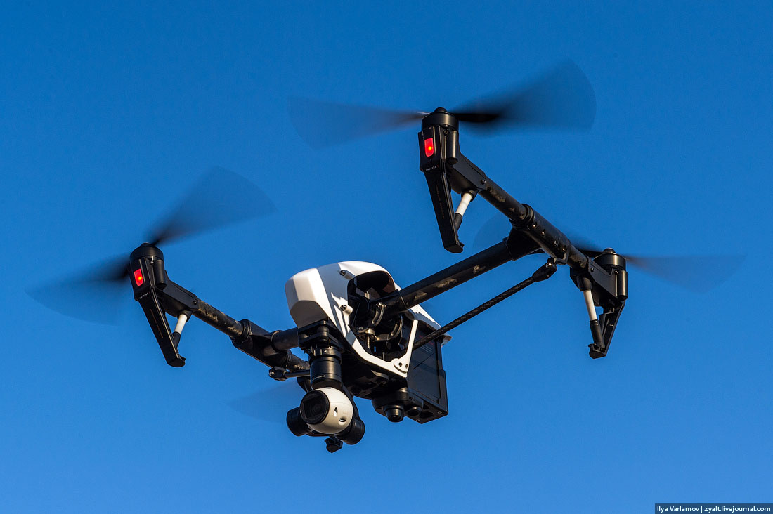
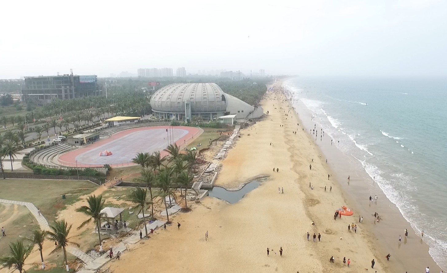
I got this awesome aerial drone - DJI inspire 1. It takes fantastic pictures.
-
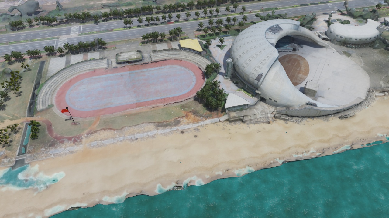
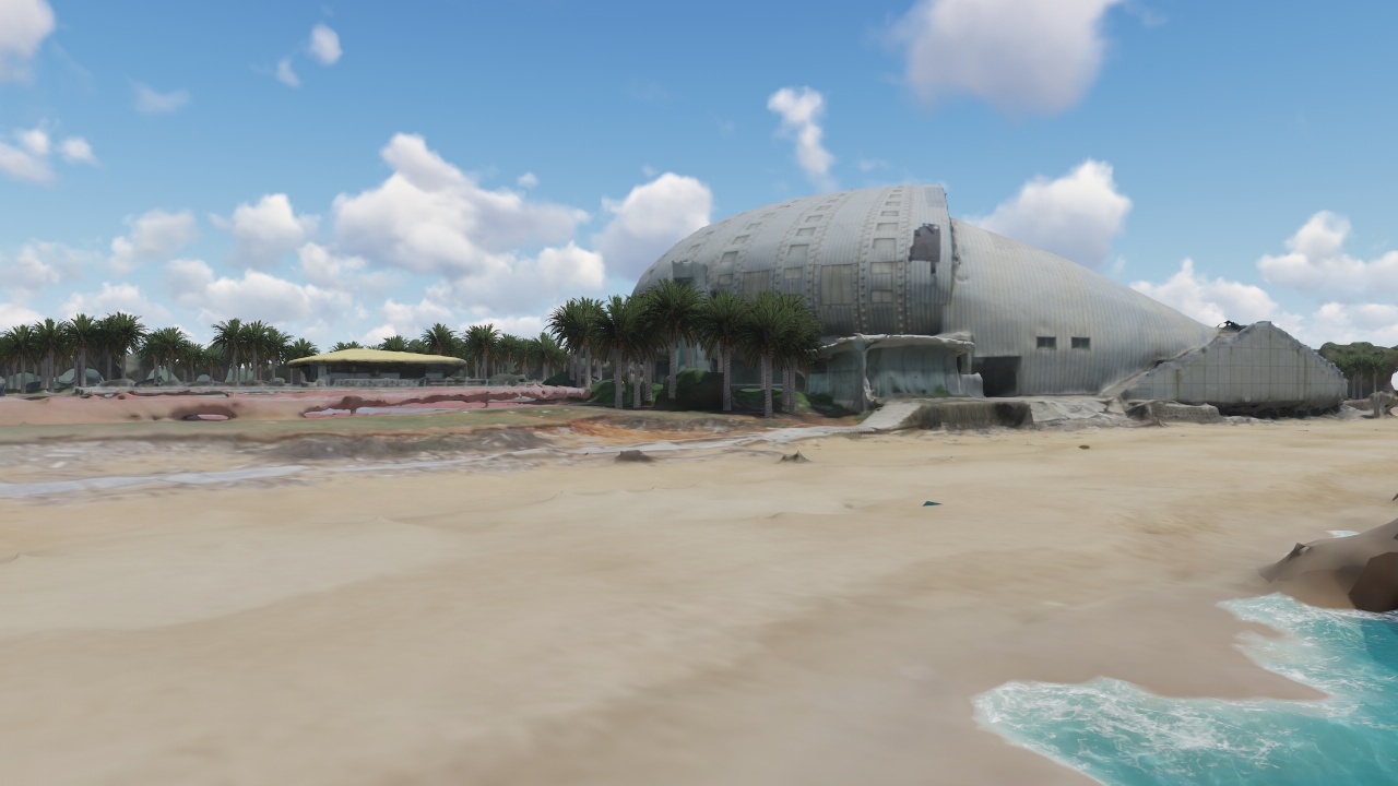
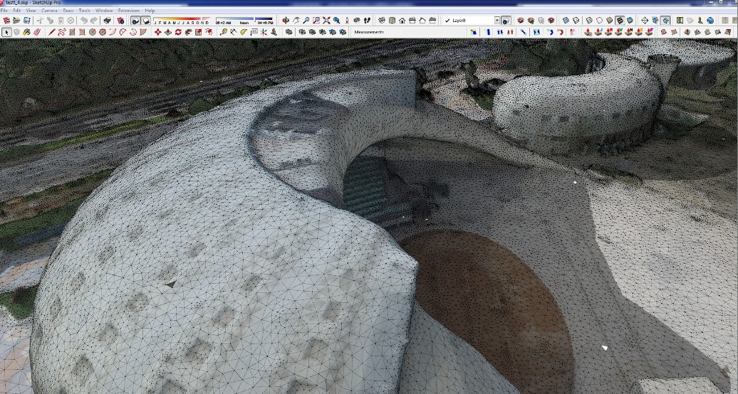
It lets me pull in the model (automatically generated from the drone pictures) into SU. That really blew my mind when it actually worked!!!
As a test subject I picked a weird shaped theater to see how it will do. I couldn't resist to shoot a few Lumion pix with it.
-
-
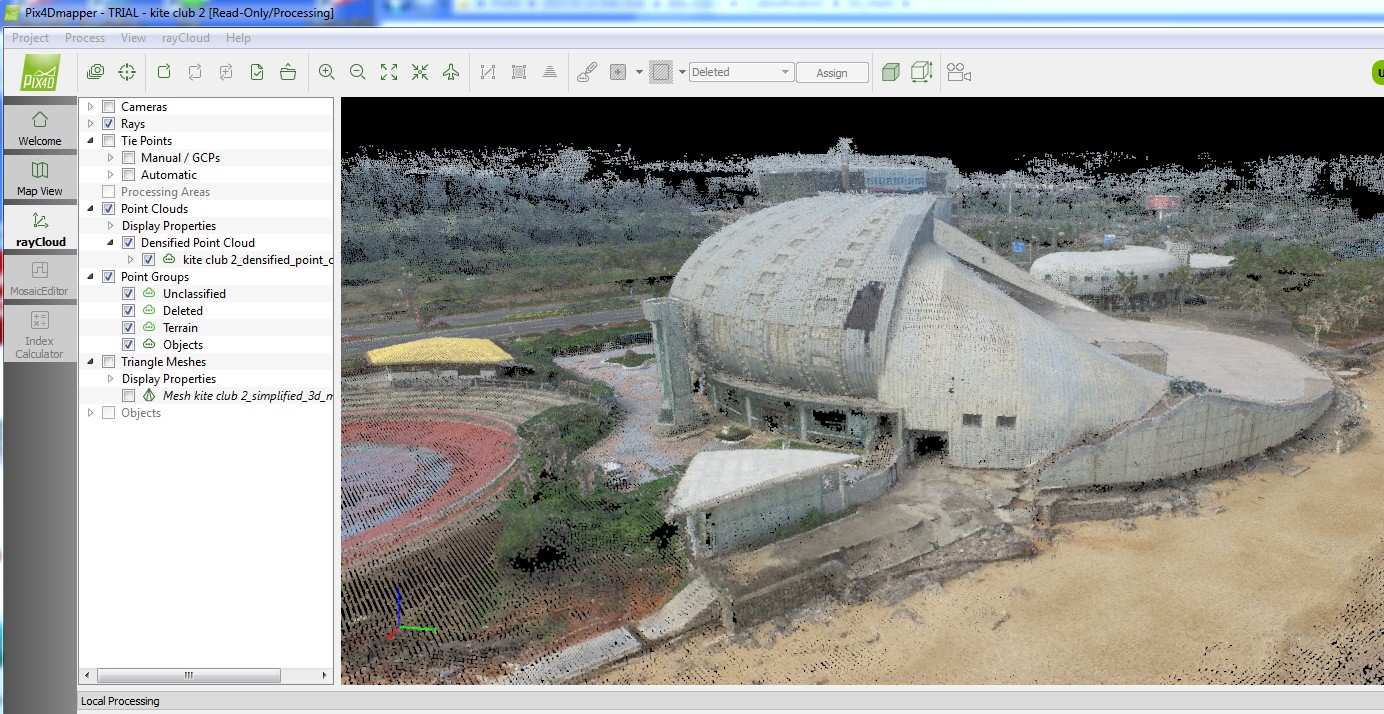
what is even more impressive is that Pix4D Mapper can crank aerial images and generate a high quality point cloud.
That point cloud can be exporte to OBJ format. Next there is a decient converter plugin for SU called SimLab OBJ importer.
-
The model comes out way too heavy. (small segment of SU model is attached) the whole thing was half a gig! No big deal, you say. Artisan plugin can optimize the geometry. Yes it can!
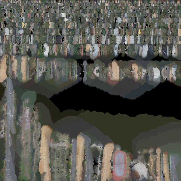
However, here comes the real problem - there is only 1 texture map that colors every face of the model (see attachment). Every face is uniquely mapped so it finds the right spot for itself on the texture. So when I optimize the geometry - all textures get lost.
Yes, I can remap it. Yes, I can bake textures for each individual building but that kind of defeates the purpose.
The purpose is to go to the project site, shoot a bunch of aerials in 15 minutes. Then in the office let it cook over night and in the morning the model is ready. Ok, Ok, I can spend a bit of time optimizing it. The whole point is to spend my time on design - not on cleaning up the site. Some times it could be 50 buildings. I am in desperate need to optimize the geometry without loosing textures.
You can ask, "can Pix4d Mapper do something to reduce the polygon count?". Yes it can, only buildings are loosing definition. You can already see - it is not giving sharp edges and if the quality is reduced further - it will be just a bunch of textured blobs.
The aerials were taken from height of 150 meters. If I fly closer and take more pictures the definition of geometry is going to be significantly sharper. and the model heavier.
.
So the big question is how to deal with the textures in efficient manner?
.
Please, help me out with brain storm ideas.
-
The DJI Inspire 1 is next on my list. I'm VERY jealous!!

I'm currently flying the Parrot Bebop.....so much fun!
But that DJI is another league! And awesome work by the way, I can't really help with your question though....
-
you need to look at other softwares. I tried once with blender when I used 123D scan to scan treestumps and wanted to make low-poly versions of the highpoly scans. It works quite well. I think I used the decimate modifier for that.
Search for softwares that enable high-poly to low-poly workflow, maybe there are some automated workflows for this. In sketchup I don't think there is.
-
Try Simplygon it's impressive...
Simplygon - The Standard in 3D Games Content Optimization
Automated 3D content optimization replacing tedious and time-consuming manual work in 3D games content creation, saving development time and costs.

Simplygon - The Standard in 3D Games Content Optimization (www.simplygon.com)
-
[sw:2rj55lcm]XsJ2M3FGmb8I9Xm[/sw:2rj55lcm]
I managed to get it down to ~6000 faces
It's texture is 16k x 16k which contributes to the mammoth file sizes you speak of.
Managing texel density can dramatically lower things...
...but polycrunching to get this into SU does mean you'll need to sacrifice something along the way.
-
Wow, Rich, how did you manage to do that? Is it the simplygon?
The 1 big texture I don't mind.it gives good resolution to the whole thing. In fact that half a gig model was moving and shading pretty quick. Where it was really bugging down is when I try to touch the mesh.
JQL , simplygon looks like what I need. Will have to mess with it tomorrow.
Dbalex, I think you are right, the solution lies outside of Sketchup.
Oli, it is so much fun, it should be forbidden. I still can't believe I own it and there is no price for me to go use it any time. You will be happy. -
Nice project!
Maby you can find some hint in this basecamp video?
-
Richard, Just opened your model. Wow. It answers my prayers. It is exactly what I need. How did you do it?
-
-
If you´re searching for a free option you can use blender, this tutorial can help bake the texture from the hi poly model to the simplified one, as a advantage you can even break down some parts of your model and set the texture quality accordingly in that part.
http://cgcookie.com/blender/cgc-courses/low-poly-game-asset-creation-fire-hydrant-in-blender-and-unity-3d/ -
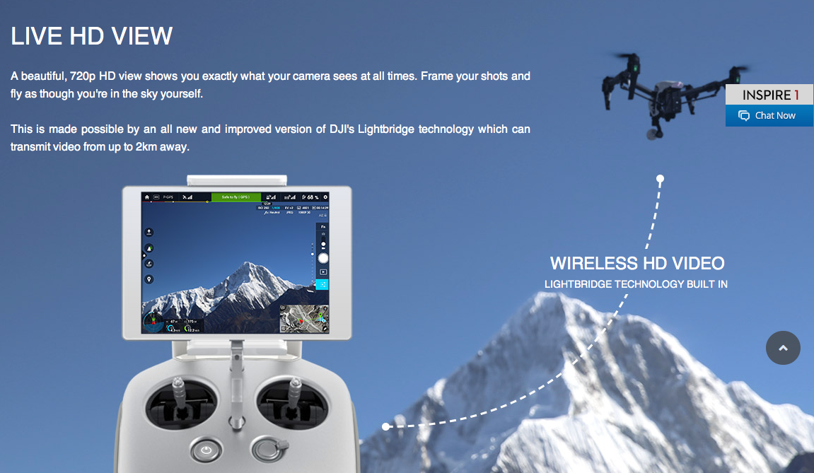
Wow! The Inspire 1 looks to be a great piece of kit. http://www.dji.com/product/inspire-1/feature Easy to operate and yet powerful results and to my surprise at a reasonable price which is sub $3,000 via dealers. http://www.bhphotovideo.com/c/product/1097099-REG/dji_inspire_1.html
I like the ability of being able the attach an iPhone 6 etc or various iPads. I imagine this will make flying much easier for the novice.
I imagine a low set-up cost business could be built on such a device producing aerial surveys resulting (with some extra work) in accurate 3D land models. It could be a great way of bringing down the cost of preliminary concept costing. -
Rich, Mike, It worked!!! I couldnt calm down for hours after the 400+ Mb model became 40 Mb without texture sucrafice!
Now it is a proven workable workflow with manageble and predictable results.Wellcome to the future.
Dennis
-
@unknownuser said:
Now it is a proven workable workflow with manageble and predictable results.
Forgive me but...workflow for what?....and can you show us the result?
When you spend your entire modeling career fighting with heavy terrain and someone comes along with a drone that is part of the solution...seems like too much fun to me.
-
-
There is also a workflow for the less expensive Parrot Bebop:
Nowhere near as advanced as the DJI Inspire 1 but similar results and more than 5 times cheaper. I am not even trying to compare them as the DJI is a different league, but if you want "cheap" 3D terrain mapping then the Bebop is pretty awesome.
http://blog.parrot.com/2015/01/06/mapping-the-statue-of-liberty-with-bebop-drone-pix4dmapper-pro/
They also used drones to 3D map the Matterhorn in Switzerland:
-
This is incredible. Years ago I was following the blog of a kite photographer who worked with a research team at University of California to map one tower and it seemed so cool, and also so far away from being something that others would be able to do.
Advertisement


