3D Terrain from color heightmap?
-
So I am trying to find a good workflow to mill 3D terrain models on my Handibot CNC, like this one:
I know you can grab Google Earth terrain in Sketchup, but you can only grab tiny squares at a time. I am trying to do multiple states at once. There doesn't seem to be a way to automate the import of GE terrain....
That being the case, I found a way that you can get color heightmaps from Google Maps, like this one:
What I'd like to do is have Sketchup automatically create terrain based on an image like that. Each color is a particular elevation (red is the highest, blue the lowest)
This is going to be used in a classroom so students can learn about their local geography.
If anyone has a good workflow for something like this, I'd greatly appreciate it. Once I get a terrain model, getting it into milling is easy....
-
Thomthom Height From Bitmap plugin would do it.
But every pixel in your image becomes a face so some resampling is needed.
-

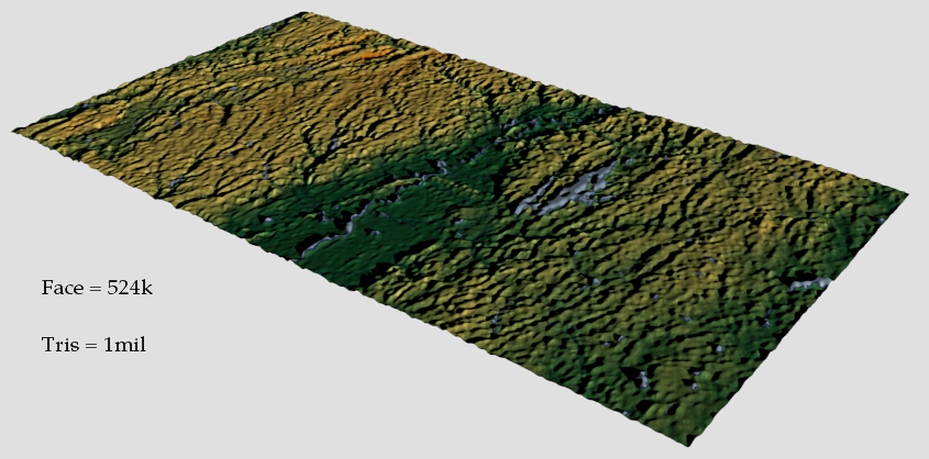
Here's one but as you can see the blue lines are getting inverted
To get even this smooth detail you needs lots of geometry
-
How did you do that so fast?!
-
Because I don't use SketchUp
-
If u can wing me a better grayscale height map I'll send u what you need
-
That would be super cool, but what I am really trying to figure out is not how I can do this, but how people teaching can make these in class with their students. If there was a way that I could do it easily in Sketchup I'd be able to accomplish that goal....
-
No unfortunately.
SketchUp is great but this is beyond its scope.
Unless you want a heavily faceted mesh then u need other options.
-
I know Sketchup can do it, the Google Earth Terrain import quality is perfect, I just can spend the time importing hundreds of tiny little land plots. It's unfortunate because in older versions of Sketchup you could bring in way larger swaths of terrain at once.
-
GE terrain and pixelated images are different beasts.
Advertisement


