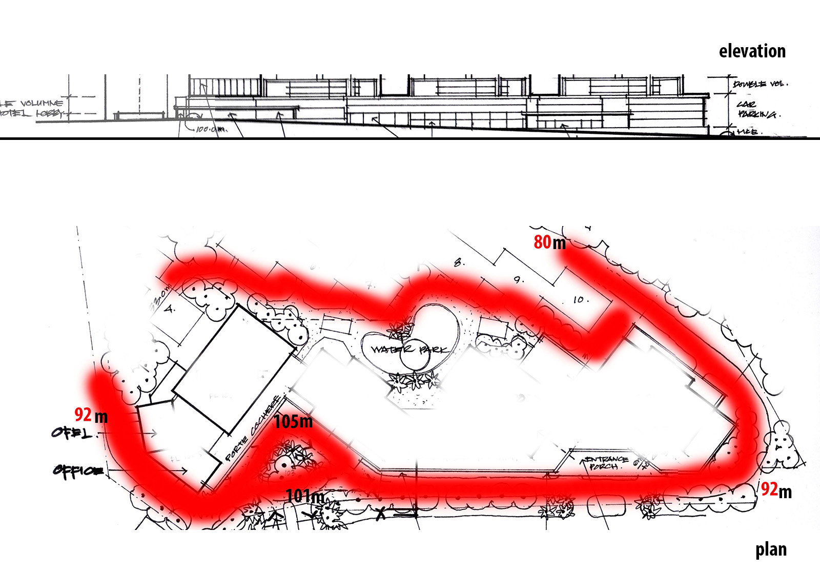
Problems with road with different value of high..
-
im having problems to do the road with slope/diff high in sketchup..
the red which is the road ramp up,coernering with junction. how can i build this on sketchup?
sorry im newbie.attached herewith the elvation and the plan of the drawing.
Help me please.

-
Do you by chance have access to the survey contours?
-
i got the survey drawing but it was too tricky/hard to read..because every point have their value.. how?
-
In the screenshot here you can see I have made the contours into a surface in Sandbox. The contours were imported from the survey into SketchUp in dxf/dwg format.
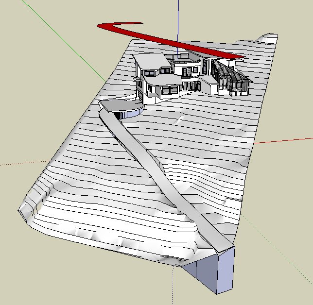
I have drawn the shape of the road, which you see hovering over the contours (in Red) and in this case rather than just stamp the road, I have first intersected the surface of the contours by pushpulling the road (you can see the original still under the road in backface blue)
The intersection I saved, which gave me this as the road.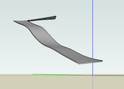
This was all done in copies of the drawing, and cut and pasted in.
Then I did the stamp in sandbox, which because of the steepness of the sight made quite deep cuts, which I worked with using intersecting surface, and some hand work to get the road placed the way I wanted it.
I tend not to be afraid to work "longhand", and it does take some work, but the results rendered up really well.
I hope that others jump in here as I know there are other approaches.
Hope this helps. -
-
thanks guys for the info..
actually the main prob is i do not have the contour dwg, thats so hard to draw it by my own..i just use drape tools on sandbox and adjust it..it works..
for the instant road, it will be more cool if i have the contour dwg.btw, thanks for the help! appreciate it!


Hello! It looks like you're interested in this conversation, but you don't have an account yet.
Getting fed up of having to scroll through the same posts each visit? When you register for an account, you'll always come back to exactly where you were before, and choose to be notified of new replies (either via email, or push notification). You'll also be able to save bookmarks and upvote posts to show your appreciation to other community members.
With your input, this post could be even better 💗
Register Login


Advertisement