So! it was the great lakes after all!
-
Ok,
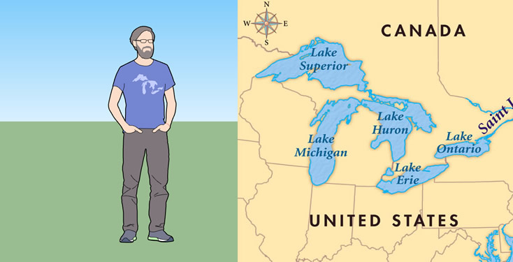
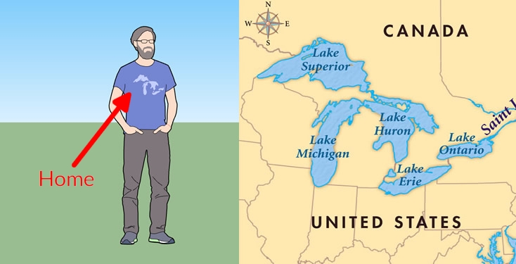
this might be obvious to our Canadian and American friends, but for the rest of us it wasn't clear what Mark's t shirt was depicting. For the past few days I was wondering in the back of my mind what this map was.Initially I thought it was a past-or future- supercontinent but then it came to me: It's the great lakes! (a nature's wonder and a sailor's nightmare to navigate)
again: it wasn't a big discovery, but I thought I'd share...
-
there goes my rohrsheck theory...

-
Hello! It looks like you're interested in this conversation, but you don't have an account yet.
Getting fed up of having to scroll through the same posts each visit? When you register for an account, you'll always come back to exactly where you were before, and choose to be notified of new replies (either via email, or push notification). You'll also be able to save bookmarks and upvote posts to show your appreciation to other community members.
With your input, this post could be even better 💗
Register Login


Advertisement