Floor plan from google earth image
-
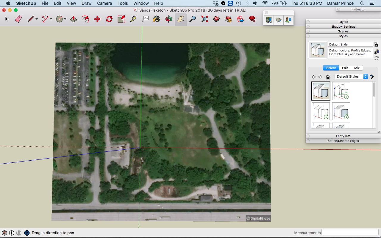
i used the add location and brag this image from it. how can i turn this in a floor plan?
-
@dprince said:
how can i turn this in a floor plan?
A floor plan usually implies a building. Is that what you are trying to draw? If so, you would model it like you would model a building without the location image. If that's not what you are trying to do, please give more information.
FWIW, the imagery doesn't come from Google Earth.
-
An event is being held at this location and i want to do something as shown in the pdf. I want to get the roads and stuff looking like the pdf the objects such as stage etc i can add. I hope this makes t clearer
-
Well, it would be like drawing any other floor plan. Just start drawing. If all you need is a 2D floor plan and not a 3D model of the building, I would draw the floor plan maybe a meter above the terrain image so you can avoid Z-fighting. If I were doing it, I would probably start by locating the perimeter of the building properly over the terrain image and then turn off the layer for the image so I don't need to look at it. Turn that layer back on when ready for exporting the images or creating scenes to go to LayOut.
-
use the line tool and draw over the image you mean?
-
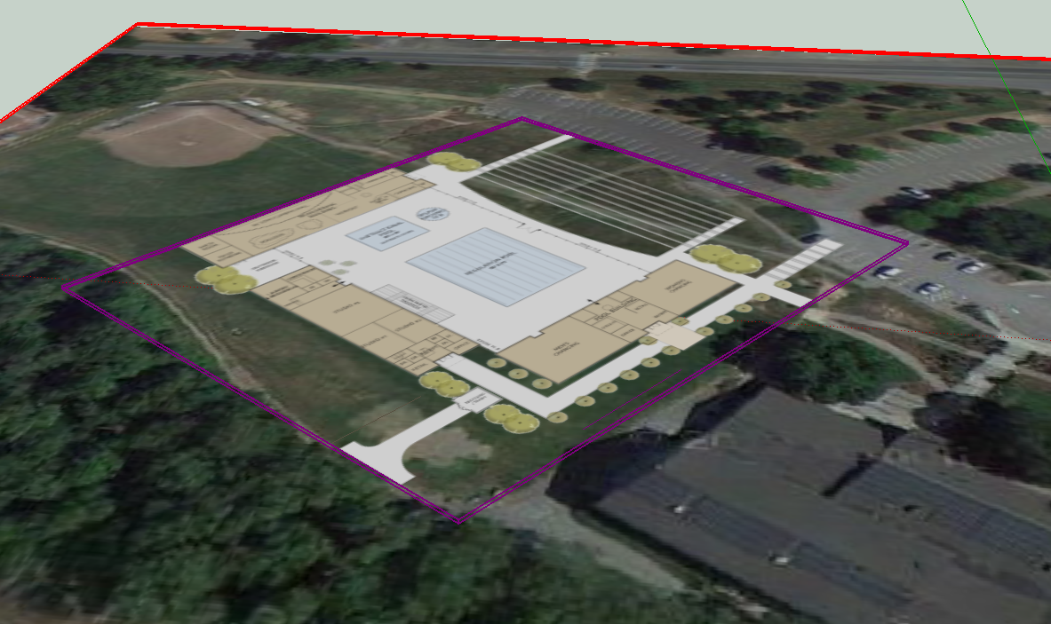
Dave's right. You don't need to draw on the image itself. I have done this for quick presentions of new projects over satellite images, with the plan being a separate element, referenced to the image. Leave the image a group or locked, (I wouldn't bother drawing directly on the face and cutting it up with edges). Working in plan view, You can draw an outline of the venue location over the image up a meter for reference when you draw the plan. To facilitate this, I usually make a simple face above the image with transparent color face and group it. This gives you a place to draw on so your lines are all in one plane and you can see the image below, and again that face is grouped separately--it needn't be part of your floor plan, just a plane to work off and hide on a separate layer when you are done.
Set up an orthographic (parallel projection) plan view-- SCENE to work in. Set up scenes both with your satellite image visible and with it hidden.
Sometimes I use translucent faces in the final drawing to adjust the color of the terrain image below or even show new work "overlaid" on the image that is slightly obscured. You may also obscure, but not hide, surrounding areas to emphasize the site of the event.
The attached image shows the purple highlighted plane raised above the site image (here shown in perspective, not the plan view). Not the best example as I actually imported CAD images for this one, but I could draw on that raised plane if I needed to
 .
.
-
Here's what I'm trying to do in essence. The geo pic shown what i want to do is actually trace that entire area but have it look like the pdf i sent earlier. Because I do designs for events mostly outdoors and to receive proper permission to use these venues that need a floor plan looking type thing similar to what i did and uploaded via pdf
-
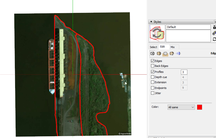
So yes, you need to use the Line tool and probably the other drawing tools. One thing you can do that will help while you are tracing over the terrain image is edit the edge style. Set Profiles to something like 3 and change the color to red so it shows clearly against the image. In that case you'll probably find it easier to draw right on the image.
-
Thanks alot! question do u think u can help with this post too? http://sketchucation.com/forums/viewtopic.php?f=322&t=69899
-
Sorry. I don't use Vray.
Hello! It looks like you're interested in this conversation, but you don't have an account yet.
Getting fed up of having to scroll through the same posts each visit? When you register for an account, you'll always come back to exactly where you were before, and choose to be notified of new replies (either via email, or push notification). You'll also be able to save bookmarks and upvote posts to show your appreciation to other community members.
With your input, this post could be even better 💗
Register Login


Advertisement