Making a contour map from GE
-
Please help me see the wood for the trees.
I am getting a lot of conflicting direction on this topic from different directions and its confusing me, so many extensions and sand box tools which seem to take me down roads leading to lots of work.
Surely there must be a simple way to make a contour map from and import GE map from the "add location" and "toggle terrain"
From there I want contour curves at say 50' intervals automatically then take these into an extension (say Sandbox bonus tools)
I want to be able to print out these 2d contour planes so I can make cutouts on thick card glued together to make a physical model
You would think this should be straight forward
Can anyone please help clear the mists for me
Cheers
Robin
-
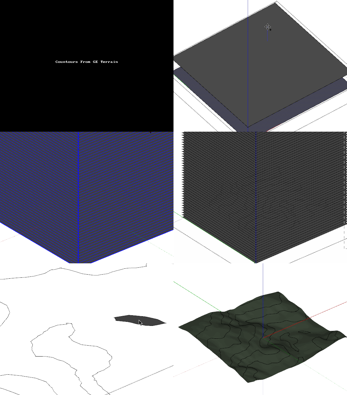
You insert the Terrain and activate it's 3d version, then:
- You draw a rectangle bigger than the terrain's area;
- You place the rectangel at level zero;
- You group it;
- You edit the group and copy it on the blue axis using CTRL and array with the * key so it gets the spacing you want (50' intervals);
- You select all rectangles in the array and rightclick one of them;
- From the context menu you select intersect faces > with model;
- You remove the excess rectangle faces until you have only the contours;
- You now have a group with all the contour lines inside juxtaposed to the terrain group.
You should create a layer for the contours so you can hide them on elevation scenes.
Here's a gif to help you further, you should click on the black image below:

-
-

SketchUp Plugins | PluginStore | SketchUcation
SketchUp Plugin and Extension Store by SketchUcation provides free downloads of hundreds of SketchUp extensions and plugins
(sketchucation.com)
Advertisement


