Axis and geolocation
-
Ok, I'm asking this in the newbie forum because I think the answer might be rudimentary. If I start a model and I'm using the standard views Front Rear etc. and I bring in a location do I rotate the model to the location to get north in the right place and when I do the standard views are skewed. Or do I rotate the location ( doubt it very much)? How do I get the standard views back to proper alignment?
-
By default the solid green axis points north and, when you get a location, it comes in with north along the green axis. So, it would make sense to rotate your model so it aligns with location. Of course if the front of your model faces some other direction than south, that does confuse the standard views a bit.
-
@dave r said:
By default the solid green axis points north and, when you get a location, it comes in with north along the green axis. So, it would make sense to rotate your model so it aligns with location. Of course if the front of your model faces some other direction than south, that does confuse the standard views a bit.
So I guess I orient the view to perpendicular and the update the scene for each standard view?
-
I think so. Without seeing your model exactly...
Maybe you'll also need to move the camera to center the model in the window after you put it in the correct location.
Maybe too late in this case but perhaps it would make some sense to delay creating scenes until you get the location and locate the model on it.
-
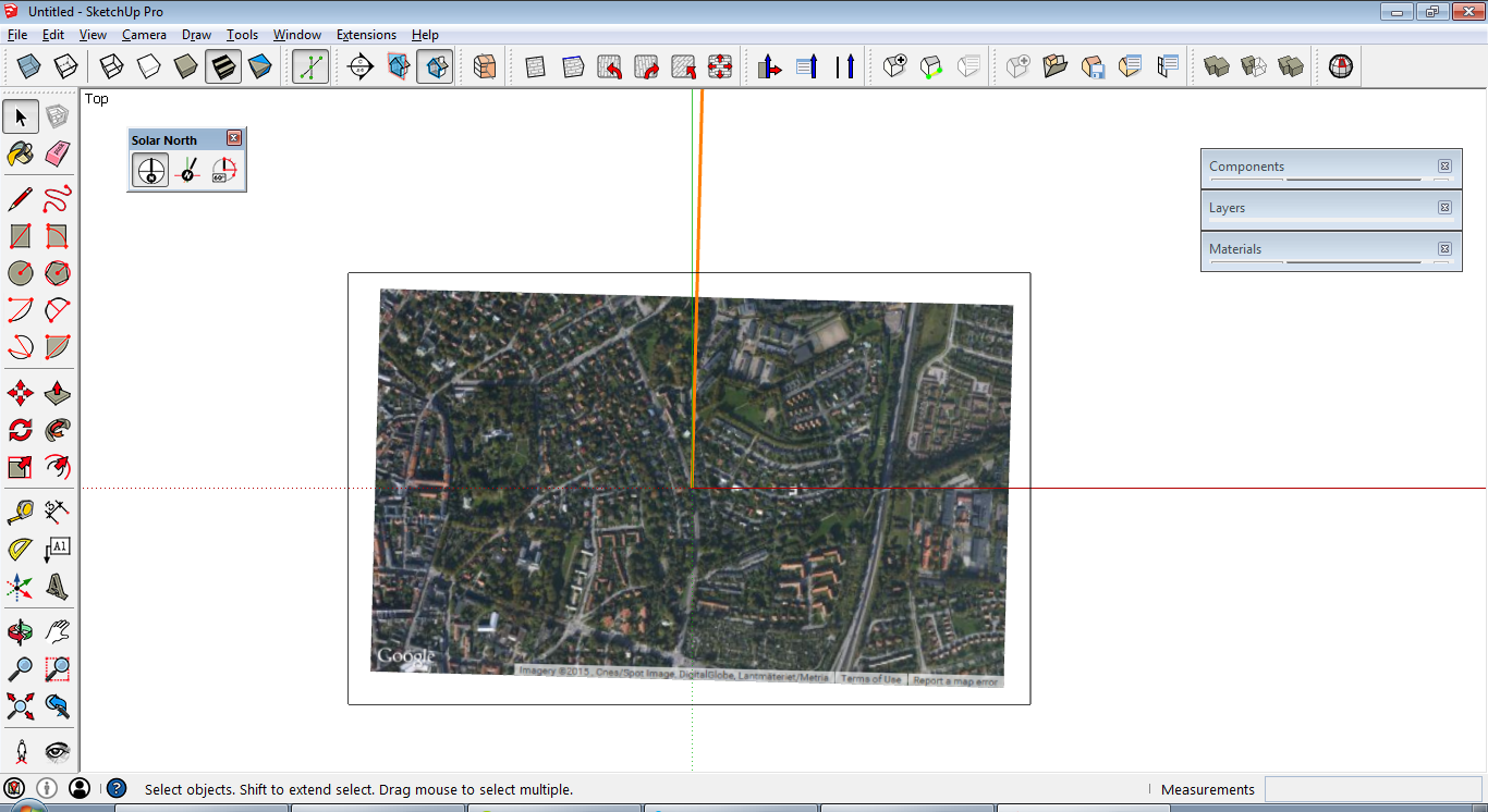
Actually green axis isn't north when geo-loating (at least not in Sweden)
 .
.Can anyone tell me why this is? I'm making a plugin where users should be able to through a dialog move objects along the cardinal directions so its very important for the plugin to know exact directions. It seems as if the solar north angle is correct but I really don't understand why it should be required to be taken into account (unless the user manually changes it). Does anyone know if this is by design or a bug?

-
Is the green "north" supposed to be solar north? Or is it true (geodetic) north or, probably unlikely, magnetic north?
-
I have no idea, that's what confuses me now. I thought geodetic was the one being used but I'm not sure anymore. What's set as solar north and written to the GeoReferenceNorthAngle attribute of the GeoReference dictionary of the model is the angle between green axis and what's upwards on Google maps anyway. Changing the attribute or solar north to another angle has no effect on the positioning of new google maps snapshot when going to File > Geo-location > Add more imagery.


-
Well, I sure don't know what they use, either, although I've wondered about it. I've always assumed that Google maps/Earth use geodetic north. And I've wondered about getting a magnetic north indication in GE before.
I also wonder how much solar north varies over the course of a year since geodetic north changes relative to the plane of Earth's orbit. I expect that could be accounted for in your extension if you had the math for figuring it out. and if anyone can manage that, it's you.

-
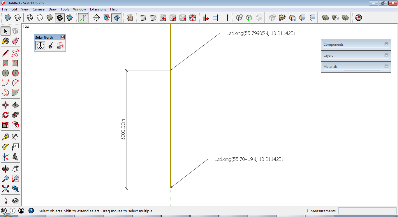
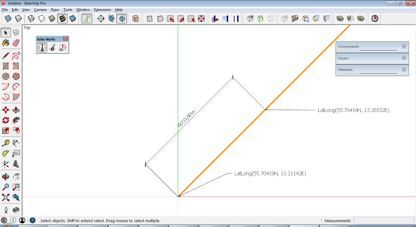
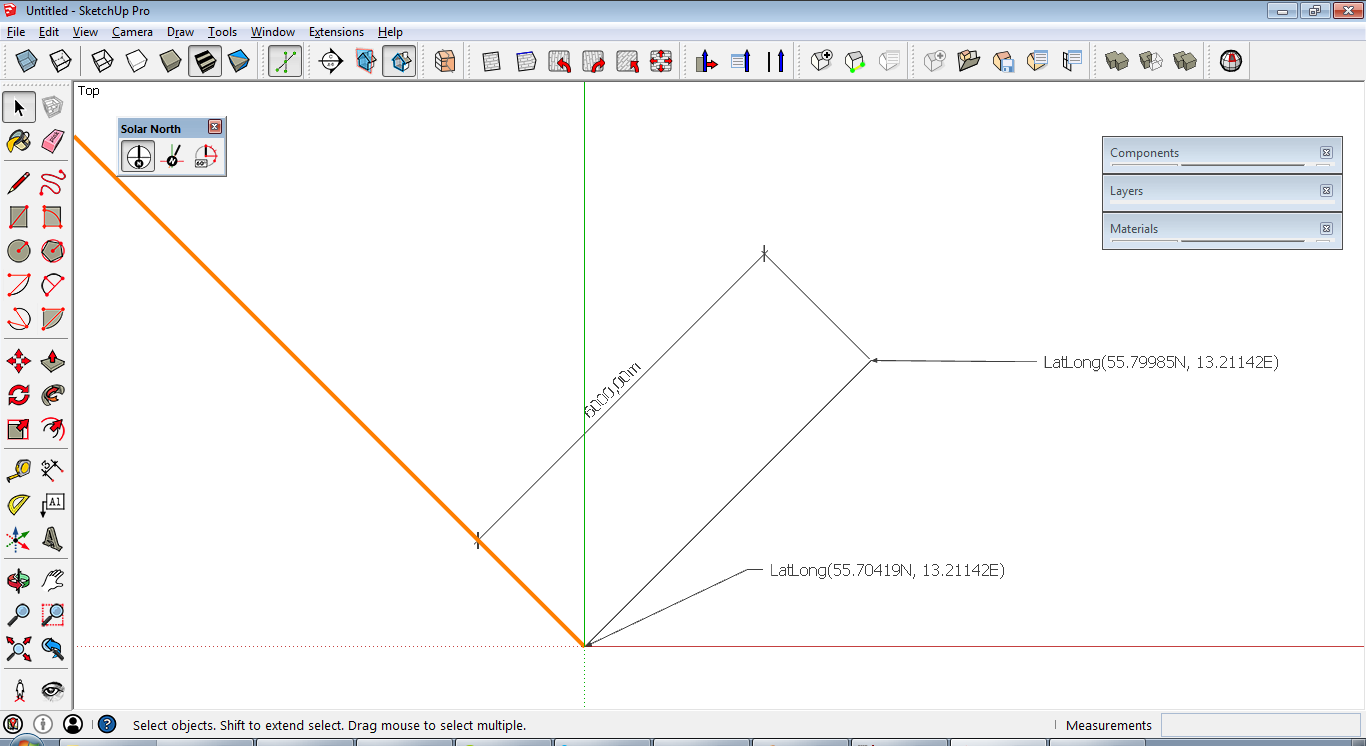
After looking into this all more it seems as the latitude and longitude from model.point_to_utm(point).to_latlong depends on the solar north value, not the GeoReferenceNorthAngle attribute. However it seems as the angle is measured in the wrong direction.
The point other than origin in the first 2 images should have the same latitude and longitude since both the point and solar north are rotated 45 degrees cw. However the point actually has the same latitude and longitude in the first and third image where the point is rotaded 45 degrees cw and solar north 45 degrees ccw.
I'll contact the devs about this, maybe they have seen it before.


-
i make it easy for me
i add location (for example Berlin Brandenburg Gate) and use a compass to see where is north. compare this with the picture what google giving me. normaly the top is north.
doing sketchup different?
could be i have misunderstand you, too
Scene North Angle Tool | SketchUcation
3D SketchUp Community for Design and Engineering Professionals.
(sketchucation.com)
-
When using geo-location in my hometown there's a difference between Google Maps north and green axis by about 1,47 degrees. When planning infrastructure in a city each meter is important and for a physically big model that angle sets thing off quite far.
If I've understood everything correctly the angle interpreted as clockwise in parts of the program and counter clockwise in other parts which means all latitudes and longitudes from a model are off by twice that angle.
-
oh yes this is really important. i think google map is only an orientation.
you could switch in the time line back and look is your house exactly on the same location or not. i dont know, could be for sketchup exist a plugin for inserting exact cordinates from GPS. when you will realy work exact, i think you need a very exact GPS and compass.here a link to an exact GPS (1 inch)
Advertisement


