Draping to Terrain
-
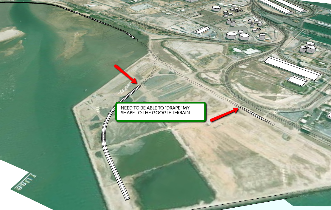
Hi Guys, I'm working with GE on a project at the moment and need to me able to drape a shape [road, rail, etc] to the Google terrain but not sure how it's done. [see attached]
Any ideas?


-
TGI3D Terrain tools...
[flash=800,600:lbcg063h]http://www.youtube.com/v/UviJRlu_00w[/flash:lbcg063h]
There's a 30 day trial
-
Also: http://forums.sketchucation.com/viewtopic.php?t=24676
(The demo videos do not work but the plugin does)
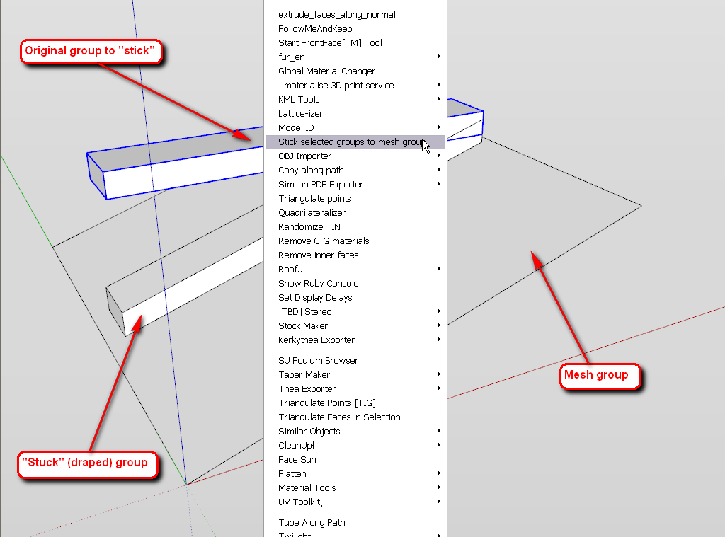
You need two groups and it works like the drape tool. First select your railroad or what group then the plugin and select the mesh group. A dialog pops up with settings and the railroad group will be "draped" nicely (additional edges created etc. but verticals remain verticals).
Everything will be softened though so you will need to unsoften.

-
Thanks guys, this is all good from within SU but I don't have the complete terrain in SU. [Terrain is over 12 kilometers...]
So when I export to GE, that's where I have the problem.....


-
That is completely out of the scope of this forum I am afraid.
Let me paraphrase your issue:
you have a 12 kilometre SU model you are too lazy to import the GE terrain for and you expect a solution that it will auto-adjust itself to something it does not even know about.
If there is a solution, I would also love to hear about it. I have a project that I already hate though have not even started it.
-
The difficulty with importing GE terrain, Csaba is that SU only allows a limited GE crop to me imported. Now if you want relatively high resolution in the imagery it will require quite a few imports.
I'd like to get this thing working by a4chitect: http://a4chitect.webng.com/ I'm interested to see if you can work it out. I have PM'd him to query it but no reply.
This tool would be perfect for what I need...

I am aware sdmitch has a few terrain stitching tools but ideally we could select a lat/long point and identify a grid size around it as well as options to multiply grids and columns of the selected grid size...
OK, OK, I'll import and stitch GE images.

-
Yes, I know (and also read your other topic about the terrain) and was just teasing you.
Indeed sometimes I also wish there were some easier way to import larger terrain at the highest resolution available. Until this function only serves exporting models to GE however, I am doubtful that Google will make anything more useful for those who want to use it for other projects.
Maybe head over that "other forum" and suggest it. I would be backing you

-
Will do.
Thanks you annoying bastard......

Advertisement


