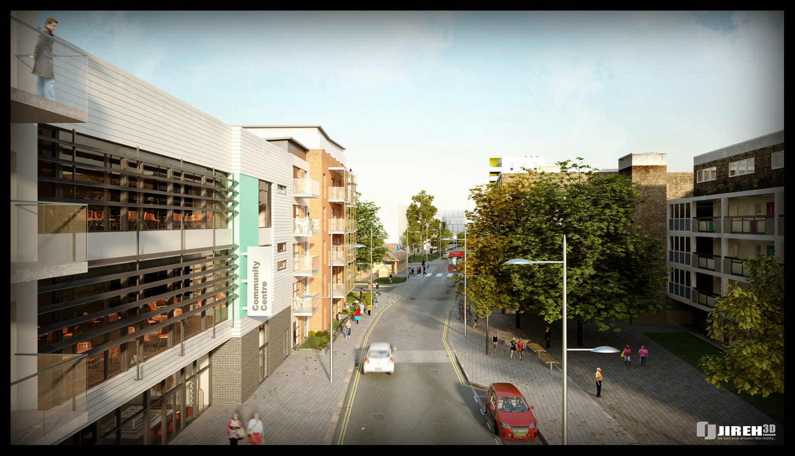
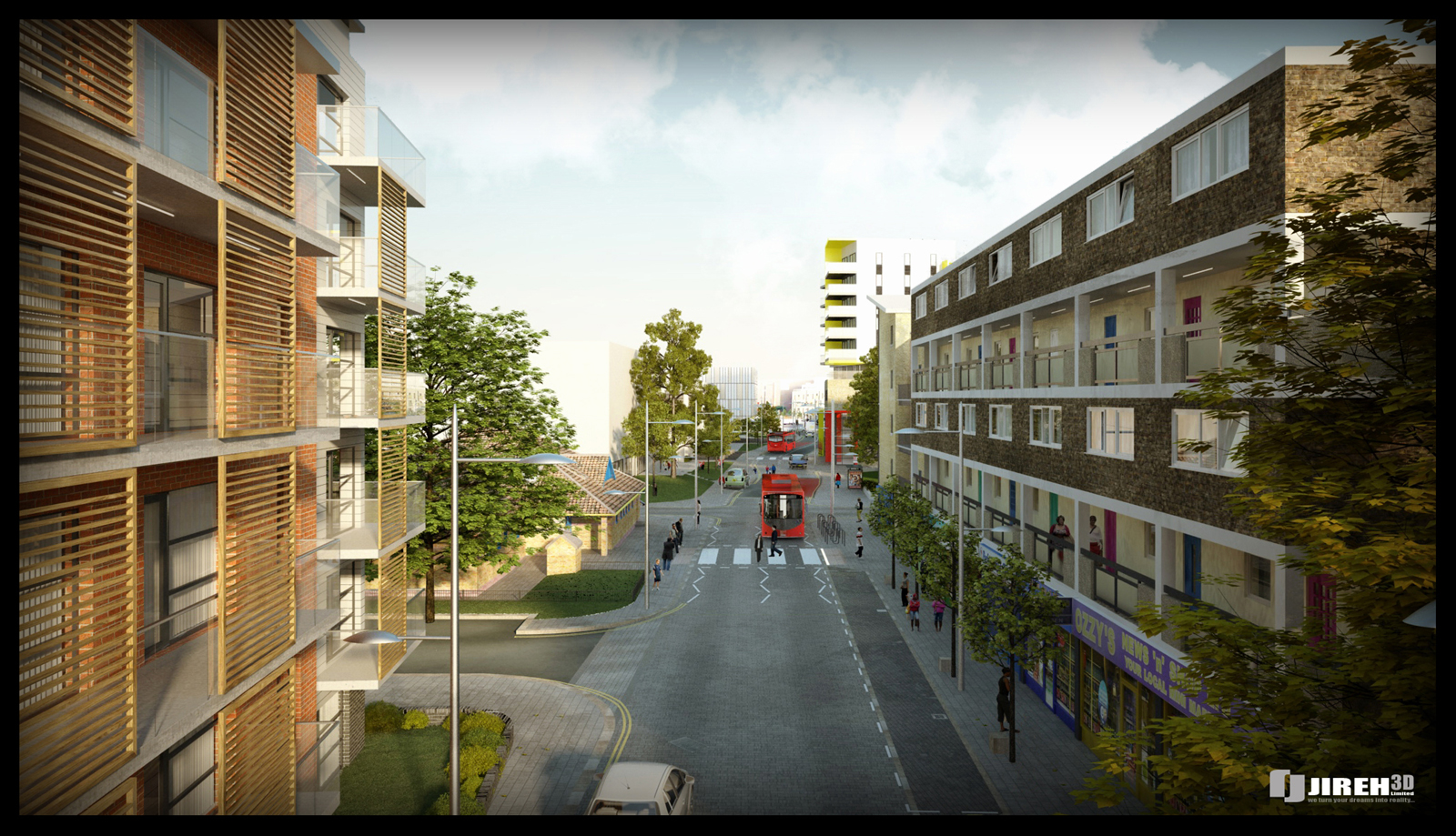
Street Project in London
-
Hi guys,
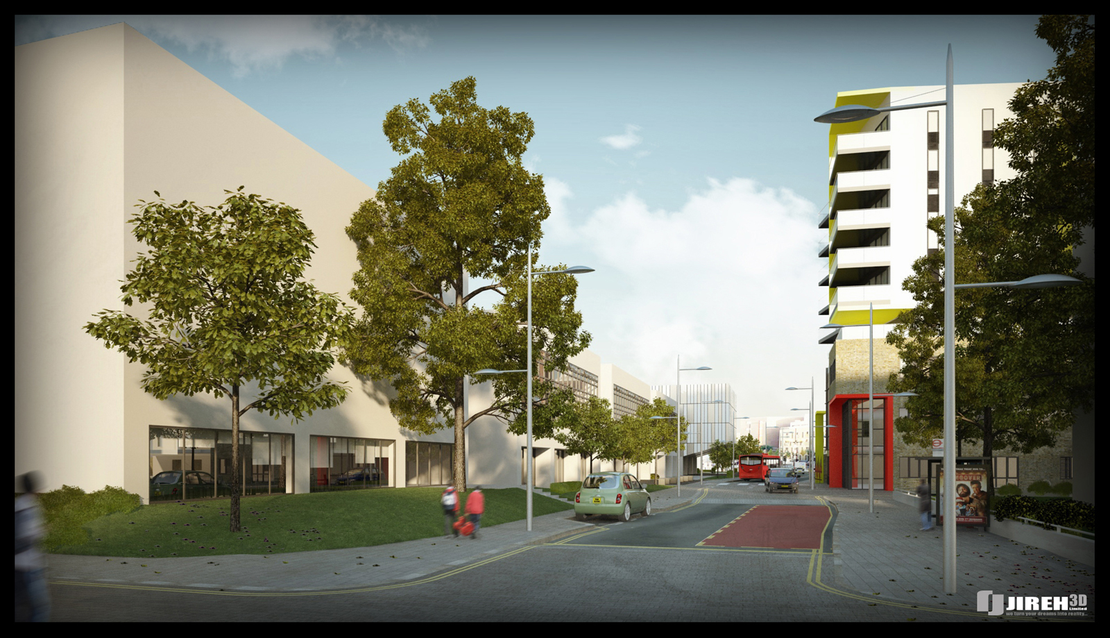
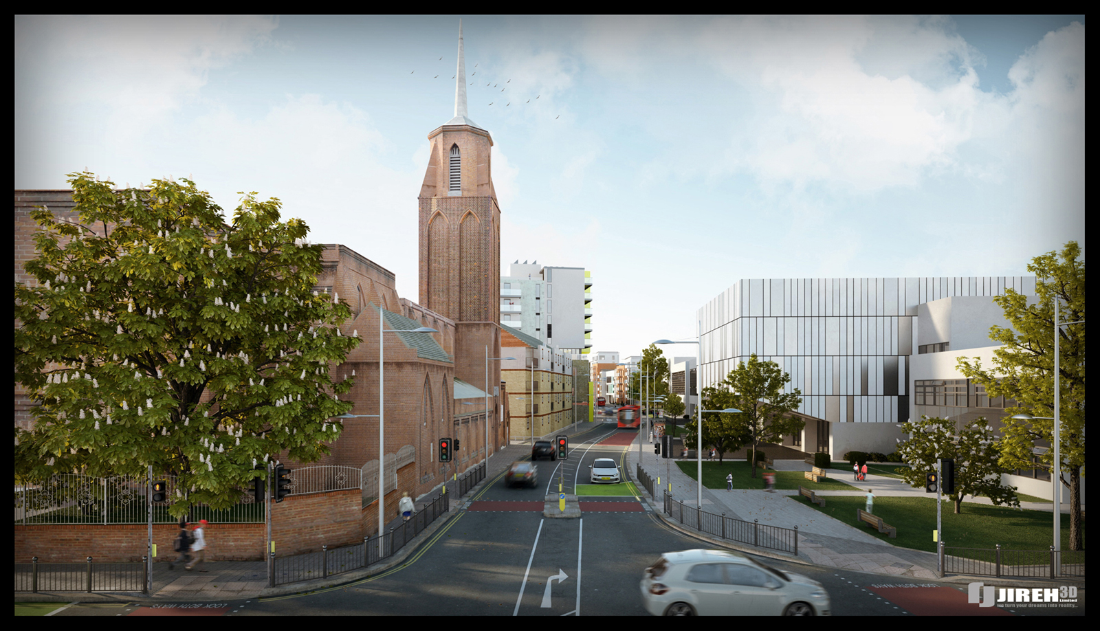
This is my latest project I've finished. All modelled in Sketch-up, except the cars and trees.
I had to model the whole street, all new tarmac,paving,lines,lights,buildings etc etc, so it was ALOT of work.
It took about 2.5 weeks to model it all up and a few days to texture, then the renderings was quite a challenge because of the many poly's, but in the end I got it rendered
Detailed in Cinema 4D & Rendered in VrayforC4D.
Comments and crits are welcome!
cheers
Choppir
-
That looks great. Very detailed. Nice work!
Scott
-
A lot of work here.

How many polygons are on SketchUp without the trees and cars?

Is there a difference between the VRay for C4D and 3D Max as a result of the render?

-

-
Great images and great work indeed! I especially like the balance of colors you obtained in renders.
-
Awesome work!
Care to share more info on the SU to C4D to vray workflow.?
-
best visuals ive seen in a long time! great work, great colour
-
Excellent model! Love it
-
Simply fantastic - loved the second one - just drew me in completely.
-
Awesome Work!
I'd also be interested in some tips from your workflow. It seems there isnt much discussion on Sketchup to c4d and vray for c4d on these forums compared to other software. Any help would be appreciated!
-
excellent, very detail work
-
Can you give us a little insight into how your dealing with model size? I'm sure your using groups and components, but are you relying on layers when you add the high poly vegitation, or are you working in completely separate files? What did you find as the biggest challenge, and how did you deal with it? Also wouldn't mind knowing you computer specs.
This amazing results from a large model. -
wohww! Thanks for the replies guys!
Ok,
Artysmedia: Not sure, i have to look when my machine stopped rendering, but it is alot. I had to use proxies for all planting as this scene crashes instantly without it.... Rendered on a 8core machine,8 gig ram which was nessesary!
Not sure what you mean by your 2nd question?D-space & spdesign: I chose the workflow of SU to C4D above max because it is so easy.
I learned max and I was quite frustrated when I saw the different workflow between the 2....Max is waaaayy to complicated. So here you can also see what is the best way to export your model to Cinema 4D: http://www.vrayforc4d.com/forum/showthread.php?t=5426&highlight=export+sketchup+modelDale: I modelled all the different buildings on their own separate file, then the street with all the bits & pieces on ones file, then on the big file, I've imported all the models together....
I definitely used components.
What is very very important is to work on different layers, because it makes the exporting part easy and also good to work with.... I always layer my stuff in the correct layers so that my workflow is ultimately faster. Neglecting layering it, makes it hardly unbearable. I did ask somebody once to help me model, but because he did not really use layers I had to re-model everything.
I also group objects alot. That makes the texturing bit very easy.So i don't have any plants in Sketch-up, but i use proxies in Cinema 4D.
hope this helps!
Feel free to ask, I'll be happy to help.Cheers
choppir
-
Awesome...! Awesome...!

-
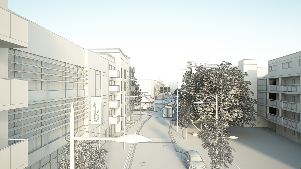
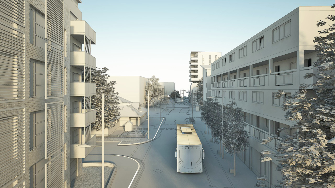
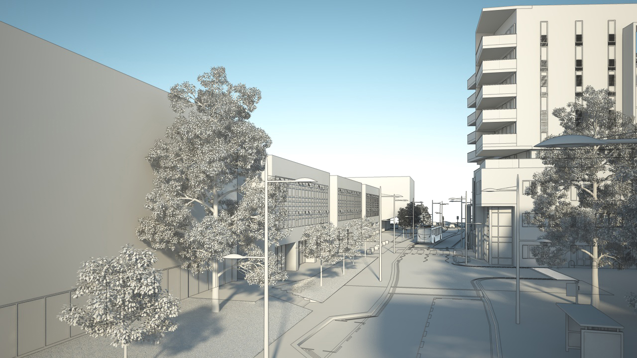
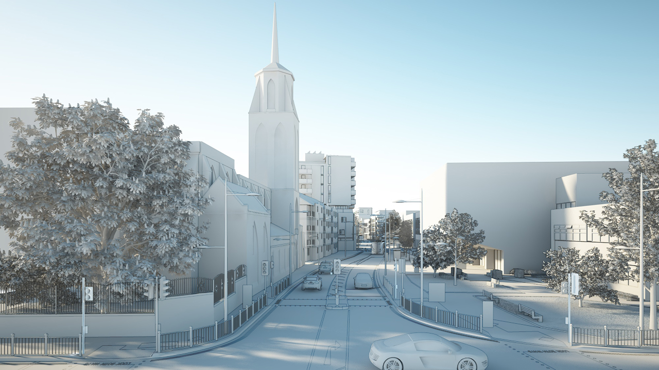
this is amazing!! shows the huge potential in sketchup, how many edges did you end up with?
also I notice in the clays that you modelled the lines on the street, I imagine it's so you only had one asphalt texture? very clever! -
Hi Jopsa2: I just looked and without the plants it comes to 3995564 poligons......yeah so almost 4 million.
The lines was modelled separately and yes the tarmac is one big texture i painted in Photoshop.
Hope this helps.
Choppir
-
these are great. Its nice to see someone using SU along with another program other than max. good work
-
Looks great, thank You!
-
Absolutely amazing! If it wasn't for the clay models I would swear it they were photos. Amazing work!What was the reason for modelling this street? Is it an existing street or is it all made up?
-
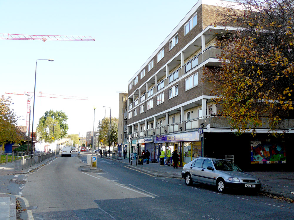
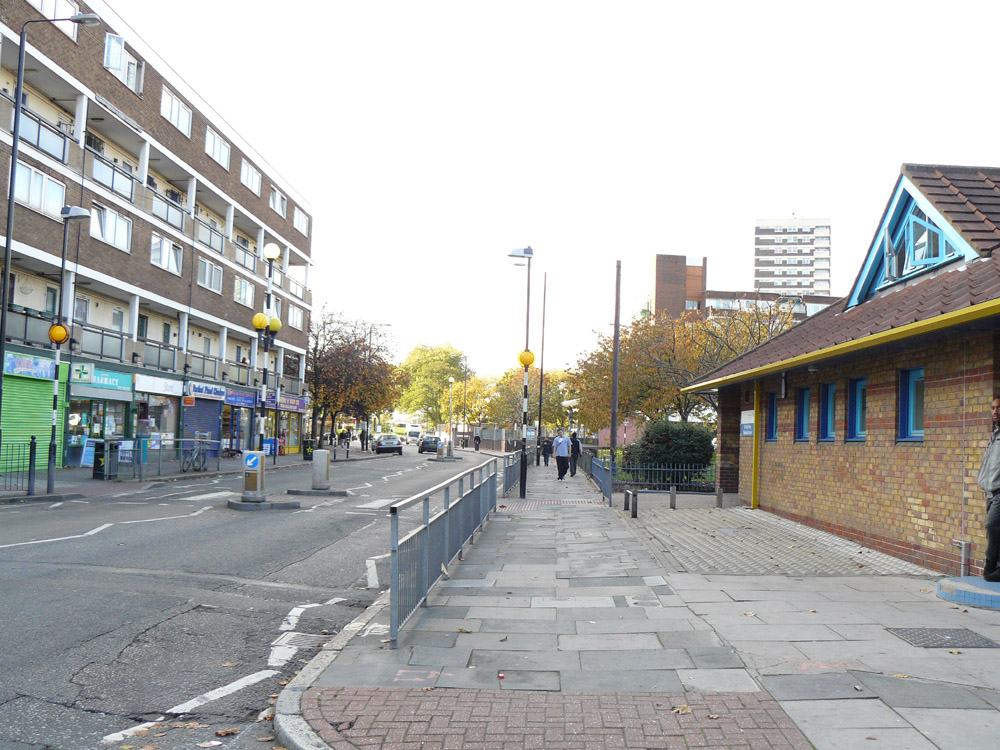
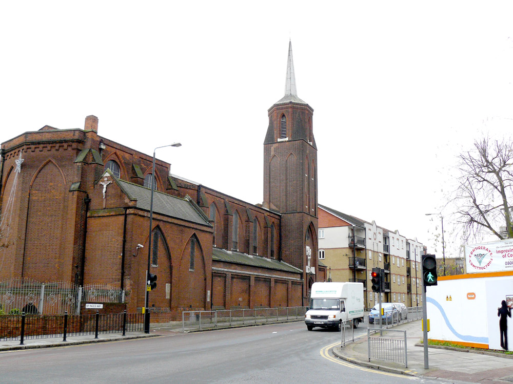
Thanks kevsterman
It is existing, but the whole street will be refurbished
Here are some existing pictures. You will see they have already started building the School in the background of the 1st pic....
Laters!
choppir
@kevsterman said:
Absolutely amazing! If it wasn't for the clay models I would swear it they were photos. Amazing work!What was the reason for modelling this street? Is it an existing street or is it all made up?
Hello! It looks like you're interested in this conversation, but you don't have an account yet.
Getting fed up of having to scroll through the same posts each visit? When you register for an account, you'll always come back to exactly where you were before, and choose to be notified of new replies (either via email, or push notification). You'll also be able to save bookmarks and upvote posts to show your appreciation to other community members.
With your input, this post could be even better 💗
Register Login


Advertisement