Create point clouds for terrain based on 2D raster drawing?
-
I'm working with raster site plans that I import into SU as image, these plans have the elevations written on them based on old surveys then based on these drawings I try to use the ruler tool to set the points to use with TopoShaper to build the terrain, it takes a long time to do as I'm not able to create the points with the ruler tool directly from the plane so I need to first draw a small line from the start point for each measurement and then use the ruler tool.
then i end up with something like the attached image. Is there a better/faster way to do this?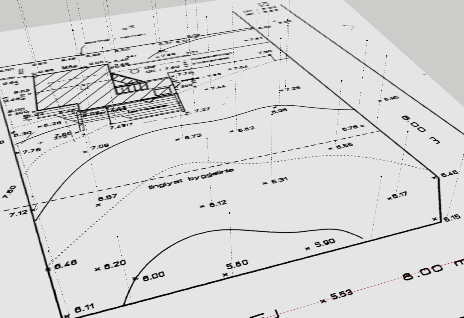
-
If the terrain is not yet existing seems there is not more elegant method than your...
...except this following is without ruler tool! So a little more speedy!
-
@pilou said:
If the terrain is not yet existing seems there is not more elegant method than your...
...except this following is without ruler tool! So a little more speedy!Thank you very much, it was a great informative video

Hello! It looks like you're interested in this conversation, but you don't have an account yet.
Getting fed up of having to scroll through the same posts each visit? When you register for an account, you'll always come back to exactly where you were before, and choose to be notified of new replies (either via email, or push notification). You'll also be able to save bookmarks and upvote posts to show your appreciation to other community members.
With your input, this post could be even better 💗
Register Login


Advertisement