Best method to create faces for complex shapes?
-
My method is to use Soap Skin and Bubble plugin. That´s basically the only reason I use the plugin, since I hardly work with tensile structures

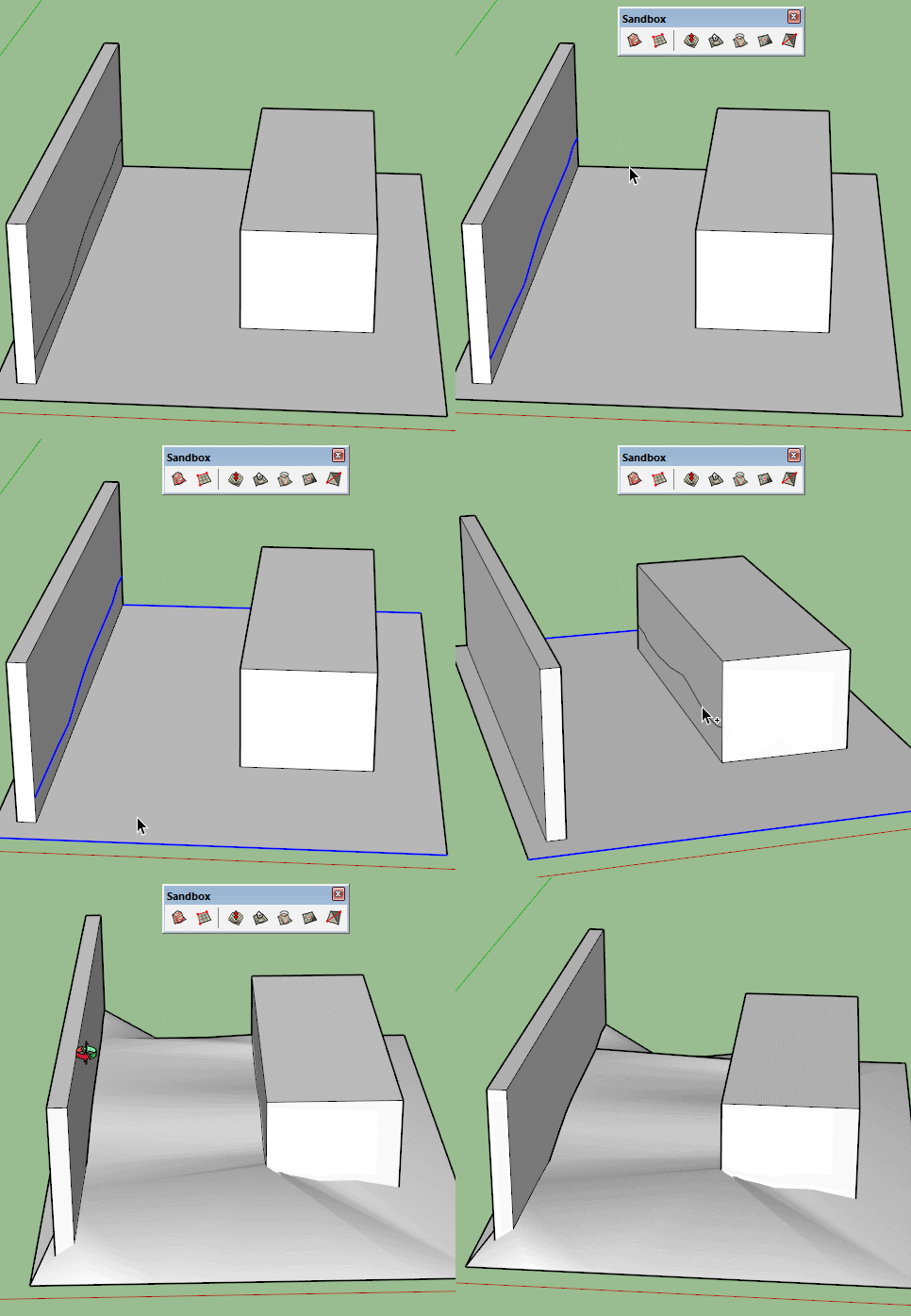
Instead, it allows me for example to draw the contour of a terrain around a house and then generate the terrain which will smoothly follow that complex shape.
-
Is there a question here?
Personally I find soapskin bubble a very restrictive and limited plugin. People get addicted to it and don't understand the many other ways of creating better meshes. -
Yes, there is a question, exactly because I may be suffering from the problem you described... and Soap Skin and Bubble just expired and http://extensions.sketchup.com/ is offline for the last 2-3 hours (maybe too many people tried to download Soap Skin and Bubble and it crashed?)
Also, SOMETIMES Soap Skin and Bubble creates some meshes that are a headache.
But really, I don´t know any other way to do these things... so if you find it limiting and thinks there are better ways (either manual or plugins) share it, please. Thanks
-
Expired ?
This Plugin is a Time-Limited Demo
NO
@unknownuser said:Time Limit is April 10, 2016

@unknownuser said:
Soap Skin and Bubble and it crashed?
I never see it crashed!

You have also Ferrari! (better but not animation inside)
But seems for complex structures Fredo6 curviloft is more versatile!
-
Still the main question: it depends on what you are making and what is the best way to layout the parameters of the shape. Curviloft is good for my needs (usually terrain sculpting) as well as Toposhaper or any plugin that creates a usable grid that can be shaped with Vertex tools or Artisan etc. And still I am always looking at different tools for different situations.
-
@pilou said:
Expired ?
This Plugin is a Time-Limited DemoI am aware of that. The time limit was 15 april 2015.
@unknownuser said:
NO
@unknownuser said:Time Limit is April 10, 2016

this is the new time-limit, it was updated yesterday.
as you are probably aware, Soap Skin and Bubble has a time limit of 1 year for each new version, and the new version with the new extended 1 year time-limit is only released like 1 day prior to the time-limit expiring date of the previous version
@unknownuser said:
@unknownuser said:
Soap Skin and Bubble and it crashed?
I never see it crashed!

well, the website (extension warehouse) was offline for most of the morning here.
-
@pbacot said:
Still the main question: it depends on what you are making and what is the best way to layout the parameters of the shape. Curviloft is good for my needs (usually terrain sculpting) as well as Toposhaper or any plugin that creates a usable grid that can be shaped with Vertex tools or Artisan etc. And still I am always looking at different tools for different situations.
neither TopoShaper nor Curviloft work for what I mentioned here, as far as I am aware. At least I tried both and TopoShaper doesn´t work properly and Curviloft doesn´t even create a surface, so maybe the problem is myself, not these two plugins.
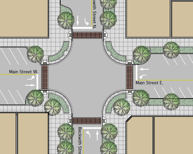
Anyway, I am attaching a skp file with a street grid. Above the street grid I extruded the border lines following the streets contours.
Must find faces for those contours, so we can generate sidewalks, internal terrain, etc.
I generated the meshes with Soap Skin & Bubble, than positioned them in the streets.
But for tests, you can use the blocks border lines, then generate the meshes with TopoShaper or Curviloft or other method of preference, and please, share the methods here...
-
Just a side note wouldn't it be better to construct the sidewalks separately? Perhaps as an extrusion based on the street. What is the end result? Streets amd sidewalks with "dirt"?
At first try it appears Toposhaper and Curviloft are not suited for this. Toposhaper doesn't keep to the edge of the street.
-
@pbacot said:
Just a side note wouldn't it be better to construct the sidewalks separately? Perhaps as an extrusion based on the street.
you mean an extrusion with Join Push Pull? Nope... the sidewalks are 4m for this project, and at that width, the curves on the block corners overlap in a geometric mess.
same thing if you try to do a follow_me or use the profile builder plugin.
@unknownuser said:
What is the end result? Streets amd sidewalks with "dirt"?
Nope. I will use the OFFSET function of ToolsOnSurface plugin... 15cm for curb and 3.85 meters for sidewalks.
Then I use Joint Push Pull and extrude the curbs, sidewalks and internal terrains, 15 centimeters up (using vector joint push pull)
@unknownuser said:
At first try it appears Toposhaper and Curviloft are not suited for this. Toposhaper doesn't keep to the edge of the street.
exactly. There are tons of other similar uses I have for SoapSkinandBubble that I can´t think how I would use Toposhaper or Curviloft.
ps: while playing with words on Google to find other plugins capable of the same thing, I found this
https://www.youtube.com/watch?t=45%26amp;v=WxQjAL11IB4however, the mesh geometry seems to be quite random... not much suited to use with Sketchup terrain tools.
-
I wouldn't use follow me (or upright extruder that way). I would probably try to make a corner element with ramps etc. and duplicate it. Might do an extrusion on the "straight" runs. But good to know those tools are feasible the way you do it. I've never faced this particular scenario, though I've made-up streets for scenes where I didn't have the grades in the first place.
I've seen how TGI3D can make a quick patch, but haven't found the impetus to buy it in the end.
What I would like is something like Toposhaper that respected the boundaries while estimating contours, and had a grid based on horizontal dimensions meters etc.--always in respect to the origin--so that patched-in grids can be fit exactly horizontally. Then it is often easy to connect patches.
-
@pbacot said:
I would probably try to make a corner element with ramps etc. and duplicate it.
that sounds reasonable... but ONLY if all the corners are alike... in real grid streets. If you have streets that are more organic, you would have to create one different corner element for each corner...
edit: actually, even in my example it wouldn´t work out I guess, because the streets aren´t flat, so corners have different inclinations...
-
City Gen Street generator by Thomthom ?
-
I do many streetscapes. I don't really understand the dialogue here. The example you provided is completed quickly with tools-on-surface. I see you already use TOS so now I'm really confused....Do you use TOS or soap skin?...hmmmm. Yes I'm totally lost now. Oh but wait! The title of the post is about making faces..... there is no face making required to complete the streets. Yikes!! I better leave

-
sorry...forgot this image..

and this link to some rendered examples.
http://ibuildmodels.com/JMC/SF/streets_four_profiles.html -
@pilou said:
City Gen Street generator by Thomthom ?
not sure... it was discontinued 6 years ago... does it even works on non planar lines? (like lines created with ToS over a mesh?)
@roland joseph said:
I do many streetscapes. I don't really understand the dialogue here. The example you provided is completed quickly with tools-on-surface. I see you already use TOS so now I'm really confused....Do you use TOS or soap skin?...hmmmm. Yes I'm totally lost now. Oh but wait! The title of the post is about making faces..... there is no face making required to complete the streets. Yikes!! I better leave

Roland Joseph, from your images, it seems you only work with VERY planar streetscapes.
@unknownuser said:
The example you provided is completed quickly with tools-on-surface
you mean, getting a terrain and just drawing the streets over it? Hmmm... nope. It results in sideways sloped streets and plenty of totally irrealistic bumps on streets and sidewalks. ToS does not generates surface meshes or faces anyway.
I use Soap Skin to generate meshes from contours.
Be them contours like the ones I showed on my skp (as I mentioned, I had the STREETS but the city blocks were only HOLES between the streets. I used Soap Skin to generate those meshes that are the city blocks... already included in the file) or be for example terrain around a house, where I will draw a line around the house, walls, etc and generate the terrain.

-
I'm not understanding what it is you want to do but I think you should be looking at sandbox tools.
You can create terrain from contours and then manipulate it, stamp it, drape it ....

-
-
@roland joseph said:
sorry...forgot this image..
[attachment=0:3ali03kb]<!-- ia0 -->grid.jpg<!-- ia0 -->[/attachment:3ali03kb]and this link to some rendered examples.
http://ibuildmodels.com/JMC/SF/streets_four_profiles.htmlHi!
Very fine rendering!
What method do you use ? -
I agree with Box, the Sandbox tool should be fine for the example shown with the house.
For creating roads on a terrain the following script is very useful:
http://www.valiarchitects.com/subscription_scripts/instant-road-nui -
@unknownuser said:
Roland Joseph, from your images, it seems you only work with VERY planar streetscapes.
No...I live in Ontario. There is no flat ground in Ontario anywhere.....sorry Windsor is flat.
@unknownuser said:
It results in sideways sloped streets
No, you need to start with a relatively accurate mesh.
The roads can be contoured and flattened as per drawings manually with a projected image as a guide before you start building road mesh.Just like building on the site. Once you have a road bed you can cut the roads in easily.
This example would represent a more typical street contour in Ontario.... http://ibuildmodels.com/JMC2/beaverton/intersections.html
All of it with TOS.
Advertisement


